
TENTEN Campus Glendale
414 N Orange St,
Glendale, CA 91203
$2,581 - $4,968
Studio - 2 Beds
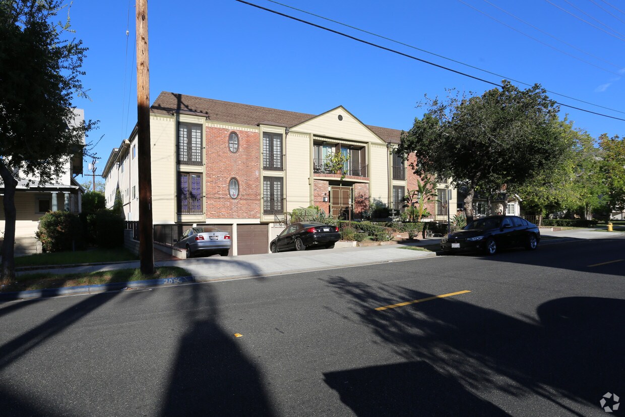
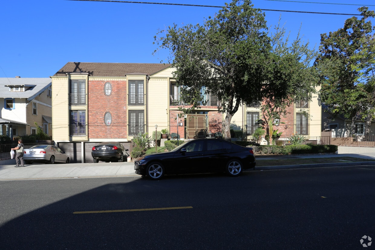

Experience Glendale living at 127 S Adams St. You'll find this community in the Citrus Grove area of Glendale. Leasing 1 to 2 bedroom apartments, your new home is right here. The leasing team is eager to show you our community. Give us a call now to schedule your tour.
127 S Adams St is an apartment community located in Los Angeles County and the 91205 ZIP Code. This area is served by the Glendale Unified attendance zone.
Air Conditioning
Dishwasher
High Speed Internet Access
Hardwood Floors
Located in the San Fernando Valley, Citrus Grove allows residents to enjoy some of the best Glendale and Los Angeles County has to offer. This palm-tree-lined, family-friendly neighborhood has excellent schools, several parks, and access to plenty of amenities. Along with its own restaurants and stores, Citrus Grove is only a mile east of Downtown Glendale, so residents live within minutes of a plethora of dining and shopping options, including Glendale Galleria and the Americana at Brand. Highways 2 and 32 connect the Citrus Grove neighborhood with Interstate 5, allowing trips up and down California in all directions, whether the aim is Los Angeles or the coast. The neighborhood is convenient to multiple local favorites including Dodger Stadium and the iconic Griffith Park. Complemented by views of the Verdugo Mountains, Citrus Grove has Mediterranean-style apartments, condos, townhouses, and houses available for rent.
Learn more about living in Citrus GroveCompare neighborhood and city base rent averages by bedroom.
| Citrus Grove | Glendale, CA | |
|---|---|---|
| Studio | $1,451 | $2,015 |
| 1 Bedroom | $1,710 | $2,074 |
| 2 Bedrooms | $2,160 | $2,625 |
| 3 Bedrooms | $2,700 | $3,441 |
| Colleges & Universities | Distance | ||
|---|---|---|---|
| Colleges & Universities | Distance | ||
| Drive: | 5 min | 2.1 mi | |
| Drive: | 7 min | 3.1 mi | |
| Drive: | 12 min | 6.2 mi | |
| Drive: | 14 min | 7.3 mi |


Transportation options available in Glendale include Southwest Museum Station, located 4.9 miles from 127 S Adams St. 127 S Adams St is near Bob Hope, located 11.2 miles or 18 minutes away, and Los Angeles International, located 22.9 miles or 37 minutes away.
| Transit / Subway | Distance | ||
|---|---|---|---|
| Transit / Subway | Distance | ||
|
|
Drive: | 11 min | 4.9 mi |
|
|
Drive: | 11 min | 5.2 mi |
|
|
Drive: | 11 min | 5.4 mi |
|
|
Drive: | 11 min | 6.2 mi |
|
|
Drive: | 13 min | 7.1 mi |
| Commuter Rail | Distance | ||
|---|---|---|---|
| Commuter Rail | Distance | ||
|
|
Drive: | 6 min | 2.3 mi |
|
|
Drive: | 10 min | 5.7 mi |
|
|
Drive: | 16 min | 8.6 mi |
|
|
Drive: | 15 min | 8.9 mi |
| Drive: | 18 min | 12.9 mi |
| Airports | Distance | ||
|---|---|---|---|
| Airports | Distance | ||
|
Bob Hope
|
Drive: | 18 min | 11.2 mi |
|
Los Angeles International
|
Drive: | 37 min | 22.9 mi |
Time and distance from 127 S Adams St.
| Shopping Centers | Distance | ||
|---|---|---|---|
| Shopping Centers | Distance | ||
| Walk: | 5 min | 0.3 mi | |
| Walk: | 5 min | 0.3 mi | |
| Walk: | 6 min | 0.3 mi |
| Parks and Recreation | Distance | ||
|---|---|---|---|
| Parks and Recreation | Distance | ||
|
Elyria Canyon Park
|
Drive: | 10 min | 4.1 mi |
|
Marsh Park
|
Drive: | 10 min | 4.9 mi |
|
Bird Sanctuary
|
Drive: | 11 min | 5.0 mi |
|
Los Angeles Zoo
|
Drive: | 14 min | 5.1 mi |
|
Griffith Park
|
Drive: | 24 min | 8.4 mi |
| Hospitals | Distance | ||
|---|---|---|---|
| Hospitals | Distance | ||
| Drive: | 4 min | 1.3 mi | |
| Drive: | 5 min | 2.1 mi | |
| Drive: | 11 min | 5.4 mi |
| Military Bases | Distance | ||
|---|---|---|---|
| Military Bases | Distance | ||
| Drive: | 34 min | 24.5 mi |
What Are Walk Score®, Transit Score®, and Bike Score® Ratings?
Walk Score® measures the walkability of any address. Transit Score® measures access to public transit. Bike Score® measures the bikeability of any address.
What is a Sound Score Rating?
A Sound Score Rating aggregates noise caused by vehicle traffic, airplane traffic and local sources

127 S Adams St
Glendale, CA 91205


