
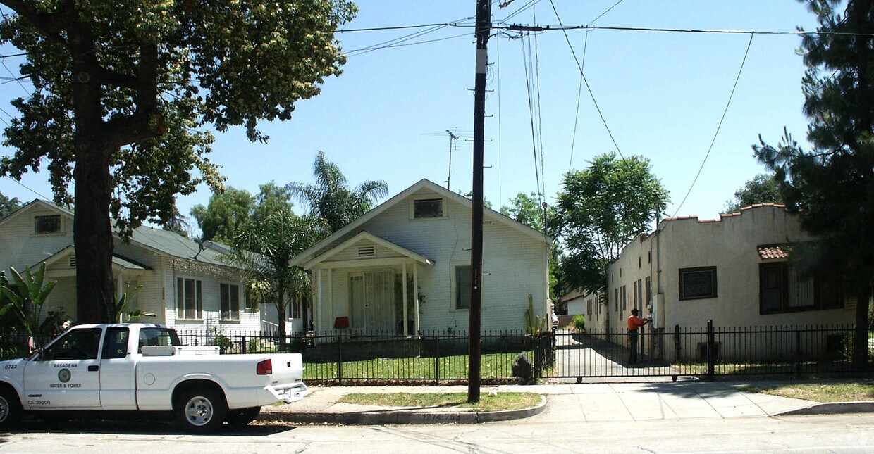
1262-1282 N Raymond Ave
1262-1282 N Raymond Ave,
Pasadena,
CA
91103
2 Weeks Ago
Favorites
1262-1282 N Raymond Ave
Favorites
Check Back Soon for Upcoming Availability
| Beds | Baths | Average SF | Availability |
|---|---|---|---|
| 1 Bedroom 1 Bedroom 1 Br | 1 Bath 1 Bath 1 Ba | — | Not Available |
| 2 Bedrooms 2 Bedrooms 2 Br | 1 Bath 1 Bath 1 Ba | — | Not Available |
Fees and Policies
Details
Property Information
-
Built in 1925
-
13 units/1 story
About 1262-1282 N Raymond Ave Pasadena, CA 91103
1262-1282 N Raymond Ave offers a blend of style and comfort. You'll find this community in the 91103 area of Pasadena. From amenities to floor plan options, the leasing team is available to help you find your perfect new place. Come see 1262-1282 N Raymond Ave today.
1262-1282 N Raymond Ave is an apartment community located in Los Angeles County and the 91103 ZIP Code. This area is served by the Pasadena Unified attendance zone.
Community Amenities
- Laundry Facilities
Apartment Features
- High Speed Internet Access
- Smoke Free
Location
Get Directions
Near the San Gabriel Mountains, where I-210 meets State Route 134 and becomes the Foothill Freeway, rests Pasadena’s Garfield Heights neighborhood. Primarily a residential area, Garfield Heights contains a number of markets, churches, and temples. Garfield Heights residents enjoy access to neighboring parks such as La Pintoresca Park and City of Pasadena Robinson Park.
There are a host of amenities located within close proximity to Garfield Heights. Among the many amenities are the Rose Bowl Stadium, Kidspace Children’s Museum, Norton Simon Museum, Brookside Golf and Country Club, Pasadena Convention Center, Paseo Colorado, and the California Institute of Technology.
Served by several Metro Local lines and Pasadena Transit routes, getting around Garfield Height is a breeze.
Learn more about living in Garfield HeightsBelow are rent ranges for similar nearby apartments
Amenities
- Laundry Facilities
- High Speed Internet Access
- Smoke Free
Education
| Colleges & Universities | Distance | ||
|---|---|---|---|
| Colleges & Universities | Distance | ||
| Drive: | 4 min | 1.9 mi | |
| Drive: | 9 min | 3.1 mi | |
| Drive: | 7 min | 3.4 mi | |
| Drive: | 9 min | 3.6 mi |
1262-1282 N Raymond Ave is within 4 minutes or 1.9 miles from Fuller Theological Seminary. It is also near Art Center College of Design and Pasadena City College.
Schools


Public Elementary School
Grades K-5
628 Students
Nearby
Public Elementary School
Grades K-6
454 Students
Nearby
Public Elementary School
Grades K-6
230 Students
Nearby
Public Elementary School
Grades K-5
406 Students
Attendance Zone
Public Middle School
Grades 6-8
513 Students
Attendance Zone
Public High School
Grades 9-12
1,012 Students
Attendance Zone
Private Elementary, Middle & High School
Grades 1-12
270 Students
Nearby
Private Elementary & Middle School
Grades PK-8
444 Students
Nearby
School data provided by
 The GreatSchools Rating helps parents compare schools within a state based on a variety of school quality indicators and provides a helpful picture of how effectively each school serves all of its students. Ratings are on a scale of 1 (below average) to 10 (above average) and can include test scores, college readiness, academic progress, advanced courses, equity, discipline and attendance data. We also advise parents to visit schools, consider other information on school performance and programs, and consider family needs as part of the school selection process.
View GreatSchools Rating Methodology
Data provided by GreatSchools.org © 2025. All rights reserved.
View GreatSchools Rating Methodology
Data provided by GreatSchools.org © 2025. All rights reserved.
Transportation options available in Pasadena include Memorial Park Station, located 1.7 miles from 1262-1282 N Raymond Ave. 1262-1282 N Raymond Ave is near Bob Hope, located 17.4 miles or 24 minutes away, and Los Angeles International, located 25.9 miles or 42 minutes away.
| Transit / Subway | Distance | ||
|---|---|---|---|
| Transit / Subway | Distance | ||
|
|
Drive: | 4 min | 1.7 mi |
|
|
Drive: | 5 min | 2.0 mi |
|
|
Drive: | 4 min | 2.1 mi |
|
|
Drive: | 6 min | 2.6 mi |
|
|
Drive: | 5 min | 3.1 mi |
| Commuter Rail | Distance | ||
|---|---|---|---|
| Commuter Rail | Distance | ||
|
|
Drive: | 14 min | 9.9 mi |
|
|
Drive: | 19 min | 10.9 mi |
|
|
Drive: | 21 min | 10.9 mi |
|
|
Drive: | 22 min | 12.1 mi |
| Drive: | 23 min | 15.0 mi |
| Airports | Distance | ||
|---|---|---|---|
| Airports | Distance | ||
|
Bob Hope
|
Drive: | 24 min | 17.4 mi |
|
Los Angeles International
|
Drive: | 42 min | 25.9 mi |
Time and distance from 1262-1282 N Raymond Ave.
| Shopping Centers | Distance | ||
|---|---|---|---|
| Shopping Centers | Distance | ||
| Walk: | 3 min | 0.2 mi | |
| Walk: | 20 min | 1.1 mi | |
| Walk: | 20 min | 1.1 mi |
1262-1282 N Raymond Ave has 3 shopping centers within 1.1 miles, which is about a 20-minute walk. The miles and minutes will be for the farthest away property.
| Parks and Recreation | Distance | ||
|---|---|---|---|
| Parks and Recreation | Distance | ||
|
Kidspace Children's Museum
|
Drive: | 5 min | 1.9 mi |
|
Jet Propulsion Laboratory
|
Drive: | 4 min | 2.2 mi |
|
Eaton Canyon Nature Center
|
Drive: | 8 min | 3.7 mi |
|
Huntington Botanical Gardens
|
Drive: | 11 min | 4.7 mi |
|
Descanso Gardens
|
Drive: | 10 min | 5.6 mi |
1262-1282 N Raymond Ave has 5 parks within 5.6 miles, including Kidspace Children's Museum, Jet Propulsion Laboratory, and Eaton Canyon Nature Center.
| Hospitals | Distance | ||
|---|---|---|---|
| Hospitals | Distance | ||
| Drive: | 5 min | 2.4 mi | |
| Drive: | 9 min | 5.1 mi | |
| Drive: | 9 min | 5.6 mi |
1262-1282 N Raymond Ave has 3 hospitals within 5.6 miles, the nearest is Huntington Memorial Hospital which is 2.4 miles away and a 5 minute drive.
| Military Bases | Distance | ||
|---|---|---|---|
| Military Bases | Distance | ||
| Drive: | 39 min | 27.5 mi | |
| Drive: | 49 min | 31.0 mi |
1262-1282 N Raymond Ave is 27.5 miles from Los Angeles Air Force Base, and is convenient to other military bases, including Los Alamitos Army Airfield.
You May Also Like
What neighborhood is the property located in?
1262-1282 N Raymond Ave Pasadena, CA 91103 is in Garfield Heights in the city of Pasadena. Here you’ll find three shopping centers within 1.1 miles of the property. Five parks are within 5.6 miles, including Kidspace Children's Museum, Jet Propulsion Laboratory, and Eaton Canyon Nature Center.
Similar Rentals Nearby


 - Violet on Virgil")


 - AVA Burbank")


What Are Walk Score®, Transit Score®, and Bike Score® Ratings?
Walk Score® measures the walkability of any address. Transit Score® measures access to public transit. Bike Score® measures the bikeability of any address.
What is a Sound Score Rating?
A Sound Score Rating aggregates noise caused by vehicle traffic, airplane traffic and local sources
1262-1282 N Raymond Ave
Pasadena, CA 91103
Responded To This Review