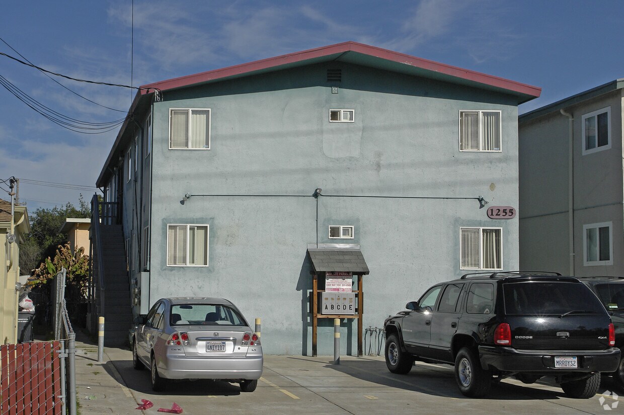
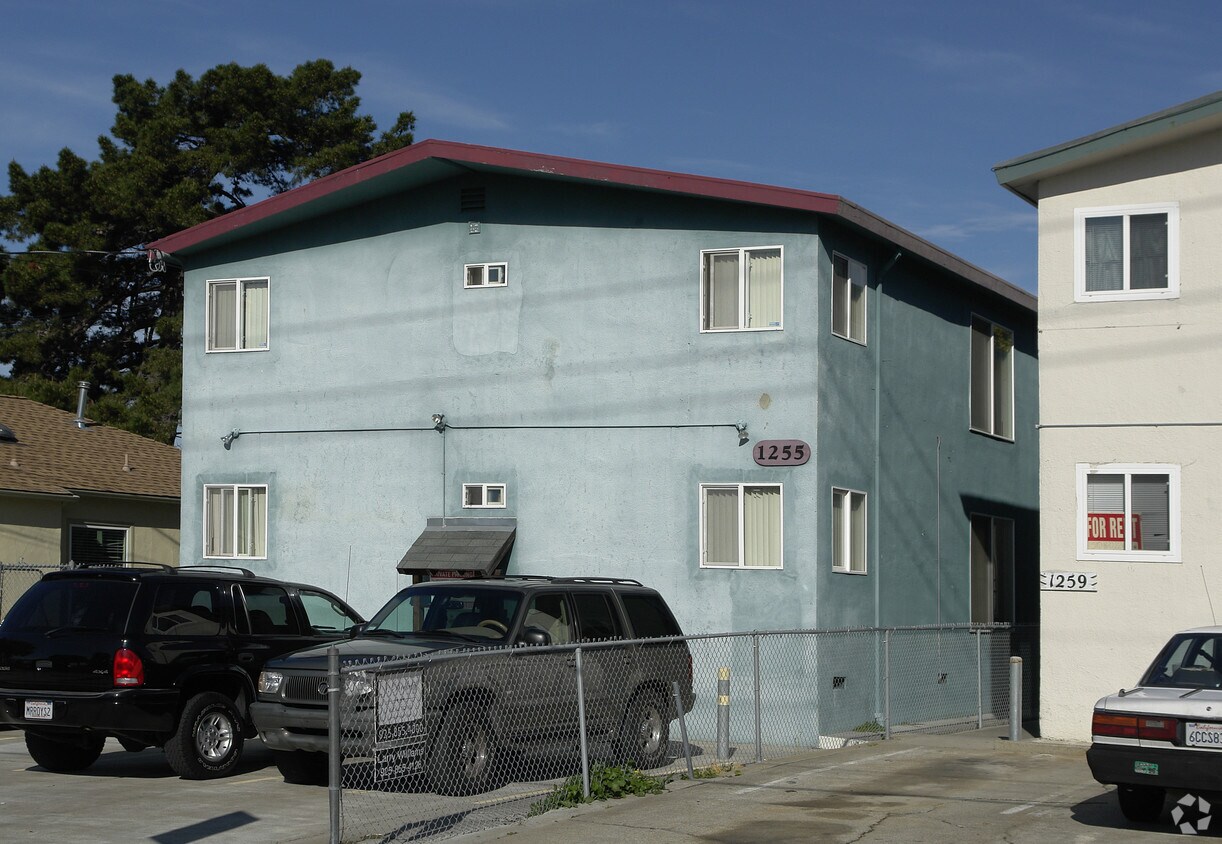
1255 Carrison St
1255 Carrison St,
Berkeley,
CA
94702
2 Weeks Ago
Favorites
1255 Carrison St
Favorites
Check Back Soon for Upcoming Availability
Fees and Policies
The fees below are based on community-supplied data and may exclude additional fees and utilities.
- Parking
-
Surface Lot--1 Max
Details
Property Information
-
Built in 1957
-
4 units/2 stories
About 1255 Carrison St Berkeley, CA 94702
1255 Carrison St is ready for you to visit. The prime Carrison St. location in the 94702 Zip code of Berkeley is a great place to move to. The professional leasing staff is waiting to show you all that this community has in store. Be sure to check out the apartment floorplan options. Visit 1255 Carrison St today.
1255 Carrison St is an apartment community located in Alameda County and the 94702 ZIP Code. This area is served by the Berkeley Unified attendance zone.
Location
Get Directions
Southwest Berkeley is bounded by University Avenue to the north, Sacramento Street to the East, Alcatraz Avenue to the south and the San Francisco Bay to the west. Southwest Berkeley comprises a fascinating mix of the educational and the industrial. Less dense than the more inland parts of Berkeley, Southwest Berkeley has a diverse mix of apartment and home rentals that will delight students and families alike. Convenient access to the illustrious university make this a great option for students and staff, but any renter will love the restaurant and retail options that make this walkable locale so convenient.
Learn more about living in Southwest BerkeleyBelow are rent ranges for similar nearby apartments
| Beds | Average Size | Lowest | Typical | Premium |
|---|---|---|---|---|
| Studio Studio Studio | 327-329 Sq Ft | $1,475 | $2,227 | $5,954 |
| 1 Bed 1 Bed 1 Bed | 673-674 Sq Ft | $900 | $2,937 | $4,725 |
| 2 Beds 2 Beds 2 Beds | 878-879 Sq Ft | $2,375 | $3,809 | $6,043 |
| 3 Beds 3 Beds 3 Beds | 1304-1318 Sq Ft | $3,495 | $4,654 | $5,480 |
| 4 Beds 4 Beds 4 Beds | 1644 Sq Ft | $5,200 | $6,399 | $6,999 |
Education
| Colleges & Universities | Distance | ||
|---|---|---|---|
| Colleges & Universities | Distance | ||
| Drive: | 6 min | 2.1 mi | |
| Drive: | 8 min | 3.1 mi | |
| Drive: | 10 min | 3.4 mi | |
| Drive: | 9 min | 4.0 mi |
1255 Carrison St is within 6 minutes or 2.1 miles from Berkeley City College. It is also near Samuel Merritt University and UC Berkeley.
Schools


Public Elementary School
Grades K-5
459 Students
Attendance Zone
Public Elementary School
Grades K-5
395 Students
Attendance Zone
Public Elementary School
Grades K-5
270 Students
Nearby
Public Middle School
Grades 6-8
596 Students
Attendance Zone
Public High School
Grades 9-12
3,204 Students
Attendance Zone
Private Elementary & Middle School
Grades PK-8
440 Students
Nearby
Private Elementary School
Grades K
20 Students
Nearby
School data provided by
 The GreatSchools Rating helps parents compare schools within a state based on a variety of school quality indicators and provides a helpful picture of how effectively each school serves all of its students. Ratings are on a scale of 1 (below average) to 10 (above average) and can include test scores, college readiness, academic progress, advanced courses, equity, discipline and attendance data. We also advise parents to visit schools, consider other information on school performance and programs, and consider family needs as part of the school selection process.
View GreatSchools Rating Methodology
Data provided by GreatSchools.org © 2025. All rights reserved.
View GreatSchools Rating Methodology
Data provided by GreatSchools.org © 2025. All rights reserved.
Transportation options available in Berkeley include Ashby Station, located 1.0 mile from 1255 Carrison St. 1255 Carrison St is near Metro Oakland International, located 13.6 miles or 22 minutes away, and San Francisco International, located 22.6 miles or 35 minutes away.
| Transit / Subway | Distance | ||
|---|---|---|---|
| Transit / Subway | Distance | ||
|
|
Walk: | 18 min | 1.0 mi |
|
|
Drive: | 5 min | 1.9 mi |
|
|
Drive: | 5 min | 1.9 mi |
|
|
Drive: | 6 min | 2.2 mi |
|
|
Drive: | 6 min | 2.2 mi |
| Commuter Rail | Distance | ||
|---|---|---|---|
| Commuter Rail | Distance | ||
|
|
Drive: | 4 min | 1.3 mi |
|
|
Drive: | 5 min | 1.9 mi |
|
|
Drive: | 11 min | 4.8 mi |
| Drive: | 13 min | 8.5 mi | |
| Drive: | 17 min | 10.2 mi |
| Airports | Distance | ||
|---|---|---|---|
| Airports | Distance | ||
|
Metro Oakland International
|
Drive: | 22 min | 13.6 mi |
|
San Francisco International
|
Drive: | 35 min | 22.6 mi |
Time and distance from 1255 Carrison St.
| Shopping Centers | Distance | ||
|---|---|---|---|
| Shopping Centers | Distance | ||
| Drive: | 4 min | 1.5 mi | |
| Drive: | 4 min | 1.5 mi | |
| Drive: | 5 min | 1.8 mi |
1255 Carrison St has 3 shopping centers within 1.8 miles, which is about a 5-minute drive. The miles and minutes will be for the farthest away property.
| Parks and Recreation | Distance | ||
|---|---|---|---|
| Parks and Recreation | Distance | ||
|
San Francisco Bay Trail (at Emeryville)
|
Drive: | 3 min | 1.2 mi |
|
Strawberry Creek Park
|
Drive: | 4 min | 1.5 mi |
|
Willard Park
|
Drive: | 6 min | 1.8 mi |
|
Habitot Children's Museum
|
Drive: | 6 min | 2.0 mi |
|
Cedar-Rose Park
|
Drive: | 6 min | 2.2 mi |
1255 Carrison St has 5 parks within 2.2 miles, including Strawberry Creek Park, San Francisco Bay Trail (at Emeryville), and Willard Park.
| Hospitals | Distance | ||
|---|---|---|---|
| Hospitals | Distance | ||
| Drive: | 5 min | 1.6 mi | |
| Drive: | 5 min | 1.7 mi | |
| Drive: | 8 min | 3.1 mi |
1255 Carrison St has 3 hospitals within 3.1 miles, the nearest is Alta Bates Summit Medical Center - Alta Bates Campus which is 1.6 miles away and a 5 minute drive.
| Military Bases | Distance | ||
|---|---|---|---|
| Military Bases | Distance | ||
| Drive: | 14 min | 5.6 mi | |
| Drive: | 18 min | 7.5 mi |
1255 Carrison St is 5.6 miles from Oakland Army Base, and is convenient to other military bases, including Alameda/US Naval Air Station Alameda.
You May Also Like
What neighborhood is the property located in?
1255 Carrison St Berkeley, CA 94702 is in Southwest Berkeley in the city of Berkeley. Here you’ll find three shopping centers within 1.8 miles of the property. Five parks are within 2.2 miles, including Strawberry Creek Park, San Francisco Bay Trail (at Emeryville), and Willard Park.
Similar Rentals Nearby


What Are Walk Score®, Transit Score®, and Bike Score® Ratings?
Walk Score® measures the walkability of any address. Transit Score® measures access to public transit. Bike Score® measures the bikeability of any address.
What is a Sound Score Rating?
A Sound Score Rating aggregates noise caused by vehicle traffic, airplane traffic and local sources
Responded To This Review