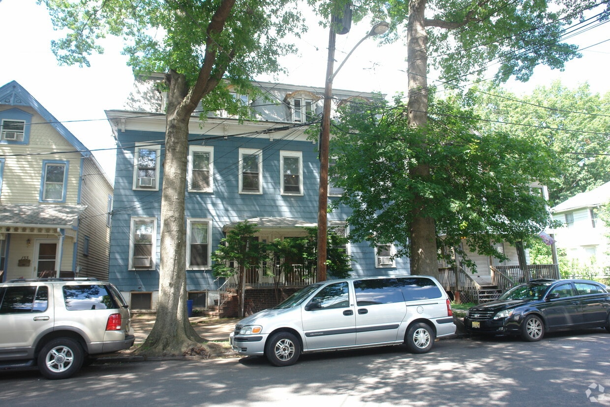
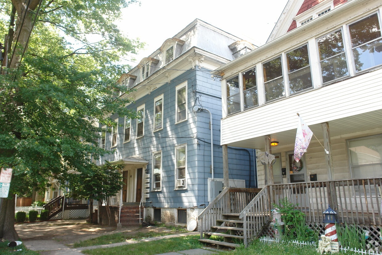
125 W Cherry St
125 W Cherry St,
Rahway,
NJ
07065
2 Weeks Ago
Favorites
125 W Cherry St
Favorites
Check Back Soon for Upcoming Availability
Fees and Policies
Details
Property Information
-
Built in 1900
-
5 units/3 stories
About 125 W Cherry St Rahway, NJ 07065
Experience Rahway living at 125 W Cherry St. This community is located in the 7065 area of Rahway. The professional leasing team is ready to show you our community. It's time to come home to 125 W Cherry St. Contact us or stop in to discuss your new apartment.
125 W Cherry St is an apartment community located in Union County and the 07065 ZIP Code. This area is served by the Rahway Public attendance zone.
Location
Get Directions
Education
| Colleges & Universities | Distance | ||
|---|---|---|---|
| Colleges & Universities | Distance | ||
| Drive: | 13 min | 6.3 mi | |
| Drive: | 16 min | 6.7 mi | |
| Drive: | 15 min | 7.6 mi | |
| Drive: | 18 min | 10.0 mi |
125 W Cherry St is within 13 minutes or 6.3 miles from Union County Coll., Elizabeth. It is also near Union County College, Cranford and Kean University.
Schools


Public Elementary School
Grades PK-6
573 Students
Nearby
Public Middle School
Grades PK & 7-8
675 Students
Attendance Zone
Public Elementary School
Grades PK-6
387 Students
Attendance Zone
Public High School
Grades 9-12
1,204 Students
Attendance Zone
Private Elementary School
Grades PK-6
53 Students
Nearby
Private Elementary & Middle School
Grades PK-8
386 Students
Nearby
Private High School
Grades 9-12
197 Students
Nearby
School data provided by
 The GreatSchools Rating helps parents compare schools within a state based on a variety of school quality indicators and provides a helpful picture of how effectively each school serves all of its students. Ratings are on a scale of 1 (below average) to 10 (above average) and can include test scores, college readiness, academic progress, advanced courses, equity, discipline and attendance data. We also advise parents to visit schools, consider other information on school performance and programs, and consider family needs as part of the school selection process.
View GreatSchools Rating Methodology
Data provided by GreatSchools.org © 2025. All rights reserved.
View GreatSchools Rating Methodology
Data provided by GreatSchools.org © 2025. All rights reserved.
Transportation options available in Rahway include 8Th Street Light Rail Station, located 11.6 miles from 125 W Cherry St. 125 W Cherry St is near Newark Liberty International, located 12.5 miles or 21 minutes away, and LaGuardia, located 33.0 miles or 53 minutes away.
| Transit / Subway | Distance | ||
|---|---|---|---|
| Transit / Subway | Distance | ||
| Drive: | 20 min | 11.6 mi | |
|
|
Drive: | 22 min | 12.8 mi |
| Commuter Rail | Distance | ||
|---|---|---|---|
| Commuter Rail | Distance | ||
|
|
Walk: | 2 min | 0.2 mi |
|
|
Drive: | 6 min | 2.3 mi |
|
|
Drive: | 7 min | 3.1 mi |
|
|
Drive: | 10 min | 4.5 mi |
|
|
Drive: | 11 min | 4.5 mi |
| Airports | Distance | ||
|---|---|---|---|
| Airports | Distance | ||
|
Newark Liberty International
|
Drive: | 21 min | 12.5 mi |
|
LaGuardia
|
Drive: | 53 min | 33.0 mi |
Time and distance from 125 W Cherry St.
| Shopping Centers | Distance | ||
|---|---|---|---|
| Shopping Centers | Distance | ||
| Walk: | 10 min | 0.5 mi | |
| Drive: | 4 min | 1.6 mi | |
| Drive: | 4 min | 1.7 mi |
125 W Cherry St has 3 shopping centers within 1.7 miles, which is about a 4-minute walk. The miles and minutes will be for the farthest away property.
| Parks and Recreation | Distance | ||
|---|---|---|---|
| Parks and Recreation | Distance | ||
|
Hawk Rise Sanctuary
|
Drive: | 6 min | 2.1 mi |
|
Merrill Park
|
Drive: | 7 min | 3.0 mi |
|
Liberty State Park
|
Drive: | 8 min | 3.4 mi |
|
Edison Park
|
Drive: | 9 min | 4.9 mi |
|
William Miller Sperry Observatory
|
Drive: | 14 min | 6.5 mi |
125 W Cherry St has 5 parks within 6.5 miles, including Hawk Rise Sanctuary, Merrill Park, and Liberty State Park.
| Hospitals | Distance | ||
|---|---|---|---|
| Hospitals | Distance | ||
| Walk: | 19 min | 1.0 mi | |
| Drive: | 11 min | 5.6 mi | |
| Drive: | 12 min | 6.0 mi |
125 W Cherry St has 3 hospitals within 6.0 miles, the nearest is Robert Wood Johnson University Hospital at Rahway which is 1.0 miles away and a 19 minute walk.
| Military Bases | Distance | ||
|---|---|---|---|
| Military Bases | Distance | ||
| Drive: | 11 min | 4.3 mi | |
| Drive: | 14 min | 5.0 mi | |
| Drive: | 25 min | 15.9 mi |
125 W Cherry St has 3 military bases within 15.9 miles, the nearest is Ash Brook Reservation which is 4.3 miles away and a 11 minute drive.
You May Also Like
How do I access Social Services in New Jersey?
Statewide service is free, confidential, multilingual and always open. Three easy ways to reach Social Services in NJ: Dial 2-1-1; text your zip code to 898-211; or chat at https://www.nj211.org
Similar Rentals Nearby


What Are Walk Score®, Transit Score®, and Bike Score® Ratings?
Walk Score® measures the walkability of any address. Transit Score® measures access to public transit. Bike Score® measures the bikeability of any address.
What is a Sound Score Rating?
A Sound Score Rating aggregates noise caused by vehicle traffic, airplane traffic and local sources
Responded To This Review