$4,000
Total Monthly Price
1232 Laurel Ave
East Palo Alto, CA 94303
Favorites
-
Bedrooms
3
-
Bathrooms
1
-
Square Feet
1,000 sq ft
-
Available
Available Aug 1
Highlight
- Pets Allowed
1232 Laurel Ave

Favorites
About This Home
12 Month Lease,
$4,000 deposit,
Available Aug 1
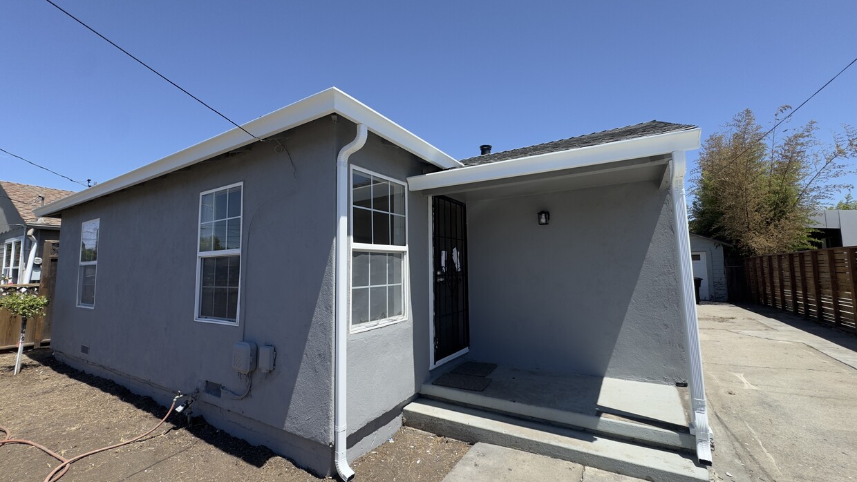
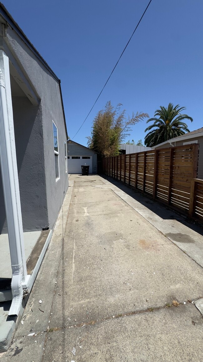
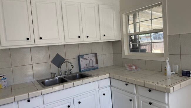
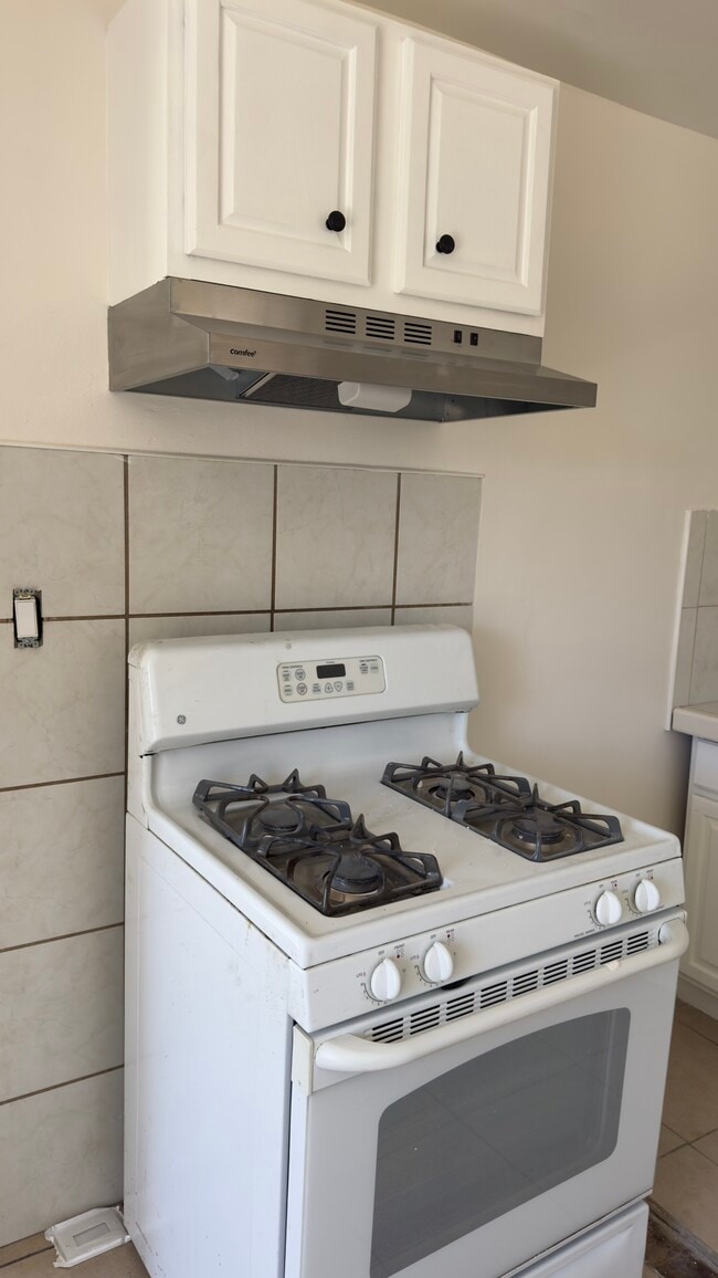
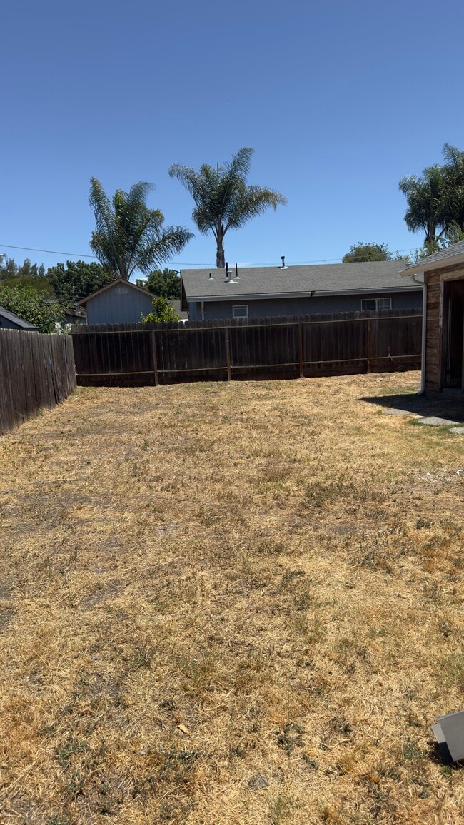
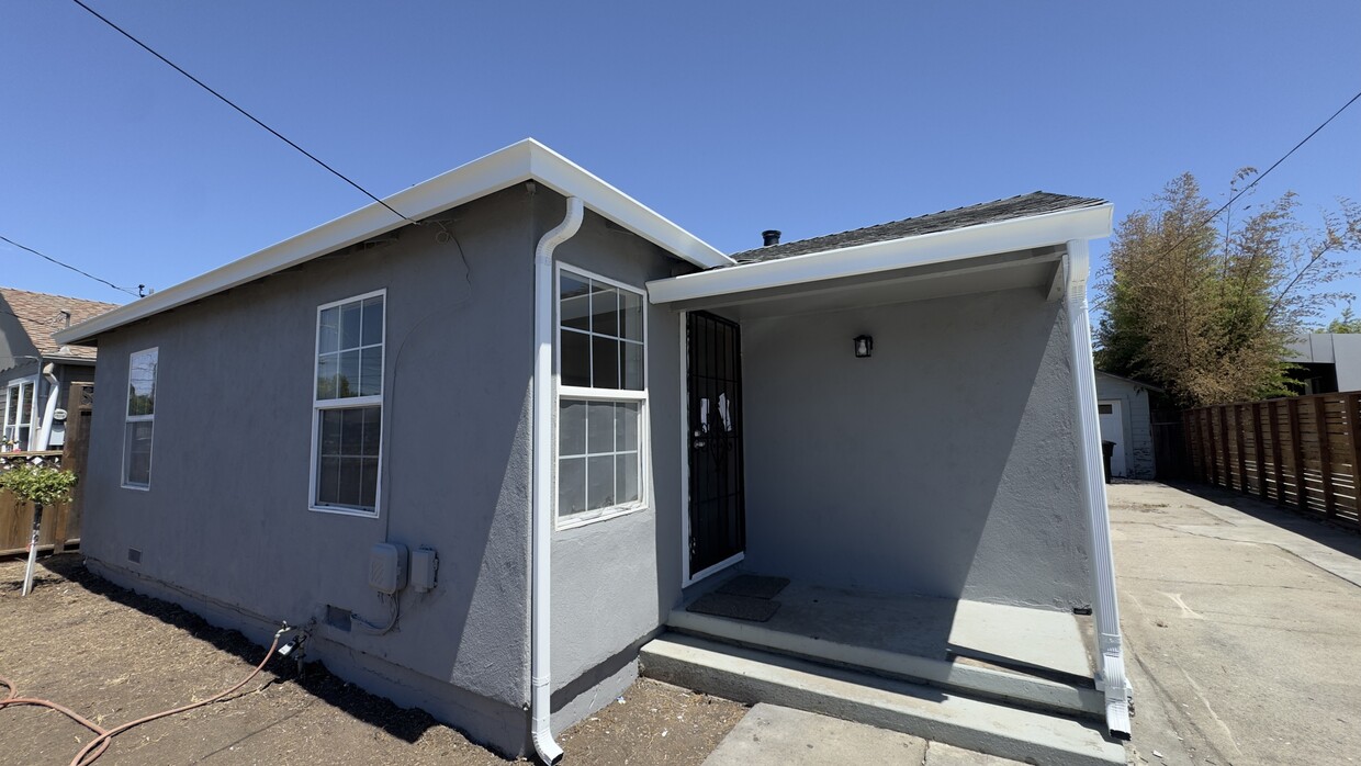
For Rent – Charming Single-Family Home Beautiful newly remodeled single-family home featuring a spacious driveway and a large backyard, perfect for outdoor entertaining, gardening, or relaxing with family and friends. Conveniently located just minutes from Meta, Stanford University, major highways, and the Dumbarton Bridge, offering easy access to Silicon Valley, the Peninsula, and the East Bay. Property Features: • Single-family home • Large driveway with ample parking • Spacious backyard • Prime commuter-friendly location • Close to shopping, dining, parks, and local amenities Don’t miss this opportunity to live in a desirable location with plenty of outdoor space and convenient access to major employers and transportation routes.
1232 Laurel Ave is a house located in San Mateo County and the 94303 ZIP Code.
* Price shown is total price based on community-supplied monthly required fees. Excludes user-selected optional fees and variable or usage-based fees and required charges due at or prior to move-in or at move-out. Price, availability, fees, and any applicable rent special are subject to change without notice.
* Square footage definitions vary. Displayed square footage is approximate.
House Features
Washer/Dryer Hookup
High Speed Internet Access
Tub/Shower
Heating
- High Speed Internet Access
- Washer/Dryer Hookup
- Heating
- Cable Ready
- Storage Space
- Tub/Shower
Fees and Policies
The fees listed below are community-provided and may exclude utilities or add-ons. All payments are made directly to the property and are non-refundable unless otherwise specified.
- Dogs Allowed
-
Fees not specified
- Cats Allowed
-
Fees not specified
- Parking
-
Surface Lot--
Contact
- Contact
Location
Get Directions
East Palo Alto sits at the edge of San Francisco Bay in San Mateo County, positioned almost exactly halfway between San Francisco and San Jose on the Peninsula. That central location puts residents within reach of two major job markets, and the city itself has drawn tech industry investment that continues to reshape its small but dense three-square-mile footprint. Incorporated in 1983, it carries a distinct identity separate from neighboring Palo Alto, though the two cities are divided by little more than San Francisquito Creek. Stanford University sits about five miles to the southwest, reinforcing the area's academic and innovation-driven atmosphere.
The housing mix here runs toward apartment communities and rental homes rather than high-rises, offering options that tend to be more accessible than those in surrounding Peninsula cities. Ravenswood 101 serves as the main commercial corridor, anchoring everyday retail alongside the bay shoreline.
Learn more about living in East Palo Alto
Education
| Colleges & Universities | Distance | ||
|---|---|---|---|
| Colleges & Universities | Distance | ||
| Drive: | 10 min | 4.7 mi | |
| Drive: | 14 min | 4.7 mi | |
| Drive: | 10 min | 6.0 mi | |
| Drive: | 18 min | 8.8 mi |
1232 Laurel Ave is within 10 minutes or 4.7 miles from Menlo College. It is also near Stanford University and Foothill College, Middlefield.
Transportation options available in East Palo Alto include Bayshore Nasa Station, located 8.3 miles from 1232 Laurel Ave. 1232 Laurel Ave is near Norman Y Mineta San Jose International, located 15.9 miles or 21 minutes away, and San Francisco International, located 18.4 miles or 24 minutes away.
| Transit / Subway | Distance | ||
|---|---|---|---|
| Transit / Subway | Distance | ||
| Drive: | 11 min | 8.3 mi | |
| Drive: | 11 min | 8.7 mi | |
|
|
Drive: | 12 min | 8.9 mi |
|
|
Drive: | 13 min | 9.0 mi |
| Drive: | 13 min | 9.2 mi |
| Commuter Rail | Distance | ||
|---|---|---|---|
| Commuter Rail | Distance | ||
| Drive: | 8 min | 2.8 mi | |
| Drive: | 8 min | 3.1 mi | |
| Drive: | 10 min | 5.3 mi | |
| Drive: | 9 min | 5.4 mi | |
| Drive: | 11 min | 6.8 mi |
| Airports | Distance | ||
|---|---|---|---|
| Airports | Distance | ||
|
Norman Y Mineta San Jose International
|
Drive: | 21 min | 15.9 mi |
|
San Francisco International
|
Drive: | 24 min | 18.4 mi |
Getting Around
 What do Walkability, Transit, Drivability, and Bikeability mean?
Walkability measures the walking distance to day-to-day needs.
Transit measures access to public transportation.
Drivability measures congestion, parking availability, and access to major roads.
Bikeability measures the suitability for cycling.
How It Works
What do Walkability, Transit, Drivability, and Bikeability mean?
Walkability measures the walking distance to day-to-day needs.
Transit measures access to public transportation.
Drivability measures congestion, parking availability, and access to major roads.
Bikeability measures the suitability for cycling.
How It Works
Fairly Walkable
Walkability
50
/ 100
Some Public Transit
Transit
50
/ 100
Exceptionally Drivable
Drivability
90
/ 100
Moderately Bikeable
Bikeability
60
/ 100
Scores provided by
What do Walkability, Transit, Drivability, and Bikeability mean?
Walkability measures the walking distance to day-to-day needs.
Transit measures access to public transportation.
Drivability measures congestion, parking availability, and access to major roads.
Bikeability measures the suitability for cycling.
How It Works
Active
Soundscore™
72
/ 100
Traffic
BusyAirport
ActiveBusinesses
ActiveScores provided by
HowLoud What is a Sound Score Rating? A Sound Score Rating aggregates noise caused by vehicle traffic, airplane traffic and local sources. How It WorksTime and distance from 1232 Laurel Ave.
| Shopping Centers | Distance | ||
|---|---|---|---|
| Shopping Centers | Distance | ||
| Walk: | 6 min | 0.3 mi | |
| Walk: | 14 min | 0.8 mi | |
| Walk: | 15 min | 0.8 mi |
1232 Laurel Ave has 3 shopping centers within 0.8 mile, which is about a 15-minute walk. The miles and minutes will be for the farthest away property.
| Parks and Recreation | Distance | ||
|---|---|---|---|
| Parks and Recreation | Distance | ||
|
Seminary Oaks Park
|
Drive: | 4 min | 1.5 mi |
|
Ravenswood Open Space Preserve
|
Drive: | 3 min | 1.6 mi |
|
Hopkins Creekside Park
|
Drive: | 5 min | 1.7 mi |
|
Burgess Park
|
Drive: | 7 min | 2.6 mi |
|
Bayfront Park
|
Drive: | 7 min | 2.8 mi |
1232 Laurel Ave has 5 parks within 2.8 miles, including Seminary Oaks Park, Ravenswood Open Space Preserve, and Hopkins Creekside Park.
| Hospitals | Distance | ||
|---|---|---|---|
| Hospitals | Distance | ||
| Drive: | 11 min | 3.8 mi | |
| Drive: | 12 min | 4.5 mi | |
| Drive: | 7 min | 4.8 mi |
1232 Laurel Ave has 3 hospitals within 4.8 miles, the nearest is Lucile Salter Packard Children's Hospital at Stanford which is 3.8 miles away and a 11 minute drive.
| Military Bases | Distance | ||
|---|---|---|---|
| Military Bases | Distance | ||
| Drive: | 14 min | 8.8 mi | |
| Drive: | 47 min | 34.1 mi | |
| Drive: | 48 min | 34.3 mi |
1232 Laurel Ave has 3 military bases within 34.3 miles, the nearest is Ames Research Center which is 8.8 miles away and a 14 minute drive.
Amenities
- High Speed Internet Access
- Washer/Dryer Hookup
- Heating
- Cable Ready
- Storage Space
- Tub/Shower
1232 Laurel Ave Photos
1232 Laurel Ave
East Palo Alto, CA 94303