12309 Pleasant Hill Ct
12309 Pleasant Hill Ct
Austin, TX 78738
Favorites
12309 Pleasant Hill Ct

Favorites
Check Back Soon for Upcoming Availability
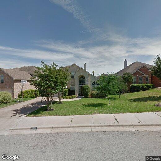
12309 Pleasant Hill Ct,
Austin,
TX
78738
Although it is the state capital and located deep in the heart of Texas, Austin generally has more in common with places like Portland, Oregon rather than other large Lone Star State cities like Dallas or Houston. Consistently named one of the best places to live in America, Austin combines passions for food, live music, entrepreneurship, iconoclastic attitudes, and Texas traditions into a wholly unique cocktail that people just can’t get enough of.
The expansion of the tech industry and the wild popularity of music festivals like Austin City Limits and South by Southwest have boosted Austin’s profile as one of America’s most in-demand communities of the 21st century so far, attracting people from all walks of life and every corner of the world.
Regardless of their atypical culture, Texas pride runs deep in Austinites. Many of the city’s hip, young entrepreneurs are more than happy to deal in classic regional staples like Tex-Mex food, cowboy boots, and country music.
Learn more about living in Austin
Education
| Colleges & Universities | Distance | ||
|---|---|---|---|
| Colleges & Universities | Distance | ||
| Drive: | 13 min | 7.6 mi | |
| Drive: | 19 min | 11.6 mi | |
| Drive: | 21 min | 13.4 mi | |
| Drive: | 26 min | 15.9 mi |
12309 Pleasant Hill Ct is within 13 minutes or 7.6 miles from Austin C.C., Pinnacle Campus. It is also near USAHS and Austin C.C., South Austin.
Walkability Near 12309 Pleasant Hill Ct Austin, TX 78738
Getting Around
 What do Walkability, Transit, Drivability, and Bikeability mean?
Walkability measures the walking distance to day-to-day needs.
Transit measures access to public transportation.
Drivability measures congestion, parking availability, and access to major roads.
Bikeability measures the suitability for cycling.
How It Works
What do Walkability, Transit, Drivability, and Bikeability mean?
Walkability measures the walking distance to day-to-day needs.
Transit measures access to public transportation.
Drivability measures congestion, parking availability, and access to major roads.
Bikeability measures the suitability for cycling.
How It Works
Fairly Walkable
Walkability
50
/ 100
Very Drivable
Drivability
80
/ 100
Fairly Bikeable
Bikeability
40
/ 100
Scores provided by
Active
Soundscore™
78
/ 100
Traffic
ActiveAirport
CalmBusinesses
CalmScores provided by
HowLoud What is a Sound Score Rating? A Sound Score Rating aggregates noise caused by vehicle traffic, airplane traffic and local sources. How It WorksYou May Also Like
Similar Rentals Nearby
-
-
3 Beds$2,159+Total Monthly PriceTotal Monthly Price NewPrices include base rent and required monthly fees of $59. Variable costs based on usage may apply.Base Rent:3 Beds$2,100+Discounts
Pets Allowed Dishwasher In Unit Washer & Dryer Maintenance on site Stainless Steel Appliances Granite Countertops
-
-
-
-
-
-
-
-


What Are Walk Score®, Transit Score®, and Bike Score® Ratings?
Walk Score® measures the walkability of any address. Transit Score® measures access to public transit. Bike Score® measures the bikeability of any address.
What is a Sound Score Rating?
A Sound Score Rating aggregates noise caused by vehicle traffic, airplane traffic and local sources.