

$2,700
/ Month
1227 W Oxford St
Philadelphia, PA 19122
2 Weeks Ago
|
Edit
Favorites
1227 W Oxford St

Favorites
Check Back Soon for Upcoming Availability
| Beds | Baths | Average SF |
|---|---|---|
| 4 Bedrooms 4 Bedrooms 4 Br | 2 Baths 2 Baths 2 Ba | — |
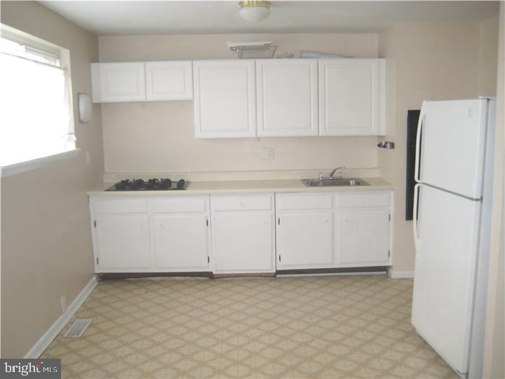
About This Property
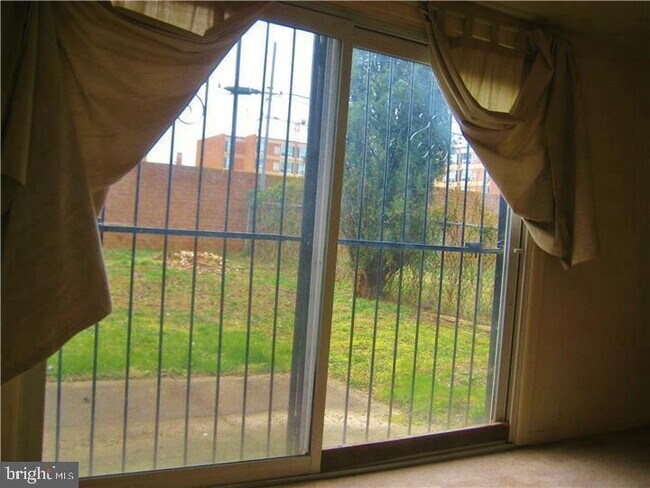
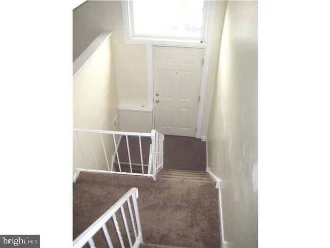
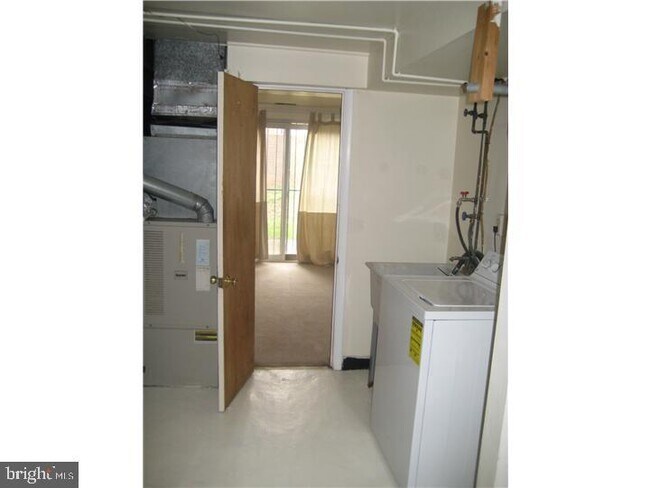
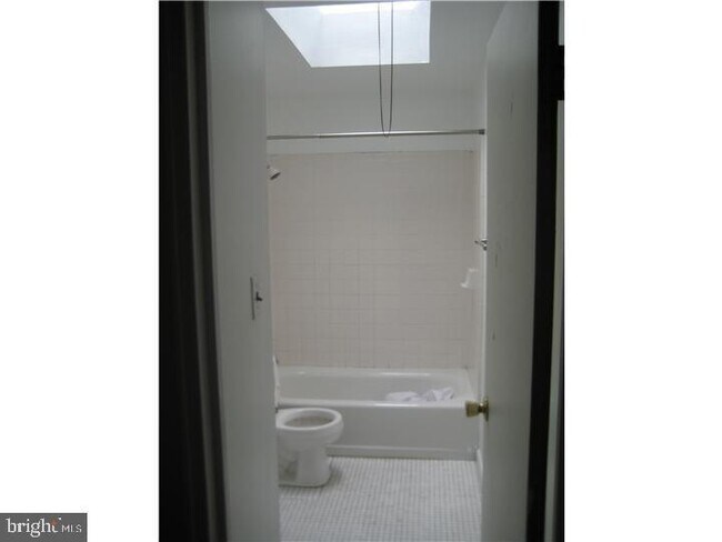
4 Bedrooms and 2 Bath spacious townhome available from 7/1/23. It is very close to campus.
1227 W Oxford St is a townhome located in Philadelphia County and the 19122 ZIP Code. This area is served by the The School District of Philadelphia attendance zone.
1227 W Oxford St,
Philadelphia,
PA
19122
Not to be confused with Northeast Philadelphia, North Philadelphia East encompasses the smaller subsets of Ludlow, Yorktown, West Kensington, Poplar, and Callowhill. This composite area runs from the Vine Street Expressway, stretching north to Erie Avenue. Broad Street acts as its eastern border, and the western edge runs a jagged line separating North Philadelphia East from the nearby Kensington, Port Richmond, and Fishtown neighborhoods. With such a long stretch of city, the neighborhood offers a diverse blend of important city landmarks, such as renowned musical venues the Electric Factory and Union Transfer, and Temple University, North Philadelphia's premiere site of higher learning.
Learn more about living in North Philadelphia EastBelow are rent ranges for similar nearby apartments
| Beds | Average Size | Lowest | Typical | Premium |
|---|---|---|---|---|
| Studio Studio Studio | 501-506 Sq Ft | $425 | $1,548 | $7,512 |
| 1 Bed 1 Bed 1 Bed | 707-709 Sq Ft | $510 | $1,913 | $7,648 |
| 2 Beds 2 Beds 2 Beds | 1007-1010 Sq Ft | $499 | $2,111 | $10,033 |
| 3 Beds 3 Beds 3 Beds | 1370-1371 Sq Ft | $599 | $2,041 | $8,159 |
| 4 Beds 4 Beds 4 Beds | 1760 Sq Ft | $525 | $2,358 | $4,950 |
Education
| Colleges & Universities | Distance | ||
|---|---|---|---|
| Colleges & Universities | Distance | ||
| Walk: | 6 min | 0.3 mi | |
| Drive: | 4 min | 1.6 mi | |
| Drive: | 5 min | 1.6 mi | |
| Drive: | 6 min | 2.3 mi |
1227 W Oxford St is within 6 minutes or 0.3 mile from Temple University, Main Campus. It is also near C.C. of Philadelphia and Drexel Univ., Hahnemann.
Schools


Public Elementary & Middle School
Grades PK-8
239 Students
Attendance Zone
Public High School
Grades 9-12
466 Students
Attendance Zone
Private Elementary School
Grades PK-5
Nearby
Private Elementary & Middle School
Grades PK-8
282 Students
Nearby
Private High School
Grades 9-12
902 Students
Nearby
Private High School
Grades 9-12
7 Students
Nearby
School data provided by
 The GreatSchools Rating helps parents compare schools within a state based on a variety of school quality indicators and provides a helpful picture of how effectively each school serves all of its students. Ratings are on a scale of 1 (below average) to 10 (above average) and can include test scores, college readiness, academic progress, advanced courses, equity, discipline and attendance data. We also advise parents to visit schools, consider other information on school performance and programs, and consider family needs as part of the school selection process.
View GreatSchools Rating Methodology
Data provided by GreatSchools.org © 2026. All rights reserved.
View GreatSchools Rating Methodology
Data provided by GreatSchools.org © 2026. All rights reserved.
Transportation options available in Philadelphia include Cecil B Moore, located 0.2 mile from 1227 W Oxford St. 1227 W Oxford St is near Philadelphia International, located 14.1 miles or 25 minutes away, and Trenton Mercer, located 33.3 miles or 51 minutes away.
| Transit / Subway | Distance | ||
|---|---|---|---|
| Transit / Subway | Distance | ||
|
|
Walk: | 4 min | 0.2 mi |
| Walk: | 11 min | 0.6 mi | |
|
|
Walk: | 11 min | 0.6 mi |
| Walk: | 12 min | 0.6 mi | |
| Walk: | 13 min | 0.7 mi |
| Commuter Rail | Distance | ||
|---|---|---|---|
| Commuter Rail | Distance | ||
|
|
Walk: | 12 min | 0.6 mi |
|
|
Drive: | 3 min | 1.2 mi |
|
|
Drive: | 4 min | 1.4 mi |
|
|
Drive: | 6 min | 1.8 mi |
|
|
Drive: | 5 min | 2.1 mi |
| Airports | Distance | ||
|---|---|---|---|
| Airports | Distance | ||
|
Philadelphia International
|
Drive: | 25 min | 14.1 mi |
|
Trenton Mercer
|
Drive: | 51 min | 33.3 mi |
Walkability Near 1227 W Oxford St Philadelphia, PA 19122
Getting Around
 What do Walkability, Transit, Drivability, and Bikeability mean?
Walkability measures the walking distance to day-to-day needs.
Transit measures access to public transportation.
Drivability measures congestion, parking availability, and access to major roads.
Bikeability measures the suitability for cycling.
How It Works
What do Walkability, Transit, Drivability, and Bikeability mean?
Walkability measures the walking distance to day-to-day needs.
Transit measures access to public transportation.
Drivability measures congestion, parking availability, and access to major roads.
Bikeability measures the suitability for cycling.
How It Works
Exceptionally Walkable
Walkability
100
/ 100
Exceptional Public Transit
Transit
90
/ 100
Fairly Drivable
Drivability
40
/ 100
Moderately Bikeable
Bikeability
60
/ 100
Scores provided by
-
Soundscore™
-
/ 100
Traffic
-Airport
-Businesses
-Scores provided by
HowLoud What is a Sound Score Rating? A Sound Score Rating aggregates noise caused by vehicle traffic, airplane traffic and local sources. How It WorksTime and distance from 1227 W Oxford St.
| Shopping Centers | Distance | ||
|---|---|---|---|
| Shopping Centers | Distance | ||
| Walk: | 4 min | 0.2 mi | |
| Walk: | 5 min | 0.3 mi | |
| Walk: | 14 min | 0.7 mi |
1227 W Oxford St has 3 shopping centers within 0.7 mile, which is about a 14-minute walk. The miles and minutes will be for the farthest away property.
| Parks and Recreation | Distance | ||
|---|---|---|---|
| Parks and Recreation | Distance | ||
|
Wagner Free Institute of Science
|
Walk: | 11 min | 0.6 mi |
|
Edgar Allan Poe Nat'l Historic Site
|
Drive: | 5 min | 1.6 mi |
|
The Academy of Natural Sciences
|
Drive: | 5 min | 2.1 mi |
|
Fels Planetarium
|
Drive: | 6 min | 2.2 mi |
|
Franklin Institute
|
Drive: | 6 min | 2.2 mi |
1227 W Oxford St has 5 parks within 2.2 miles, including Wagner Free Institute of Science, Edgar Allan Poe Nat'l Historic Site, and The Academy of Natural Sciences.
| Hospitals | Distance | ||
|---|---|---|---|
| Hospitals | Distance | ||
| Drive: | 4 min | 1.5 mi | |
| Drive: | 6 min | 2.1 mi | |
| Drive: | 7 min | 2.5 mi |
1227 W Oxford St has 3 hospitals within 2.5 miles, the nearest is Hahnemann University Hospital which is 1.5 miles away and a 4 minute drive.
| Military Bases | Distance | ||
|---|---|---|---|
| Military Bases | Distance | ||
| Drive: | 15 min | 8.5 mi |
1227 W Oxford St is 8.5 miles and a 15 minute drive from Philadelphia Naval Busi Center.
You May Also Like
Similar Rentals Nearby
-
-

-
-

-

-

-
 4 Beds, 4 Baths, 2,640 sq ft$4,900Total Monthly PriceTotal Monthly Price NewPrices include all required monthly fees.601 Poplar St
 -
 4 Beds, 2 Baths, 1,536 sq ft$2,000Total Monthly PriceTotal Monthly Price NewPrices include all required monthly fees.1525 S 24th St
 -
 4 Beds, 3 Baths, 2,250 sq ft$2,500Total Monthly PriceTotal Monthly Price NewPrices include all required monthly fees.5736 Woodcrest Ave
 -
 4 Beds, 3 Baths, 2,040 sq ft$2,950Total Monthly PriceTotal Monthly Price NewPrices include all required monthly fees.4658 Mansion St

What Are Walk Score®, Transit Score®, and Bike Score® Ratings?
Walk Score® measures the walkability of any address. Transit Score® measures access to public transit. Bike Score® measures the bikeability of any address.
What is a Sound Score Rating?
A Sound Score Rating aggregates noise caused by vehicle traffic, airplane traffic and local sources.
1227 W Oxford St
Philadelphia, PA 19122