$2,800 / Month
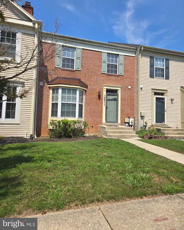
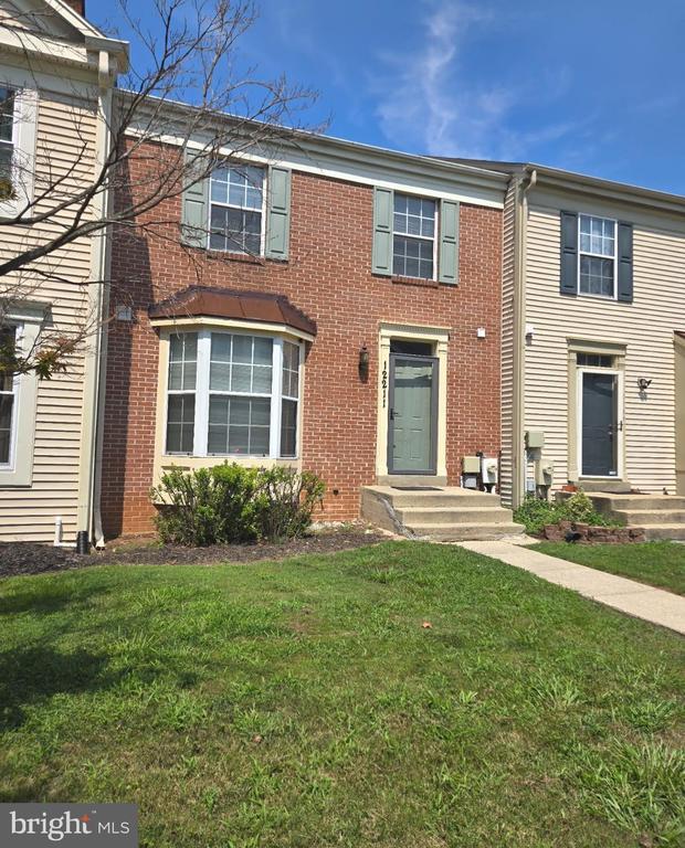
12211 Blue Moon Ct
Laurel, MD 20708
Today
Favorites
240-602-5188
-
Bedrooms
3
-
Bathrooms
3.5
-
Square Feet
--
-
Available
Available Aug 15
Highlights
- Colonial Architecture
- Attic
- Den
- Eat-In Kitchen
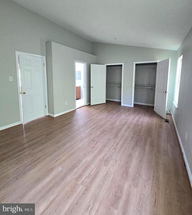
- En-Suite Primary Bedroom
- Forced Air Heating and Cooling System
12211 Blue Moon Ct

Favorites
About This Home
Available Aug 15
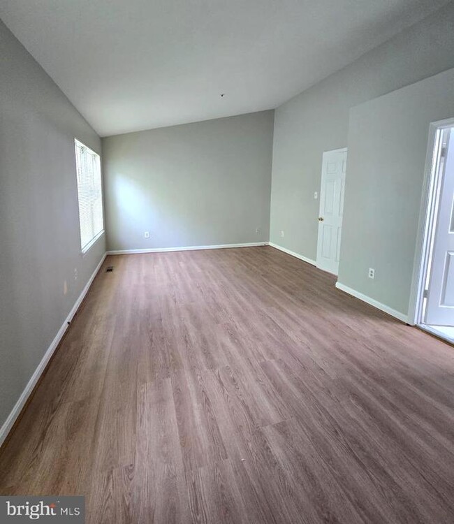
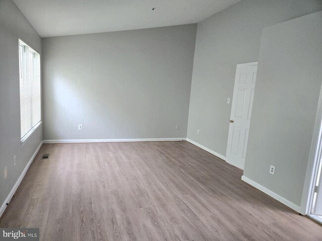
A very nice 3-level Townhome located in the Montpelier Hills subdivision of Laurel, MD. This Townhome was recently upgraded. Features include 3 bedrooms (with brand-new luxury vinyl plank flooring), 3.5 baths, a fully finished basement with a den, family room, plus storage. There is hardwood flooring in the living/dining area. The home also has a spacious kitchen with a bay window and energy-efficient appliances. The External features include a large backyard and two reserved parking spaces. An ideal location with easy access to shopping centers, entertainment, and Washington, DC via MD 295/BW Parkway.
12211 Blue Moon Ct is a townhome located in Prince George's County and the 20708 ZIP Code. This area is served by the Prince George's County Public Schools attendance zone.
* Price shown is base rent and may not include non-optional fees and utilities.
Price, availability, fees, and any applicable rent special are subject to change without notice.
* Square footage definitions vary. Displayed square footage is approximate.
Home Details
Home Type
Interior Unit Townhome
Year Built
Built in 1988 | Remodeled in 2025
Bedrooms and Bathrooms
En-Suite Primary Bedroom
3.5 Bathrooms
En-Suite Bathroom
3 Bedrooms
Finished Basement
Basement with some natural light
Rear Basement Entry
Home Design
Colonial Architecture
Brick Exterior Construction
Block Foundation
Interior Spaces
Den
Combination Dining and Living Room
Family Room
1,596 Sq Ft Home
Fireplace With Glass Doors
Property has 3 Levels
Window Treatments
Kitchen
Eat-In Kitchen
ENERGY STAR Qualified Dishwasher
ENERGY STAR Qualified Refrigerator
Stove
Microwave
Disposal
Laundry
Dryer
ENERGY STAR Qualified Washer
Listing and Financial Details
Security Deposit $2,800
12-Month Min and 24-Month Max Lease Term
Available 8/1/25
Assessor Parcel Number 17101001874
No Smoking Allowed
Coming Soon on 8/18/25
Residential Lease
Lot Details
1,760 Sq Ft Lot
Parking
2 Assigned Parking Spaces
On-Street Parking
Utilities
Forced Air Heating and Cooling System
Heat Pump System
Electric Water Heater
Vented Exhaust Fan
Community Details
Overview
No Home Owners Association
Montpelier Hills Plat 1 Subdivision
Pet Policy
Breed Restrictions
Pet Deposit $350
Contact
- Listed by Chizea C Nwosa | Bennett Realty Solutions
- Phone Number
- Contact
-
Source
 Bright MLS, Inc.
Copyright © 2025 Bright MLS, Inc.
Location
Get Directions
Amenities
- Fireplace
- Basement
If you haven’t been to South Laurel yet, imagine a hilly, wooded community with attractive houses and peaceful roads. Together with its manicured lawns and shady sidewalks, you might think this is a suburban neighborhood. Well, sort of – it is, after all, only 18 miles from DC -- but there’s much more to South Laurel. For one, the Patuxent Research Refuge is its backyard.
The vast Patuxent Research Refuge covers nearly 13,000 acres of land. It was established in 1936 by President Franklin D. Roosevelt to support wildlife research – the only one established for such a purpose. The refuge is ideal for birdwatching, hiking, and fishing. For those who prefer shopping to hiking, Baltimore Avenue is home to Towne Centre at Laurel, a large shopping plaza with a movie theater and several restaurants. Head into Downtown Laurel to visit the shops and restaurants along Main Street.
Learn more about living in South Laurel
Education
| Colleges & Universities | Distance | ||
|---|---|---|---|
| Colleges & Universities | Distance | ||
| Drive: | 12 min | 7.2 mi | |
| Drive: | 19 min | 10.1 mi | |
| Drive: | 20 min | 13.4 mi | |
| Drive: | 25 min | 13.9 mi |
12211 Blue Moon Ct is within 12 minutes or 7.2 miles from Bowie State University. It is also near University of Maryland and Univ. of Md. Univ. Coll..
Schools


Public Elementary School
Grades PK-5
562 Students
Attendance Zone
Public Middle School
Grades 6-8
1,084 Students
Attendance Zone
Public High School
Grades 9-12
2,134 Students
Attendance Zone
Private Elementary & Middle School
Grades PK-8
157 Students
Nearby
Private Elementary, Middle & High School
Grades 1-12
110 Students
Nearby
School data provided by
 The GreatSchools Rating helps parents compare schools within a state based on a variety of school quality indicators and provides a helpful picture of how effectively each school serves all of its students. Ratings are on a scale of 1 (below average) to 10 (above average) and can include test scores, college readiness, academic progress, advanced courses, equity, discipline and attendance data. We also advise parents to visit schools, consider other information on school performance and programs, and consider family needs as part of the school selection process.
View GreatSchools Rating Methodology
Data provided by GreatSchools.org © 2025. All rights reserved.
View GreatSchools Rating Methodology
Data provided by GreatSchools.org © 2025. All rights reserved.
Transportation options available in Laurel include Greenbelt, Green/Yellow Line Center Platform, located 8.6 miles from 12211 Blue Moon Ct. 12211 Blue Moon Ct is near Baltimore/Washington International Thurgood Marshall, located 16.2 miles or 25 minutes away, and Ronald Reagan Washington Ntl, located 22.7 miles or 36 minutes away.
| Transit / Subway | Distance | ||
|---|---|---|---|
| Transit / Subway | Distance | ||
| Drive: | 15 min | 8.6 mi | |
|
|
Drive: | 16 min | 10.3 mi |
| Drive: | 20 min | 11.9 mi | |
| Drive: | 20 min | 11.9 mi | |
| Drive: | 21 min | 12.2 mi |
| Commuter Rail | Distance | ||
|---|---|---|---|
| Commuter Rail | Distance | ||
|
|
Drive: | 6 min | 3.5 mi |
|
|
Drive: | 7 min | 3.6 mi |
|
|
Drive: | 9 min | 4.3 mi |
|
Bowie State Marc Sb
|
Drive: | 11 min | 6.6 mi |
|
Bowie State Marc Nb
|
Drive: | 12 min | 7.2 mi |
| Airports | Distance | ||
|---|---|---|---|
| Airports | Distance | ||
|
Baltimore/Washington International Thurgood Marshall
|
Drive: | 25 min | 16.2 mi |
|
Ronald Reagan Washington Ntl
|
Drive: | 36 min | 22.7 mi |
Time and distance from 12211 Blue Moon Ct.
| Shopping Centers | Distance | ||
|---|---|---|---|
| Shopping Centers | Distance | ||
| Walk: | 16 min | 0.9 mi | |
| Drive: | 3 min | 1.5 mi | |
| Drive: | 3 min | 1.6 mi |
12211 Blue Moon Ct has 3 shopping centers within 1.6 miles, which is about a 3-minute walk. The miles and minutes will be for the farthest away property.
| Parks and Recreation | Distance | ||
|---|---|---|---|
| Parks and Recreation | Distance | ||
|
Patuxent Research Refuge - South Tract
|
Drive: | 10 min | 5.0 mi |
|
NASA Goddard Space Flight Center
|
Drive: | 12 min | 6.4 mi |
|
Fairland Regional Park
|
Drive: | 12 min | 6.5 mi |
|
Howard Owens Science Center
|
Drive: | 13 min | 7.4 mi |
|
Patuxent Research Refuge - North Tract
|
Drive: | 14 min | 7.5 mi |
12211 Blue Moon Ct has 5 parks within 7.5 miles, including Patuxent Research Refuge - South Tract, Fairland Regional Park, and NASA Goddard Space Flight Center.
| Hospitals | Distance | ||
|---|---|---|---|
| Hospitals | Distance | ||
| Drive: | 8 min | 3.7 mi | |
| Drive: | 14 min | 8.0 mi | |
| Drive: | 14 min | 8.2 mi |
12211 Blue Moon Ct has 3 hospitals within 8.2 miles, the nearest is Laurel Regional Medical Center which is 3.7 miles away and a 8 minute drive.
| Military Bases | Distance | ||
|---|---|---|---|
| Military Bases | Distance | ||
| Drive: | 15 min | 9.0 mi |
12211 Blue Moon Ct is 9.0 miles and a 15 minute drive from Fort George Meade.
You May Also Like
Similar Rentals Nearby


What Are Walk Score®, Transit Score®, and Bike Score® Ratings?
Walk Score® measures the walkability of any address. Transit Score® measures access to public transit. Bike Score® measures the bikeability of any address.
What is a Sound Score Rating?
A Sound Score Rating aggregates noise caused by vehicle traffic, airplane traffic and local sources

12211 Blue Moon Ct
Laurel, MD 20708