

$1,700
Total Monthly Price
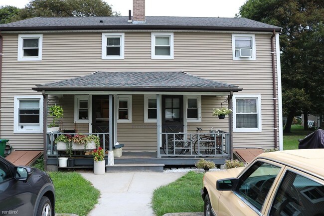
118 Rowe St Unit A
Auburndale, MA 02466
2 Weeks Ago
|
Edit
Favorites
118 Rowe St Unit A

Favorites
Check Back Soon for Upcoming Availability
| Beds | Baths | Average SF |
|---|---|---|
| 2 Bedrooms 2 Bedrooms 2 Br | 1 Bath 1 Bath 1 Ba | — |
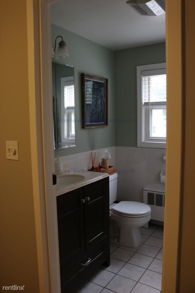
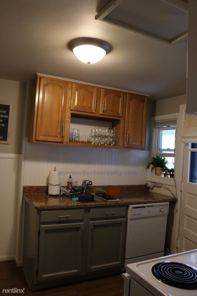
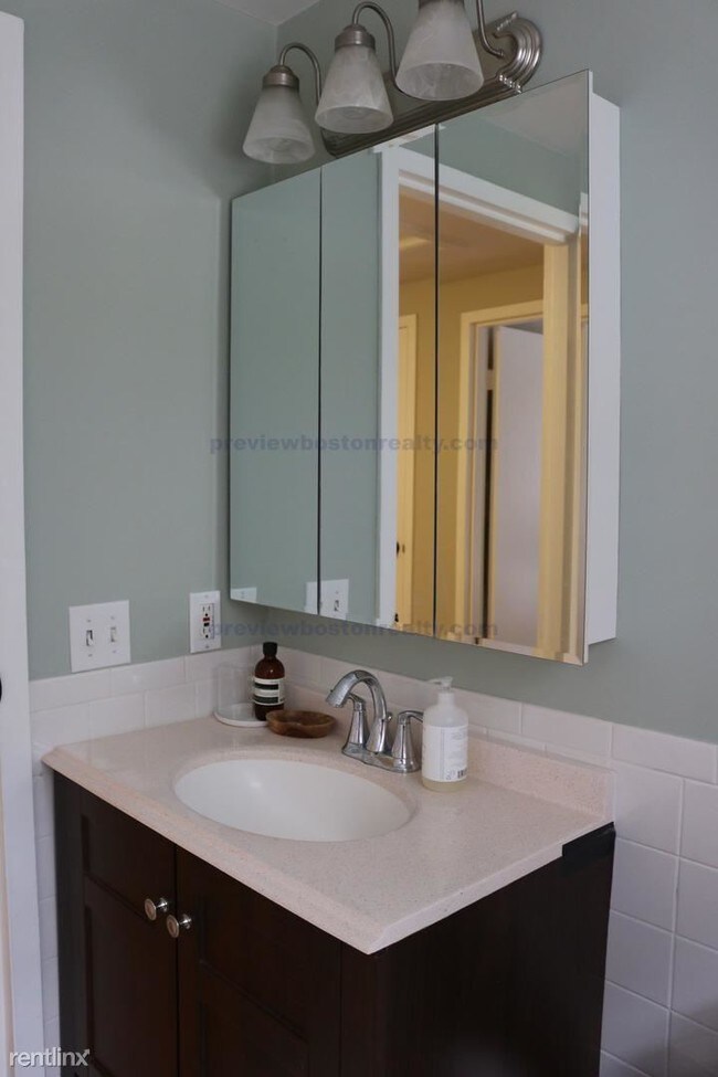
About This Property
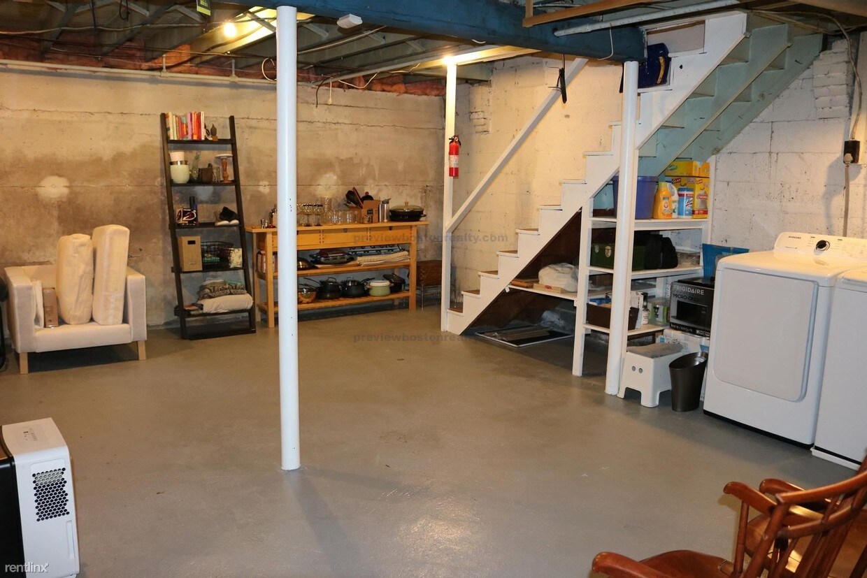
(857) 919-0350 - Excellent Property available for Rent through Preview Properties - Allston (RLNE3480893) Other Amenities - Unfurnished. Appliances - Washer & Dryer- In Building |, Washer & Dryer Hookup. Lease lengths - 12 Months. Details regarding this property's Utilities - Resident Pays Heat, Resident Pays Electricity, Resident Pays Gas, Water Included, Trash Pick-up Included.
118 Rowe St is a condo located in Middlesex County and the 02466 ZIP Code. This area is served by the Newton School District attendance zone.
118 Rowe St,
Auburndale,
MA
02466
Auburndale, affectionately referred to as “The Dale” by locals, is one of 13 villages in the City of Newton. Situated near the intersection of Interstates 90 and 95, the Dale is surrounded by the City of Waltham and the Charles River as well as three other Newton villages including West Newton, Waban, and Newton Lower Falls. Getting around from the Dale is simple with access to the MBTA commuter rail.
The western end of Auburndale is well known for containing two historic parks, Norumbega Park and the Auburndale Cove Park and Playground, which offer plenty of options for outdoor recreation. The Auburndale Historic District is comprised of about 275 properties, many of which are on the National Register of Historic Places. Treasured resources like the Auburndale Community Library and Lasell College provide learning opportunities for the community.
Learn more about living in Auburndale
Education
| Colleges & Universities | Distance | ||
|---|---|---|---|
| Colleges & Universities | Distance | ||
| Drive: | 8 min | 3.2 mi | |
| Drive: | 10 min | 4.1 mi | |
| Drive: | 10 min | 5.0 mi | |
| Drive: | 12 min | 5.6 mi |
118 Rowe St Unit A is within 8 minutes or 3.2 miles from Brandeis University. It is also near Bentley University and Boston College.
Schools


Public Elementary School
Grades PK-5
396 Students
Nearby
Public Elementary School
Grades K-5
336 Students
Attendance Zone
Public Middle School
Grades 6-8
830 Students
Attendance Zone
Public High School
Grades 9-12
2,055 Students
Attendance Zone
Private Elementary & Middle School
Grades PK-8
517 Students
Nearby
Private Middle & High School
Grades 6-12
39 Students
Nearby
School data provided by
 The GreatSchools Rating helps parents compare schools within a state based on a variety of school quality indicators and provides a helpful picture of how effectively each school serves all of its students. Ratings are on a scale of 1 (below average) to 10 (above average) and can include test scores, college readiness, academic progress, advanced courses, equity, discipline and attendance data. We also advise parents to visit schools, consider other information on school performance and programs, and consider family needs as part of the school selection process.
View GreatSchools Rating Methodology
Data provided by GreatSchools.org © 2026. All rights reserved.
View GreatSchools Rating Methodology
Data provided by GreatSchools.org © 2026. All rights reserved.
Transportation options available in Auburndale include Riverside Station, located 1.2 miles from 118 Rowe St Unit A. 118 Rowe St Unit A is near General Edward Lawrence Logan International, located 13.9 miles or 23 minutes away, and Worcester Regional, located 39.0 miles or 56 minutes away.
| Transit / Subway | Distance | ||
|---|---|---|---|
| Transit / Subway | Distance | ||
|
|
Drive: | 4 min | 1.2 mi |
|
|
Drive: | 3 min | 1.4 mi |
|
|
Drive: | 5 min | 2.5 mi |
|
|
Drive: | 8 min | 3.3 mi |
|
|
Drive: | 8 min | 3.8 mi |
| Commuter Rail | Distance | ||
|---|---|---|---|
| Commuter Rail | Distance | ||
|
|
Drive: | 6 min | 2.5 mi |
| Drive: | 6 min | 2.5 mi | |
|
|
Drive: | 5 min | 2.8 mi |
|
|
Drive: | 10 min | 6.1 mi |
|
|
Drive: | 12 min | 6.9 mi |
| Airports | Distance | ||
|---|---|---|---|
| Airports | Distance | ||
|
General Edward Lawrence Logan International
|
Drive: | 23 min | 13.9 mi |
|
Worcester Regional
|
Drive: | 56 min | 39.0 mi |
Time and distance from 118 Rowe St Unit A.
| Shopping Centers | Distance | ||
|---|---|---|---|
| Shopping Centers | Distance | ||
| Walk: | 5 min | 0.3 mi | |
| Drive: | 4 min | 2.1 mi | |
| Drive: | 8 min | 3.3 mi |
118 Rowe St Unit A has 3 shopping centers within 3.3 miles, which is about a 8-minute drive. The miles and minutes will be for the farthest away property.
| Parks and Recreation | Distance | ||
|---|---|---|---|
| Parks and Recreation | Distance | ||
|
Land's Sake Farm
|
Drive: | 8 min | 3.7 mi |
|
Hemlock Gorge Reservation
|
Drive: | 9 min | 3.8 mi |
|
Hammond Pond Reservation
|
Drive: | 9 min | 4.4 mi |
|
Beaver Brook Reservation
|
Drive: | 10 min | 4.8 mi |
|
Cutler Park Reservation
|
Drive: | 10 min | 5.5 mi |
118 Rowe St Unit A has 5 parks within 5.5 miles, including Hemlock Gorge Reservation, Land's Sake Farm, and Hammond Pond Reservation.
| Hospitals | Distance | ||
|---|---|---|---|
| Hospitals | Distance | ||
| Drive: | 3 min | 1.5 mi | |
| Drive: | 6 min | 2.5 mi | |
| Drive: | 11 min | 5.2 mi |
118 Rowe St Unit A has 3 hospitals within 5.2 miles, the nearest is Newton - Wellesley Hospital which is 1.5 miles away and a 3 minute drive.
| Military Bases | Distance | ||
|---|---|---|---|
| Military Bases | Distance | ||
| Drive: | 17 min | 9.2 mi | |
| Drive: | 19 min | 10.3 mi |
118 Rowe St Unit A is 9.2 miles from US Military Reservation, and is convenient to other military bases, including Hanscom Air Force Base.
You May Also Like
Similar Rentals Nearby


What Are Walk Score®, Transit Score®, and Bike Score® Ratings?
Walk Score® measures the walkability of any address. Transit Score® measures access to public transit. Bike Score® measures the bikeability of any address.
What is a Sound Score Rating?
A Sound Score Rating aggregates noise caused by vehicle traffic, airplane traffic and local sources.
118 Rowe St
Auburndale, MA 02466