
$1,399 / Month
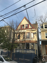
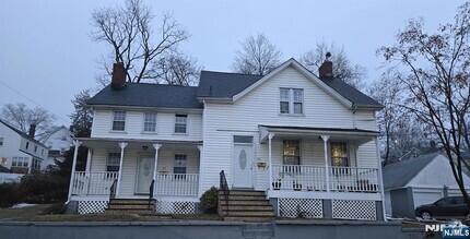
117 Monroe St Unit B
Roselle, NJ 07203
2 Weeks Ago
Favorites
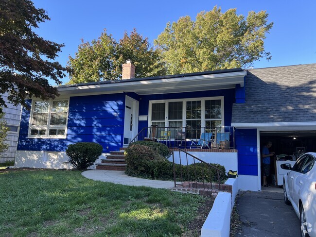
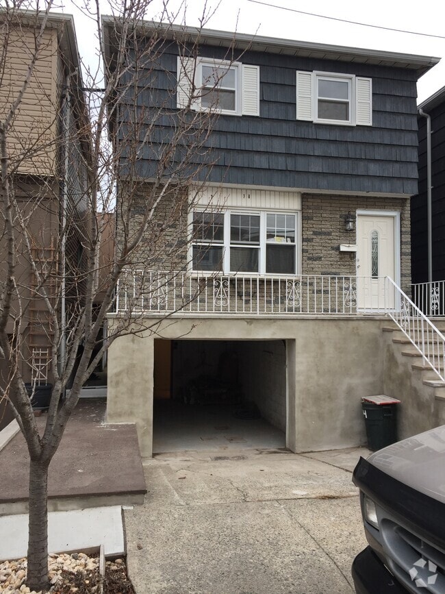
117 Monroe St

Favorites
Check Back Soon for Upcoming Availability
| Beds | Baths | Average SF |
|---|---|---|
| 1 Bedroom 1 Bedroom 1 Br | 1 Bath 1 Bath 1 Ba | 600 SF |
Fees and Policies
Details
Property Information
-
2 units
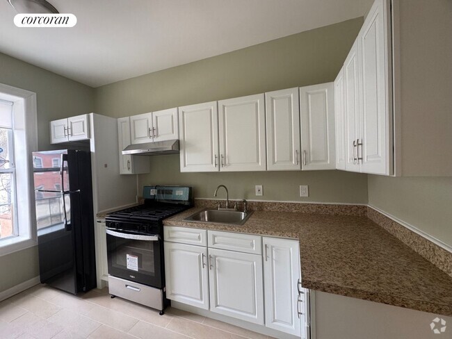
About This Property
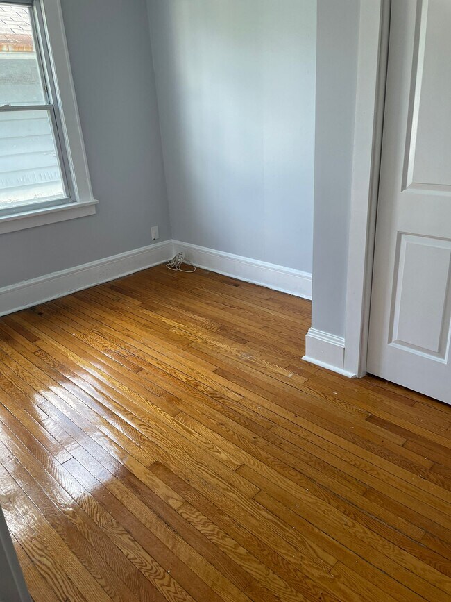
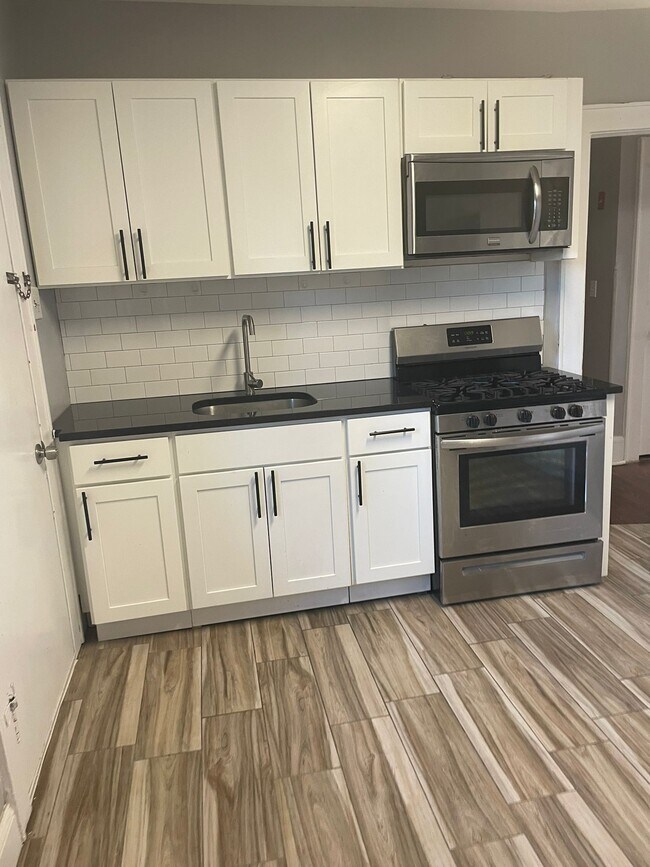
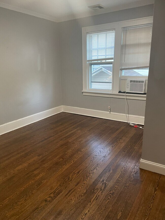
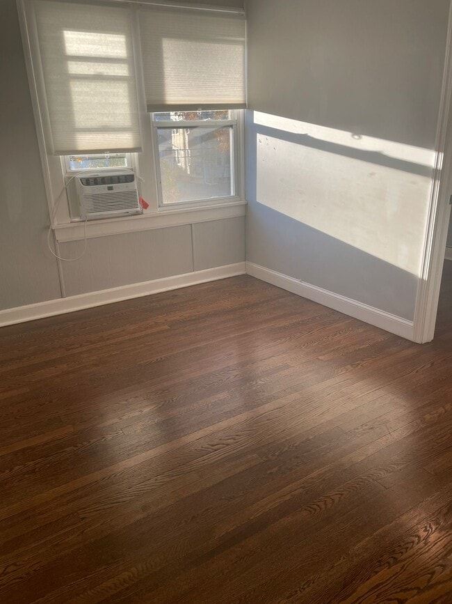
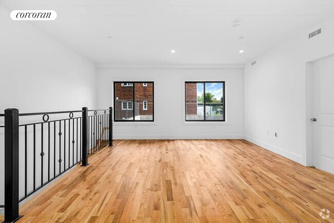
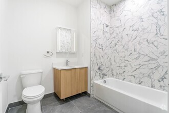
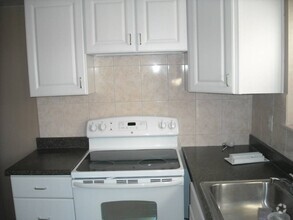
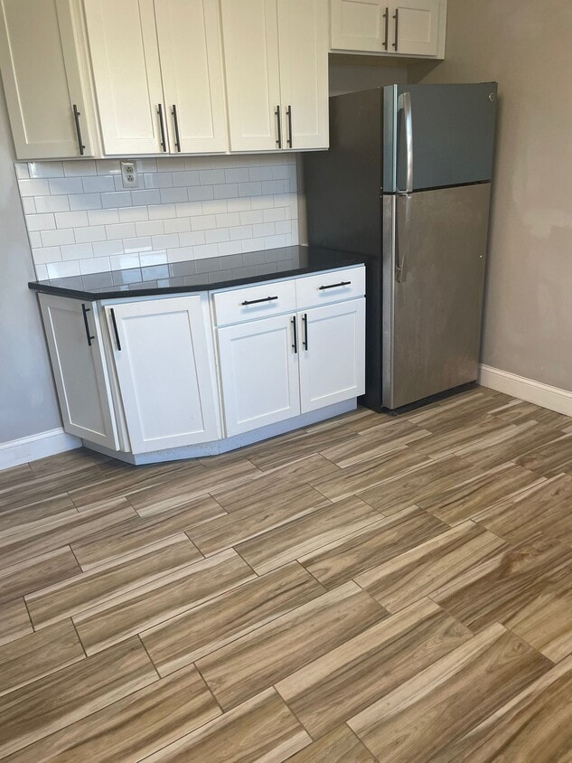
Renovated apartment in a great location NO BROKER FEE Close to public transportation and a park We require proof of income and good credit
117 Monroe St is a house located in Union County and the 07203 ZIP Code.
Location
Get Directions
Ideally located about 10 miles southwest of Newark and 18 miles from New York City, Roselle is a cozy borough for those looking for a quieter place to call home. First settled around 1664, Roselle was settled by farmers looking for better farmland. It was part of the first New Jersey settlement called Elizabethtown. The borough was officially incorporated in 1894 as Roselle.
Today, this terrific community features beautiful parks and great shopping. Warinanco Park, the borough's largest park, offers ball fields, a running track, a playground, pedal boats, an ice skating rink, a fitness trail, a bicycle path, fishing, a spray pool, tennis courts, picnic areas, and shuffleboard. Roselle's tree-lined streets are mainly residential, with a shopping district located between Westfield Avenue and West 1st Avenue.
Learn more about living in Roselle
Education
| Colleges & Universities | Distance | ||
|---|---|---|---|
| Colleges & Universities | Distance | ||
| Drive: | 5 min | 2.3 mi | |
| Drive: | 6 min | 2.5 mi | |
| Drive: | 12 min | 4.2 mi | |
| Drive: | 19 min | 8.9 mi |
117 Monroe St is within 5 minutes or 2.3 miles from Union County Coll., Elizabeth. It is also near Kean University and Union County College, Cranford.
Transportation options available in Roselle include Norfolk Street Light Rail Station, located 8.1 miles from 117 Monroe St. 117 Monroe St is near Newark Liberty International, located 8.9 miles or 17 minutes away, and Laguardia, located 26.7 miles or 50 minutes away.
| Transit / Subway | Distance | ||
|---|---|---|---|
| Transit / Subway | Distance | ||
| Drive: | 16 min | 8.1 mi | |
| Drive: | 15 min | 8.4 mi | |
| Drive: | 15 min | 8.9 mi | |
|
|
Drive: | 16 min | 9.4 mi |
| Drive: | 18 min | 9.6 mi |
| Commuter Rail | Distance | ||
|---|---|---|---|
| Commuter Rail | Distance | ||
|
|
Drive: | 3 min | 1.1 mi |
| Drive: | 5 min | 2.4 mi | |
|
|
Drive: | 7 min | 2.8 mi |
|
|
Drive: | 7 min | 3.1 mi |
|
|
Drive: | 8 min | 3.2 mi |
| Airports | Distance | ||
|---|---|---|---|
| Airports | Distance | ||
|
Newark Liberty International
|
Drive: | 17 min | 8.9 mi |
|
Laguardia
|
Drive: | 50 min | 26.7 mi |
Time and distance from 117 Monroe St.
| Shopping Centers | Distance | ||
|---|---|---|---|
| Shopping Centers | Distance | ||
| Walk: | 7 min | 0.4 mi | |
| Walk: | 10 min | 0.6 mi | |
| Drive: | 4 min | 1.4 mi |
117 Monroe St has 3 shopping centers within 1.4 miles, which is about a 4-minute walk. The miles and minutes will be for the farthest away property.
| Parks and Recreation | Distance | ||
|---|---|---|---|
| Parks and Recreation | Distance | ||
|
William Miller Sperry Observatory
|
Drive: | 10 min | 4.0 mi |
|
Hawk Rise Sanctuary
|
Drive: | 14 min | 5.5 mi |
|
Staten Island Industrial Park
|
Drive: | 13 min | 7.0 mi |
|
Cora Hartshorn Arboretum
|
Drive: | 20 min | 7.9 mi |
|
Liberty State Park
|
Drive: | 16 min | 8.3 mi |
117 Monroe St has 5 parks within 8.3 miles, including William Miller Sperry Observatory, Hawk Rise Sanctuary, and Staten Island Industrial Park.
| Hospitals | Distance | ||
|---|---|---|---|
| Hospitals | Distance | ||
| Drive: | 7 min | 2.6 mi | |
| Drive: | 11 min | 4.7 mi | |
| Drive: | 11 min | 5.3 mi |
117 Monroe St has 3 hospitals within 5.3 miles, the nearest is Trinitas Regional Medical Center which is 2.6 miles away and a 7 minute drive.
| Military Bases | Distance | ||
|---|---|---|---|
| Military Bases | Distance | ||
| Drive: | 18 min | 7.5 mi | |
| Drive: | 15 min | 7.9 mi | |
| Drive: | 22 min | 12.7 mi |
117 Monroe St has 3 military bases within 12.7 miles, the nearest is Tamdques Reservation which is 7.5 miles away and a 18 minute drive.
You May Also Like
Similar Rentals Nearby

What Are Walk Score®, Transit Score®, and Bike Score® Ratings?
Walk Score® measures the walkability of any address. Transit Score® measures access to public transit. Bike Score® measures the bikeability of any address.
What is a Sound Score Rating?
A Sound Score Rating aggregates noise caused by vehicle traffic, airplane traffic and local sources
117 Monroe St
Roselle, NJ 07203