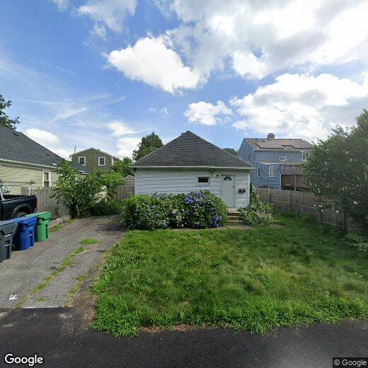
116 Van Zandt Ave
116 Van Zandt Ave
Warwick, RI 02889
2 Weeks Ago
|
Edit
Favorites
116 Van Zandt Ave

Favorites
Check Back Soon for Upcoming Availability
| Beds | Baths | Average SF |
|---|---|---|
| 1 Bedroom 1 Bedroom 1 Br | 1 Bath 1 Bath 1 Ba | — |
116 Van Zandt Ave,
Warwick,
RI
02889
Situated along Rhode Island's coastline, Warwick combines suburban living with waterfront appeal. As the state's third-largest city, Warwick offers housing options from Greenwich Bay waterfront properties to established inland neighborhoods. Current rental trends show one-bedroom apartments averaging $1,781 per month and two-bedroom units at $2,126, reflecting year-over-year increases of 5.8% and 6.8% respectively. Notable areas include Cowesett with its tree-lined streets and Apponaug, where historic architecture meets contemporary rentals near the village center.
The city's 39-mile coastline includes Oakland Beach, City Park Beach, and Conimicut Point Park, each offering distinctive waterfront experiences. Residents benefit from convenient access to Rhode Island T.F. Green International Airport, while historic Pawtuxet Village preserves colonial-era buildings alongside local shops.
Learn more about living in Warwick
Education
| Colleges & Universities | Distance | ||
|---|---|---|---|
| Colleges & Universities | Distance | ||
| Drive: | 16 min | 7.3 mi | |
| Drive: | 15 min | 7.8 mi | |
| Drive: | 18 min | 9.6 mi | |
| Drive: | 44 min | 26.6 mi |
116 Van Zandt Ave is within 16 minutes or 7.3 miles from C.C. of Rhode Island, Knight. It is also near Johnson & Wales, Harborside and C.C. of Rhode Island, Liston.
Walkability Near 116 Van Zandt Ave Warwick, RI 02889
Getting Around
 What do Walkability, Transit, Drivability, and Bikeability mean?
Walkability measures the walking distance to day-to-day needs.
Transit measures access to public transportation.
Drivability measures congestion, parking availability, and access to major roads.
Bikeability measures the suitability for cycling.
How It Works
What do Walkability, Transit, Drivability, and Bikeability mean?
Walkability measures the walking distance to day-to-day needs.
Transit measures access to public transportation.
Drivability measures congestion, parking availability, and access to major roads.
Bikeability measures the suitability for cycling.
How It Works
Somewhat Walkable
Walkability
20
/ 100
Limited Public Transit
Transit
30
/ 100
Very Drivable
Drivability
80
/ 100
Fairly Bikeable
Bikeability
50
/ 100
Scores provided by
-
Soundscore™
-
/ 100
Traffic
-Airport
-Businesses
-Scores provided by
HowLoud What is a Sound Score Rating? A Sound Score Rating aggregates noise caused by vehicle traffic, airplane traffic and local sources. How It WorksYou May Also Like
Similar Rentals Nearby
-
-

-

-

-

-

-

-
 2 Beds, 1 Bath, 1,439 sq ft$3,250Total Monthly Price12 Month LeaseTotal Monthly Price NewPrices include all required monthly fees.19 King St
 -
 3 Beds, 1 Bath, 1,200 sq ft$2,300Total Monthly Price12 Month LeaseTotal Monthly Price NewPrices include all required monthly fees.60 Concord St
 -
 2 Beds, 1 Bath, 872 sq ft$1,900Total Monthly PriceTotal Monthly Price NewPrices include all required monthly fees.2 Brook St

What Are Walk Score®, Transit Score®, and Bike Score® Ratings?
Walk Score® measures the walkability of any address. Transit Score® measures access to public transit. Bike Score® measures the bikeability of any address.
What is a Sound Score Rating?
A Sound Score Rating aggregates noise caused by vehicle traffic, airplane traffic and local sources.

116 Van Zandt Ave
Warwick, RI 02889