
Fourth and U
2020 4th St,
Berkeley, CA 94710
$2,495 - $3,247
1-2 Beds
Bedrooms
2 bd
Bathrooms
1 ba
Square Feet
--
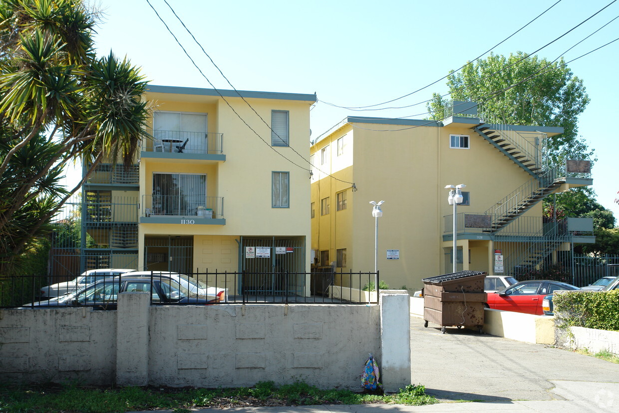
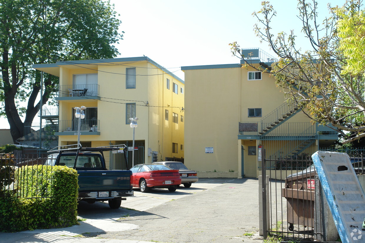
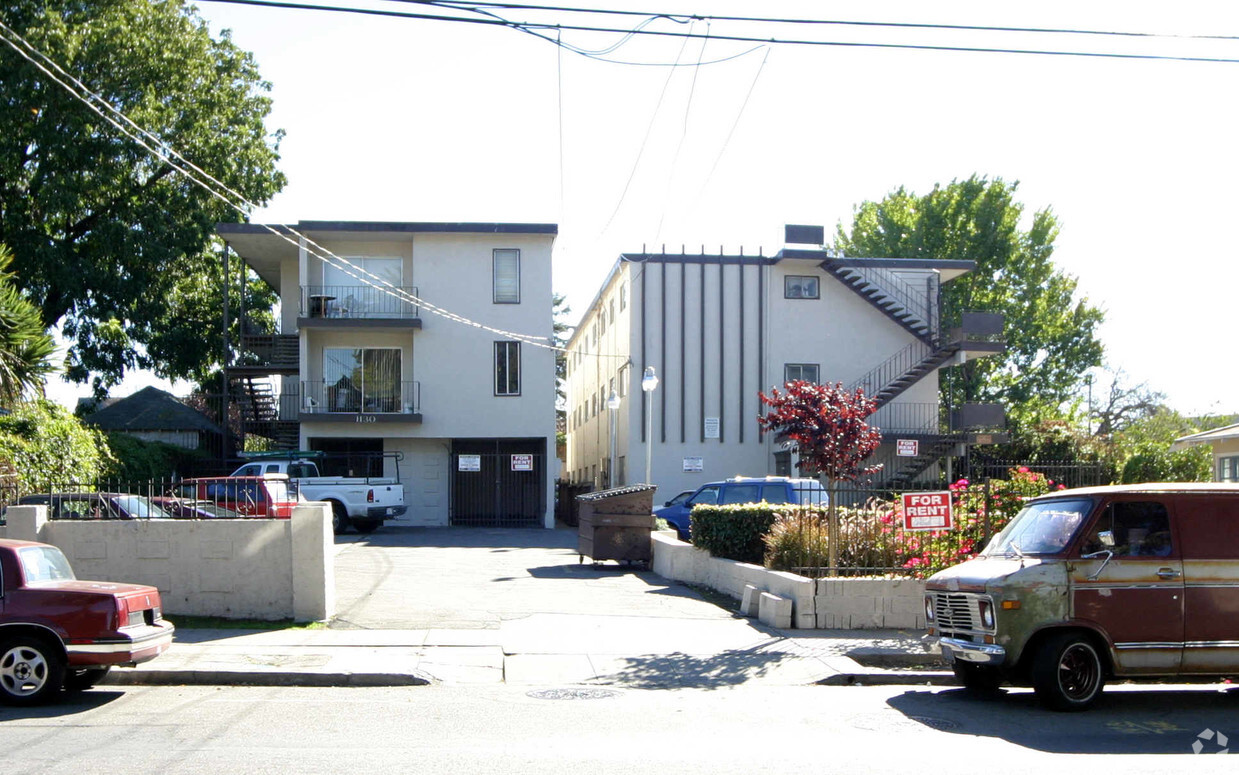
Experience Berkeley living at 1128-1130 Bancroft Way. This community is located on Bancroft Way in the 94702 area of Berkeley. The team of leasing professionals is ready and waiting for you to visit. Be sure to check out the current floorplan options. Stop by 1128-1130 Bancroft Way today.
Experience Berkeley living at 1128-1130 Bancroft Way. This community is located on Bancroft Way in the 94702 area of Berkeley. The team of leasing professionals is ready and waiting for you to visit. Be sure to check out the current floorplan options. Stop by 1128-1130 Bancroft Way today.
1128 - 1130 Bancroft is an apartment community located in Alameda County and the 94702 ZIP Code. This area is served by the Berkeley Unified School District attendance zone.
Unique Features
Southwest Berkeley is bounded by University Avenue to the north, Sacramento Street to the East, Alcatraz Avenue to the south and the San Francisco Bay to the west. Southwest Berkeley comprises a fascinating mix of the educational and the industrial. Less dense than the more inland parts of Berkeley, Southwest Berkeley has a diverse mix of apartment and home rentals that will delight students and families alike. Convenient access to the illustrious university make this a great option for students and staff, but any renter will love the restaurant and retail options that make this walkable locale so convenient.
Learn more about living in Southwest BerkeleyCompare neighborhood and city base rent averages by bedroom.
| Southwest Berkeley | Berkeley, CA | |
|---|---|---|
| Studio | $2,140 | $2,109 |
| 1 Bedroom | $2,494 | $2,282 |
| 2 Bedrooms | $2,760 | $3,326 |
| 3 Bedrooms | $3,806 | $4,271 |
| Colleges & Universities | Distance | ||
|---|---|---|---|
| Colleges & Universities | Distance | ||
| Drive: | 4 min | 1.3 mi | |
| Drive: | 8 min | 2.6 mi | |
| Drive: | 11 min | 3.9 mi | |
| Drive: | 12 min | 4.6 mi |


Transportation options available in Berkeley include North Berkeley, located 1.0 mile from 1128 - 1130 Bancroft. 1128 - 1130 Bancroft is near Metro Oakland International, located 13.9 miles or 25 minutes away, and San Francisco International, located 24.1 miles or 37 minutes away.
| Transit / Subway | Distance | ||
|---|---|---|---|
| Transit / Subway | Distance | ||
|
|
Walk: | 19 min | 1.0 mi |
|
|
Drive: | 4 min | 1.4 mi |
|
|
Drive: | 5 min | 2.0 mi |
|
|
Drive: | 7 min | 2.9 mi |
|
|
Drive: | 11 min | 3.7 mi |
| Commuter Rail | Distance | ||
|---|---|---|---|
| Commuter Rail | Distance | ||
|
|
Drive: | 4 min | 1.4 mi |
| Drive: | 6 min | 2.1 mi | |
|
|
Drive: | 13 min | 5.4 mi |
| Drive: | 12 min | 7.3 mi | |
| Drive: | 19 min | 11.7 mi |
| Airports | Distance | ||
|---|---|---|---|
| Airports | Distance | ||
|
Metro Oakland International
|
Drive: | 25 min | 13.9 mi |
|
San Francisco International
|
Drive: | 37 min | 24.1 mi |
Scores provided by
Traffic
-Airport
-Businesses
-Scores provided by
HowLoud What is a Sound Score Rating? A Sound Score Rating aggregates noise caused by vehicle traffic, airplane traffic and local sources. How It WorksTime and distance from 1128 - 1130 Bancroft.
| Shopping Centers | Distance | ||
|---|---|---|---|
| Shopping Centers | Distance | ||
| Walk: | 7 min | 0.4 mi | |
| Walk: | 16 min | 0.9 mi | |
| Drive: | 3 min | 1.3 mi |
| Parks and Recreation | Distance | ||
|---|---|---|---|
| Parks and Recreation | Distance | ||
|
Strawberry Creek Park
|
Walk: | 5 min | 0.3 mi |
|
Cedar-Rose Park
|
Drive: | 3 min | 1.2 mi |
|
McLaughlin Eastshore State Park
|
Drive: | 3 min | 1.2 mi |
|
Habitot Children's Museum
|
Drive: | 4 min | 1.3 mi |
|
Shorebird Nature Center
|
Drive: | 4 min | 1.7 mi |
| Hospitals | Distance | ||
|---|---|---|---|
| Hospitals | Distance | ||
| Drive: | 7 min | 2.5 mi | |
| Drive: | 7 min | 2.8 mi | |
| Drive: | 10 min | 6.0 mi |
| Military Bases | Distance | ||
|---|---|---|---|
| Military Bases | Distance | ||
| Drive: | 13 min | 5.2 mi | |
| Drive: | 16 min | 7.1 mi | |
| Drive: | 19 min | 10.1 mi |
Pets Allowed Fitness Center In Unit Washer & Dryer Stainless Steel Appliances Business Center Package Service Elevator
What Are Walk Score®, Transit Score®, and Bike Score® Ratings?
Walk Score® measures the walkability of any address. Transit Score® measures access to public transit. Bike Score® measures the bikeability of any address.
What is a Sound Score Rating?
A Sound Score Rating aggregates noise caused by vehicle traffic, airplane traffic and local sources.

1128-1130 Bancroft Way
Berkeley, CA 94702


