
The Vitagraph
1277 E 14th St,
Brooklyn, NY 11230
$2,770 - $3,668
1-3 Beds
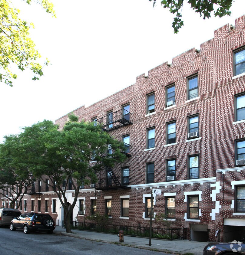
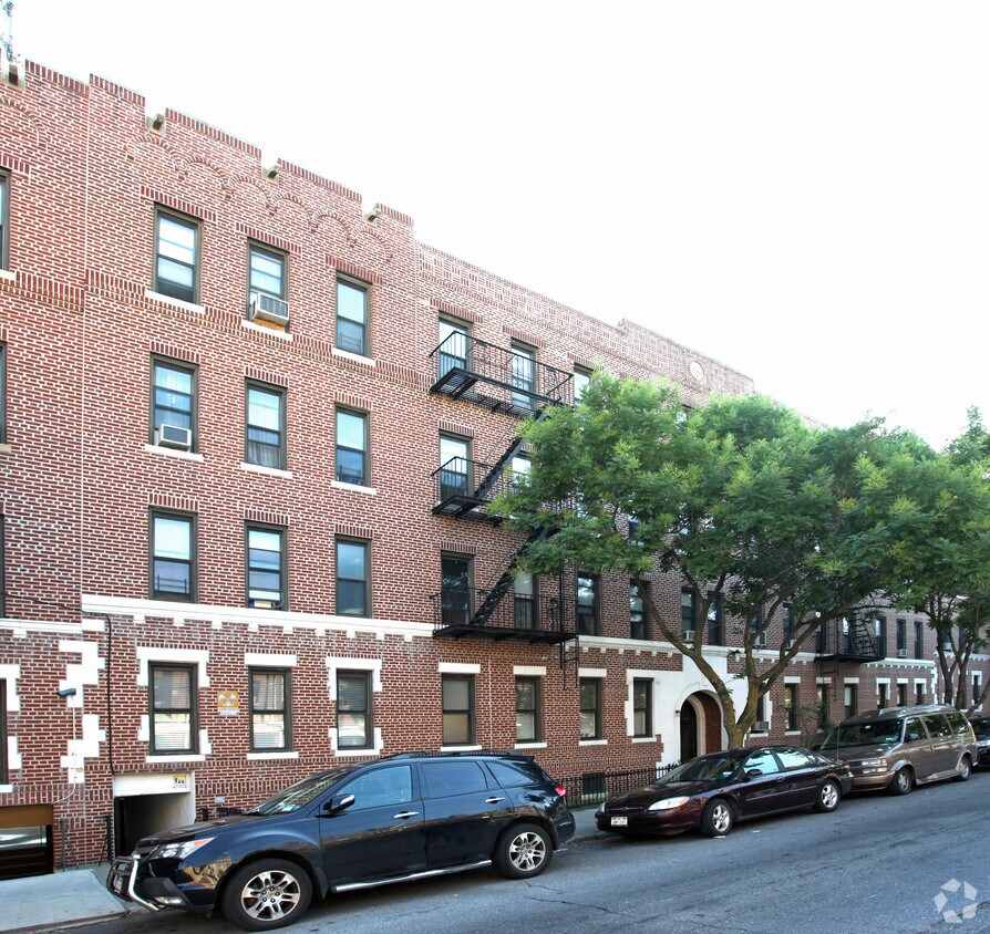
Meet your new apartment at 1125 63rd St in Brooklyn, NY. Situated in the 11219 Zip code of Brooklyn on 63rd St., residents have an easy connection to great nearby attractions. The team of leasing professionals will assist you in finding your perfect place. Be sure to come for a visit to check out the apartment floorplan options. It's time to find your next place. Contact or stop by 1125 63rd St to talk about leasing your next apartment!
1125 63rd St is an apartment community located in Kings County and the 11219 ZIP Code. This area is served by the New York City Geographic District #20 attendance zone.
High Speed Internet Access
Smoke Free
Heating
Kitchen
Situated in the southwest corner of the bustling borough of Brooklyn in New York City, Dyker Heights is an affluent urban neighborhood that stands out from the rest. Though it’s considered an urban neighborhood, Dyker Heights’ variety of apartments, townhomes, and detached houses for rent give it a somewhat suburban feel, considering more urban neighborhoods in NYC lack detached homes.
Mature trees, community parks, and a family-friendly atmosphere add to the laid-back culture of this neighborhood. As a community-focused area, residents feel safe in their homes and appreciate the walkability of the neighborhood.
With nearby subway and bus stations, as well as proximity to major interstates, Dyker Heights is a great place to live for convenience and commuting purposes. Enjoy athletic fields, tennis courts, open green space, and walking trails at McKinley Park, or visit the popular Dyker Beach Golf Course to practice your swing.
Learn more about living in Dyker HeightsCompare neighborhood and city base rent averages by bedroom.
| Dyker Heights | Brooklyn, NY | |
|---|---|---|
| Studio | $1,419 | $2,674 |
| 1 Bedroom | $1,564 | $2,996 |
| 2 Bedrooms | $1,978 | $3,925 |
| 3 Bedrooms | - | $4,864 |
| Colleges & Universities | Distance | ||
|---|---|---|---|
| Colleges & Universities | Distance | ||
| Drive: | 11 min | 4.1 mi | |
| Drive: | 12 min | 4.6 mi | |
| Drive: | 12 min | 6.1 mi | |
| Drive: | 12 min | 6.3 mi |


Transportation options available in Brooklyn include Fort Hamilton Parkway (N Line), located 0.2 mile from 1125 63rd St. 1125 63rd St is near John F Kennedy International, located 14.7 miles or 28 minutes away, and Newark Liberty International, located 19.7 miles or 33 minutes away.
| Transit / Subway | Distance | ||
|---|---|---|---|
| Transit / Subway | Distance | ||
|
|
Walk: | 3 min | 0.2 mi |
|
|
Walk: | 9 min | 0.5 mi |
|
|
Walk: | 9 min | 0.5 mi |
|
|
Walk: | 10 min | 0.6 mi |
|
|
Walk: | 12 min | 0.6 mi |
| Commuter Rail | Distance | ||
|---|---|---|---|
| Commuter Rail | Distance | ||
|
|
Drive: | 14 min | 5.9 mi |
|
|
Drive: | 12 min | 6.1 mi |
|
|
Drive: | 14 min | 6.7 mi |
|
|
Drive: | 16 min | 7.3 mi |
|
|
Drive: | 19 min | 7.9 mi |
| Airports | Distance | ||
|---|---|---|---|
| Airports | Distance | ||
|
John F Kennedy International
|
Drive: | 28 min | 14.7 mi |
|
Newark Liberty International
|
Drive: | 33 min | 19.7 mi |
Scores provided by
Traffic
-Airport
-Businesses
-Scores provided by
HowLoud What is a Sound Score Rating? A Sound Score Rating aggregates noise caused by vehicle traffic, airplane traffic and local sources. How It WorksTime and distance from 1125 63rd St.
| Shopping Centers | Distance | ||
|---|---|---|---|
| Shopping Centers | Distance | ||
| Walk: | 7 min | 0.4 mi | |
| Walk: | 10 min | 0.5 mi | |
| Drive: | 4 min | 1.3 mi |
| Parks and Recreation | Distance | ||
|---|---|---|---|
| Parks and Recreation | Distance | ||
|
Dyker Beach Park
|
Drive: | 5 min | 2.0 mi |
|
Sunset Park
|
Drive: | 6 min | 2.3 mi |
|
Owl's Head Park
|
Drive: | 6 min | 2.4 mi |
|
Prospect Park Zoo
|
Drive: | 9 min | 4.0 mi |
|
Narrows Botanical Gardens
|
Drive: | 10 min | 4.5 mi |
| Hospitals | Distance | ||
|---|---|---|---|
| Hospitals | Distance | ||
| Walk: | 17 min | 0.9 mi | |
| Drive: | 9 min | 3.9 mi | |
| Drive: | 11 min | 4.6 mi |
| Military Bases | Distance | ||
|---|---|---|---|
| Military Bases | Distance | ||
| Drive: | 7 min | 2.6 mi | |
| Drive: | 15 min | 6.9 mi |
What Are Walk Score®, Transit Score®, and Bike Score® Ratings?
Walk Score® measures the walkability of any address. Transit Score® measures access to public transit. Bike Score® measures the bikeability of any address.
What is a Sound Score Rating?
A Sound Score Rating aggregates noise caused by vehicle traffic, airplane traffic and local sources.


