
The Vitagraph
1277 E 14th St,
Brooklyn, NY 11230
$2,481 - $4,308
1-3 Beds


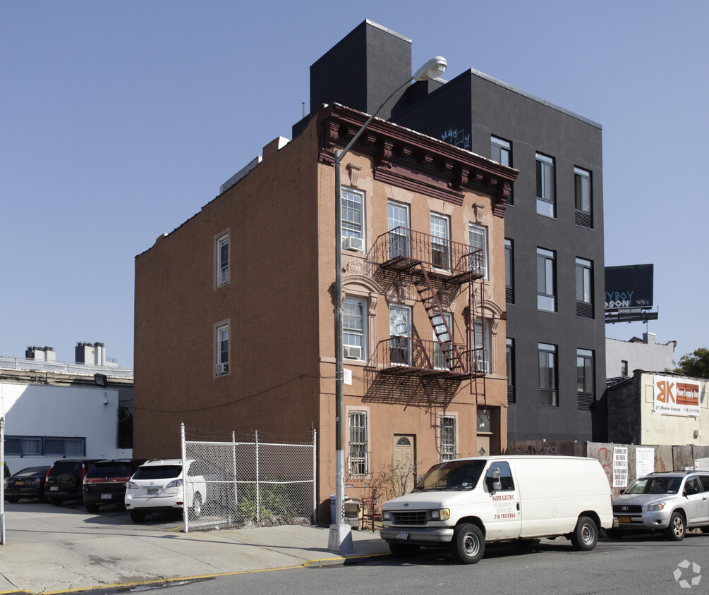
Experience Brooklyn living at 111 Richardson St. The location in Brooklyn's 11211 area is an ideal place to move. Here at this community, the leasing staff will assist you in finding your perfect home. Come for a visit to check out the current floorplan options. Drop by 111 Richardson St today.
111 Richardson St is an apartment community located in Kings County and the 11211 ZIP Code. This area is served by the New York City Geographic District #14 attendance zone.
Refrigerator
Patio
Oven
Garden
Nestled on the banks of the East River, Williamsburg’s nightlife scene glows just as bright as its art culture. Artists first moved to the area in the 1970s because of its affordability compared to surrounding areas, such as Manhattan. The neighborhood also offers larger homes, and direct access to transportation. In addition, the art community is alive and thriving, with local gallery favorites such as Front Room Gallery and Greenpoint.
To discover whether you should move to Williamsburg, find out what the neighborhood is all about. This area’s energy is unmatched, especially since the neighborhood has become a mecca for the creatives throughout the city. The luxury apartments in Williamsburg are surrounded by exceptional restaurants from authentic takeout to tapas to Michelin-rated fine dining. Longstanding spots like the Brooklyn Brewery have been providing residents with chilled pints since 1988.
Learn more about living in WilliamsburgCompare neighborhood and city base rent averages by bedroom.
| Williamsburg | Brooklyn, NY | |
|---|---|---|
| Studio | $3,545 | $2,693 |
| 1 Bedroom | $4,140 | $3,044 |
| 2 Bedrooms | $5,536 | $3,977 |
| 3 Bedrooms | $8,123 | $4,922 |
| Colleges & Universities | Distance | ||
|---|---|---|---|
| Colleges & Universities | Distance | ||
| Drive: | 7 min | 2.3 mi | |
| Drive: | 6 min | 2.5 mi | |
| Drive: | 7 min | 2.6 mi | |
| Drive: | 12 min | 4.3 mi |


Transportation options available in Brooklyn include Lorimer Street (L Line), located 0.4 mile from 111 Richardson St. 111 Richardson St is near LaGuardia, located 6.6 miles or 14 minutes away, and John F Kennedy International, located 14.8 miles or 23 minutes away.
| Transit / Subway | Distance | ||
|---|---|---|---|
| Transit / Subway | Distance | ||
|
|
Walk: | 7 min | 0.4 mi |
|
|
Walk: | 8 min | 0.4 mi |
|
|
Walk: | 9 min | 0.5 mi |
|
|
Walk: | 10 min | 0.5 mi |
|
|
Walk: | 12 min | 0.6 mi |
| Commuter Rail | Distance | ||
|---|---|---|---|
| Commuter Rail | Distance | ||
|
|
Drive: | 7 min | 2.3 mi |
|
|
Drive: | 8 min | 2.6 mi |
|
|
Drive: | 9 min | 3.7 mi |
|
|
Drive: | 9 min | 4.0 mi |
|
|
Drive: | 13 min | 4.8 mi |
| Airports | Distance | ||
|---|---|---|---|
| Airports | Distance | ||
|
LaGuardia
|
Drive: | 14 min | 6.6 mi |
|
John F Kennedy International
|
Drive: | 23 min | 14.8 mi |
Scores provided by
Traffic
-Airport
-Businesses
-Scores provided by
HowLoud What is a Sound Score Rating? A Sound Score Rating aggregates noise caused by vehicle traffic, airplane traffic and local sources. How It WorksTime and distance from 111 Richardson St.
| Shopping Centers | Distance | ||
|---|---|---|---|
| Shopping Centers | Distance | ||
| Walk: | 16 min | 0.8 mi | |
| Drive: | 7 min | 2.7 mi | |
| Drive: | 7 min | 2.8 mi |
| Parks and Recreation | Distance | ||
|---|---|---|---|
| Parks and Recreation | Distance | ||
|
McCarren Park
|
Walk: | 6 min | 0.4 mi |
|
Martinez Playground
|
Walk: | 14 min | 0.7 mi |
|
Sternberg Park
|
Walk: | 17 min | 0.9 mi |
|
East River State Park
|
Drive: | 3 min | 1.4 mi |
|
East River Park
|
Drive: | 11 min | 4.3 mi |
| Hospitals | Distance | ||
|---|---|---|---|
| Hospitals | Distance | ||
| Drive: | 4 min | 1.4 mi | |
| Drive: | 8 min | 2.5 mi | |
| Drive: | 12 min | 4.4 mi |
| Military Bases | Distance | ||
|---|---|---|---|
| Military Bases | Distance | ||
| Drive: | 16 min | 6.4 mi | |
| Drive: | 20 min | 11.2 mi | |
| Drive: | 25 min | 12.6 mi |
What Are Walk Score®, Transit Score®, and Bike Score® Ratings?
Walk Score® measures the walkability of any address. Transit Score® measures access to public transit. Bike Score® measures the bikeability of any address.
What is a Sound Score Rating?
A Sound Score Rating aggregates noise caused by vehicle traffic, airplane traffic and local sources.
111 Richardson St
Brooklyn, NY 11211


