
$7,000
/ Month
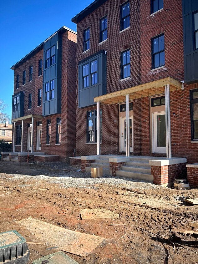
111-117 Thornton Ln Unit 117 Thornton Lane
Newtown, PA 18940
2 Weeks Ago
|
Edit
Favorites
111-117 Thornton Ln Unit 117 Thornton Lane

Favorites
Check Back Soon for Upcoming Availability
| Beds | Baths | Average SF |
|---|---|---|
| 4 Bedrooms 4 Bedrooms 4 Br | 3.5 Baths 3.5 Baths 3.5 Ba | 3,000 SF |
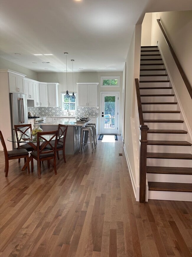
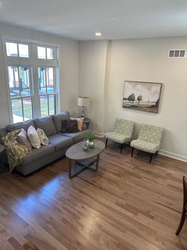
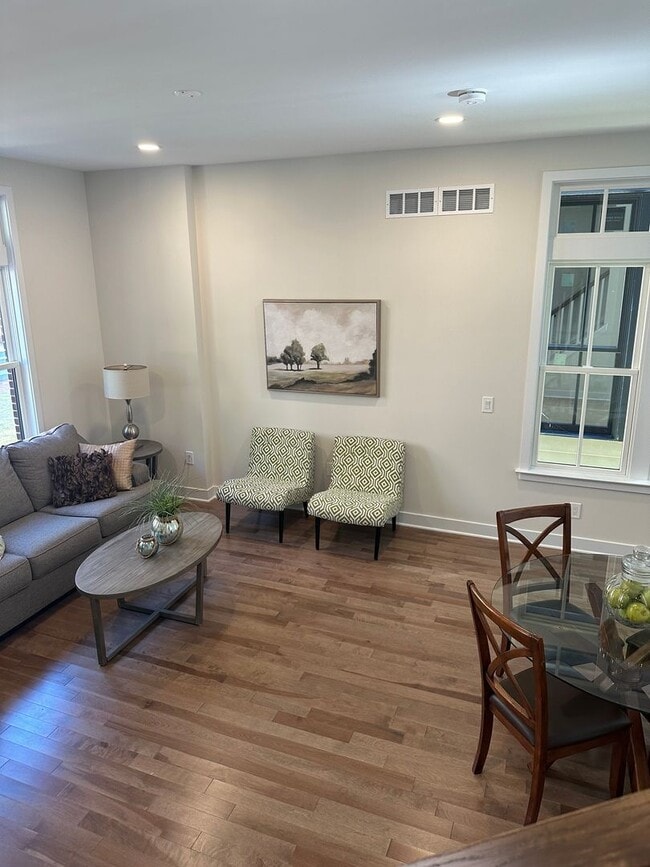
About This Property
Explore your new address in Newtown, PA. This property can be found at 111-117 Thornton Ln in Newtown. With this great space, you'll feel right at home. To learn more about this property, contact us.
111-117 Thornton Ln is an apartment community located in Bucks County and the 18940 ZIP Code.
Features
- Dishwasher
111-117 Thornton Ln,
Newtown,
PA
18940
Amenities
- Dishwasher
Education
| Colleges & Universities | Distance | ||
|---|---|---|---|
| Colleges & Universities | Distance | ||
| Drive: | 5 min | 2.2 mi | |
| Drive: | 18 min | 10.1 mi | |
| Drive: | 20 min | 10.9 mi | |
| Drive: | 22 min | 13.1 mi |
111-117 Thornton Ln Unit 117 Thornton Lane is within 5 minutes or 2.2 miles from Bucks County Community College. It is also near Mercer Co. C.C., Kerney and C.C. of Philadelphia, NE Ctr.
Transportation options available in Newtown include Hamilton Avenue, located 10.9 miles from 111-117 Thornton Ln Unit 117 Thornton Lane. 111-117 Thornton Ln Unit 117 Thornton Lane is near Trenton Mercer, located 8.8 miles or 15 minutes away, and Philadelphia International, located 37.0 miles or 59 minutes away.
| Transit / Subway | Distance | ||
|---|---|---|---|
| Transit / Subway | Distance | ||
|
|
Drive: | 19 min | 10.9 mi |
| Drive: | 19 min | 11.0 mi | |
|
|
Drive: | 22 min | 12.3 mi |
| Commuter Rail | Distance | ||
|---|---|---|---|
| Commuter Rail | Distance | ||
|
|
Drive: | 10 min | 5.1 mi |
|
|
Drive: | 11 min | 6.0 mi |
|
|
Drive: | 10 min | 6.3 mi |
|
|
Drive: | 15 min | 7.8 mi |
|
|
Drive: | 16 min | 9.4 mi |
| Airports | Distance | ||
|---|---|---|---|
| Airports | Distance | ||
|
Trenton Mercer
|
Drive: | 15 min | 8.8 mi |
|
Philadelphia International
|
Drive: | 59 min | 37.0 mi |
Walkability Near 111-117 Thornton Ln Newtown, PA 18940
Getting Around
 What do Walkability, Transit, Drivability, and Bikeability mean?
Walkability measures the walking distance to day-to-day needs.
Transit measures access to public transportation.
Drivability measures congestion, parking availability, and access to major roads.
Bikeability measures the suitability for cycling.
How It Works
What do Walkability, Transit, Drivability, and Bikeability mean?
Walkability measures the walking distance to day-to-day needs.
Transit measures access to public transportation.
Drivability measures congestion, parking availability, and access to major roads.
Bikeability measures the suitability for cycling.
How It Works
Moderately Walkable
Walkability
60
/ 100
Limited Public Transit
Transit
30
/ 100
Very Drivable
Drivability
80
/ 100
Fairly Bikeable
Bikeability
50
/ 100
Scores provided by
-
Soundscore™
-
/ 100
Traffic
-Airport
-Businesses
-Scores provided by
HowLoud What is a Sound Score Rating? A Sound Score Rating aggregates noise caused by vehicle traffic, airplane traffic and local sources. How It WorksTime and distance from 111-117 Thornton Ln Unit 117 Thornton Lane.
| Shopping Centers | Distance | ||
|---|---|---|---|
| Shopping Centers | Distance | ||
| Walk: | 9 min | 0.5 mi | |
| Walk: | 11 min | 0.6 mi | |
| Walk: | 11 min | 0.6 mi |
111-117 Thornton Ln Unit 117 Thornton Lane has 3 shopping centers within 0.6 mile, which is about a 11-minute walk. The miles and minutes will be for the farthest away property.
| Parks and Recreation | Distance | ||
|---|---|---|---|
| Parks and Recreation | Distance | ||
|
Tyler State Park
|
Drive: | 8 min | 3.7 mi |
|
Core Creek Park
|
Drive: | 9 min | 3.9 mi |
|
Churchville Nature Center
|
Drive: | 10 min | 5.5 mi |
|
Washington Crossing State Park
|
Drive: | 17 min | 8.2 mi |
|
Simpson Observatory
|
Drive: | 19 min | 8.8 mi |
111-117 Thornton Ln Unit 117 Thornton Lane has 5 parks within 8.8 miles, including Tyler State Park, Core Creek Park, and Churchville Nature Center.
| Hospitals | Distance | ||
|---|---|---|---|
| Hospitals | Distance | ||
| Drive: | 18 min | 9.9 mi | |
| Drive: | 20 min | 10.6 mi | |
| Drive: | 19 min | 11.3 mi |
111-117 Thornton Ln Unit 117 Thornton Lane has 3 hospitals within 11.3 miles, the nearest is Rothman Orthopaedic Specialty Hospital which is 9.9 miles away and a 18 minute drive.
| Military Bases | Distance | ||
|---|---|---|---|
| Military Bases | Distance | ||
| Drive: | 19 min | 9.7 mi | |
| Drive: | 29 min | 15.1 mi |
111-117 Thornton Ln Unit 117 Thornton Lane is 9.7 miles from Naval Air Development Center, and is convenient to other military bases, including Willow Grove Naval Air Station.
You May Also Like
Similar Rentals Nearby
-
-
-
-
-
-
4 Beds$1,149Total Monthly PriceTotal Monthly Price NewPrices include all required monthly fees.Specials
Maintenance on site Individual Locking Bedrooms
-
4 Beds$1,299Total Monthly PriceTotal Monthly Price NewPrices include all required monthly fees.Specials
High-Speed Internet Controlled Access Elevator Wheelchair Access
-
-
-


What Are Walk Score®, Transit Score®, and Bike Score® Ratings?
Walk Score® measures the walkability of any address. Transit Score® measures access to public transit. Bike Score® measures the bikeability of any address.
What is a Sound Score Rating?
A Sound Score Rating aggregates noise caused by vehicle traffic, airplane traffic and local sources.

111-117 Thornton Ln
Newtown, PA 18940