

$2,200 / Month
109 Hoxsie Ct
Folsom, CA 95630
2 Weeks Ago
Favorites
109 Hoxsie Ct

Favorites
Check Back Soon for Upcoming Availability
| Beds | Baths | Average SF |
|---|---|---|
| 2 Bedrooms 2 Bedrooms 2 Br | 2 Baths 2 Baths 2 Ba | — |
About This Property
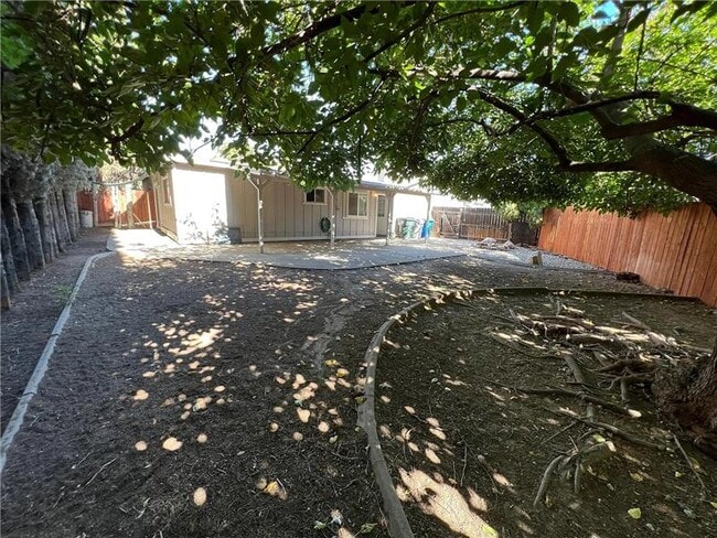
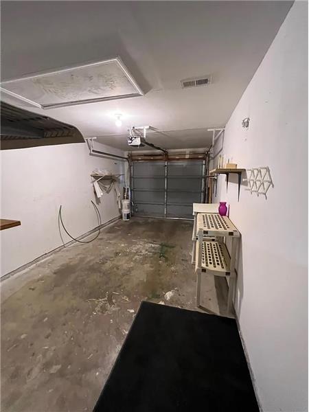
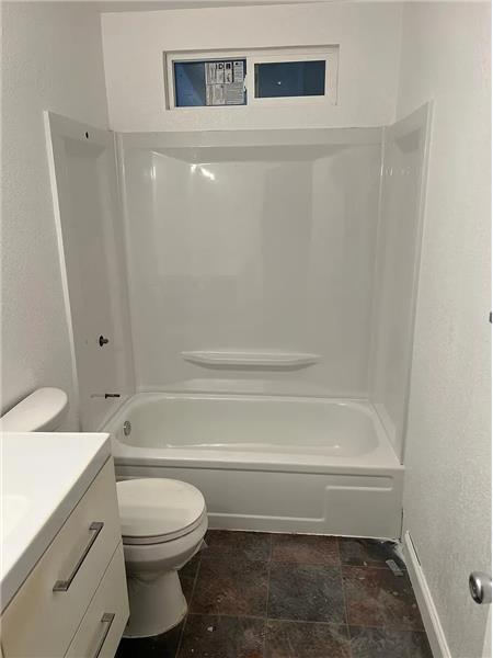
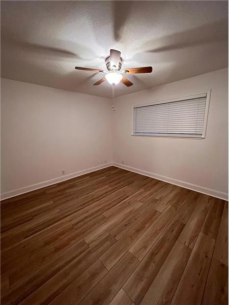
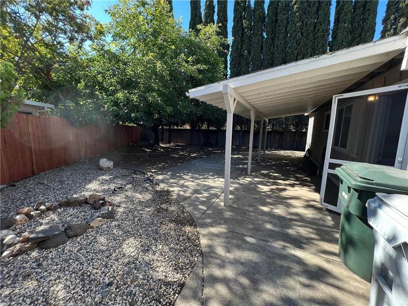
2Bd, 2Ba Half plex in Folsom. Located in Folsom near E Bidwell St & Wales Drive. Close to schools, shopping, restaurants, parks, public transportation, Intel, Old Town Folsom, Folsom Lake and more.... This 1128 sq ft unit has the following: new paint, inside and out, new easy maintenance flooring, new roof, new granite countertop in kitchen, new applicances. Large side yard with covered patio, great for enjoying the outdoors. Single car garage with opener. Gas fireplace, central heat and air, washer and dryer hookups.
109 Hoxsie Ct is a house located in Sacramento County and the 95630 ZIP Code. This area is served by the Folsom-Cordova Unified attendance zone.
Location
Get Directions
Located just east of Sacramento and adjacent to the breathtaking scenery of Folsom Lake, you’ll find Folsom, California. This suburb offers its residents the essence of California living, with tree-lined boulevards, lovely stucco homes, and year-round warm breezes. Located on a charming landscape, Folsom features the very best of amenities, comfort, and luxury. Renting an apartment in Folsom allows its residents to get the best of quiet neighborhoods and picturesque architecture, with a tranquil ambiance that you’re sure to love in your next apartment.
Take a family trip to the Folsom City Zoo Sanctuary or visit one of Folsom’s historic walking areas, Sutter Street. Grab a show or see your favorite artists in concert at the Harris Center or engage with Folsom’s history at the Folsom Powerhouse and the Folsom Historical Museum. Hang your hat in Folsom, California and get the best of both worlds every day.
Learn more about living in Folsom
Education
| Colleges & Universities | Distance | ||
|---|---|---|---|
| Colleges & Universities | Distance | ||
| Drive: | 7 min | 2.5 mi | |
| Drive: | 22 min | 11.6 mi | |
| Drive: | 24 min | 12.2 mi | |
| Drive: | 26 min | 18.3 mi |
109 Hoxsie Ct is within 7 minutes or 2.5 miles from Folsom Lake College, Folsom. It is also near Sierra College, Rocklin Campus and American River College.
Schools


Public Elementary School
Grades K-5
581 Students
Attendance Zone
Public Elementary School
Grades K-3
518 Students
Nearby
Public Middle School
Grades 6-8
1,552 Students
Attendance Zone
Public High School
Grades 9-12
2,718 Students
Attendance Zone
Private Elementary School
Grades PK-K
64 Students
Nearby
Private Elementary & Middle School
Grades K-8
338 Students
Nearby
Private Elementary, Middle & High School
Grades PK-10
51 Students
Nearby
Private Elementary, Middle & High School
Grades 2-12
45 Students
Nearby
School data provided by
 The GreatSchools Rating helps parents compare schools within a state based on a variety of school quality indicators and provides a helpful picture of how effectively each school serves all of its students. Ratings are on a scale of 1 (below average) to 10 (above average) and can include test scores, college readiness, academic progress, advanced courses, equity, discipline and attendance data. We also advise parents to visit schools, consider other information on school performance and programs, and consider family needs as part of the school selection process.
View GreatSchools Rating Methodology
Data provided by GreatSchools.org © 2025. All rights reserved.
View GreatSchools Rating Methodology
Data provided by GreatSchools.org © 2025. All rights reserved.
Transportation options available in Folsom include Historic Folsom Station (Eb), located 1.8 miles from 109 Hoxsie Ct. 109 Hoxsie Ct is near Sacramento International, located 29.6 miles or 44 minutes away.
| Transit / Subway | Distance | ||
|---|---|---|---|
| Transit / Subway | Distance | ||
| Drive: | 4 min | 1.8 mi | |
| Drive: | 5 min | 2.4 mi | |
| Drive: | 7 min | 3.5 mi | |
|
Hazel Station (Wb)
|
Drive: | 9 min | 5.0 mi |
| Drive: | 16 min | 9.2 mi |
| Commuter Rail | Distance | ||
|---|---|---|---|
| Commuter Rail | Distance | ||
|
|
Drive: | 25 min | 13.1 mi |
|
|
Drive: | 24 min | 14.0 mi |
| Drive: | 33 min | 21.4 mi | |
|
|
Drive: | 33 min | 21.4 mi |
| Drive: | 33 min | 24.4 mi |
| Airports | Distance | ||
|---|---|---|---|
| Airports | Distance | ||
|
Sacramento International
|
Drive: | 44 min | 29.6 mi |
Time and distance from 109 Hoxsie Ct.
| Shopping Centers | Distance | ||
|---|---|---|---|
| Shopping Centers | Distance | ||
| Walk: | 3 min | 0.2 mi | |
| Walk: | 4 min | 0.2 mi | |
| Walk: | 6 min | 0.4 mi |
109 Hoxsie Ct has 3 shopping centers within 0.4 mile, which is about a 6-minute walk. The miles and minutes will be for the farthest away property.
| Parks and Recreation | Distance | ||
|---|---|---|---|
| Parks and Recreation | Distance | ||
|
Folsom Powerhouse State Historic Park
|
Drive: | 3 min | 1.2 mi |
|
Folsom City Zoo Sanctuary
|
Drive: | 3 min | 1.2 mi |
|
Folsom Lake State Recreation Area
|
Drive: | 11 min | 3.5 mi |
|
Sailor Bar County Park
|
Drive: | 15 min | 7.1 mi |
|
Lower Sunrise Recreational Area
|
Drive: | 17 min | 9.6 mi |
109 Hoxsie Ct has 5 parks within 9.6 miles, including Folsom City Zoo Sanctuary, Folsom Powerhouse State Historic Park, and Folsom Lake State Recreation Area.
| Hospitals | Distance | ||
|---|---|---|---|
| Hospitals | Distance | ||
| Walk: | 20 min | 1.0 mi | |
| Drive: | 18 min | 9.8 mi | |
| Drive: | 18 min | 10.7 mi |
109 Hoxsie Ct has 3 hospitals within 10.7 miles, the nearest is Mercy Hospital of Folsom which is 1.0 miles away and a 20 minute walk.
| Military Bases | Distance | ||
|---|---|---|---|
| Military Bases | Distance | ||
| Drive: | 34 min | 16.5 mi |
109 Hoxsie Ct is 16.5 miles and a 34 minute drive from McClellan Air Force Base.
You May Also Like
Similar Rentals Nearby


What Are Walk Score®, Transit Score®, and Bike Score® Ratings?
Walk Score® measures the walkability of any address. Transit Score® measures access to public transit. Bike Score® measures the bikeability of any address.
What is a Sound Score Rating?
A Sound Score Rating aggregates noise caused by vehicle traffic, airplane traffic and local sources
109 Hoxsie Ct
Folsom, CA 95630