
Acadia
5155 Katella Ave,
Cypress, CA 90720
$3,210 - $8,019
1-3 Beds

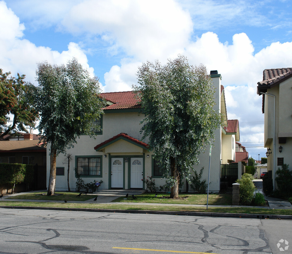

Find your new home at 10882-10884 Walnut St. In a location on 10882-10884 Walnut St. in Los Alamitos's 90720 area, residents can easily connect with a number of nearby points of interest. Come by to check out the current floorplan options. The team of leasing professionals is available to assist you in finding your perfect new apartment. Stop by 10882-10884 Walnut St today.
10882-10884 Walnut St is an apartment community located in Orange County and the 90720 ZIP Code. This area is served by the Los Alamitos Unified School District attendance zone.
Los Alamitos is a small city in Orange County, California, sitting about 25 miles southeast of Los Angeles, where the quiet pace of a compact suburb coexists with easy access to one of the country's largest metro areas. Incorporated in 1960, the city spans just five square miles, yet it carries a distinct character shaped in part by Joint Forces Training Base Los Alamitos, which occupies a significant portion of its land. That military presence has long influenced the city's identity, drawing a steady mix of service members and longtime residents who value stability and community. The city's name comes from the Spanish word for "little cottonwoods," a nod to its roots as part of Rancho Los Alamitos, land the Tongva people once called home. Nearby Seal Beach and Cypress offer additional retail, dining, and recreation options, while Los Alamitos Race Course remains one of the area's most recognizable landmarks, hosting thoroughbred and quarter horse racing throughout the year.
Learn more about living in Los Alamitos| Colleges & Universities | Distance | ||
|---|---|---|---|
| Colleges & Universities | Distance | ||
| Drive: | 7 min | 4.6 mi | |
| Drive: | 9 min | 4.9 mi | |
| Drive: | 10 min | 5.8 mi | |
| Drive: | 11 min | 7.3 mi |


Transportation options available in Los Alamitos include Pacific Coast Highway Station, located 7.1 miles from 10882-10884 Walnut St. 10882-10884 Walnut St is near Long Beach (Daugherty Field), located 6.6 miles or 10 minutes away, and John Wayne/Orange County, located 17.1 miles or 23 minutes away.
| Transit / Subway | Distance | ||
|---|---|---|---|
| Transit / Subway | Distance | ||
|
|
Drive: | 13 min | 7.1 mi |
|
|
Drive: | 15 min | 7.6 mi |
|
|
Drive: | 12 min | 7.8 mi |
|
|
Drive: | 16 min | 8.2 mi |
|
|
Drive: | 17 min | 8.5 mi |
| Commuter Rail | Distance | ||
|---|---|---|---|
| Commuter Rail | Distance | ||
|
|
Drive: | 18 min | 10.5 mi |
|
|
Drive: | 16 min | 11.2 mi |
|
|
Drive: | 20 min | 11.7 mi |
| Drive: | 20 min | 11.8 mi | |
|
|
Drive: | 22 min | 13.9 mi |
| Airports | Distance | ||
|---|---|---|---|
| Airports | Distance | ||
|
Long Beach (Daugherty Field)
|
Drive: | 10 min | 6.6 mi |
|
John Wayne/Orange County
|
Drive: | 23 min | 17.1 mi |
Scores provided by
Traffic
-Airport
-Businesses
-Scores provided by
HowLoud What is a Sound Score Rating? A Sound Score Rating aggregates noise caused by vehicle traffic, airplane traffic and local sources. How It WorksTime and distance from 10882-10884 Walnut St.
| Shopping Centers | Distance | ||
|---|---|---|---|
| Shopping Centers | Distance | ||
| Walk: | 5 min | 0.3 mi | |
| Walk: | 5 min | 0.3 mi | |
| Walk: | 7 min | 0.4 mi |
| Parks and Recreation | Distance | ||
|---|---|---|---|
| Parks and Recreation | Distance | ||
|
El Dorado East Regional Park
|
Drive: | 5 min | 2.1 mi |
|
El Dorado Nature Center
|
Drive: | 3 min | 2.1 mi |
|
Earl Burns Miller Japanese Garden
|
Drive: | 7 min | 3.9 mi |
|
Colorado Lagoon
|
Drive: | 9 min | 5.6 mi |
|
Los Cerritos Wetlands Trust
|
Drive: | 9 min | 5.8 mi |
| Hospitals | Distance | ||
|---|---|---|---|
| Hospitals | Distance | ||
| Walk: | 9 min | 0.5 mi | |
| Drive: | 7 min | 4.6 mi | |
| Drive: | 9 min | 5.1 mi |
| Military Bases | Distance | ||
|---|---|---|---|
| Military Bases | Distance | ||
| Drive: | 8 min | 4.3 mi | |
| Drive: | 29 min | 17.9 mi | |
| Drive: | 32 min | 21.0 mi |
Pets Allowed Fitness Center Pool In Unit Washer & Dryer Clubhouse Balcony
What Are Walk Score®, Transit Score®, and Bike Score® Ratings?
Walk Score® measures the walkability of any address. Transit Score® measures access to public transit. Bike Score® measures the bikeability of any address.
What is a Sound Score Rating?
A Sound Score Rating aggregates noise caused by vehicle traffic, airplane traffic and local sources.
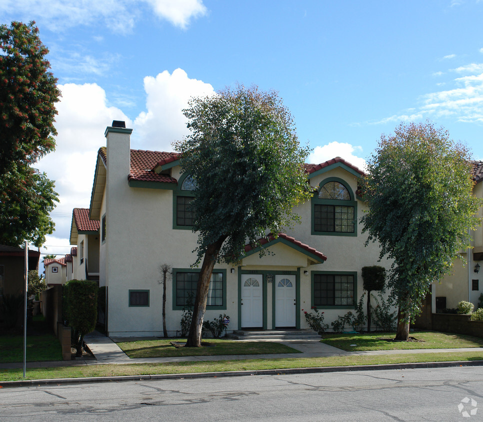
10882-10884 Walnut St
Los Alamitos, CA 90720


 - Violet on Virgil")