
$1,675
Total Monthly Price
10626 S Budlong Ave Unit 7
Los Angeles, CA 90044
Favorites
10626 S Budlong Ave Unit 7

Favorites
Check Back Soon for Upcoming Availability
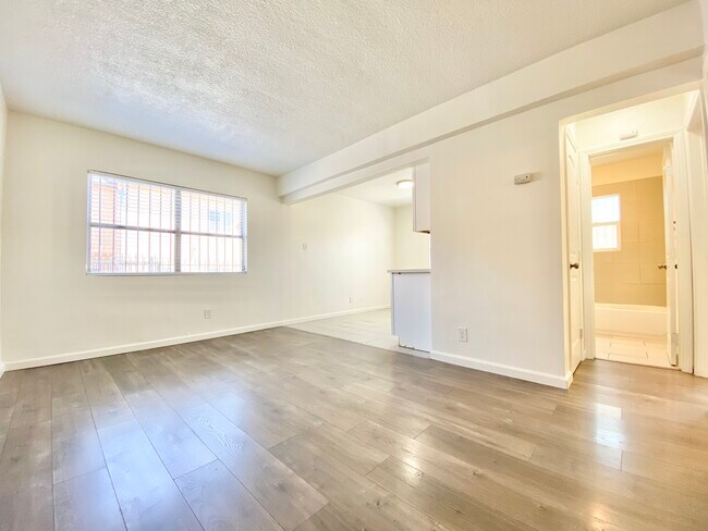
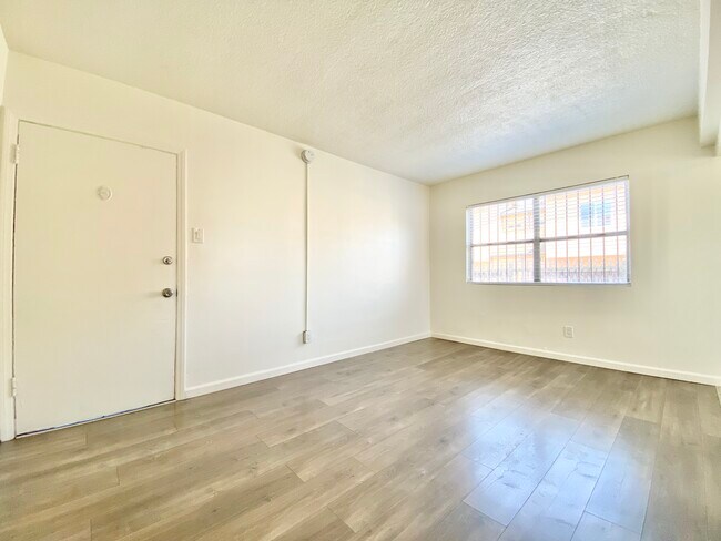
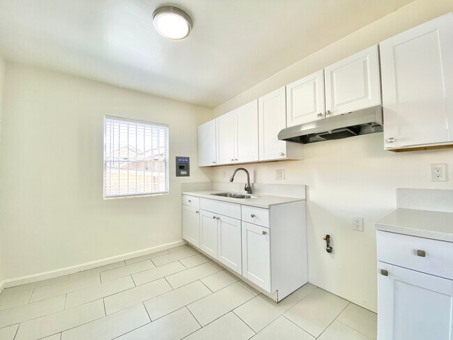
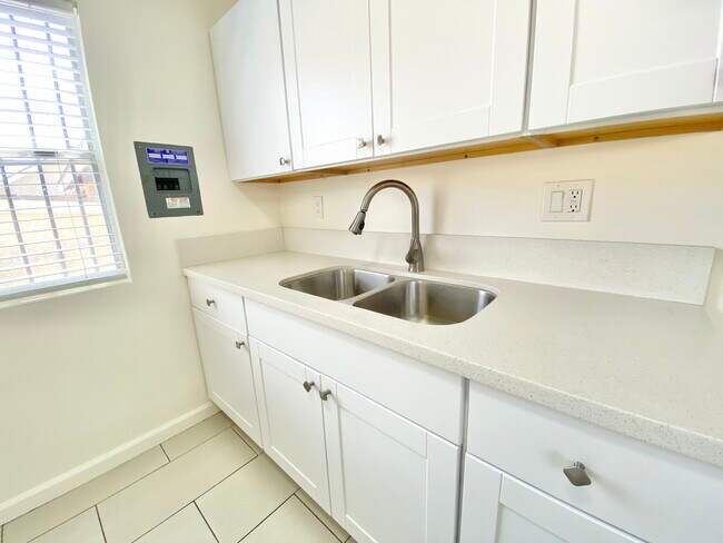
| Beds | Baths | Average SF |
|---|---|---|
| 2 Bedrooms 2 Bedrooms 2 Br | 1 Bath 1 Bath 1 Ba | 900 SF |
Fees and Policies
Details
Property Information
-
10 units
About This Property
10626 S Budlong Ave is an apartment community located in Los Angeles County and the 90044 ZIP Code.
10626 S Budlong Ave,
Los Angeles,
CA
90044
Westmont is a community east of Inglewood in the southern part of Los Angeles. Westmont is characterized as a typical Los Angeles neighborhood with well-populated residential avenues holding an array of rental choices. Shops and restaurants dot the neighborhood, but large shopping centers like Crenshaw Imperial Plaza and the Village at Century are located within minutes of Westmont. Despite being in the urbanized Los Angeles region, outdoor adventure abounds in nearby golf courses, parks, and recreation centers. Commuters appreciate the neighborhood’s easy access to Interstate 105 and 110 junction, making travel in and around the are simple and convenient.
Learn more about living in WestmontBelow are rent ranges for similar nearby apartments
Education
| Colleges & Universities | Distance | ||
|---|---|---|---|
| Colleges & Universities | Distance | ||
| Drive: | 5 min | 1.5 mi | |
| Drive: | 10 min | 5.9 mi | |
| Drive: | 12 min | 7.9 mi | |
| Drive: | 15 min | 8.5 mi |
10626 S Budlong Ave Unit 7 is within 5 minutes or 1.5 miles from Los Angeles Southwest College. It is also near El Camino College, Torrance and UEI, Huntington Park.
Transportation options available in Los Angeles include Vermont Station, located 0.9 mile from 10626 S Budlong Ave Unit 7. 10626 S Budlong Ave Unit 7 is near Los Angeles International, located 9.0 miles or 14 minutes away, and Long Beach (Daugherty Field), located 14.8 miles or 22 minutes away.
| Transit / Subway | Distance | ||
|---|---|---|---|
| Transit / Subway | Distance | ||
|
|
Walk: | 18 min | 0.9 mi |
|
|
Drive: | 3 min | 1.5 mi |
|
|
Drive: | 5 min | 2.6 mi |
|
|
Drive: | 6 min | 3.5 mi |
|
|
Drive: | 7 min | 3.7 mi |
| Commuter Rail | Distance | ||
|---|---|---|---|
| Commuter Rail | Distance | ||
|
|
Drive: | 16 min | 11.0 mi |
|
|
Drive: | 18 min | 11.2 mi |
|
|
Drive: | 23 min | 13.2 mi |
|
|
Drive: | 25 min | 14.7 mi |
| Drive: | 20 min | 15.0 mi |
| Airports | Distance | ||
|---|---|---|---|
| Airports | Distance | ||
|
Los Angeles International
|
Drive: | 14 min | 9.0 mi |
|
Long Beach (Daugherty Field)
|
Drive: | 22 min | 14.8 mi |
Walkability Near 10626 S Budlong Ave Los Angeles, CA 90044
Getting Around
 What do Walkability, Transit, Drivability, and Bikeability mean?
Walkability measures the walking distance to day-to-day needs.
Transit measures access to public transportation.
Drivability measures congestion, parking availability, and access to major roads.
Bikeability measures the suitability for cycling.
How It Works
What do Walkability, Transit, Drivability, and Bikeability mean?
Walkability measures the walking distance to day-to-day needs.
Transit measures access to public transportation.
Drivability measures congestion, parking availability, and access to major roads.
Bikeability measures the suitability for cycling.
How It Works
Fairly Walkable
Walkability
50
/ 100
Good Public Transit
Transit
60
/ 100
Exceptionally Drivable
Drivability
90
/ 100
Fairly Bikeable
Bikeability
50
/ 100
Scores provided by
Active
Soundscore™
76
/ 100
Traffic
ActiveAirport
CalmBusinesses
ActiveScores provided by
HowLoud What is a Sound Score Rating? A Sound Score Rating aggregates noise caused by vehicle traffic, airplane traffic and local sources. How It WorksTime and distance from 10626 S Budlong Ave Unit 7.
| Shopping Centers | Distance | ||
|---|---|---|---|
| Shopping Centers | Distance | ||
| Walk: | 20 min | 1.1 mi | |
| Drive: | 3 min | 1.4 mi | |
| Drive: | 4 min | 1.5 mi |
10626 S Budlong Ave Unit 7 has 3 shopping centers within 1.5 miles, which is about a 4-minute drive. The miles and minutes will be for the farthest away property.
| Parks and Recreation | Distance | ||
|---|---|---|---|
| Parks and Recreation | Distance | ||
|
Watts Senior Center & Rose Garden
|
Drive: | 7 min | 3.5 mi |
|
Watts Towers-Rodia State Park
|
Drive: | 9 min | 4.4 mi |
|
Compton Creek Natural Park at George Washington Elementary
|
Drive: | 10 min | 5.8 mi |
|
Augustus Hawkins Natural Park
|
Drive: | 10 min | 6.3 mi |
|
California Science Center
|
Drive: | 10 min | 6.5 mi |
10626 S Budlong Ave Unit 7 has 5 parks within 6.5 miles, including Watts Towers-Rodia State Park, Watts Senior Center & Rose Garden, and Compton Creek Natural Park at George Washington Elementary.
| Hospitals | Distance | ||
|---|---|---|---|
| Hospitals | Distance | ||
| Drive: | 6 min | 3.6 mi | |
| Drive: | 8 min | 3.8 mi | |
| Drive: | 7 min | 4.0 mi |
10626 S Budlong Ave Unit 7 has 3 hospitals within 4.0 miles, the nearest is Memorial Hospital of Gardena which is 3.6 miles away and a 6 minute drive.
| Military Bases | Distance | ||
|---|---|---|---|
| Military Bases | Distance | ||
| Drive: | 11 min | 7.4 mi | |
| Drive: | 24 min | 16.7 mi | |
| Drive: | 28 min | 18.9 mi |
10626 S Budlong Ave Unit 7 has 3 military bases within 18.9 miles, the nearest is Los Angeles Air Force Base which is 7.4 miles away and a 11 minute drive.
You May Also Like
Similar Rentals Nearby
-
-
-
-
-
-
-
-
-
-
2 Beds$3,469+Total Monthly PriceTotal Monthly Price NewPrices include base rent and required monthly fees of $15. Variable costs based on usage may apply.Base Rent:2 Beds$3,453+2 Months Free
Pets Allowed In Unit Washer & Dryer Maintenance on site Heat Controlled Access Elevator


What Are Walk Score®, Transit Score®, and Bike Score® Ratings?
Walk Score® measures the walkability of any address. Transit Score® measures access to public transit. Bike Score® measures the bikeability of any address.
What is a Sound Score Rating?
A Sound Score Rating aggregates noise caused by vehicle traffic, airplane traffic and local sources.

10626 S Budlong Ave
Los Angeles, CA 90044