$3,250
/ Month
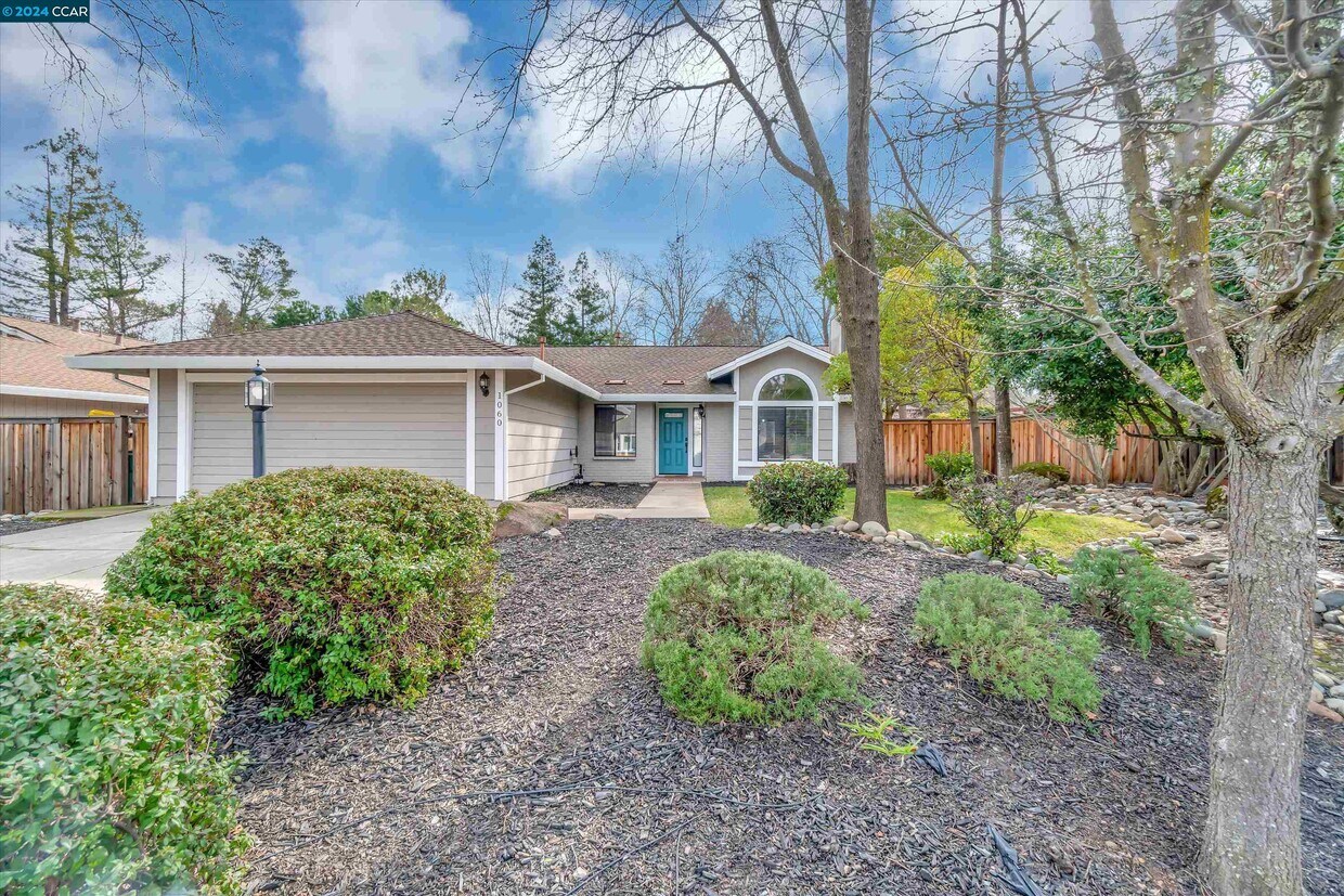
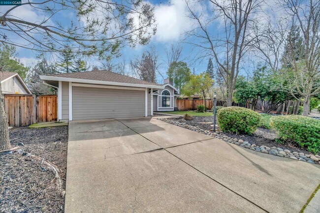
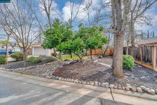
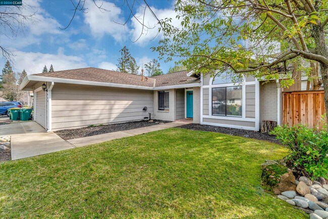
1060 St Andrews Dr
El Dorado Hills, CA 95762
Favorites
1060 St Andrews Dr

Favorites
Check Back Soon for Upcoming Availability
| Beds | Baths | Average SF |
|---|---|---|
| 3 Bedrooms 3 Bedrooms 3 Br | 2 Baths 2 Baths 2 Ba | 1,370 SF |
About This Property
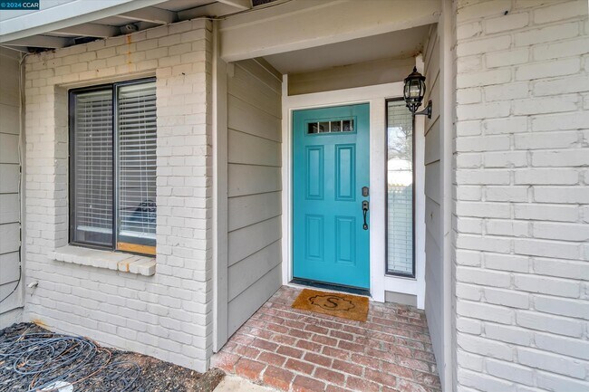
Amazing Stonegate Village home in the heart of El Dorado Hills! This RENOVATED,charming,single-story is the perfect place to call Home. The great room is spacious & inviting and opens to the private,flat,pool-sized backyard! The location is primo! Tucked away in the quiet & desirable Stonegate Village,it is close to excellent Oak Ridge High School & the fun of the CSD Park (pools,dog park,community events,etc.)! Plus,the New York Creek trail system is just steps away! Be prepared to fall in love!
1060 St Andrews Dr is a house located in El Dorado County and the 95762 ZIP Code. This area is served by the Buckeye Union Elementary School District attendance zone.
1060 St Andrews Dr,
El Dorado Hills,
CA
95762
El Dorado Hills covers 48 square miles in the Sierra Nevada foothills, combining residential areas with natural landscapes. The El Dorado Hills Town Center serves as the community hub, featuring the Steven Young Amphitheatre where residents gather for summer concerts. The area provides access to Folsom Lake and the South Fork of the American River for outdoor recreation. Students attend schools in the El Dorado Union High School District and Buckeye Union School District. Housing includes apartments with one-bedroom units averaging $2,158, while established neighborhoods like Lake Forest Village, Highland Hills, and Bridlewood offer single-family homes.
The area's history connects to the California Gold Rush, with historic Pony Express routes now serving as modern roadways. Developer Allan Lindsey established El Dorado Hills in the 1960s, creating residential villages interwoven with preserved open spaces that protect the native oak trees and rolling terrain.
Learn more about living in El Dorado Hills
Education
| Colleges & Universities | Distance | ||
|---|---|---|---|
| Colleges & Universities | Distance | ||
| Drive: | 13 min | 6.9 mi | |
| Drive: | 28 min | 15.6 mi | |
| Drive: | 25 min | 16.6 mi | |
| Drive: | 33 min | 20.6 mi |
1060 St Andrews Dr is within 13 minutes or 6.9 miles from Folsom Lake College, Folsom. It is also near Sierra College, Rocklin Campus and Folsom Lake College, El Dorado.
Schools


Public Elementary School
Grades K-5
554 Students
Nearby
Public Elementary School
Grades K-5
416 Students
Attendance Zone
Public Middle & High School
Grades 6-12
2,346 Students
Attendance Zone
Public Middle School
Grades 6-8
778 Students
Attendance Zone
Private Elementary School
Grades PK-5
Nearby
Private Elementary, Middle & High School
Grades K-12
Nearby
School data provided by
 The GreatSchools Rating helps parents compare schools within a state based on a variety of school quality indicators and provides a helpful picture of how effectively each school serves all of its students. Ratings are on a scale of 1 (below average) to 10 (above average) and can include test scores, college readiness, academic progress, advanced courses, equity, discipline and attendance data. We also advise parents to visit schools, consider other information on school performance and programs, and consider family needs as part of the school selection process.
View GreatSchools Rating Methodology
Data provided by GreatSchools.org © 2026. All rights reserved.
View GreatSchools Rating Methodology
Data provided by GreatSchools.org © 2026. All rights reserved.
Transportation options available in El Dorado Hills include Historic Folsom, located 8.4 miles from 1060 St Andrews Dr. 1060 St Andrews Dr is near Sacramento International, located 40.4 miles or 51 minutes away.
| Transit / Subway | Distance | ||
|---|---|---|---|
| Transit / Subway | Distance | ||
|
|
Drive: | 16 min | 8.4 mi |
|
|
Drive: | 15 min | 9.8 mi |
|
|
Drive: | 15 min | 10.5 mi |
|
|
Drive: | 16 min | 11.0 mi |
| Commuter Rail | Distance | ||
|---|---|---|---|
| Commuter Rail | Distance | ||
|
|
Drive: | 31 min | 17.2 mi |
|
|
Drive: | 30 min | 18.0 mi |
| Drive: | 39 min | 25.4 mi | |
|
|
Drive: | 39 min | 25.4 mi |
| Drive: | 38 min | 30.0 mi |
| Airports | Distance | ||
|---|---|---|---|
| Airports | Distance | ||
|
Sacramento International
|
Drive: | 51 min | 40.4 mi |
Walkability Near 1060 St Andrews Dr El Dorado Hills, CA 95762
Getting Around
 What do Walkability, Transit, Drivability, and Bikeability mean?
Walkability measures the walking distance to day-to-day needs.
Transit measures access to public transportation.
Drivability measures congestion, parking availability, and access to major roads.
Bikeability measures the suitability for cycling.
How It Works
What do Walkability, Transit, Drivability, and Bikeability mean?
Walkability measures the walking distance to day-to-day needs.
Transit measures access to public transportation.
Drivability measures congestion, parking availability, and access to major roads.
Bikeability measures the suitability for cycling.
How It Works
Somewhat Walkable
Walkability
20
/ 100
Minimal Public Transit
Transit
0
/ 100
Exceptionally Drivable
Drivability
90
/ 100
Fairly Bikeable
Bikeability
50
/ 100
Scores provided by
-
Soundscore™
-
/ 100
Traffic
-Airport
-Businesses
-Scores provided by
HowLoud What is a Sound Score Rating? A Sound Score Rating aggregates noise caused by vehicle traffic, airplane traffic and local sources. How It WorksTime and distance from 1060 St Andrews Dr.
| Shopping Centers | Distance | ||
|---|---|---|---|
| Shopping Centers | Distance | ||
| Drive: | 4 min | 2.0 mi | |
| Drive: | 4 min | 2.0 mi | |
| Drive: | 5 min | 2.5 mi |
1060 St Andrews Dr has 3 shopping centers within 2.5 miles, which is about a 5-minute drive. The miles and minutes will be for the farthest away property.
| Parks and Recreation | Distance | ||
|---|---|---|---|
| Parks and Recreation | Distance | ||
|
Folsom Lake State Recreation Area
|
Drive: | 13 min | 4.7 mi |
|
Folsom City Zoo Sanctuary
|
Drive: | 14 min | 7.1 mi |
|
Folsom Powerhouse State Historic Park
|
Drive: | 15 min | 7.7 mi |
|
Sailor Bar County Park
|
Drive: | 20 min | 13.1 mi |
|
Sierra College Natural History Museum
|
Drive: | 27 min | 15.5 mi |
1060 St Andrews Dr has 5 parks within 15.5 miles, including Folsom Lake State Recreation Area, Folsom City Zoo Sanctuary, and Folsom Powerhouse State Historic Park.
| Hospitals | Distance | ||
|---|---|---|---|
| Hospitals | Distance | ||
| Drive: | 12 min | 6.6 mi |
1060 St Andrews Dr is 6.6 miles and a 12 minute drive from Mercy Hospital of Folsom.
| Military Bases | Distance | ||
|---|---|---|---|
| Military Bases | Distance | ||
| Drive: | 46 min | 23.6 mi | |
| Drive: | 76 min | 48.7 mi | |
| Drive: | 97 min | 72.6 mi |
1060 St Andrews Dr has 3 military bases within 72.6 miles, the nearest is McClellan Air Force Base which is 23.6 miles away and a 46 minute drive.
You May Also Like
Similar Rentals Nearby
-
-
3 Beds$3,0564 Beds$3,256+Total Monthly PriceTotal Monthly Price NewPrices include base rent and required monthly fees of $60. Variable costs based on usage may apply.Base Rent:3 Beds$2,9954 Beds$3,195+Specials
Pets Allowed Fitness Center Pool In Unit Washer & Dryer Clubhouse Stainless Steel Appliances Package Service
-
-
-

-
-

-
-
-


What Are Walk Score®, Transit Score®, and Bike Score® Ratings?
Walk Score® measures the walkability of any address. Transit Score® measures access to public transit. Bike Score® measures the bikeability of any address.
What is a Sound Score Rating?
A Sound Score Rating aggregates noise caused by vehicle traffic, airplane traffic and local sources.

1060 St Andrews Dr
El Dorado Hills, CA 95762