$4,488
Total Monthly Price
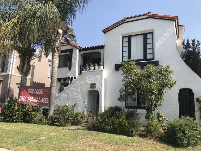
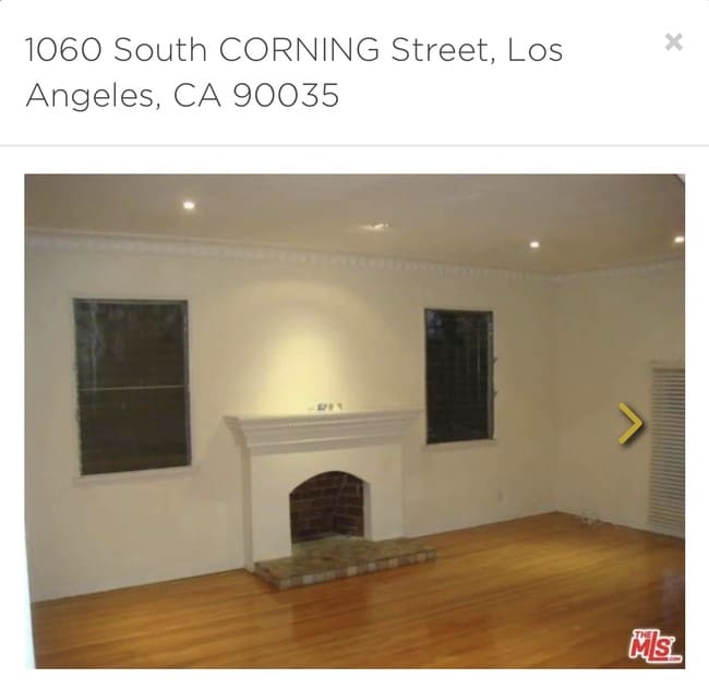
1060 S Corning St
Los Angeles, CA 90035
Favorites
424-306-0909
-
Bedrooms
3
-
Bathrooms
2
-
Square Feet
2,200 sq ft
-
Available
Available Now
Highlights
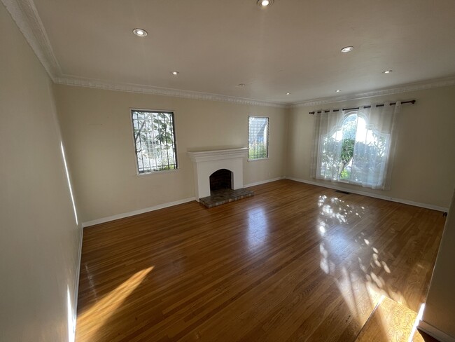
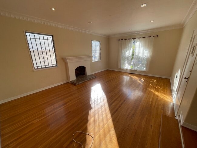
- Hardwood Floors
- Gated
- Fireplace
1060 S Corning St

Favorites
About This Home
12 Month Lease,
$4,688 deposit,
Available Now
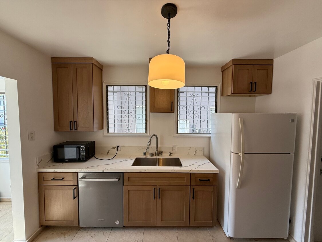
Lower unit Duplex for rent 3 bed 2 bath New white oak Kitchen Breakfast room Dining room Living room Hardwood floors 5 Ton carrier ac/heat unit with nest Near cedars, Beverly Hills adj, West Hollywood
1060 S Corning St is a townhome located in Los Angeles County and the 90035 ZIP Code. This area is served by the Los Angeles Unified Rocp School District attendance zone.
* Price shown is total price based on community-supplied monthly required fees. Excludes user-selected optional fees and variable or usage-based fees and required charges due at or prior to move-in or at move-out. Price, availability, fees, and any applicable rent special are subject to change without notice.
* Square footage definitions vary. Displayed square footage is approximate.
Townhome Features
Washer/Dryer
Air Conditioning
Dishwasher
Hardwood Floors
- Washer/Dryer
- Air Conditioning
- Heating
- Cable Ready
- Tub/Shower
- Fireplace
- Dishwasher
- Kitchen
- Hardwood Floors
- Dining Room
- Gated
Fees and Policies
The fees listed below are community-provided and may exclude utilities or add-ons. All payments are made directly to the property and are non-refundable unless otherwise specified.
- Cats Allowed
-
Fees not specified
-
Weight limit--
-
Pet Limit--
- Parking
-
Garage--
Details
Utilities Included
-
Water
Lease Options
-
12
Contact
- Listed by Aiden Group
- Phone Number
- Contact
Location
Get Directions
Pico-Robertson is a popular Los Angeles neighborhood situated directly south of Beverly Hills and east of Century City. Despite its location in the heart of glittery West Los Angeles near the Miracle Mile, Beverlywood, Carthay, and Cheviot Hills, Pico-Robertson is much more low-key. You won't find trendy hotspots and wild nightlife in Pico-Robertson, but you will find a strong sense of community and a quiet setting.
Pico-Robertson offers a unique collection of delis, bakeries, and more. It is named for the intersection of Pico Boulevard and Robertson Boulevard, and that's where you'll find the majority of the neighborhood's shops, restaurants, and cafes.
Learn more about living in Pico-Robertson
Education
| Colleges & Universities | Distance | ||
|---|---|---|---|
| Colleges & Universities | Distance | ||
| Drive: | 12 min | 4.8 mi | |
| Drive: | 12 min | 5.4 mi | |
| Drive: | 10 min | 5.5 mi | |
| Drive: | 11 min | 5.8 mi |
1060 S Corning St is within 12 minutes or 4.8 miles from West Los Angeles College. It is also near UCLA and Musicians Institute.
Schools


Public Elementary School
Grades K-5
562 Students
Nearby
Public Elementary School
Grades K-5
327 Students
Attendance Zone
Public Middle School
Grades 6-8
454 Students
Attendance Zone
Public High School
Grades 9-12
1,495 Students
Attendance Zone
Private Elementary & Middle School
Grades K-8
312 Students
Nearby
Private High School
Grades 9-12
Nearby
School data provided by
 The GreatSchools Rating helps parents compare schools within a state based on a variety of school quality indicators and provides a helpful picture of how effectively each school serves all of its students. Ratings are on a scale of 1 (below average) to 10 (above average) and can include test scores, college readiness, academic progress, advanced courses, equity, discipline and attendance data. We also advise parents to visit schools, consider other information on school performance and programs, and consider family needs as part of the school selection process.
View GreatSchools Rating Methodology
Data provided by GreatSchools.org © 2026. All rights reserved.
View GreatSchools Rating Methodology
Data provided by GreatSchools.org © 2026. All rights reserved.
Transportation options available in Los Angeles include La Cienega/Jefferson, located 2.4 miles from 1060 S Corning St. 1060 S Corning St is near Los Angeles International, located 9.5 miles or 19 minutes away, and Bob Hope, located 13.8 miles or 26 minutes away.
| Transit / Subway | Distance | ||
|---|---|---|---|
| Transit / Subway | Distance | ||
|
|
Drive: | 5 min | 2.4 mi |
|
|
Drive: | 6 min | 2.5 mi |
|
|
Drive: | 6 min | 3.2 mi |
|
|
Drive: | 7 min | 4.0 mi |
|
|
Drive: | 9 min | 4.0 mi |
| Commuter Rail | Distance | ||
|---|---|---|---|
| Commuter Rail | Distance | ||
|
|
Drive: | 17 min | 9.0 mi |
|
|
Drive: | 19 min | 9.3 mi |
|
|
Drive: | 20 min | 11.4 mi |
|
|
Drive: | 23 min | 11.7 mi |
|
|
Drive: | 24 min | 12.7 mi |
| Airports | Distance | ||
|---|---|---|---|
| Airports | Distance | ||
|
Los Angeles International
|
Drive: | 19 min | 9.5 mi |
|
Bob Hope
|
Drive: | 26 min | 13.8 mi |
Getting Around
 What do Walkability, Transit, Drivability, and Bikeability mean?
Walkability measures the walking distance to day-to-day needs.
Transit measures access to public transportation.
Drivability measures congestion, parking availability, and access to major roads.
Bikeability measures the suitability for cycling.
How It Works
What do Walkability, Transit, Drivability, and Bikeability mean?
Walkability measures the walking distance to day-to-day needs.
Transit measures access to public transportation.
Drivability measures congestion, parking availability, and access to major roads.
Bikeability measures the suitability for cycling.
How It Works
Very Walkable
Walkability
80
/ 100
Good Public Transit
Transit
70
/ 100
Moderately Drivable
Drivability
60
/ 100
Fairly Bikeable
Bikeability
50
/ 100
Scores provided by
Active
Soundscore™
69
/ 100
Traffic
BusyAirport
CalmBusinesses
BusyScores provided by
HowLoud What is a Sound Score Rating? A Sound Score Rating aggregates noise caused by vehicle traffic, airplane traffic and local sources. How It WorksTime and distance from 1060 S Corning St.
| Shopping Centers | Distance | ||
|---|---|---|---|
| Shopping Centers | Distance | ||
| Walk: | 3 min | 0.2 mi | |
| Walk: | 7 min | 0.4 mi | |
| Walk: | 7 min | 0.4 mi |
1060 S Corning St has 3 shopping centers within 0.4 mile, which is about a 7-minute walk. The miles and minutes will be for the farthest away property.
| Parks and Recreation | Distance | ||
|---|---|---|---|
| Parks and Recreation | Distance | ||
|
Zimmer Children's Museum
|
Drive: | 3 min | 1.2 mi |
|
La Brea Tar Pits
|
Drive: | 3 min | 1.6 mi |
|
Virginia Robinson Gardens
|
Drive: | 9 min | 3.7 mi |
|
Kenneth Hahn State Recreation Area
|
Drive: | 12 min | 4.5 mi |
|
Runyon Canyon
|
Drive: | 11 min | 4.7 mi |
1060 S Corning St has 5 parks within 4.7 miles, including Zimmer Children's Museum, La Brea Tar Pits, and Virginia Robinson Gardens.
| Hospitals | Distance | ||
|---|---|---|---|
| Hospitals | Distance | ||
| Walk: | 19 min | 1.0 mi | |
| Drive: | 2 min | 1.1 mi | |
| Drive: | 3 min | 1.4 mi |
1060 S Corning St has 3 hospitals within 1.4 miles, the nearest is Docs Surgical Hospital which is 1.0 miles away and a 19 minute walk.
| Military Bases | Distance | ||
|---|---|---|---|
| Military Bases | Distance | ||
| Drive: | 19 min | 11.1 mi | |
| Drive: | 41 min | 27.8 mi | |
| Drive: | 44 min | 30.1 mi |
1060 S Corning St has 3 military bases within 30.1 miles, the nearest is Los Angeles Air Force Base which is 11.1 miles away and a 19 minute drive.
Amenities
- Washer/Dryer
- Air Conditioning
- Heating
- Cable Ready
- Tub/Shower
- Fireplace
- Dishwasher
- Kitchen
- Hardwood Floors
- Dining Room
- Gated
1060 S Corning St Photos

1060 S Corning St
Los Angeles, CA 90035