
$1,900
/ Month
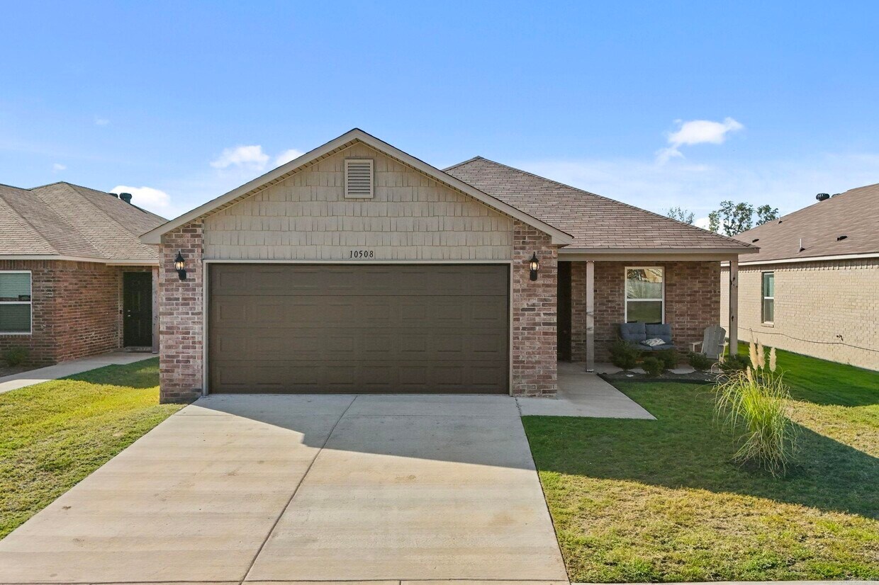
10508 Cypress Knee Dr
North Little Rock, AR 72113
Favorites
10508 Cypress Knee Dr

Favorites
Check Back Soon for Upcoming Availability
| Beds | Baths | Average SF |
|---|---|---|
| 4 Bedrooms 4 Bedrooms 4 Br | 2 Baths 2 Baths 2 Ba | 1,759 SF |
About This Property
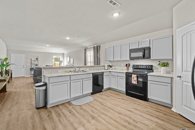
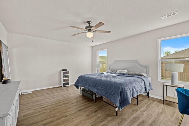
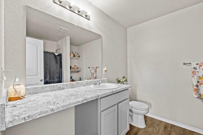
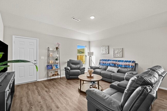
This pristine 4 bedroom 2 bathroom home is move-in ready for you! The layout is open and welcoming to accommodate a family of almost any size. The master bedroom is separate from the other bedrooms and the 4th bedroom is a great bedroom or flex/ office area. With a convenient location for any commute, this newly built home is nearly BRAND NEW. This home s immediately available for rent. Contact us today!
10508 Cypress Knee Dr is a house located in Pulaski County and the 72113 ZIP Code. This area is served by the Pulaski County Special School District attendance zone.
10508 Cypress Knee Dr,
North Little Rock,
AR
72113
North Little Rock sits on the north bank of the Arkansas River, directly across from the state capital, giving residents a city of their own with immediate access to a major metro area. The two cities share the iconic Big Dam Bridge, one of the longest pedestrian and bicycle bridges in the country built specifically for non-motorized travel, and the River Rail Streetcar, which connects both downtowns with a short, scenic ride. Originally called Argenta before incorporating as North Little Rock in 1917, the city carries that history proudly through its revitalized Argenta Historic District, where restored storefronts now house galleries, live theater, boutiques, and locally rooted restaurants. Burns Park, stretching over 1,700 acres, anchors the outdoor scene with golf courses, trails, tennis courts, and athletic fields. Neighborhoods like Park Hill and Lakewood offer distinct residential pockets within the city.
Learn more about living in North Little Rock
Education
| Colleges & Universities | Distance | ||
|---|---|---|---|
| Colleges & Universities | Distance | ||
| Drive: | 15 min | 9.5 mi | |
| Drive: | 17 min | 12.0 mi | |
| Drive: | 20 min | 12.6 mi | |
| Drive: | 20 min | 13.7 mi |
10508 Cypress Knee Dr is within 15 minutes or 9.5 miles from Pulaski Technical College. It is also near Univ. of Ark. Medical Scis. and Philander Smith College.
Schools


Public Elementary School
Grades PK-5
411 Students
Attendance Zone
Public Middle School
Grades 6-8
511 Students
Attendance Zone
Private Elementary & Middle School
Grades PK-8
131 Students
Nearby
Private Middle & High School
Grades 6-12
470 Students
Nearby
School data provided by
 The GreatSchools Rating helps parents compare schools within a state based on a variety of school quality indicators and provides a helpful picture of how effectively each school serves all of its students. Ratings are on a scale of 1 (below average) to 10 (above average) and can include test scores, college readiness, academic progress, advanced courses, equity, discipline and attendance data. We also advise parents to visit schools, consider other information on school performance and programs, and consider family needs as part of the school selection process.
View GreatSchools Rating Methodology
Data provided by GreatSchools.org © 2026. All rights reserved.
View GreatSchools Rating Methodology
Data provided by GreatSchools.org © 2026. All rights reserved.
Transportation options available in North Little Rock include Main St & Bishop Lindsey Ave, located 9.7 miles from 10508 Cypress Knee Dr. 10508 Cypress Knee Dr is near Bill and Hillary Clinton Ntl/Adams Field, located 15.5 miles or 21 minutes away.
| Transit / Subway | Distance | ||
|---|---|---|---|
| Transit / Subway | Distance | ||
| Drive: | 12 min | 9.7 mi | |
| Drive: | 13 min | 9.8 mi | |
| Drive: | 13 min | 9.9 mi | |
| Drive: | 13 min | 10.0 mi | |
| Drive: | 13 min | 10.1 mi |
| Commuter Rail | Distance | ||
|---|---|---|---|
| Commuter Rail | Distance | ||
|
|
Drive: | 16 min | 11.4 mi |
| Airports | Distance | ||
|---|---|---|---|
| Airports | Distance | ||
|
Bill and Hillary Clinton Ntl/Adams Field
|
Drive: | 21 min | 15.5 mi |
Walkability Near 10508 Cypress Knee Dr North Little Rock, AR 72113
Getting Around
 What do Walkability, Transit, Drivability, and Bikeability mean?
Walkability measures the walking distance to day-to-day needs.
Transit measures access to public transportation.
Drivability measures congestion, parking availability, and access to major roads.
Bikeability measures the suitability for cycling.
How It Works
What do Walkability, Transit, Drivability, and Bikeability mean?
Walkability measures the walking distance to day-to-day needs.
Transit measures access to public transportation.
Drivability measures congestion, parking availability, and access to major roads.
Bikeability measures the suitability for cycling.
How It Works
Somewhat Walkable
Walkability
20
/ 100
Minimal Public Transit
Transit
0
/ 100
Exceptionally Drivable
Drivability
90
/ 100
Fairly Bikeable
Bikeability
40
/ 100
Scores provided by
-
Soundscore™
-
/ 100
Traffic
-Airport
-Businesses
-Scores provided by
HowLoud What is a Sound Score Rating? A Sound Score Rating aggregates noise caused by vehicle traffic, airplane traffic and local sources. How It WorksTime and distance from 10508 Cypress Knee Dr.
| Shopping Centers | Distance | ||
|---|---|---|---|
| Shopping Centers | Distance | ||
| Drive: | 4 min | 1.9 mi | |
| Drive: | 4 min | 2.0 mi | |
| Drive: | 4 min | 2.0 mi |
10508 Cypress Knee Dr has 3 shopping centers within 2.0 miles, which is about a 4-minute drive. The miles and minutes will be for the farthest away property.
| Parks and Recreation | Distance | ||
|---|---|---|---|
| Parks and Recreation | Distance | ||
|
Burns Park
|
Drive: | 10 min | 6.7 mi |
|
Museum of Discovery
|
Drive: | 15 min | 10.8 mi |
|
Little Rock Zoo
|
Drive: | 19 min | 13.0 mi |
|
Central High School National Historic Site
|
Drive: | 19 min | 13.1 mi |
|
Pinnacle Mountain State Park
|
Drive: | 24 min | 13.6 mi |
10508 Cypress Knee Dr has 5 parks within 13.6 miles, including Burns Park, Museum of Discovery, and Little Rock Zoo.
| Hospitals | Distance | ||
|---|---|---|---|
| Hospitals | Distance | ||
| Drive: | 8 min | 4.6 mi | |
| Drive: | 9 min | 4.8 mi | |
| Drive: | 10 min | 5.1 mi |
10508 Cypress Knee Dr has 3 hospitals within 5.1 miles, the nearest is Arkansas Surgical Hospital which is 4.6 miles away and a 8 minute drive.
| Military Bases | Distance | ||
|---|---|---|---|
| Military Bases | Distance | ||
| Drive: | 24 min | 10.8 mi | |
| Drive: | 29 min | 18.4 mi | |
| Drive: | 35 min | 24.3 mi |
10508 Cypress Knee Dr has 3 military bases within 24.3 miles, the nearest is Camp Joseph T. Robinson Hill which is 10.8 miles away and a 24 minute drive.
You May Also Like
Similar Rentals Nearby


What Are Walk Score®, Transit Score®, and Bike Score® Ratings?
Walk Score® measures the walkability of any address. Transit Score® measures access to public transit. Bike Score® measures the bikeability of any address.
What is a Sound Score Rating?
A Sound Score Rating aggregates noise caused by vehicle traffic, airplane traffic and local sources.

10508 Cypress Knee Dr
North Little Rock, AR 72113