$1,450
Total Monthly Price
12 Month Lease
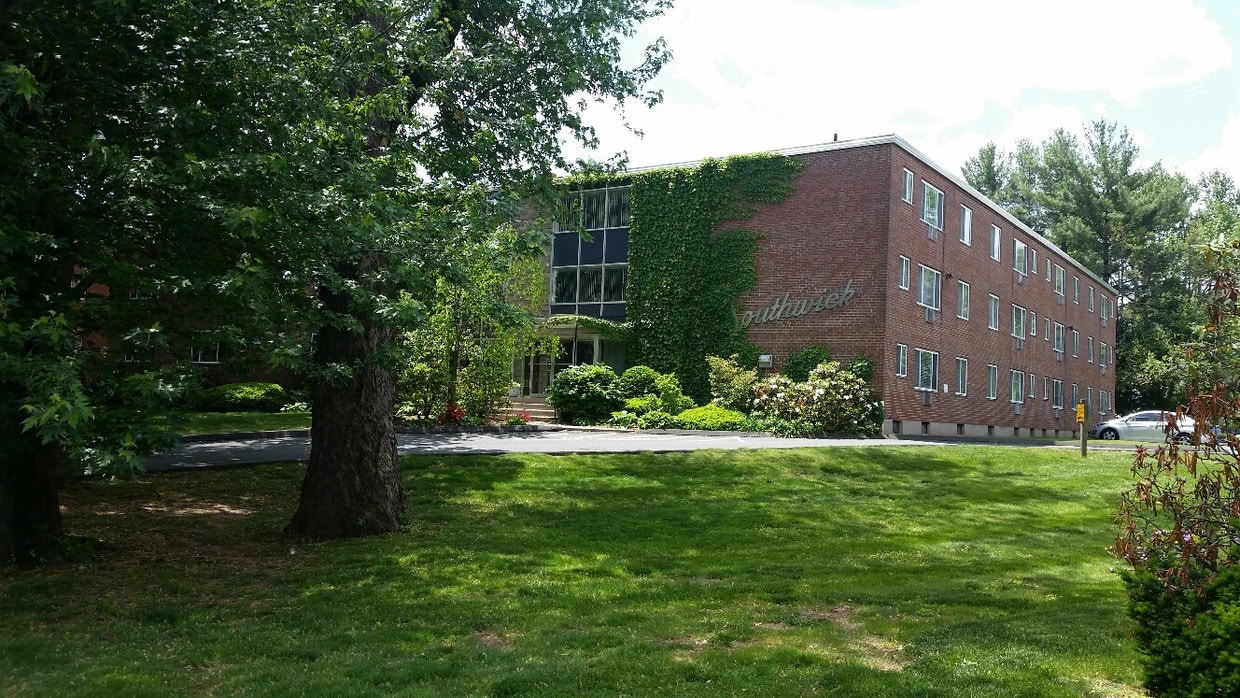
105 S Main St Unit 314
West Hartford, CT 06107
1 Week Ago
|
Edit
Favorites
860-920-4850
-
Bedrooms
1
-
Bathrooms
1
-
Square Feet
540 sq ft
-
Available
Available Jun 1
Highlights
- Basement
- Smoke Free
105 S Main St Unit 314

Favorites
About This Home
12 Month Lease,
$1,450 deposit,
Available Jun 1
Lovely apartment! Within walking distance to West Hartford Center and Blue Back Square. Heat, hot water, parking for ONE car (only), laundry and storage facilities in the basement. Please contact me directly via email or phone. Do not use the "Request to Apply" feature. Please don't text. Thanks!
Lovely apartment. Within walking distance to West Hartford Center and Blue Back Square. Heat, hot water, parking for ONE car (only), laundry and storage facilities in the basement.
105 S Main St is an apartment community located in Hartford County and the 06107 ZIP Code. This area is served by the West Hartford School District attendance zone.
* Price shown is total price based on community-supplied monthly required fees. Excludes user-selected optional fees and variable or usage-based fees and required charges due at or prior to move-in or at move-out. Price, availability, fees, and any applicable rent special are subject to change without notice.
* Square footage definitions vary. Displayed square footage is approximate.
Apartment Features
Air Conditioning
Smoke Free
Basement
Instant Hot Water
- Air Conditioning
- Smoke Free
- Instant Hot Water
- Basement
- Laundry Facilities
- Elevator
Fees and Policies
The fees listed below are community-provided and may exclude utilities or add-ons. All payments are made directly to the property and are non-refundable unless otherwise specified.
- Cats Allowed
-
Fees not specified
-
Weight limit--
-
Pet Limit--
- Parking
-
Surface Lot--
Details
Utilities Included
-
Gas
-
Water
-
Heat
-
Trash Removal
-
Sewer
-
Air Conditioning
Lease Options
-
12 Months
Property Information
-
4 units
Contact
- Phone Number
- Contact
Location
Get Directions
Set five miles west of Connecticut's state capital, West Hartford carries the ease of a walkable town with the economic pull of a major metro close by. The University of Hartford and the University of Saint Joseph both anchor the town, lending it a steady academic presence alongside the government, insurance, and healthcare sectors concentrated in Hartford. West Hartford Center, built around Farmington Avenue and Main Street, has served as the commercial core since the late 17th century and still draws people with its mix of independent shops, theaters, and outdoor dining. Neighborhoods like Elmwood, Bishops Corner, and the Asylum Avenue corridor each have their own character, from tree-lined residential streets to areas with quick highway and transit access. Elizabeth Park, home to the oldest public rose garden in the country, sits on the town's northeastern edge and anchors an active outdoor scene year-round.
Learn more about living in West HartfordYou May Also Like
-
One West Hartford
950 Trout Brook Dr
West Hartford, CT 06119
$2,875 - $6,345 Total Monthly Price
1-3 Br 12 Month Lease 0.6 mi
-
Element 250
250 Main St
Hartford, CT 06106
$1,725 - $1,975 Plus Fees
1-2 Br 12 Month Lease 3.6 mi
-
The Pennant at North Crossing
1212 Main St
Hartford, CT 06103
$2,015 - $7,173 Total Monthly Price
1-3 Br 3.8 mi
Education
| Colleges & Universities | Distance | ||
|---|---|---|---|
| Colleges & Universities | Distance | ||
| Drive: | 4 min | 2.0 mi | |
| Drive: | 6 min | 3.0 mi | |
| Drive: | 9 min | 4.2 mi | |
| Drive: | 10 min | 4.5 mi |
105 S Main St Unit 314 is within 4 minutes or 2.0 miles from UCONN, Tri Campus, Hartford. It is also near University of Connecticut and Trinity College.
Schools


Public Elementary School
Grades PK-5
338 Students
Attendance Zone
Public Middle School
Grades 6-8
315 Students
Attendance Zone
Public Middle School
Grades 6-8
866 Students
Attendance Zone
Public High School
Grades 9-12
1,418 Students
Attendance Zone
Private Elementary School
Grades PK-5
184 Students
Nearby
Private Elementary, Middle & High School
Grades K-12
47 Students
Nearby
Private Middle & High School
Grades 6-12
511 Students
Nearby
School data provided by
 The GreatSchools Rating helps parents compare schools within a state based on a variety of school quality indicators and provides a helpful picture of how effectively each school serves all of its students. Ratings are on a scale of 1 (below average) to 10 (above average) and can include test scores, college readiness, academic progress, advanced courses, equity, discipline and attendance data. We also advise parents to visit schools, consider other information on school performance and programs, and consider family needs as part of the school selection process.
View GreatSchools Rating Methodology
Data provided by GreatSchools.org © 2026. All rights reserved.
View GreatSchools Rating Methodology
Data provided by GreatSchools.org © 2026. All rights reserved.
Getting Around
 What do Walkability, Transit, Drivability, and Bikeability mean?
Walkability measures the walking distance to day-to-day needs.
Transit measures access to public transportation.
Drivability measures congestion, parking availability, and access to major roads.
Bikeability measures the suitability for cycling.
How It Works
What do Walkability, Transit, Drivability, and Bikeability mean?
Walkability measures the walking distance to day-to-day needs.
Transit measures access to public transportation.
Drivability measures congestion, parking availability, and access to major roads.
Bikeability measures the suitability for cycling.
How It Works
Moderately Walkable
Walkability
60
/ 100
Limited Public Transit
Transit
30
/ 100
Exceptionally Drivable
Drivability
90
/ 100
Fairly Bikeable
Bikeability
50
/ 100
Scores provided by
Active
Soundscore™
76
/ 100
Traffic
ActiveAirport
CalmBusinesses
CalmScores provided by
HowLoud What is a Sound Score Rating? A Sound Score Rating aggregates noise caused by vehicle traffic, airplane traffic and local sources. How It Works
Amenities
- Air Conditioning
- Smoke Free
- Instant Hot Water
- Basement
- Laundry Facilities
- Elevator
105 S Main St Unit 314 Photos
What Are Walk Score®, Transit Score®, and Bike Score® Ratings?
Walk Score® measures the walkability of any address. Transit Score® measures access to public transit. Bike Score® measures the bikeability of any address.
What is a Sound Score Rating?
A Sound Score Rating aggregates noise caused by vehicle traffic, airplane traffic and local sources.

105 S Main St
West Hartford, CT 06107