$1,798
/ Month
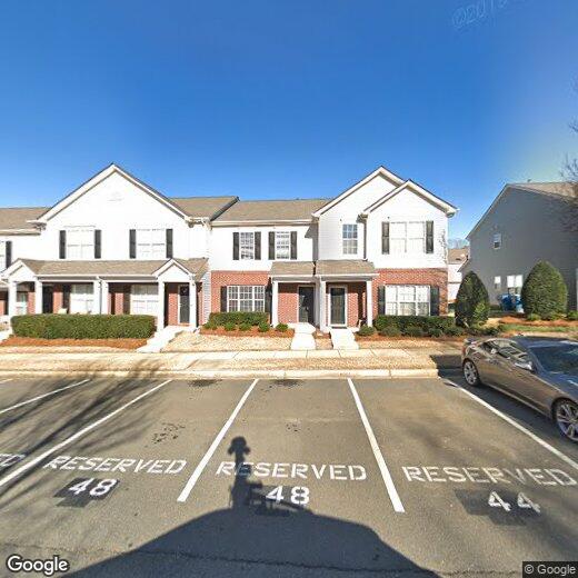
10448 Stokeshill Ct
Pineville, NC 28134
Today
Favorites
980-800-9999
-
Bedrooms
3
-
Bathrooms
2.5
-
Square Feet
1,393 sq ft
-
Available
Available Now
10448 Stokeshill Ct

Favorites
Nestled along the South Carolina-North Carolina state line, South Charlotte is a sprawling sector of the city that offers a family-friendly atmosphere, quiet residential streets, and easy access to Uptown Charlotte and beyond. Charlotte’s city center is around 15 miles north of town, so residents can easily commute into the city for work or entertainment. Local breweries, restaurants, and boutiques can all be found within the heart of the city. Abundant apartments, houses, condos, and townhomes are available for rent in South Charlotte, ranging from cozy to upscale. The neighborhood is also only a few miles from the Charlotte Douglas International Airport, which can be easily accessed via Interstate 485.
Learn more about living in South Charlotte
Education
| Colleges & Universities | Distance | ||
|---|---|---|---|
| Colleges & Universities | Distance | ||
| Drive: | 12 min | 5.8 mi | |
| Drive: | 21 min | 9.7 mi | |
| Drive: | 25 min | 12.7 mi | |
| Drive: | 23 min | 13.4 mi |
10448 Stokeshill Ct is within 12 minutes or 5.8 miles from Central Piedmont C.C., Harper. It is also near Queens University of Charlotte and Central Piedmont C.C., Central.
Schools


Public Elementary School
Grades K-5
771 Students
Attendance Zone
Public Elementary School
Grades PK-5
780 Students
Nearby
Public Middle School
Grades 6-8
1,144 Students
Attendance Zone
Public High School
Grades 9-12
3,344 Students
Attendance Zone
Private Elementary & Middle School
Grades PK-8
86 Students
Nearby
Private Elementary, Middle & High School
Grades PK-12
183 Students
Nearby
School data provided by
 The GreatSchools Rating helps parents compare schools within a state based on a variety of school quality indicators and provides a helpful picture of how effectively each school serves all of its students. Ratings are on a scale of 1 (below average) to 10 (above average) and can include test scores, college readiness, academic progress, advanced courses, equity, discipline and attendance data. We also advise parents to visit schools, consider other information on school performance and programs, and consider family needs as part of the school selection process.
View GreatSchools Rating Methodology
Data provided by GreatSchools.org © 2025. All rights reserved.
View GreatSchools Rating Methodology
Data provided by GreatSchools.org © 2025. All rights reserved.
Transportation options available in Pineville include I-485/South Boulevard, located 3.2 miles from 10448 Stokeshill Ct. 10448 Stokeshill Ct is near Charlotte/Douglas International, located 12.8 miles or 24 minutes away, and Concord-Padgett Regional, located 35.8 miles or 45 minutes away.
| Transit / Subway | Distance | ||
|---|---|---|---|
| Transit / Subway | Distance | ||
|
|
Drive: | 7 min | 3.2 mi |
|
|
Drive: | 10 min | 4.1 mi |
|
|
Drive: | 10 min | 5.1 mi |
|
|
Drive: | 13 min | 6.4 mi |
|
|
Drive: | 14 min | 7.1 mi |
| Commuter Rail | Distance | ||
|---|---|---|---|
| Commuter Rail | Distance | ||
|
|
Drive: | 27 min | 16.5 mi |
|
|
Drive: | 38 min | 27.8 mi |
| Drive: | 58 min | 40.9 mi |
| Airports | Distance | ||
|---|---|---|---|
| Airports | Distance | ||
|
Charlotte/Douglas International
|
Drive: | 24 min | 12.8 mi |
|
Concord-Padgett Regional
|
Drive: | 45 min | 35.8 mi |
Time and distance from 10448 Stokeshill Ct.
| Shopping Centers | Distance | ||
|---|---|---|---|
| Shopping Centers | Distance | ||
| Walk: | 9 min | 0.5 mi | |
| Walk: | 15 min | 0.8 mi | |
| Drive: | 4 min | 1.7 mi |
10448 Stokeshill Ct has 3 shopping centers within 1.7 miles, which is about a 4-minute walk. The miles and minutes will be for the farthest away property.
| Parks and Recreation | Distance | ||
|---|---|---|---|
| Parks and Recreation | Distance | ||
|
Brixham Park
|
Drive: | 7 min | 3.3 mi |
|
Stream Park
|
Drive: | 8 min | 3.7 mi |
|
Ballantyne's Backyard
|
Drive: | 12 min | 5.7 mi |
|
Briar Creek Greenway
|
Drive: | 18 min | 8.6 mi |
|
Wing Haven Gardens & Bird Sanctuary
|
Drive: | 20 min | 9.0 mi |
10448 Stokeshill Ct has 5 parks within 9.0 miles, including Brixham Park, Stream Park, and Ballantyne's Backyard.
| Hospitals | Distance | ||
|---|---|---|---|
| Hospitals | Distance | ||
| Drive: | 6 min | 2.3 mi | |
| Drive: | 9 min | 4.4 mi | |
| Drive: | 22 min | 11.0 mi |
10448 Stokeshill Ct has 3 hospitals within 11.0 miles, the nearest is Carolinas Medical Center - Pineville which is 2.3 miles away and a 6 minute drive.
| Military Bases | Distance | ||
|---|---|---|---|
| Military Bases | Distance | ||
| Drive: | 123 min | 89.2 mi |
10448 Stokeshill Ct is 89.2 miles and a 123 minute drive from Fort Jackson.
You May Also Like
-
Crossing at NODA
204 Monarch Creek Ln
Charlotte, NC 28206
$2,195 - $2,845
3 Br 13.9 mi
-
NOVEL University Place by Crescent Communi...
5315 Waters Edge Village Dr
Charlotte, NC 28262
$2,930 - $3,800
3 Br 18.1 mi
-
Greenway at Mallard Creek
8230 Greenway Village Dr
Charlotte, NC 28269
$2,395
3 Br 18.2 mi
Similar Rentals Nearby


What Are Walk Score®, Transit Score®, and Bike Score® Ratings?
Walk Score® measures the walkability of any address. Transit Score® measures access to public transit. Bike Score® measures the bikeability of any address.
What is a Sound Score Rating?
A Sound Score Rating aggregates noise caused by vehicle traffic, airplane traffic and local sources

10448 Stokeshill Ct
Pineville, NC 28134