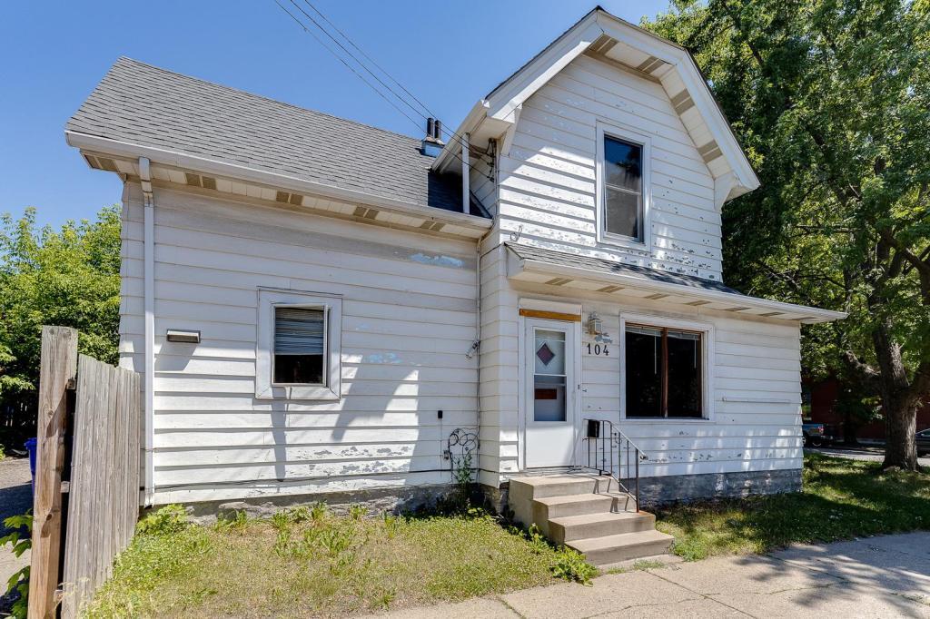
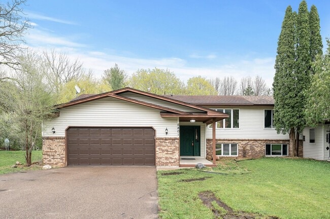
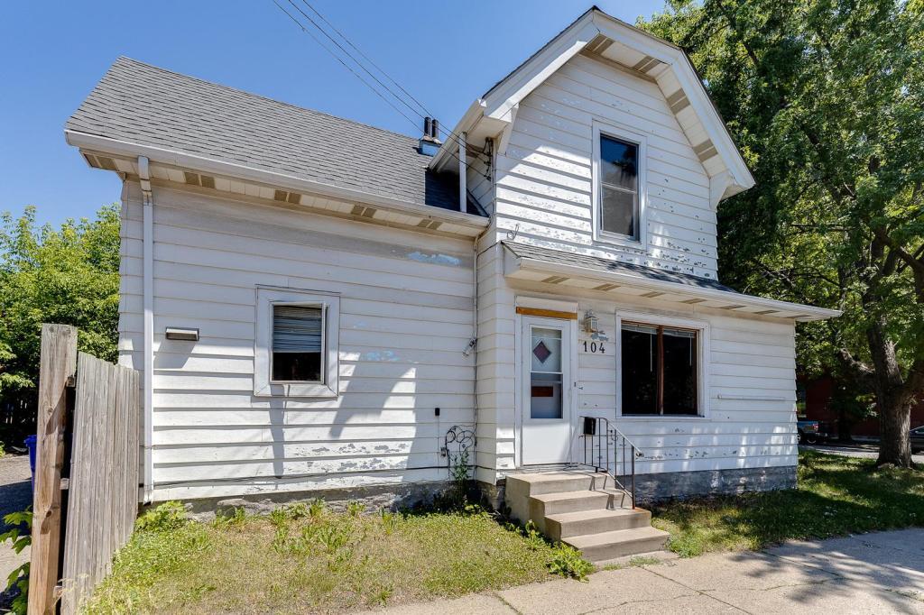
5 Beds, 2 Baths, 2,100 sq ft
104 Dale St N
Saint Paul, MN 55102

Check Back Soon for Upcoming Availability
| Beds | Baths | Average SF |
|---|---|---|
| 5 Bedrooms 5 Bedrooms 5 Br | 2 Baths 2 Baths 2 Ba | 1,817 SF |
Fees and Policies
The fees below are based on community-supplied data and may exclude additional fees and utilities.
- Dogs Allowed
-
Fees not specified
- Cats Allowed
-
Fees not specified
- Parking
-
Garage--
About This Property
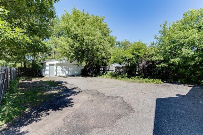
Large 5 bed 2 bath home, with two car garage and lots of extra off street parking in large lot. Great Crocus Hill location, two blocks from Grand Ave! Close to colleges, shops, restaurants, and highways.
104 Dale St N is a house located in Ramsey County and the 55102 ZIP Code.
House Features
Washer/Dryer
Air Conditioning
Dishwasher
Tub/Shower
- Washer/Dryer
- Air Conditioning
- Heating
- Smoke Free
- Tub/Shower
- Dishwasher
Summit-University borders Downtown Saint Paul to the west. This historic neighborhood is also home to one of F. Scott Fitzgerald’s houses. Filled with Victorian mansions, brick apartments, canopy streets, and lush parks, Summit-University maintains a quaint charm. A handful of locally-owned pubs, coffee shops, and restaurants in cozy settings heighten the neighborhood’s small-town charm. There are rental options for every budget, but residents certainly appreciate the area’s affordability.
Along with access to good public schools, Summit-University is convenient to Concordia University-Saint Paul and Macalester College. Interstate 94 and US Route 12 run through Summit-University so residents can easily drive into downtown or Minneapolis. If you prefer public transportation, there are several rail stations located along the northern border of the neighborhood.
Learn more about living in Summit-UniversityBelow are rent ranges for similar nearby apartments
- Washer/Dryer
- Air Conditioning
- Heating
- Smoke Free
- Tub/Shower
- Dishwasher
| Colleges & Universities | Distance | ||
|---|---|---|---|
| Colleges & Universities | Distance | ||
| Drive: | 3 min | 1.2 mi | |
| Drive: | 4 min | 1.8 mi | |
| Drive: | 4 min | 2.5 mi | |
| Drive: | 8 min | 3.3 mi |
Transportation options available in Saint Paul include Dale St Station, located 0.8 mile from 104 Dale St N. 104 Dale St N is near Minneapolis-St Paul International/Wold-Chamberlain, located 8.3 miles or 16 minutes away.
| Transit / Subway | Distance | ||
|---|---|---|---|
| Transit / Subway | Distance | ||
| Walk: | 15 min | 0.8 mi | |
| Drive: | 3 min | 1.3 mi | |
| Drive: | 3 min | 1.5 mi | |
| Drive: | 3 min | 1.8 mi | |
| Drive: | 4 min | 1.8 mi |
| Commuter Rail | Distance | ||
|---|---|---|---|
| Commuter Rail | Distance | ||
|
|
Drive: | 5 min | 2.9 mi |
|
|
Drive: | 17 min | 9.1 mi |
|
|
Drive: | 24 min | 18.5 mi |
|
|
Drive: | 34 min | 26.6 mi |
|
|
Drive: | 36 min | 28.3 mi |
| Airports | Distance | ||
|---|---|---|---|
| Airports | Distance | ||
|
Minneapolis-St Paul International/Wold-Chamberlain
|
Drive: | 16 min | 8.3 mi |
Time and distance from 104 Dale St N.
| Shopping Centers | Distance | ||
|---|---|---|---|
| Shopping Centers | Distance | ||
| Walk: | 15 min | 0.8 mi | |
| Walk: | 15 min | 0.8 mi | |
| Walk: | 16 min | 0.8 mi |
| Parks and Recreation | Distance | ||
|---|---|---|---|
| Parks and Recreation | Distance | ||
|
Irvine Park
|
Drive: | 3 min | 1.6 mi |
|
Western Park
|
Drive: | 3 min | 1.6 mi |
|
Science Museum of Minnesota
|
Drive: | 4 min | 1.9 mi |
|
Mississippi National River & Recreation Area
|
Drive: | 4 min | 2.0 mi |
|
Minnesota Children's Museum
|
Drive: | 4 min | 2.1 mi |
| Hospitals | Distance | ||
|---|---|---|---|
| Hospitals | Distance | ||
| Drive: | 2 min | 1.3 mi | |
| Drive: | 3 min | 1.8 mi | |
| Drive: | 4 min | 2.3 mi |
| Military Bases | Distance | ||
|---|---|---|---|
| Military Bases | Distance | ||
| Drive: | 15 min | 7.0 mi |
You May Also Like
Similar Rentals Nearby
-
$2,600Total Monthly PriceTotal Monthly Price NewPrices include all required monthly fees.12 Month LeaseHouse for Rent
-
$3,500Total Monthly PriceTotal Monthly Price NewPrices include all required monthly fees.6 Month LeaseHouse for Rent
4 Beds, 3.5 Baths, 3,096 sq ft
-
$3,450Total Monthly PriceTotal Monthly Price NewPrices include all required monthly fees.12 Month LeaseHouse for Rent
4 Beds, 2.5 Baths, 2,200 sq ft
-
4 Beds$2,869+Total Monthly PriceTotal Monthly Price NewPrices include base rent and required monthly fees of $4. Variable costs based on usage may apply.Base Rent:4 Beds$2,865+Specials
Pets Allowed Fitness Center Pool Dishwasher In Unit Washer & Dryer Walk-In Closets
-
-
-
4 Beds$2,585Total Monthly PriceTotal Monthly Price NewPrices include required monthly fees of $56.Base Rent:4 Beds$2,529House for Rent
-
-
5 Beds$2,848Total Monthly PriceTotal Monthly Price NewPrices include required monthly fees of $49.Base Rent:5 Beds$2,799House for Rent
-
What Are Walk Score®, Transit Score®, and Bike Score® Ratings?
Walk Score® measures the walkability of any address. Transit Score® measures access to public transit. Bike Score® measures the bikeability of any address.
What is a Sound Score Rating?
A Sound Score Rating aggregates noise caused by vehicle traffic, airplane traffic and local sources
