
1213 Walnut
1213 Walnut St,
Philadelphia, PA 19107
$2,045 - $7,340
Studio - 2 Beds


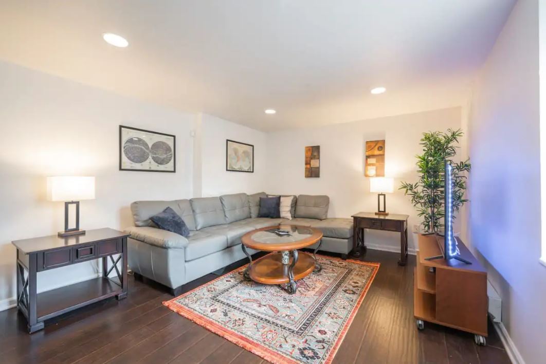
Unit E: This charming, trinity-style 2 Bedroom apartment in Fishtown features a private roof deck, and is available August 1st! The four-story, 780sf unit has a brand-new oven range, on-site laundry, and an outdoor patio area for building residents. We are pet-friendly, and the residences come unfurnished.
1037 Crease St is an apartment community located in Philadelphia County and the 19125 ZIP Code. This area is served by the The School District of Philadelphia attendance zone.
Dishwasher
Hardwood Floors
Granite Countertops
Refrigerator
Once the epicenter of the commercial shad fishing industry, Fishtown is now a creative hub for artistic, culinary, and musical action in Philadelphia. Beer gardens, independent coffee shops, diverse restaurants, eclectic bars, vibrant murals, and live music abound in Fishtown.
Renting in Fishtown affords residents the option to catch a concert at the Fillmore Philadelphia, play classic video games at Barcade, and drink artisanal coffee at La Colombe Coffee Roasters. Palmer Park and Penn Treaty Park also offer a lush reprieve from city life in the neighborhood.
Fishtown manages to feel far removed from the hustle and bustle of Center City, despite being less than a ten-minute ride away via the El. Convenience to I-95 connects Fishtown to destinations like New Jersey, New York, Baltimore, and Washington D.C. in less than a two-hour drive.
Learn more about living in FishtownCompare neighborhood and city base rent averages by bedroom.
| Fishtown | Philadelphia, PA | |
|---|---|---|
| Studio | $1,340 | $1,426 |
| 1 Bedroom | $1,868 | $1,783 |
| 2 Bedrooms | $2,641 | $2,220 |
| 3 Bedrooms | $2,719 | $2,910 |
| Colleges & Universities | Distance | ||
|---|---|---|---|
| Colleges & Universities | Distance | ||
| Drive: | 5 min | 2.0 mi | |
| Drive: | 6 min | 2.6 mi | |
| Drive: | 8 min | 3.8 mi | |
| Drive: | 9 min | 4.2 mi |


Transportation options available in Philadelphia include Frankford Av & Girard Av - Fs, located 0.2 mile from 1037 Crease St. 1037 Crease St is near Philadelphia International, located 14.1 miles or 23 minutes away, and Trenton Mercer, located 31.5 miles or 46 minutes away.
| Transit / Subway | Distance | ||
|---|---|---|---|
| Transit / Subway | Distance | ||
| Walk: | 3 min | 0.2 mi | |
| Walk: | 3 min | 0.2 mi | |
| Walk: | 4 min | 0.3 mi | |
| Walk: | 5 min | 0.3 mi | |
| Walk: | 6 min | 0.3 mi |
| Commuter Rail | Distance | ||
|---|---|---|---|
| Commuter Rail | Distance | ||
|
|
Drive: | 5 min | 1.9 mi |
|
|
Drive: | 7 min | 2.5 mi |
|
|
Drive: | 7 min | 2.7 mi |
|
|
Drive: | 7 min | 3.1 mi |
|
|
Drive: | 7 min | 3.1 mi |
| Airports | Distance | ||
|---|---|---|---|
| Airports | Distance | ||
|
Philadelphia International
|
Drive: | 23 min | 14.1 mi |
|
Trenton Mercer
|
Drive: | 46 min | 31.5 mi |
Scores provided by
Traffic
-Airport
-Businesses
-Scores provided by
HowLoud What is a Sound Score Rating? A Sound Score Rating aggregates noise caused by vehicle traffic, airplane traffic and local sources. How It WorksTime and distance from 1037 Crease St.
| Shopping Centers | Distance | ||
|---|---|---|---|
| Shopping Centers | Distance | ||
| Walk: | 12 min | 0.6 mi | |
| Walk: | 17 min | 0.9 mi | |
| Drive: | 3 min | 1.1 mi |
| Parks and Recreation | Distance | ||
|---|---|---|---|
| Parks and Recreation | Distance | ||
|
Edgar Allan Poe Nat'l Historic Site
|
Drive: | 5 min | 1.7 mi |
|
Great Egg Harbor River
|
Drive: | 5 min | 2.0 mi |
|
Lower Delaware National Wild and Scenic River
|
Drive: | 5 min | 2.0 mi |
|
Independence National Historical Park
|
Drive: | 5 min | 2.2 mi |
|
Adventure Aquarium
|
Drive: | 11 min | 4.6 mi |
| Hospitals | Distance | ||
|---|---|---|---|
| Hospitals | Distance | ||
| Drive: | 6 min | 2.6 mi | |
| Drive: | 7 min | 2.7 mi | |
| Drive: | 8 min | 2.9 mi |
| Military Bases | Distance | ||
|---|---|---|---|
| Military Bases | Distance | ||
| Drive: | 14 min | 8.4 mi | |
| Drive: | 40 min | 19.9 mi | |
| Drive: | 39 min | 20.6 mi |
What Are Walk Score®, Transit Score®, and Bike Score® Ratings?
Walk Score® measures the walkability of any address. Transit Score® measures access to public transit. Bike Score® measures the bikeability of any address.
What is a Sound Score Rating?
A Sound Score Rating aggregates noise caused by vehicle traffic, airplane traffic and local sources.
1037 Crease St
Philadelphia, PA 19125


