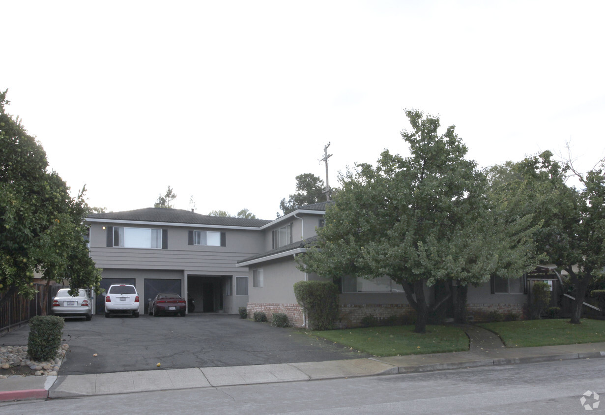
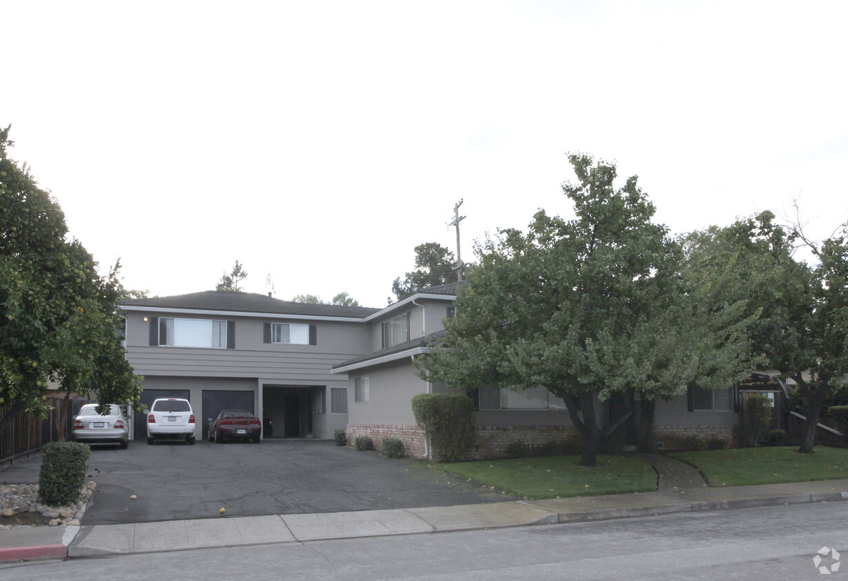
1035 Williams Way
1035 Williams Way,
Mountain View,
CA
94040
2 Weeks Ago
Favorites
1035 Williams Way
Favorites
Check Back Soon for Upcoming Availability
| Beds | Baths | Average SF | Availability |
|---|---|---|---|
| 2 Bedrooms 2 Bedrooms 2 Br | 1 Bath 1 Bath 1 Ba | 900 SF | Not Available |
Fees and Policies
Details
Property Information
-
Built in 1964
-
4 units/2 stories
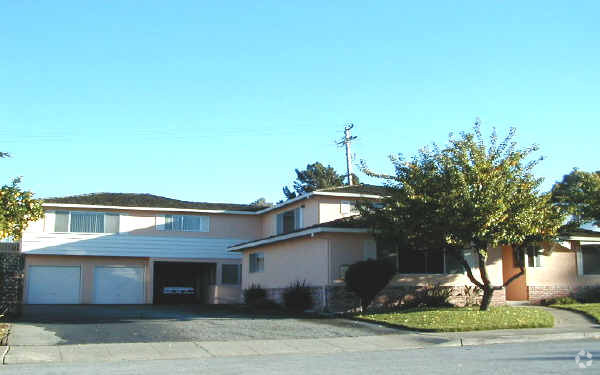
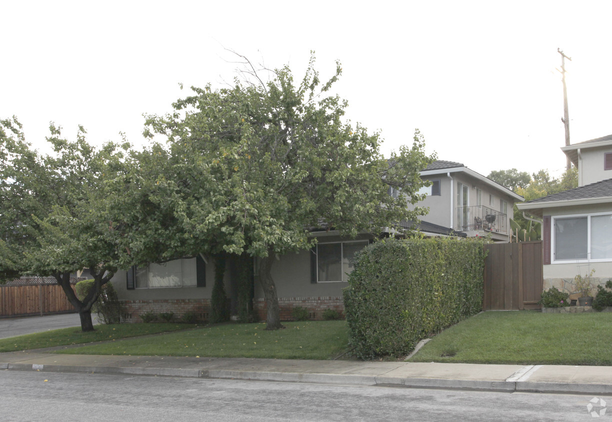
About 1035 Williams Way Mountain View, CA 94040
Thanks for visiting 1035 Williams Way in Mountain View. This apartment community is located on Williams Way in Mountain View. Be sure to come for a visit to view the available floorplans. Here at this community, the community staff will assist you in finding the perfect fit. At 1035 Williams Way you'll feel right at home. Stop by the community today.
1035 Williams Way is an apartment community located in Santa Clara County and the 94040 ZIP Code. This area is served by the Mountain View Whisman attendance zone.
Community Amenities
- Laundry Facilities
Apartment Features
- High Speed Internet Access
- Smoke Free
- Disposal
Location
Get Directions
Sitting on the eastern edge of the city, the Cuernavaca neighborhood of Mountain View, California, borders the neighboring town of Sunnyvale. The neighborhood's prime location in the Bay Area makes it highly desirable. San Jose sits 15 miles to the southeast and Downtown San Francisco lies 40 miles northwest.
The neighborhood is known for its variety of apartments for rent, all offering a slightly different living arrangement from the detached homes which occupy many of the surrounding neighborhoods. Largely residential, the neighborhood maintains a tranquility that residents appreciate. Countless restaurants, bars, and shopping centers are well within reach, but a Cuernavaca home provides a nice enclave to retreat to at the end of the day.
Learn more about living in CuernavacaBelow are rent ranges for similar nearby apartments
Amenities
- Laundry Facilities
- High Speed Internet Access
- Smoke Free
- Disposal
Education
| Colleges & Universities | Distance | ||
|---|---|---|---|
| Colleges & Universities | Distance | ||
| Drive: | 13 min | 4.8 mi | |
| Drive: | 10 min | 5.1 mi | |
| Drive: | 10 min | 5.6 mi | |
| Drive: | 19 min | 7.7 mi |
1035 Williams Way is within 10 minutes or 5.6 miles from De Anza College. It is also near Foothill Coll., Los Altos and Foothill College, Middlefield.
Schools


Public Elementary School
Grades K-5
380 Students
Attendance Zone
Public Elementary School
Grades K-5
367 Students
Nearby
Public Middle School
Grades 6-8
881 Students
Attendance Zone
Public High School
Grades 9-12
2,220 Students
Attendance Zone
Private Elementary School
Grades PK-1
Nearby
Private Elementary School
Grades K-5
81 Students
Nearby
Private Elementary & Middle School
Grades PK-8
137 Students
Nearby
Private High School
Grades 9-12
1,776 Students
Nearby
School data provided by
 The GreatSchools Rating helps parents compare schools within a state based on a variety of school quality indicators and provides a helpful picture of how effectively each school serves all of its students. Ratings are on a scale of 1 (below average) to 10 (above average) and can include test scores, college readiness, academic progress, advanced courses, equity, discipline and attendance data. We also advise parents to visit schools, consider other information on school performance and programs, and consider family needs as part of the school selection process.
View GreatSchools Rating Methodology
Data provided by GreatSchools.org © 2025. All rights reserved.
View GreatSchools Rating Methodology
Data provided by GreatSchools.org © 2025. All rights reserved.
Transportation options available in Mountain View include Whisman Station, located 2.0 miles from 1035 Williams Way. 1035 Williams Way is near Norman Y Mineta San Jose International, located 9.6 miles or 16 minutes away, and San Francisco International, located 27.0 miles or 35 minutes away.
| Transit / Subway | Distance | ||
|---|---|---|---|
| Transit / Subway | Distance | ||
|
|
Drive: | 6 min | 2.0 mi |
|
|
Drive: | 5 min | 2.1 mi |
| Drive: | 6 min | 2.2 mi | |
|
|
Drive: | 6 min | 2.3 mi |
|
|
Drive: | 8 min | 3.0 mi |
| Commuter Rail | Distance | ||
|---|---|---|---|
| Commuter Rail | Distance | ||
| Drive: | 6 min | 2.0 mi | |
| Drive: | 5 min | 2.1 mi | |
| Drive: | 7 min | 2.7 mi | |
| Drive: | 10 min | 4.2 mi | |
| Drive: | 10 min | 5.0 mi |
| Airports | Distance | ||
|---|---|---|---|
| Airports | Distance | ||
|
Norman Y Mineta San Jose International
|
Drive: | 16 min | 9.6 mi |
|
San Francisco International
|
Drive: | 35 min | 27.0 mi |
Time and distance from 1035 Williams Way.
| Shopping Centers | Distance | ||
|---|---|---|---|
| Shopping Centers | Distance | ||
| Walk: | 5 min | 0.3 mi | |
| Walk: | 6 min | 0.3 mi | |
| Walk: | 6 min | 0.3 mi |
1035 Williams Way has 3 shopping centers within 0.3 mile, which is about a 6-minute walk. The miles and minutes will be for the farthest away property.
| Parks and Recreation | Distance | ||
|---|---|---|---|
| Parks and Recreation | Distance | ||
|
Redwood Grove
|
Drive: | 12 min | 4.3 mi |
|
Stevens Creek Shoreline Nature Study Area
|
Drive: | 11 min | 4.9 mi |
|
Foothill College Observatory
|
Drive: | 14 min | 5.1 mi |
|
Deer Hollow Farm
|
Drive: | 12 min | 6.2 mi |
|
Rancho San Antonio County Park
|
Drive: | 13 min | 6.3 mi |
1035 Williams Way has 5 parks within 6.3 miles, including Redwood Grove, Stevens Creek Shoreline Nature Study Area, and Deer Hollow Farm.
| Hospitals | Distance | ||
|---|---|---|---|
| Hospitals | Distance | ||
| Drive: | 5 min | 1.9 mi | |
| Drive: | 11 min | 5.0 mi | |
| Drive: | 11 min | 5.3 mi |
1035 Williams Way has 3 hospitals within 5.3 miles, the nearest is El Camino Hospital which is 1.9 miles away and a 5 minute drive.
| Military Bases | Distance | ||
|---|---|---|---|
| Military Bases | Distance | ||
| Drive: | 10 min | 4.0 mi |
1035 Williams Way is 4.0 miles and a 10 minute drive from Ames Research Center.
You May Also Like
What neighborhood is the property located in?
1035 Williams Way Mountain View, CA 94040 is in Cuernavaca in the city of Mountain View. Here you’ll find three shopping centers within 0.3 mile of the property. Five parks are within 6.3 miles, including Redwood Grove, Stevens Creek Shoreline Nature Study Area, and Deer Hollow Farm.
Similar Rentals Nearby


What Are Walk Score®, Transit Score®, and Bike Score® Ratings?
Walk Score® measures the walkability of any address. Transit Score® measures access to public transit. Bike Score® measures the bikeability of any address.
What is a Sound Score Rating?
A Sound Score Rating aggregates noise caused by vehicle traffic, airplane traffic and local sources
1035 Williams Way
Mountain View, CA 94040
Responded To This Review