
Venue Residences
3688 Overland Ave,
Los Angeles, CA 90034
$2,795 - $5,150
Studio - 2 Beds

Bedrooms
1 bd
Bathrooms
1 ba
Square Feet
--
Pets are allowed with prior approval and with a nonrefundable fee of $350 per pet. Building Amenities: Hardwood floors, Building surveillance cameras, Pet Friendly, Balcony, Upper, Utilities: None MANAGED BY: Century West Properties IT491104 - IT49CWmis103
Pets are allowed with prior approval and with a nonrefundable fee of $350 per pet. Building Amenities: Hardwood floors, Building surveillance cameras, Pet Friendly, Balcony, Upper, Utilities: None MANAGED BY: Century West Properties IT491104 - IT49CWmis103
10323 Missouri Ave is an apartment community located in Los Angeles County and the 90025 ZIP Code. This area is served by the Los Angeles Unified attendance zone.
Air Conditioning
Dishwasher
Hardwood Floors
Refrigerator
Primarily known as a major business hub on the Westside of Los Angeles, Century City also boasts an array of condos and apartments available for rent. These rentals are perfect for those seeking close proximity to the neighboring community of Beverly Hills. The Century City lifestyle especially caters to those who want to minimize their commutes and live a lifestyle that's luxurious yet practical.
The Westfield Century City shopping center takes up a sizeable portion of the LA neighborhood, and serves as a retail, culinary, and entertainment destination for people from all over the Westside and beyond. The neighborhood also contains several cultural amenities like the Annenberg Space for Photography and multiple art galleries. Area destinations like Rodeo Drive, the University of California Los Angeles, and Downtown Santa Monica are all within close reach of Century City as well.
Learn more about living in Century City| Colleges & Universities | Distance | ||
|---|---|---|---|
| Colleges & Universities | Distance | ||
| Drive: | 7 min | 2.6 mi | |
| Drive: | 9 min | 3.9 mi | |
| Drive: | 10 min | 4.0 mi | |
| Drive: | 10 min | 4.0 mi |


Transportation options available in Los Angeles include Westwood/Rancho Park, located 2.1 miles from 10323 Missouri Ave. 10323 Missouri Ave is near Los Angeles International, located 10.8 miles or 19 minutes away, and Bob Hope, located 14.8 miles or 29 minutes away.
| Transit / Subway | Distance | ||
|---|---|---|---|
| Transit / Subway | Distance | ||
|
|
Drive: | 6 min | 2.1 mi |
| Drive: | 5 min | 2.3 mi | |
|
|
Drive: | 7 min | 2.8 mi |
|
|
Drive: | 8 min | 3.1 mi |
|
|
Drive: | 9 min | 4.3 mi |
| Commuter Rail | Distance | ||
|---|---|---|---|
| Commuter Rail | Distance | ||
|
|
Drive: | 24 min | 12.4 mi |
|
|
Drive: | 26 min | 12.7 mi |
|
|
Drive: | 27 min | 13.7 mi |
|
|
Drive: | 23 min | 14.1 mi |
|
|
Drive: | 23 min | 15.6 mi |
| Airports | Distance | ||
|---|---|---|---|
| Airports | Distance | ||
|
Los Angeles International
|
Drive: | 19 min | 10.8 mi |
|
Bob Hope
|
Drive: | 29 min | 14.8 mi |
Time and distance from 10323 Missouri Ave.
| Shopping Centers | Distance | ||
|---|---|---|---|
| Shopping Centers | Distance | ||
| Walk: | 5 min | 0.3 mi | |
| Drive: | 3 min | 1.2 mi | |
| Drive: | 3 min | 1.2 mi |
| Parks and Recreation | Distance | ||
|---|---|---|---|
| Parks and Recreation | Distance | ||
|
Mathias Botanical Garden
|
Drive: | 6 min | 2.2 mi |
|
Virginia Robinson Gardens
|
Drive: | 7 min | 2.8 mi |
|
Hannah Carter Japanese Garden
|
Drive: | 7 min | 2.8 mi |
|
Zimmer Children's Museum
|
Drive: | 7 min | 3.5 mi |
|
La Brea Tar Pits
|
Drive: | 8 min | 4.2 mi |
| Hospitals | Distance | ||
|---|---|---|---|
| Hospitals | Distance | ||
| Drive: | 7 min | 2.5 mi | |
| Drive: | 7 min | 2.6 mi | |
| Drive: | 7 min | 3.1 mi |
| Military Bases | Distance | ||
|---|---|---|---|
| Military Bases | Distance | ||
| Drive: | 19 min | 13.3 mi |
What Are Walk Score®, Transit Score®, and Bike Score® Ratings?
Walk Score® measures the walkability of any address. Transit Score® measures access to public transit. Bike Score® measures the bikeability of any address.
What is a Sound Score Rating?
A Sound Score Rating aggregates noise caused by vehicle traffic, airplane traffic and local sources
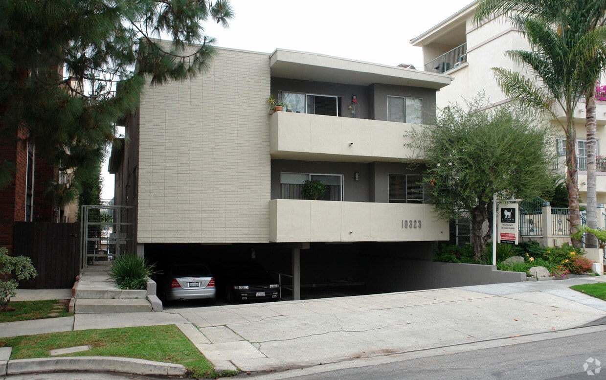
10323 Missouri Ave
Los Angeles, CA 90025


