
$3,300
/ Month
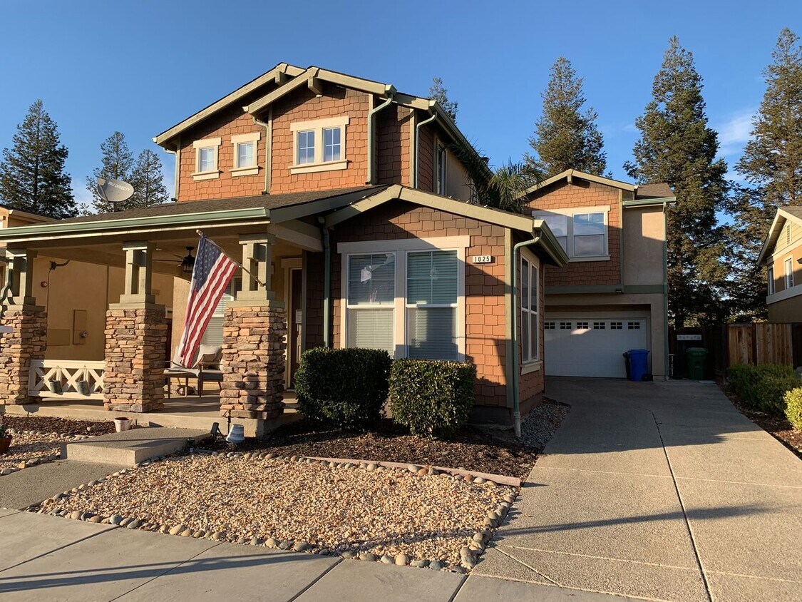
1025 Spruce St
Brentwood, CA 94513
2 Weeks Ago
|
Edit
Favorites
-
Bedrooms
4
-
Bathrooms
3
-
Square Feet
2,286 sq ft
1025 Spruce St

Favorites
About This Home
$3,100 deposit
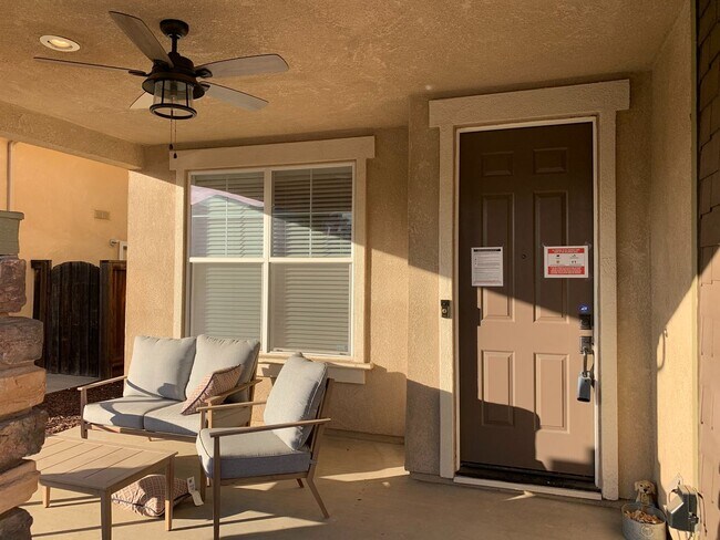
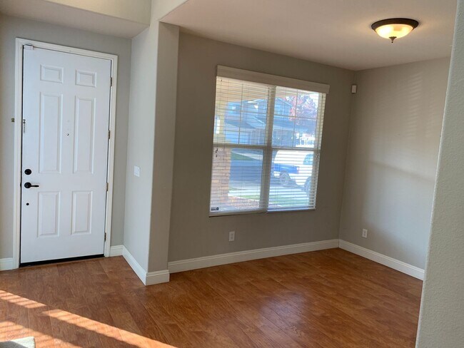
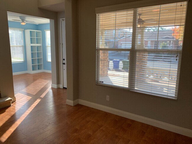
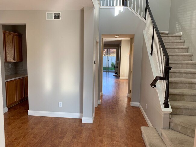
Beautiful 4 bedroom, 2.5, 2,286 sqft Garin Ranch Home. No rear neighbors and backs up to Heron Park. Beautiful laminate wood floors throughout downstairs. Gorgeous kitchen with upgraded cabinets and quartz counters. Great backyard with hot tub included. Walk to Downtown. Close to schools, shopping and freeway access. MORE PICTURES TO COME. Please contact Reese to schedule a showing. One-year lease to start. Applicant must have gross income 3 times higher than the rental rate and be able to pass rental history and criminal background check. FICO score of 650 or higher. Brendan Reese Cal BRE #01978176
1025 Spruce St is a house located in Contra Costa County and the 94513 ZIP Code. This area is served by the Brentwood Union Elementary School District attendance zone.
* Price shown is base rent. Excludes user-selected optional fees and variable or usage-based fees and required charges due at or prior to move-in or at move-out. Price, availability, fees, and any applicable rent special are subject to change without notice.
* Square footage definitions vary. Displayed square footage is approximate.
Contact
- Listed by Best Property Management | Best Property Management
Location
Get Directions
Brentwood, California is a great place to live for those seeking a peaceful suburban lifestyle while still being within close proximity to the action of The Bay. Located in Contra Costa County, Brentwood has a population of around 60,000 people and is known for its picturesque parks, top-notch schools, and friendly community.
For potential renters looking for a place to call home in Brentwood, there are a variety of options available. Rental properties in the area range from apartments and townhomes to single-family homes and condos, giving renters a wide range of choices to fit their lifestyle and budget. One of the most attractive features of Brentwood is its abundance of parks and outdoor recreation areas. For those who love to hike, bike, or simply enjoy a leisurely stroll, the Iron Horse Trail is a popular choice. This paved trail stretches over 30 miles from Concord to Dublin and is perfect for all fitness levels.
Learn more about living in Brentwood
Education
| Colleges & Universities | Distance | ||
|---|---|---|---|
| Colleges & Universities | Distance | ||
| Drive: | 3 min | 1.3 mi | |
| Drive: | 24 min | 14.2 mi | |
| Drive: | 32 min | 17.8 mi | |
| Drive: | 41 min | 26.0 mi |
1025 Spruce St is within 3 minutes or 1.3 miles from Los Medanos College, Brentwood. It is also near Los Medanos College, Pittsburg and San Joaquin Delta, Mtn. House.
Schools


Public Elementary School
Grades K-5
537 Students
Nearby
Public Elementary School
Grades K-5
680 Students
Attendance Zone
Public Middle School
Grades 6-8
1,047 Students
Attendance Zone
Public High School
Grades 9-12
2,836 Students
Attendance Zone
Private Elementary School
Grades PK-5
65 Students
Nearby
Private Elementary, Middle & High School
Grades K-12
Nearby
Private Elementary School
Grades K-5
Nearby
School data provided by
 The GreatSchools Rating helps parents compare schools within a state based on a variety of school quality indicators and provides a helpful picture of how effectively each school serves all of its students. Ratings are on a scale of 1 (below average) to 10 (above average) and can include test scores, college readiness, academic progress, advanced courses, equity, discipline and attendance data. We also advise parents to visit schools, consider other information on school performance and programs, and consider family needs as part of the school selection process.
View GreatSchools Rating Methodology
Data provided by GreatSchools.org © 2026. All rights reserved.
View GreatSchools Rating Methodology
Data provided by GreatSchools.org © 2026. All rights reserved.
Transportation options available in Brentwood include Antioch, located 8.7 miles from 1025 Spruce St. 1025 Spruce St is near Stockton Metro, located 31.6 miles or 47 minutes away, and Metro Oakland International, located 50.2 miles or 68 minutes away.
| Transit / Subway | Distance | ||
|---|---|---|---|
| Transit / Subway | Distance | ||
|
|
Drive: | 13 min | 8.7 mi |
| Commuter Rail | Distance | ||
|---|---|---|---|
| Commuter Rail | Distance | ||
| Drive: | 35 min | 21.9 mi | |
| Drive: | 39 min | 23.8 mi | |
| Drive: | 43 min | 25.2 mi | |
|
|
Drive: | 41 min | 27.2 mi |
| Drive: | 51 min | 32.4 mi |
| Airports | Distance | ||
|---|---|---|---|
| Airports | Distance | ||
|
Stockton Metro
|
Drive: | 47 min | 31.6 mi |
|
Metro Oakland International
|
Drive: | 68 min | 50.2 mi |
Getting Around
 What do Walkability, Transit, Drivability, and Bikeability mean?
Walkability measures the walking distance to day-to-day needs.
Transit measures access to public transportation.
Drivability measures congestion, parking availability, and access to major roads.
Bikeability measures the suitability for cycling.
How It Works
What do Walkability, Transit, Drivability, and Bikeability mean?
Walkability measures the walking distance to day-to-day needs.
Transit measures access to public transportation.
Drivability measures congestion, parking availability, and access to major roads.
Bikeability measures the suitability for cycling.
How It Works
Fairly Walkable
Walkability
40
/ 100
Minimal Public Transit
Transit
0
/ 100
Very Drivable
Drivability
80
/ 100
Fairly Bikeable
Bikeability
40
/ 100
Scores provided by
-
Soundscore™
-
/ 100
Traffic
-Airport
-Businesses
-Scores provided by
HowLoud What is a Sound Score Rating? A Sound Score Rating aggregates noise caused by vehicle traffic, airplane traffic and local sources. How It WorksTime and distance from 1025 Spruce St.
| Shopping Centers | Distance | ||
|---|---|---|---|
| Shopping Centers | Distance | ||
| Walk: | 13 min | 0.7 mi | |
| Walk: | 14 min | 0.7 mi | |
| Walk: | 14 min | 0.7 mi |
1025 Spruce St has 3 shopping centers within 0.7 mile, which is about a 14-minute walk. The miles and minutes will be for the farthest away property.
| Parks and Recreation | Distance | ||
|---|---|---|---|
| Parks and Recreation | Distance | ||
|
Marsh Creek Regional Trail
|
Drive: | 4 min | 2.1 mi |
|
Big Break Regional Shoreline
|
Drive: | 14 min | 7.2 mi |
|
Vasco Caves Regional Preserve
|
Drive: | 13 min | 7.5 mi |
|
Contra Loma Regional Park
|
Drive: | 20 min | 9.5 mi |
|
Franks Tract State Recreation Area
|
Drive: | 25 min | 11.2 mi |
1025 Spruce St has 5 parks within 11.2 miles, including Marsh Creek Regional Trail, Big Break Regional Shoreline, and Vasco Caves Regional Preserve.
| Hospitals | Distance | ||
|---|---|---|---|
| Hospitals | Distance | ||
| Drive: | 16 min | 7.9 mi | |
| Drive: | 16 min | 8.7 mi |
1025 Spruce St is 7.9 miles from Kaiser Foundation Hospital - Antioch, and is convenient to other hospitals, including Sutter Delta Medical Center.
| Military Bases | Distance | ||
|---|---|---|---|
| Military Bases | Distance | ||
| Drive: | 39 min | 24.7 mi |
1025 Spruce St is 24.7 miles and a 39 minute drive from Stockton Naval Commun Station.
You May Also Like
Similar Rentals Nearby


What Are Walk Score®, Transit Score®, and Bike Score® Ratings?
Walk Score® measures the walkability of any address. Transit Score® measures access to public transit. Bike Score® measures the bikeability of any address.
What is a Sound Score Rating?
A Sound Score Rating aggregates noise caused by vehicle traffic, airplane traffic and local sources.

1025 Spruce St
Brentwood, CA 94513