
$1,650
/ Month
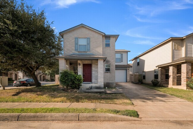
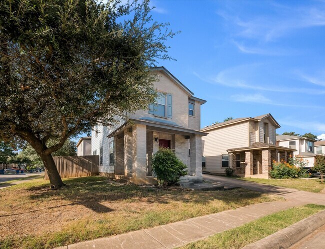
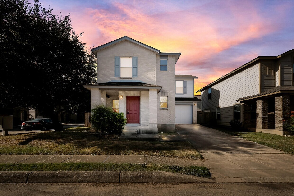
102 Kenrock Ridge
San Antonio, TX 78254
1 Day Ago
Favorites
210-846-6992
-
Bedrooms
3
-
Bathrooms
2.5
-
Square Feet
1,465 sq ft
-
Available
Available Now
102 Kenrock Ridge

Favorites
About This Home
$1,650 deposit,
Available Now
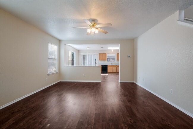
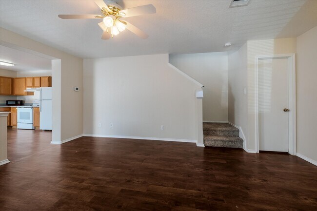
Corner lot 3 bedroom 2.5 bath home in Sagewood! Vinyl plank throughout open floor plan downstairs. Eat-in kitchen w/ all appliances including fridge. Master bedroom features a great walk-in closet and is split from the other bedrooms. Great location near shopping, schools, restaurants, NISD schools. Neighborhood playground!
102 Kenrock Ridge is a house located in Bexar County and the 78254 ZIP Code. This area is served by the Northside Independent School District (NISD) attendance zone.
* Price shown is base rent. Excludes user-selected optional fees and variable or usage-based fees and required charges due at or prior to move-in or at move-out. Price, availability, fees, and any applicable rent special are subject to change without notice.
* Square footage definitions vary. Displayed square footage is approximate.
Contact
- Listed by Susan Wahl
- Phone Number
- Contact
Location
Get Directions
Starting at the intersection of Bandera Road and East Charles William Anderson loop and extending along these highways south to New Guilbeau Road, Braun Station includes Braun’s Farm, Braun Station East, Oak Grove, and Saddlebrook Farms. The residential sections of the neighborhood contain a variety of architectural styles, from modest ranches and bungalows to large, two-story homes. Braun Station is about 15 miles northwest of Downtown San Antonio, and easy access to two major roadways help commuters get to the city in less than 30 minutes.
Commercial districts are scattered between the residential areas. At the intersection of Guilbeau Road and Tezel Road, you’ll find a Walmart, CVS, and Gold’s Gym. Farther down Guilbeau Road, where it meets Bandera Road, you’ll find several businesses, and H-E-B grocery store, several banks, and some chain restaurants.
Learn more about living in Braun Station
Education
| Colleges & Universities | Distance | ||
|---|---|---|---|
| Colleges & Universities | Distance | ||
| Drive: | 9 min | 5.0 mi | |
| Drive: | 11 min | 5.6 mi | |
| Drive: | 14 min | 7.0 mi | |
| Drive: | 15 min | 9.1 mi |
102 Kenrock Ridge is within 9 minutes or 5.0 miles from Galen Nursing - San Antonio. It is also near UT Health San Antonio and UT San Antonio.
Schools


Public Elementary School
Grades PK-5
390 Students
Attendance Zone
Public Middle School
Grades 6-8
999 Students
Attendance Zone
Public High School
Grades 9-12
2,634 Students
Attendance Zone
Private Elementary & Middle School
Grades PK-9
158 Students
Nearby
Private High School
Grades 9-12
Nearby
School data provided by
 The GreatSchools Rating helps parents compare schools within a state based on a variety of school quality indicators and provides a helpful picture of how effectively each school serves all of its students. Ratings are on a scale of 1 (below average) to 10 (above average) and can include test scores, college readiness, academic progress, advanced courses, equity, discipline and attendance data. We also advise parents to visit schools, consider other information on school performance and programs, and consider family needs as part of the school selection process.
View GreatSchools Rating Methodology
Data provided by GreatSchools.org © 2025. All rights reserved.
View GreatSchools Rating Methodology
Data provided by GreatSchools.org © 2025. All rights reserved.
You May Also Like
Similar Rentals Nearby
-
-
-
-
-
-
-
1 / 50

-
-
-


What Are Walk Score®, Transit Score®, and Bike Score® Ratings?
Walk Score® measures the walkability of any address. Transit Score® measures access to public transit. Bike Score® measures the bikeability of any address.
What is a Sound Score Rating?
A Sound Score Rating aggregates noise caused by vehicle traffic, airplane traffic and local sources
102 Kenrock Ridge
San Antonio, TX 78254