
1213 Walnut
1213 Walnut St,
Philadelphia, PA 19107
$2,205 - $7,115
Studio - 2 Beds
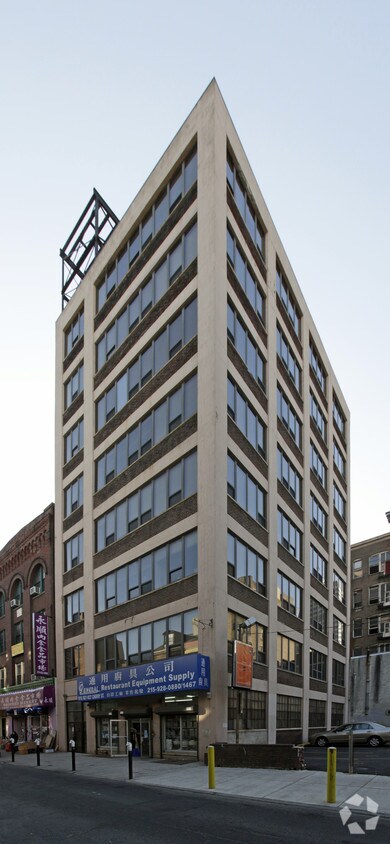
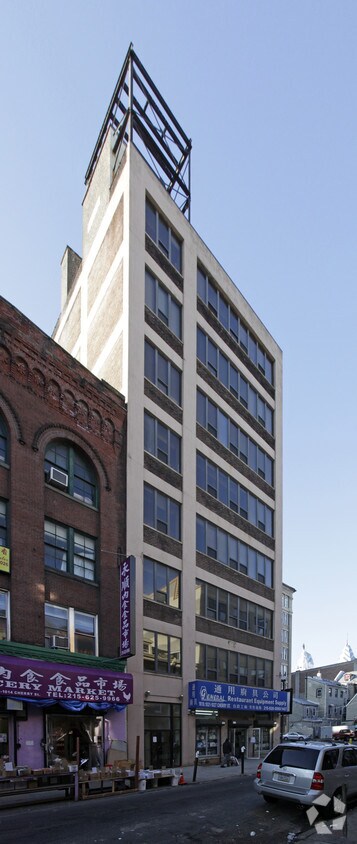
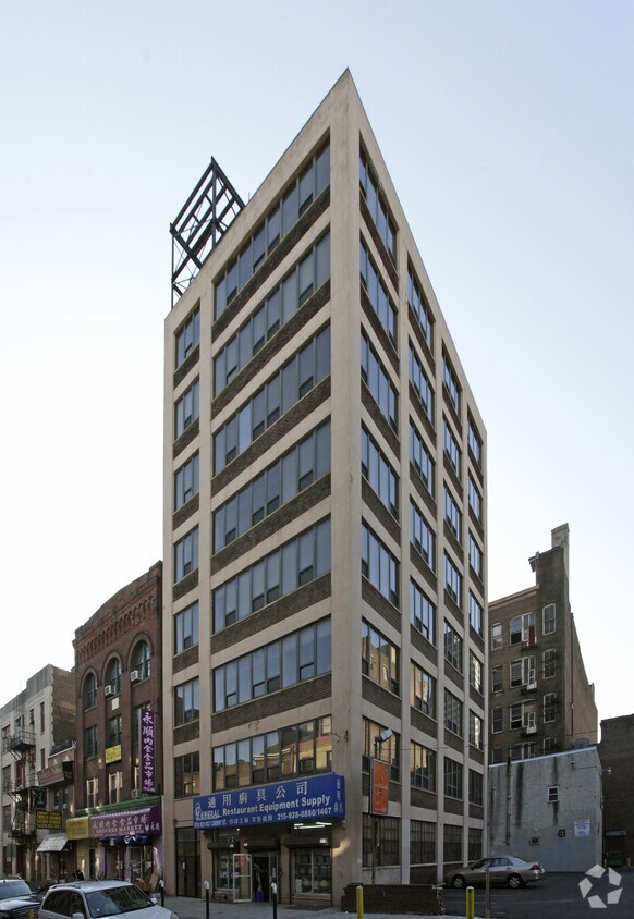

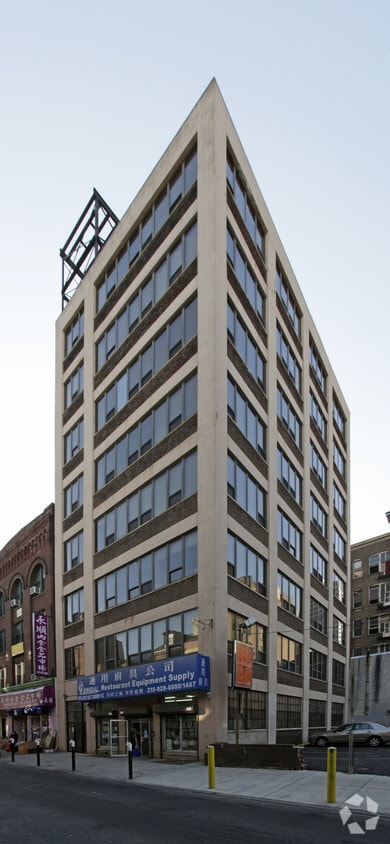
At 1016-1018 Cherry St, experience great living. The location in Philadelphia's 19107 area is an ideal place to live. Come by to check out the apartment floorplan options. The community staff is excited to help you find the perfect new apartment. Stop by 1016-1018 Cherry St today.
1016-1018 Cherry St is an apartment community located in Philadelphia County and the 19107 ZIP Code. This area is served by the The School District of Philadelphia attendance zone.
Philadelphia sits at the center of American history and still carries that weight with quiet confidence — it's the city where the Declaration of Independence was signed, and today those same streets anchor neighborhoods full of energy and purpose. As Pennsylvania's largest city and the sixth most populous in the country, Philly draws renters with a broad economy spanning healthcare, financial services, biotechnology, and information technology, plus a university presence that includes the University of Pennsylvania, Drexel, Temple, and several other institutions spread across the city.
Neighborhoods here range considerably in character. Old City offers cobblestone streets alongside contemporary gallery spaces, Fishtown pulses with creative industries and converted-warehouse architecture, Rittenhouse Square delivers manicured parks and polished streets, and Manayunk brings a hillside village feel within city limits.
Learn more about living in PhiladelphiaCompare neighborhood and city base rent averages by bedroom.
| Chinatown | Philadelphia, PA | |
|---|---|---|
| Studio | - | $1,429 |
| 1 Bedroom | $1,305 | $1,787 |
| 2 Bedrooms | $1,943 | $2,221 |
| 3 Bedrooms | - | $2,915 |
| Colleges & Universities | Distance | ||
|---|---|---|---|
| Colleges & Universities | Distance | ||
| Walk: | 7 min | 0.4 mi | |
| Walk: | 11 min | 0.6 mi | |
| Walk: | 15 min | 0.8 mi | |
| Drive: | 4 min | 1.4 mi |


Transportation options available in Philadelphia include 11Th Street, located 0.2 mile from 1016-1018 Cherry St. 1016-1018 Cherry St is near Philadelphia International, located 12.7 miles or 21 minutes away, and Trenton Mercer, located 33.3 miles or 48 minutes away.
| Transit / Subway | Distance | ||
|---|---|---|---|
| Transit / Subway | Distance | ||
|
|
Walk: | 4 min | 0.2 mi |
|
|
Walk: | 6 min | 0.3 mi |
|
|
Walk: | 7 min | 0.4 mi |
| Walk: | 7 min | 0.4 mi | |
|
|
Walk: | 12 min | 0.6 mi |
| Commuter Rail | Distance | ||
|---|---|---|---|
| Commuter Rail | Distance | ||
|
|
Walk: | 3 min | 0.2 mi |
|
|
Walk: | 12 min | 0.6 mi |
|
|
Drive: | 4 min | 1.5 mi |
|
|
Drive: | 7 min | 2.4 mi |
| Drive: | 7 min | 3.3 mi |
| Airports | Distance | ||
|---|---|---|---|
| Airports | Distance | ||
|
Philadelphia International
|
Drive: | 21 min | 12.7 mi |
|
Trenton Mercer
|
Drive: | 48 min | 33.3 mi |
Scores provided by
Traffic
-Airport
-Businesses
-Scores provided by
HowLoud What is a Sound Score Rating? A Sound Score Rating aggregates noise caused by vehicle traffic, airplane traffic and local sources. How It WorksTime and distance from 1016-1018 Cherry St.
| Shopping Centers | Distance | ||
|---|---|---|---|
| Shopping Centers | Distance | ||
| Walk: | 3 min | 0.2 mi | |
| Walk: | 11 min | 0.6 mi | |
| Walk: | 15 min | 0.8 mi |
| Parks and Recreation | Distance | ||
|---|---|---|---|
| Parks and Recreation | Distance | ||
|
Independence National Historical Park
|
Walk: | 11 min | 0.6 mi |
|
The Academy of Natural Sciences
|
Walk: | 16 min | 0.8 mi |
|
Great Egg Harbor River
|
Walk: | 19 min | 1.0 mi |
|
Lower Delaware National Wild and Scenic River
|
Walk: | 19 min | 1.0 mi |
|
Edgar Allan Poe Nat'l Historic Site
|
Drive: | 3 min | 1.1 mi |
| Hospitals | Distance | ||
|---|---|---|---|
| Hospitals | Distance | ||
| Walk: | 7 min | 0.4 mi | |
| Walk: | 9 min | 0.5 mi | |
| Walk: | 10 min | 0.5 mi |
| Military Bases | Distance | ||
|---|---|---|---|
| Military Bases | Distance | ||
| Drive: | 12 min | 7.1 mi | |
| Drive: | 43 min | 22.4 mi | |
| Drive: | 42 min | 23.1 mi |
What Are Walk Score®, Transit Score®, and Bike Score® Ratings?
Walk Score® measures the walkability of any address. Transit Score® measures access to public transit. Bike Score® measures the bikeability of any address.
What is a Sound Score Rating?
A Sound Score Rating aggregates noise caused by vehicle traffic, airplane traffic and local sources.
1016-1018 Cherry St
Philadelphia, PA 19107


