$1,500
Total Monthly Price
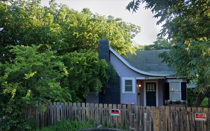
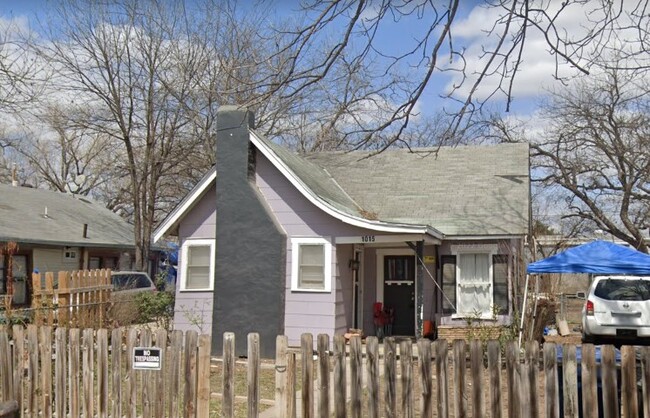
1015 King Ave
San Antonio, TX 78211
Favorites
830-381-0878
-
Bedrooms
3
-
Bathrooms
1
-
Square Feet
900 sq ft
-
Available
Available Now
1015 King Ave

Favorites
About This Home
12 Month Lease,
$1,500 deposit,
Available Now
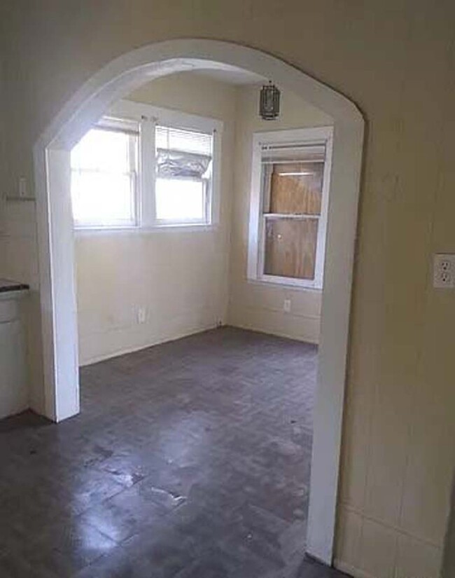
Cute home, great starter home or investment property. Has great potential. Good Neighborhood with mature trees easy access to major highways. This house located at nearby Nerio Plaza, beside the King Ave. Nearest Elemantory school is Kindred Elementary School .All the necessary things neighbors of this house like schools, restaurants, shopping centers, hospitals, etc. This house is for Rent. If you are interested please set a schedule to visit this house or apply now.
1015 King Ave is a house located in Bexar County and the 78211 ZIP Code. This area is served by the South San Antonio Independent School District attendance zone.
* Price shown is total price based on community-supplied monthly required fees. Excludes user-selected optional fees and variable or usage-based fees and required charges due at or prior to move-in or at move-out. Price, availability, fees, and any applicable rent special are subject to change without notice.
* Square footage definitions vary. Displayed square footage is approximate.
Contact
- Listed by Elias Joseph Karam
- Phone Number
- Contact
Location
Get Directions
Quintana Community borders Lackland Air Force Base in southwest San Antonio. The residential sections are interspersed with industry, containing such businesses as Fiesta Warehousing & Distribution, GBW Railcar Services, and CIG Logistics Metal Yard. Several restaurants, shops, and other businesses are located along Quintana Road. A large shopping area is located off Somerset Road and Military Drive, including Sam’s Club, Burlington, and Target. This is also the location of Southwest General Hospital.
Normoyle Park provides a community center, tennis courts, ball fields, a swimming pool, and a basketball court. This park is located off Culberson Avenue. Several other parks are located within a short distance of Quintana, including the 505-acre Pearsall Park, which is adjacent to Quintana on the southwest side. This park includes a playground, the Pearsall Water-Skate Park, picnic areas, and a dog park.
Learn more about living in Quintana
Education
| Colleges & Universities | Distance | ||
|---|---|---|---|
| Colleges & Universities | Distance | ||
| Drive: | 4 min | 1.6 mi | |
| Drive: | 8 min | 4.0 mi | |
| Drive: | 10 min | 4.7 mi | |
| Drive: | 14 min | 6.8 mi |
1015 King Ave is within 4 minutes or 1.6 miles from St. Philip's College, SWC. It is also near Palo Alto College and Our Lady of the Lake Univ..
Schools


Public Elementary School
Grades PK-5
391 Students
Attendance Zone
Public Elementary School
Grades PK-5
277 Students
Attendance Zone
Public Middle School
Grades 6-8
437 Students
Attendance Zone
Public Middle School
Grades 6-8
432 Students
Attendance Zone
Public High School
Grades 9-12
1,786 Students
Attendance Zone
Private Elementary & Middle School
Grades PK-8
354 Students
Nearby
Private Elementary, Middle & High School
Grades 2-12
Nearby
School data provided by
 The GreatSchools Rating helps parents compare schools within a state based on a variety of school quality indicators and provides a helpful picture of how effectively each school serves all of its students. Ratings are on a scale of 1 (below average) to 10 (above average) and can include test scores, college readiness, academic progress, advanced courses, equity, discipline and attendance data. We also advise parents to visit schools, consider other information on school performance and programs, and consider family needs as part of the school selection process.
View GreatSchools Rating Methodology
Data provided by GreatSchools.org © 2026. All rights reserved.
View GreatSchools Rating Methodology
Data provided by GreatSchools.org © 2026. All rights reserved.
Getting Around
 What do Walkability, Transit, Drivability, and Bikeability mean?
Walkability measures the walking distance to day-to-day needs.
Transit measures access to public transportation.
Drivability measures congestion, parking availability, and access to major roads.
Bikeability measures the suitability for cycling.
How It Works
What do Walkability, Transit, Drivability, and Bikeability mean?
Walkability measures the walking distance to day-to-day needs.
Transit measures access to public transportation.
Drivability measures congestion, parking availability, and access to major roads.
Bikeability measures the suitability for cycling.
How It Works
Fairly Walkable
Walkability
50
/ 100
Limited Public Transit
Transit
20
/ 100
Moderately Drivable
Drivability
70
/ 100
Fairly Bikeable
Bikeability
40
/ 100
Scores provided by
-
Soundscore™
-
/ 100
Traffic
-Airport
-Businesses
-Scores provided by
HowLoud What is a Sound Score Rating? A Sound Score Rating aggregates noise caused by vehicle traffic, airplane traffic and local sources. How It Works1015 King Ave Photos
What Are Walk Score®, Transit Score®, and Bike Score® Ratings?
Walk Score® measures the walkability of any address. Transit Score® measures access to public transit. Bike Score® measures the bikeability of any address.
What is a Sound Score Rating?
A Sound Score Rating aggregates noise caused by vehicle traffic, airplane traffic and local sources.

1015 King Ave
San Antonio, TX 78211