$1,900
/ Month
1011 65th St
Brooklyn, NY 11219
2 Weeks Ago
|
Edit
Favorites
1011 65th St

Favorites
Check Back Soon for Upcoming Availability
| Beds | Baths | Average SF |
|---|---|---|
| 2 Bedrooms 2 Bedrooms 2 Br | 1 Bath 1 Bath 1 Ba | — |
About This Property
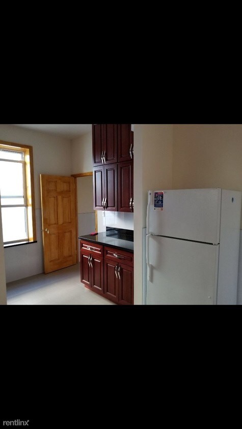
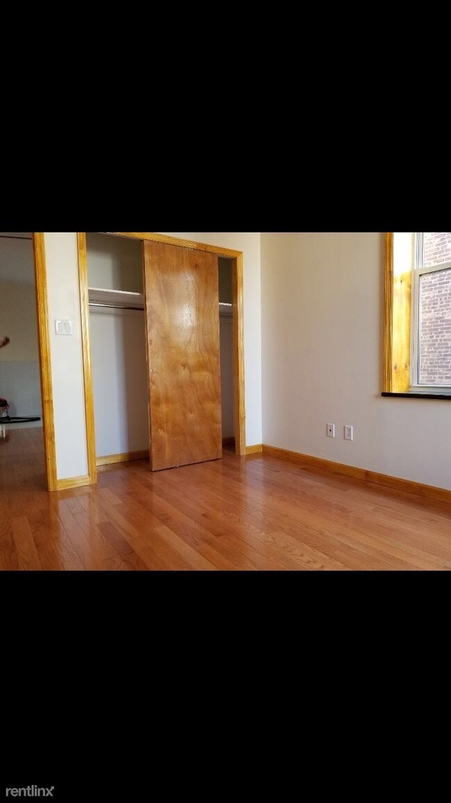
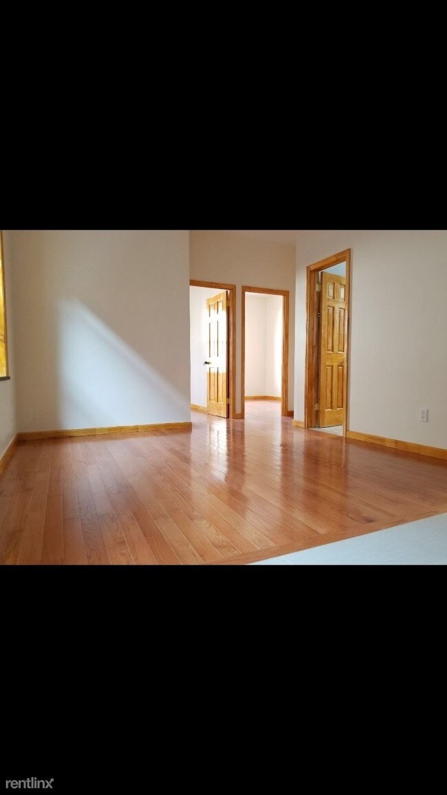
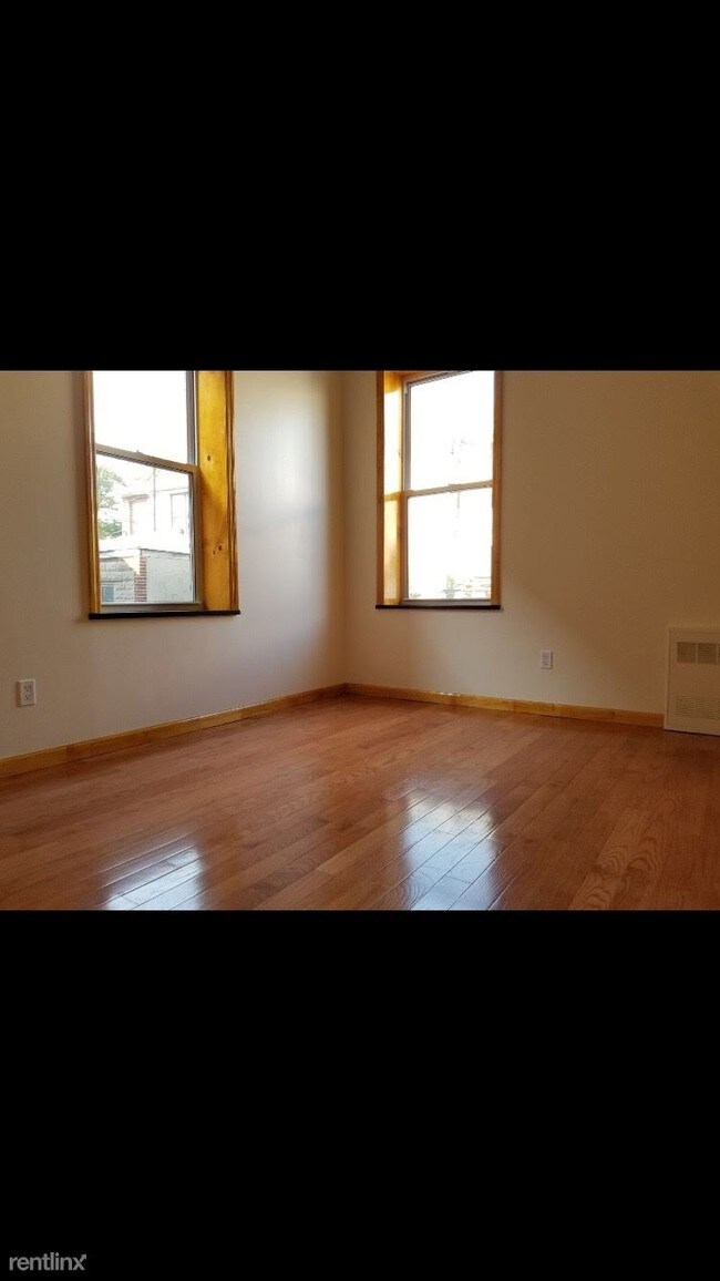
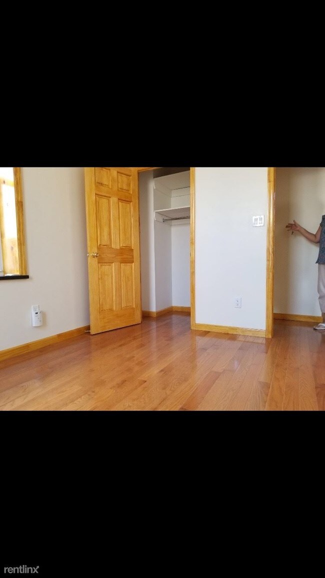
(347) 673-9904 - Brand new move in ready True two bedroom Fresh paint and hardwood floors throughout High ceilings Plenty of sunlight Ample storage space Heat/hot water included in rent Good income and credit a MUST (RLNE3451827) Appliances - Refrigerator, Oven. Lease lengths - 12 Months. Details regarding this property's Utilities - Heat Included, Water Included.
1011 65th St is a condo located in Kings County and the 11219 ZIP Code. This area is served by the New York City Geographic District #20 attendance zone.
1011 65th St,
Brooklyn,
NY
11219
Borough Park offers a slightly quieter atmosphere in a scenic New York setting just west of Long Island. The area’s peaceful blocks are shared by renters of all types enjoying an easy-going Brooklyn lifestyle. The quiet streets and charming historic homes make planting roots in the area an attractive option. This classically Brooklyn area is home to dense blocks of brick apartments buildings and buzzing local businesses. Prospect Park is just a few blocks walk to the northeast. Subway service abounds in this exciting Brooklyn neighborhood, putting the rest of arguably NYC’s most exciting borough at your fingertips, with Manhattan just a 30-minute train ride away as well.
Learn more about living in Borough ParkBelow are rent ranges for similar nearby apartments
Education
| Colleges & Universities | Distance | ||
|---|---|---|---|
| Colleges & Universities | Distance | ||
| Drive: | 10 min | 4.1 mi | |
| Drive: | 11 min | 4.8 mi | |
| Drive: | 10 min | 5.9 mi | |
| Drive: | 11 min | 6.0 mi |
1011 65th St is within 10 minutes or 4.1 miles from Brooklyn College. It is also near Medgar Evers College, CUNY and Brooklyn Law School.
Schools


Public Elementary School
Grades K-5
170 Students
Nearby
Public Elementary School
Grades K-5
553 Students
Attendance Zone
Public Elementary School
Grades K-5
535 Students
Attendance Zone
Public Middle School
Grades 6-8
1,329 Students
Attendance Zone
Public High School
Grades 9-12
4,038 Students
Attendance Zone
Private Elementary, Middle & High School
Grades PK-12
251 Students
Nearby
Private Elementary & Middle School
Grades PK-8
145 Students
Nearby
Private Elementary & Middle School
Grades PK-8
119 Students
Nearby
Private Middle & High School
Grades 6-12
194 Students
Nearby
School data provided by
 The GreatSchools Rating helps parents compare schools within a state based on a variety of school quality indicators and provides a helpful picture of how effectively each school serves all of its students. Ratings are on a scale of 1 (below average) to 10 (above average) and can include test scores, college readiness, academic progress, advanced courses, equity, discipline and attendance data. We also advise parents to visit schools, consider other information on school performance and programs, and consider family needs as part of the school selection process.
View GreatSchools Rating Methodology
Data provided by GreatSchools.org © 2026. All rights reserved.
View GreatSchools Rating Methodology
Data provided by GreatSchools.org © 2026. All rights reserved.
Transportation options available in Brooklyn include Fort Hamilton Parkway (N Line), located 0.2 mile from 1011 65th St. 1011 65th St is near John F Kennedy International, located 14.9 miles or 27 minutes away, and Newark Liberty International, located 19.4 miles or 32 minutes away.
| Transit / Subway | Distance | ||
|---|---|---|---|
| Transit / Subway | Distance | ||
|
|
Walk: | 4 min | 0.2 mi |
|
|
Walk: | 9 min | 0.5 mi |
|
|
Walk: | 14 min | 0.8 mi |
|
|
Walk: | 15 min | 0.8 mi |
|
|
Drive: | 2 min | 1.2 mi |
| Commuter Rail | Distance | ||
|---|---|---|---|
| Commuter Rail | Distance | ||
|
|
Drive: | 14 min | 5.7 mi |
|
|
Drive: | 11 min | 5.8 mi |
|
|
Drive: | 13 min | 6.5 mi |
|
|
Drive: | 15 min | 7.0 mi |
|
|
Drive: | 18 min | 7.6 mi |
| Airports | Distance | ||
|---|---|---|---|
| Airports | Distance | ||
|
John F Kennedy International
|
Drive: | 27 min | 14.9 mi |
|
Newark Liberty International
|
Drive: | 32 min | 19.4 mi |
Walkability Near 1011 65th St Brooklyn, NY 11219
Getting Around
 What do Walkability, Transit, Drivability, and Bikeability mean?
Walkability measures the walking distance to day-to-day needs.
Transit measures access to public transportation.
Drivability measures congestion, parking availability, and access to major roads.
Bikeability measures the suitability for cycling.
How It Works
What do Walkability, Transit, Drivability, and Bikeability mean?
Walkability measures the walking distance to day-to-day needs.
Transit measures access to public transportation.
Drivability measures congestion, parking availability, and access to major roads.
Bikeability measures the suitability for cycling.
How It Works
Exceptionally Walkable
Walkability
100
/ 100
Exceptional Public Transit
Transit
90
/ 100
Moderately Drivable
Drivability
60
/ 100
Moderately Bikeable
Bikeability
60
/ 100
Scores provided by
-
Soundscore™
-
/ 100
Traffic
-Airport
-Businesses
-Scores provided by
HowLoud What is a Sound Score Rating? A Sound Score Rating aggregates noise caused by vehicle traffic, airplane traffic and local sources. How It WorksTime and distance from 1011 65th St.
| Shopping Centers | Distance | ||
|---|---|---|---|
| Shopping Centers | Distance | ||
| Walk: | 5 min | 0.3 mi | |
| Walk: | 12 min | 0.7 mi | |
| Drive: | 3 min | 1.3 mi |
1011 65th St has 3 shopping centers within 1.3 miles, which is about a 3-minute drive. The miles and minutes will be for the farthest away property.
| Parks and Recreation | Distance | ||
|---|---|---|---|
| Parks and Recreation | Distance | ||
|
Dyker Beach Park
|
Drive: | 4 min | 1.7 mi |
|
Owl's Head Park
|
Drive: | 5 min | 2.1 mi |
|
Sunset Park
|
Drive: | 5 min | 2.3 mi |
|
Narrows Botanical Gardens
|
Drive: | 8 min | 4.2 mi |
|
Red Hook Park
|
Drive: | 9 min | 4.7 mi |
1011 65th St has 5 parks within 4.7 miles, including Dyker Beach Park, Owl's Head Park, and Sunset Park.
| Hospitals | Distance | ||
|---|---|---|---|
| Hospitals | Distance | ||
| Walk: | 18 min | 0.9 mi | |
| Drive: | 8 min | 3.9 mi | |
| Drive: | 10 min | 4.1 mi |
1011 65th St has 3 hospitals within 4.1 miles, the nearest is Maimonides Medical Center which is 0.9 mile away and a 18 minute walk.
| Military Bases | Distance | ||
|---|---|---|---|
| Military Bases | Distance | ||
| Drive: | 6 min | 2.3 mi | |
| Drive: | 14 min | 6.6 mi |
1011 65th St is 2.3 miles from Fort Hamilton, and is convenient to other military bases, including Naval Station NY Stapleton Site.
You May Also Like
Similar Rentals Nearby


What Are Walk Score®, Transit Score®, and Bike Score® Ratings?
Walk Score® measures the walkability of any address. Transit Score® measures access to public transit. Bike Score® measures the bikeability of any address.
What is a Sound Score Rating?
A Sound Score Rating aggregates noise caused by vehicle traffic, airplane traffic and local sources.

1011 65th St
Brooklyn, NY 11219