$1,900
/ Month
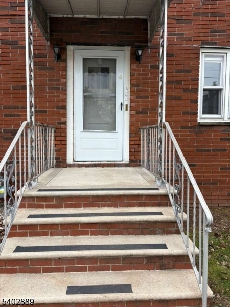
1000 Allen St
Linden, NJ 07036
Today
|
Edit
Favorites
908-558-2727
-
Bedrooms
2
-
Bathrooms
1
-
Square Feet
--
-
Available
Available Now
Highlight
- Forced Air Heating System
1000 Allen St

Favorites
About This Home
Available Now
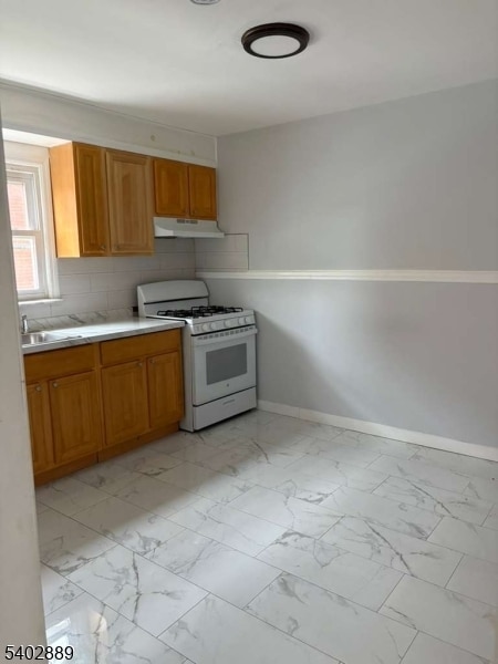
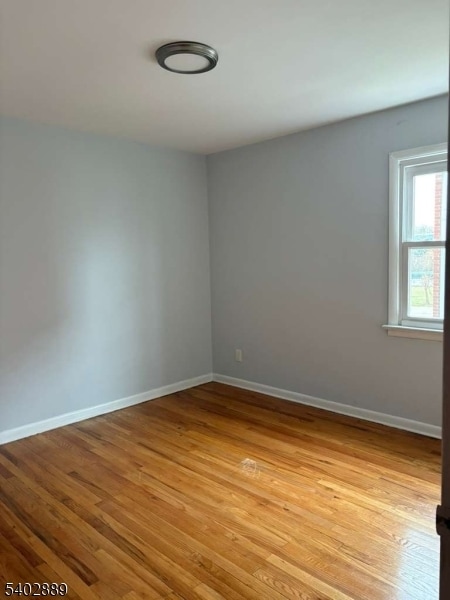
For Rent- Spacious 2 Bedroom, 1 Bathroom apartment located on the 2nd Floor, Includes parking. Quit residential area. No pets Allowed.
1000 Allen St is an apartment community located in Union County and the 07036 ZIP Code.
* Price shown is base rent. Excludes user-selected optional fees and variable or usage-based fees and required charges due at or prior to move-in or at move-out. Price, availability, fees, and any applicable rent special are subject to change without notice.
* Square footage definitions vary. Displayed square footage is approximate.
Home Details
Year Built
Built in 1968
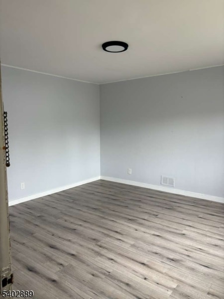
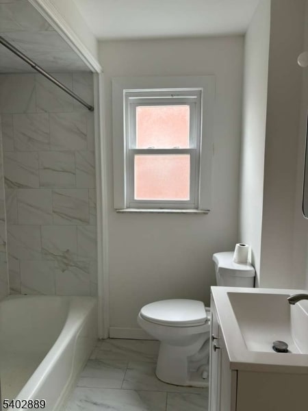
Bedrooms and Bathrooms
1 Full Bathroom
2 Bedrooms
Listing and Financial Details
Assessor Parcel Number 2909-00478-0000-00006-0001-
Tenant pays for electric, gas
Lot Details
50 Sq Ft Lot
Parking
Assigned Parking
1 Parking Space
Utilities
Forced Air Heating System
Window Unit Cooling System
Community Details
Contact
- Listed by LUCAS GALEANO | GardenStateMLS#NJ
- Phone Number
-
Source
Garden State Multiple Listing Service, LLC
Copyright © 2026 Garden State MLS, LLC. All rights reserved. All information provided by the listing agent/broker is deemed reliable but is not guaranteed and should be independently verified.
Location
Get Directions
Nestled on the banks of Pralls Island Reach across from Staten Island, Linden is a quiet suburban community between the cities of Elizabeth and Woodbridge Township. Predominantly residential, Linden is dotted with cozy condos and apartments along picturesque tree-lined streets.
Linden is home to an array of charming shops, salons, and eateries on Wood Avenue, forming a popular shopping district for residents and visitors alike. For even more shopping options, residents can easily get to the department and specialty stores at Menlo Park Mall. Linden locals enjoy the town’s well-landscaped parks just a few blocks from the many available apartments in town.
Residents of Linden have easy access to I-95 and I-278, the Linden Airport, the Newark Liberty International Airport, and the New Jersey Transit Linden Station. The amenities and trendy restaurants in Manhattan are only 15 miles away, putting the best of New York City at the fingertips of Linden residents.
Learn more about living in Linden
Amenities
- Air Conditioning
Education
| Colleges & Universities | Distance | ||
|---|---|---|---|
| Colleges & Universities | Distance | ||
| Drive: | 4 min | 1.5 mi | |
| Drive: | 8 min | 3.1 mi | |
| Drive: | 11 min | 5.5 mi | |
| Drive: | 18 min | 7.1 mi |
1000 Allen St is within 4 minutes or 1.5 miles from Union County Coll., Elizabeth. It is also near Kean University and Coll. of Staten Island, CUNY.
Transportation options available in Linden include 8Th Street Light Rail Station, located 7.1 miles from 1000 Allen St. 1000 Allen St is near Newark Liberty International, located 7.9 miles or 13 minutes away, and LaGuardia, located 28.5 miles or 46 minutes away.
| Transit / Subway | Distance | ||
|---|---|---|---|
| Transit / Subway | Distance | ||
| Drive: | 13 min | 7.1 mi | |
|
|
Drive: | 12 min | 7.9 mi |
|
|
Drive: | 14 min | 8.3 mi |
|
|
Drive: | 16 min | 9.2 mi |
|
|
Drive: | 16 min | 10.9 mi |
| Commuter Rail | Distance | ||
|---|---|---|---|
| Commuter Rail | Distance | ||
|
|
Drive: | 4 min | 1.6 mi |
|
|
Drive: | 6 min | 2.7 mi |
|
|
Drive: | 7 min | 3.4 mi |
|
|
Drive: | 7 min | 3.5 mi |
|
|
Drive: | 9 min | 4.0 mi |
| Airports | Distance | ||
|---|---|---|---|
| Airports | Distance | ||
|
Newark Liberty International
|
Drive: | 13 min | 7.9 mi |
|
LaGuardia
|
Drive: | 46 min | 28.5 mi |
Time and distance from 1000 Allen St.
| Shopping Centers | Distance | ||
|---|---|---|---|
| Shopping Centers | Distance | ||
| Walk: | 18 min | 0.9 mi | |
| Drive: | 3 min | 1.2 mi | |
| Drive: | 4 min | 1.6 mi |
1000 Allen St has 3 shopping centers within 1.6 miles, which is about a 4-minute drive. The miles and minutes will be for the farthest away property.
| Parks and Recreation | Distance | ||
|---|---|---|---|
| Parks and Recreation | Distance | ||
|
Hawk Rise Sanctuary
|
Drive: | 11 min | 4.1 mi |
|
Staten Island Industrial Park
|
Drive: | 8 min | 4.5 mi |
|
Willowbrook Park
|
Drive: | 10 min | 5.3 mi |
|
William T. Davis Wildlife Refuge
|
Drive: | 10 min | 5.7 mi |
|
Liberty State Park
|
Drive: | 11 min | 5.8 mi |
1000 Allen St has 5 parks within 5.8 miles, including Staten Island Industrial Park, Hawk Rise Sanctuary, and Willowbrook Park.
| Hospitals | Distance | ||
|---|---|---|---|
| Hospitals | Distance | ||
| Drive: | 4 min | 1.2 mi | |
| Drive: | 11 min | 5.1 mi | |
| Drive: | 12 min | 5.6 mi |
1000 Allen St has 3 hospitals within 5.6 miles, the nearest is Trinitas Regional Medical Center which is 1.2 miles away and a 4 minute drive.
| Military Bases | Distance | ||
|---|---|---|---|
| Military Bases | Distance | ||
| Drive: | 22 min | 9.0 mi | |
| Drive: | 19 min | 9.4 mi | |
| Drive: | 18 min | 11.5 mi |
1000 Allen St has 3 military bases within 11.5 miles, the nearest is Tamdques Reservation which is 9.0 miles away and a 22 minute drive.
You May Also Like
How do I access Social Services in New Jersey?
Statewide service is free, confidential, multilingual and always open. Three easy ways to reach Social Services in NJ: Dial 2-1-1; text your zip code to 898-211; or chat at https://www.nj211.org
Similar Rentals Nearby


What Are Walk Score®, Transit Score®, and Bike Score® Ratings?
Walk Score® measures the walkability of any address. Transit Score® measures access to public transit. Bike Score® measures the bikeability of any address.
What is a Sound Score Rating?
A Sound Score Rating aggregates noise caused by vehicle traffic, airplane traffic and local sources

1000 Allen St
Linden, NJ 07036