


$3,500
/ Month
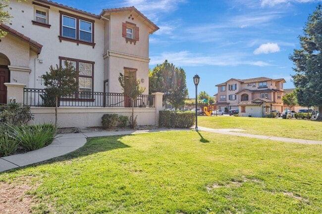
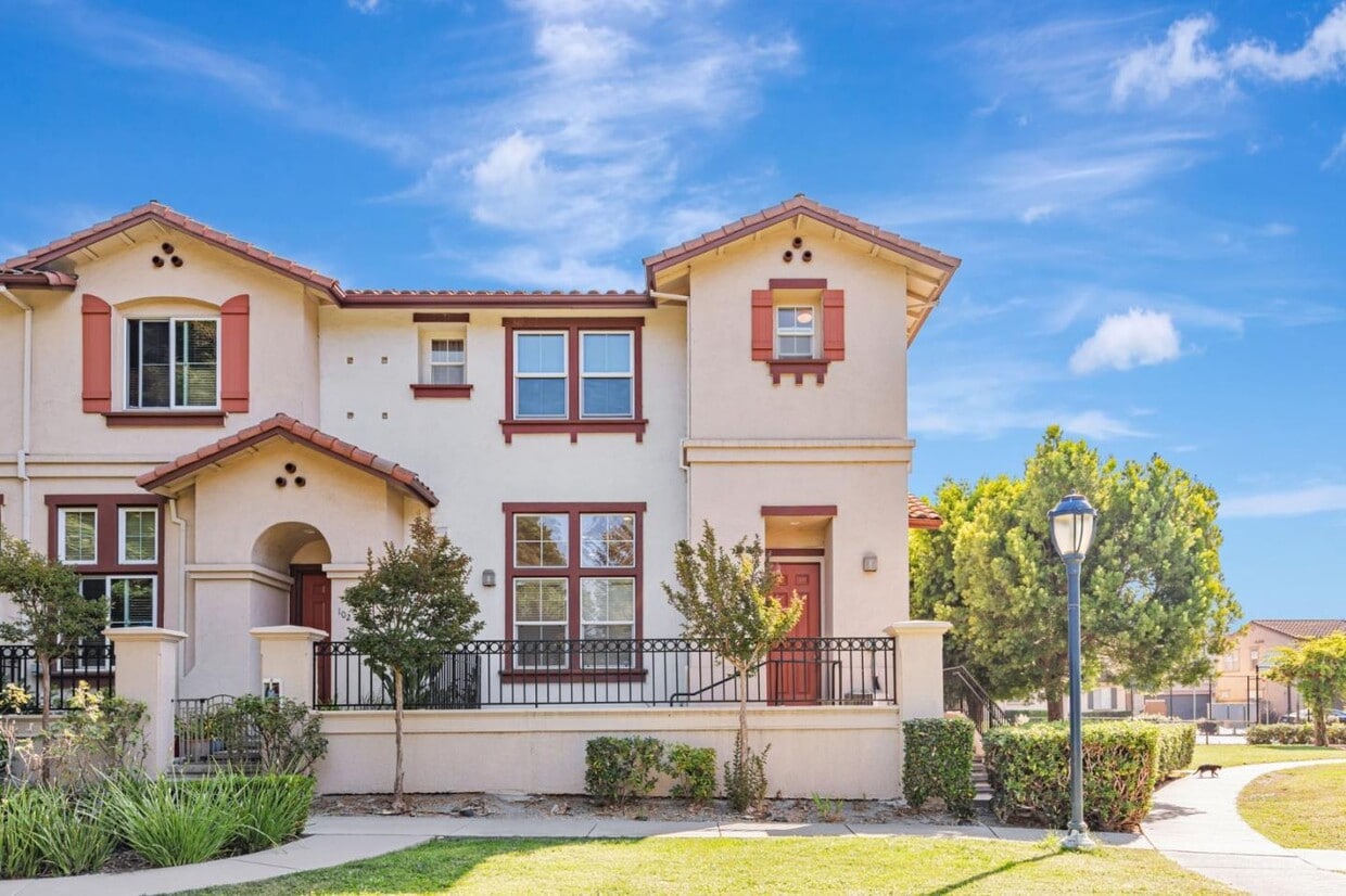
100 Santa Ines St
San Pablo, CA 94806
Today
Favorites
-
Bedrooms
3
-
Bathrooms
2.5
-
Square Feet
1,668 sq ft
-
Available
Available Now
Highlights
- 1 Car Attached Garage
- Separate Family Room
- Dining Area
100 Santa Ines St

Favorites
About This Home
Available Now
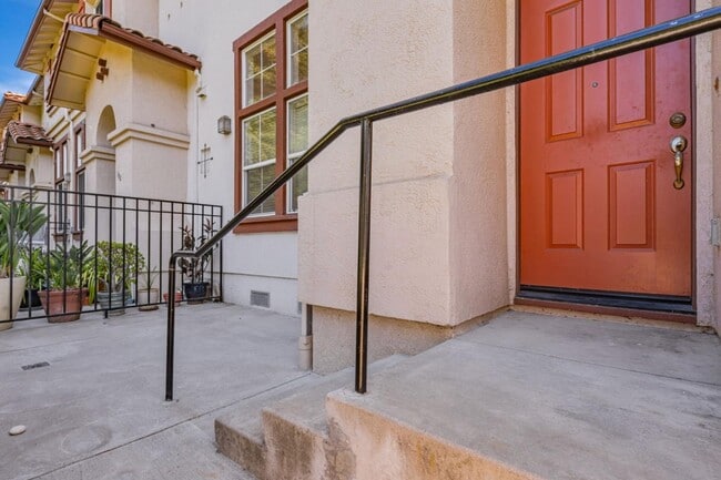
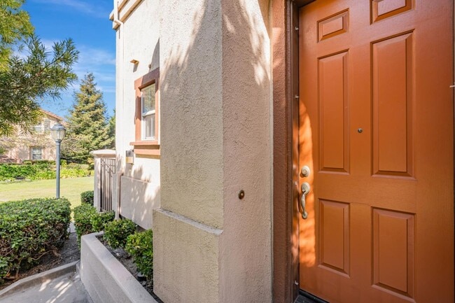
Flooded with natural light and surrounded by tall trees, this 3-bedroom, 2.5-bath San Pablo home blends comfort, convenience, and a quiet sense of community living. Large windows brighten the spacious living area, where high ceilings create an airy backdrop for cozy evenings or lively gatherings. The kitchen offers plenty of cabinetry, a full suite of appliances, and generous counters that make preparing meals simple and enjoyable. A breakfast bar adds a casual spot for coffee or conversation, while the adjacent dining area enjoys leafy views through double windows that pour in sunshine. Three comfortable bedrooms provide private retreats, and two and a half baths bring ease to daily routines. With its open layout and thoughtful design, this home balances lively household moments with quiet relaxation. Youll love the peaceful neighborhood - perfect for walks, jogging, or children at play. Shopping and groceries are close at hand with Trader Joes, Safeway, and Costco all nearby. Hilltop Mall and Contra Costa College sit just minutes away, while Kennedy Grove Regional Recreation Area and Wildcat Canyon Regional Park provide beautiful outdoor escapes. Commuting is made simple with quick access to I-80, connecting you to Berkeley, Oakland, and San Francisco.
100 Santa Ines St is a townhome located in Contra Costa County and the 94806 ZIP Code.
* Price shown is base rent. Excludes user-selected optional fees and variable or usage-based fees and required charges due at or prior to move-in or at move-out. Price, availability, fees, and any applicable rent special are subject to change without notice.
* Square footage definitions vary. Displayed square footage is approximate.
Home Details
Home Type
Townhome
Bedrooms and Bathrooms
2.5 Bathrooms
3 Bedrooms
Interior Spaces
Separate Family Room
Dining Area
1,668 Sq Ft Home
2-Story Property
Kitchen
Electric Oven
Microwave
Dishwasher
Listing and Financial Details
Security Deposit $3,500
Property Available on 9/23/25
12-Month Minimum Lease Term
Lot Details
1,525 Sq Ft Lot
Parking
1 Car Attached Garage
Utilities
Heating System Uses Gas
Community Details
Overview
Property has a Home Owners Association
Pet Policy
No Pets Allowed
Contact
- Listed by Owen Savir | Omer Savir, Broker
- Contact
-
Source
 MLSListings Inc.
Copyright © 2025 MLSListings Inc.
Location
Get Directions
Completely encompassed by the city of Richmond, San Pablo is a unique city nearing the coast of both the San Francisco Bay and San Pablo Bay. Beautiful bay views along the west coast are always a plus in our book! And on the other end of town, San Pablo borders Wildcat Canyon Regional Park. Though wildcat sightings are unlikely, these picturesque rolling hills are more known for their multi-use trails, playgrounds, and scenic picnic spots.
San Pablo boasts a diverse community with relatively affordable housing in comparison to neighboring cities. The city’s tight-knit community supports education and community growth, and Contra Costa College is a pristine example of that with its welcoming atmosphere and numerous athletic programs.
Along with a family-friendly vibe, San Pablo is a great place to find everyday conveniences such as casual dining, grocery stores, banks, and more.
Learn more about living in San Pablo
Education
| Colleges & Universities | Distance | ||
|---|---|---|---|
| Colleges & Universities | Distance | ||
| Walk: | 12 min | 0.7 mi | |
| Drive: | 17 min | 9.9 mi | |
| Drive: | 21 min | 10.9 mi | |
| Drive: | 24 min | 14.5 mi |
100 Santa Ines St is within 12 minutes or 0.7 mile from Contra Costa College. It is also near Berkeley City College and UC Berkeley.
Transportation options available in San Pablo include Richmond Station, located 2.4 miles from 100 Santa Ines St. 100 Santa Ines St is near Metro Oakland International, located 22.9 miles or 32 minutes away, and San Francisco International, located 30.5 miles or 45 minutes away.
| Transit / Subway | Distance | ||
|---|---|---|---|
| Transit / Subway | Distance | ||
|
|
Drive: | 5 min | 2.4 mi |
|
|
Drive: | 7 min | 3.5 mi |
|
|
Drive: | 7 min | 3.6 mi |
|
|
Drive: | 10 min | 5.6 mi |
|
|
Drive: | 16 min | 9.3 mi |
| Commuter Rail | Distance | ||
|---|---|---|---|
| Commuter Rail | Distance | ||
| Drive: | 5 min | 2.7 mi | |
|
|
Drive: | 13 min | 8.5 mi |
|
|
Drive: | 15 min | 10.3 mi |
| Drive: | 22 min | 12.7 mi | |
| Drive: | 22 min | 13.7 mi |
| Airports | Distance | ||
|---|---|---|---|
| Airports | Distance | ||
|
Metro Oakland International
|
Drive: | 32 min | 22.9 mi |
|
San Francisco International
|
Drive: | 45 min | 30.5 mi |
Time and distance from 100 Santa Ines St.
| Shopping Centers | Distance | ||
|---|---|---|---|
| Shopping Centers | Distance | ||
| Walk: | 1 min | 0.1 mi | |
| Walk: | 9 min | 0.5 mi | |
| Walk: | 13 min | 0.7 mi |
100 Santa Ines St has 3 shopping centers within 0.7 mile, which is about a 13-minute walk. The miles and minutes will be for the farthest away property.
| Parks and Recreation | Distance | ||
|---|---|---|---|
| Parks and Recreation | Distance | ||
|
Point Pinole Regional Shoreline
|
Drive: | 8 min | 3.8 mi |
|
Marina Park & Green
|
Drive: | 8 min | 3.9 mi |
|
Rosie the Riveter WWII Home Front National Historical Park
|
Drive: | 9 min | 4.4 mi |
|
Shimada Friendship Park
|
Drive: | 9 min | 4.4 mi |
|
Wildcat Canyon Regional Park
|
Drive: | 14 min | 6.2 mi |
100 Santa Ines St has 5 parks within 6.2 miles, including Point Pinole Regional Shoreline, Marina Park & Green, and Rosie the Riveter WWII Home Front National Historical Park.
| Hospitals | Distance | ||
|---|---|---|---|
| Hospitals | Distance | ||
| Drive: | 20 min | 11.5 mi | |
| Drive: | 18 min | 12.4 mi |
100 Santa Ines St is 11.5 miles from Alta Bates Summit Medical Center - Alta Bates Campus, and is convenient to other hospitals, including Children's Hospital & Research Center Oakland.
| Military Bases | Distance | ||
|---|---|---|---|
| Military Bases | Distance | ||
| Walk: | 9 min | 0.5 mi | |
| Drive: | 13 min | 6.3 mi | |
| Drive: | 27 min | 16.8 mi |
100 Santa Ines St has 3 military bases within 16.8 miles, the nearest is Armory West Contra Costa which is 0.5 mile away and a 9 minute walk.
You May Also Like
Similar Rentals Nearby


What Are Walk Score®, Transit Score®, and Bike Score® Ratings?
Walk Score® measures the walkability of any address. Transit Score® measures access to public transit. Bike Score® measures the bikeability of any address.
What is a Sound Score Rating?
A Sound Score Rating aggregates noise caused by vehicle traffic, airplane traffic and local sources
100 Santa Ines St
San Pablo, CA 94806