
The Equestrian At Pelham Parkway
1680 Pelham Pkwy S,
Bronx, NY 10461
Studio - 2 Beds $1,700 - $2,650

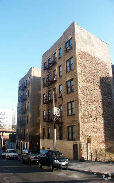
Meet your new apartment at 10 W 182nd St. These apartments are located in Bronx on W. 182nd St. in the 10453 area. The leasing team is ready and waiting for you to come by for a visit. Be sure to check out the apartment floorplan options. Stop by to check the current floorplan availability.
10 W 182nd St is an apartment community located in Bronx County and the 10453 ZIP Code. This area is served by the New York City Geographic District #10 attendance zone.
University Heights is a historic neighborhood in the Bronx. As its name implies, University Heights was once home to New York University. Today, Bronx Community College is located in NYU’s old buildings, and many of them have earned a National Historic Landmark designation. The Hall of Fame for Great Americans is also located in University Heights. Like many New York neighborhoods, University Heights has multiple bus stops, several subway stations, and apartments and condos available for rent. Parks and greenways are located throughout University Heights, adding a pop of greenery in this urban neighborhood. University Woods overlooks the Harlem River while Roberto Clemente State Park is a popular spot for swimming.
Learn more about living in University Heights| Colleges & Universities | Distance | ||
|---|---|---|---|
| Colleges & Universities | Distance | ||
| Walk: | 11 min | 0.6 mi | |
| Walk: | 11 min | 0.6 mi | |
| Drive: | 5 min | 1.5 mi | |
| Drive: | 3 min | 1.5 mi |


Transportation options available in Bronx include 183 Street, located 0.1 mile from 10 W 182nd St. 10 W 182nd St is near LaGuardia, located 10.1 miles or 20 minutes away, and John F Kennedy International, located 20.5 miles or 30 minutes away.
| Transit / Subway | Distance | ||
|---|---|---|---|
| Transit / Subway | Distance | ||
|
|
Walk: | 2 min | 0.1 mi |
|
|
Walk: | 5 min | 0.3 mi |
|
|
Walk: | 6 min | 0.3 mi |
|
|
Walk: | 9 min | 0.5 mi |
|
|
Walk: | 12 min | 0.6 mi |
| Commuter Rail | Distance | ||
|---|---|---|---|
| Commuter Rail | Distance | ||
|
|
Walk: | 20 min | 1.1 mi |
|
|
Drive: | 4 min | 1.1 mi |
|
|
Drive: | 3 min | 1.2 mi |
|
|
Drive: | 5 min | 1.4 mi |
|
|
Drive: | 6 min | 2.4 mi |
| Airports | Distance | ||
|---|---|---|---|
| Airports | Distance | ||
|
LaGuardia
|
Drive: | 20 min | 10.1 mi |
|
John F Kennedy International
|
Drive: | 30 min | 20.5 mi |
Time and distance from 10 W 182nd St.
| Shopping Centers | Distance | ||
|---|---|---|---|
| Shopping Centers | Distance | ||
| Walk: | 7 min | 0.4 mi | |
| Walk: | 15 min | 0.8 mi | |
| Walk: | 18 min | 0.9 mi |
| Parks and Recreation | Distance | ||
|---|---|---|---|
| Parks and Recreation | Distance | ||
|
St. James Park
|
Walk: | 14 min | 0.8 mi |
|
Poe Park
|
Drive: | 2 min | 1.1 mi |
|
Roberto Clemente State Park
|
Drive: | 5 min | 1.5 mi |
|
Crotona Park
|
Drive: | 6 min | 2.3 mi |
|
Sherman Creek and Swindler Cove
|
Drive: | 12 min | 5.1 mi |
| Hospitals | Distance | ||
|---|---|---|---|
| Hospitals | Distance | ||
| Drive: | 5 min | 1.3 mi | |
| Drive: | 7 min | 2.6 mi | |
| Drive: | 5 min | 2.7 mi |
| Military Bases | Distance | ||
|---|---|---|---|
| Military Bases | Distance | ||
| Drive: | 20 min | 11.0 mi |
What Are Walk Score®, Transit Score®, and Bike Score® Ratings?
Walk Score® measures the walkability of any address. Transit Score® measures access to public transit. Bike Score® measures the bikeability of any address.
What is a Sound Score Rating?
A Sound Score Rating aggregates noise caused by vehicle traffic, airplane traffic and local sources
10 W 182nd St
Bronx, NY 10453


