
1213 Walnut
1213 Walnut St,
Philadelphia, PA 19107
$2,045 - $7,340
Studio - 2 Beds
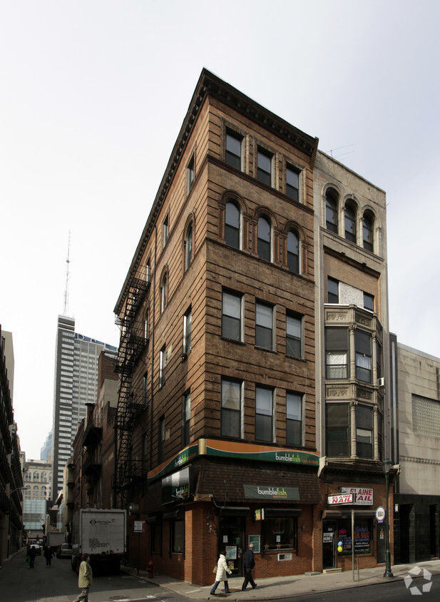
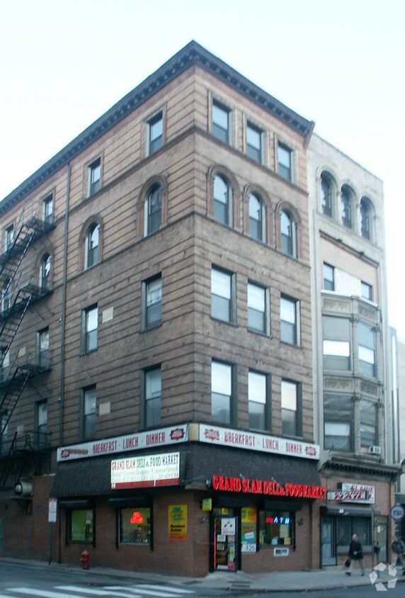
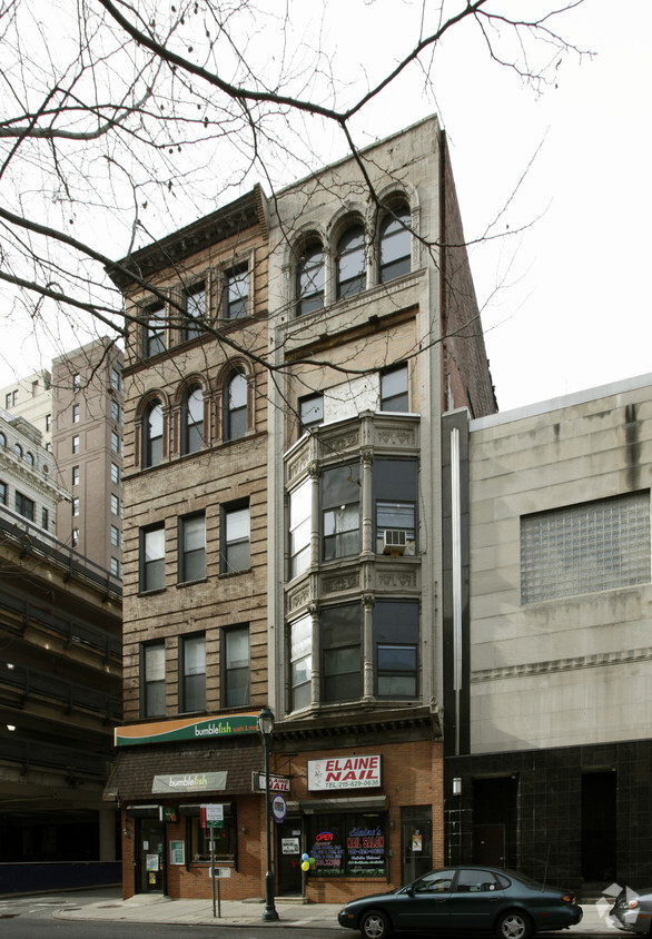
Find a new place to live at 10 S 10th St. Based in Philadelphia's 19107 area, moving to this community gives you plenty of nearby experiences. Here at this community, the team of leasing professionals is ready to help you find your perfect floorplan option. Come for a visit to view the available floorplans. Drop by to schedule your tour.
10 S 10th St is an apartment community located in Philadelphia County and the 19107 ZIP Code. This area is served by the The School District of Philadelphia attendance zone.
Known locally as “Old City,” Center City East comprises some of Philadelphia's oldest buildings, dating back to colonial times. The area includes the Graff house, where Thomas Jefferson lived while writing the Declaration of Independence; Independence Hall, where it was signed and ratified; and numerous other legendary American artifacts and landmarks such as the Liberty Bell.
As you might expect, it’s an extremely popular tourist destination, but the vintage buildings are home to exquisite restaurants and a thriving nightlife scene that locals can’t get enough of. Philadelphia’s Chinatown takes up a significant portion of the neighborhood, injecting international flair into the all-American landscape. The tight layout gives many residents the option of walking to work, the grocery store, or out to eat, while PATCO and SEPTA service provide several convenient options for getting around the city.
Learn more about living in Center City EastCompare neighborhood and city base rent averages by bedroom.
| Center City East | Philadelphia, PA | |
|---|---|---|
| Studio | $2,082 | $1,428 |
| 1 Bedroom | $2,429 | $1,782 |
| 2 Bedrooms | $3,070 | $2,220 |
| 3 Bedrooms | $5,788 | $2,910 |
| Colleges & Universities | Distance | ||
|---|---|---|---|
| Colleges & Universities | Distance | ||
| Walk: | 2 min | 0.1 mi | |
| Walk: | 12 min | 0.6 mi | |
| Walk: | 16 min | 0.9 mi | |
| Drive: | 4 min | 1.5 mi |


Transportation options available in Philadelphia include 11Th Street, located 0.1 mile from 10 S 10th St. 10 S 10th St is near Philadelphia International, located 12.0 miles or 22 minutes away, and Trenton Mercer, located 33.4 miles or 49 minutes away.
| Transit / Subway | Distance | ||
|---|---|---|---|
| Transit / Subway | Distance | ||
|
|
Walk: | 2 min | 0.1 mi |
| Walk: | 4 min | 0.2 mi | |
|
|
Walk: | 5 min | 0.3 mi |
|
|
Walk: | 5 min | 0.3 mi |
|
|
Walk: | 8 min | 0.4 mi |
| Commuter Rail | Distance | ||
|---|---|---|---|
| Commuter Rail | Distance | ||
|
|
Walk: | 3 min | 0.2 mi |
|
|
Walk: | 13 min | 0.7 mi |
|
|
Drive: | 4 min | 1.5 mi |
|
|
Drive: | 7 min | 2.6 mi |
| Drive: | 7 min | 3.5 mi |
| Airports | Distance | ||
|---|---|---|---|
| Airports | Distance | ||
|
Philadelphia International
|
Drive: | 22 min | 12.0 mi |
|
Trenton Mercer
|
Drive: | 49 min | 33.4 mi |
Scores provided by
Traffic
-Airport
-Businesses
-Scores provided by
HowLoud What is a Sound Score Rating? A Sound Score Rating aggregates noise caused by vehicle traffic, airplane traffic and local sources. How It WorksTime and distance from 10 S 10th St.
| Shopping Centers | Distance | ||
|---|---|---|---|
| Shopping Centers | Distance | ||
| Walk: | 4 min | 0.2 mi | |
| Walk: | 8 min | 0.4 mi | |
| Walk: | 12 min | 0.6 mi |
| Parks and Recreation | Distance | ||
|---|---|---|---|
| Parks and Recreation | Distance | ||
|
Independence National Historical Park
|
Walk: | 8 min | 0.4 mi |
|
Great Egg Harbor River
|
Walk: | 15 min | 0.8 mi |
|
Lower Delaware National Wild and Scenic River
|
Walk: | 15 min | 0.8 mi |
|
Thaddeus Kosciuszko National Memorial
|
Drive: | 4 min | 1.3 mi |
|
Edgar Allan Poe Nat'l Historic Site
|
Drive: | 3 min | 1.3 mi |
| Hospitals | Distance | ||
|---|---|---|---|
| Hospitals | Distance | ||
| Walk: | 3 min | 0.2 mi | |
| Walk: | 5 min | 0.3 mi | |
| Walk: | 5 min | 0.3 mi |
| Military Bases | Distance | ||
|---|---|---|---|
| Military Bases | Distance | ||
| Drive: | 12 min | 6.4 mi | |
| Drive: | 43 min | 22.5 mi | |
| Drive: | 42 min | 23.2 mi |
What Are Walk Score®, Transit Score®, and Bike Score® Ratings?
Walk Score® measures the walkability of any address. Transit Score® measures access to public transit. Bike Score® measures the bikeability of any address.
What is a Sound Score Rating?
A Sound Score Rating aggregates noise caused by vehicle traffic, airplane traffic and local sources.


