
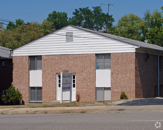
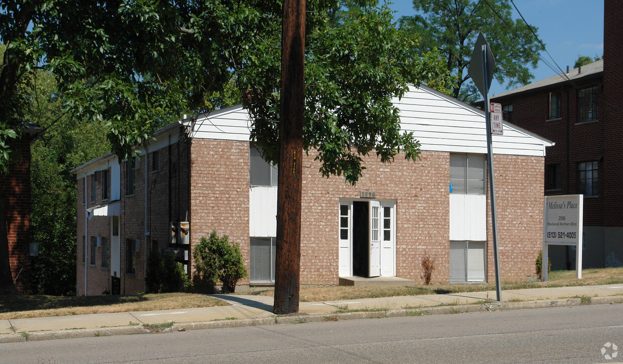
Westwood Nine Apartments
2596 Westwood Northern Blvd,
Cincinnati,
OH
45211
-
Monthly Rent
$825 - $925
-
Bedrooms
1 - 2 bd
-
Bathrooms
1 ba
-
Square Feet
750 - 900 sq ft

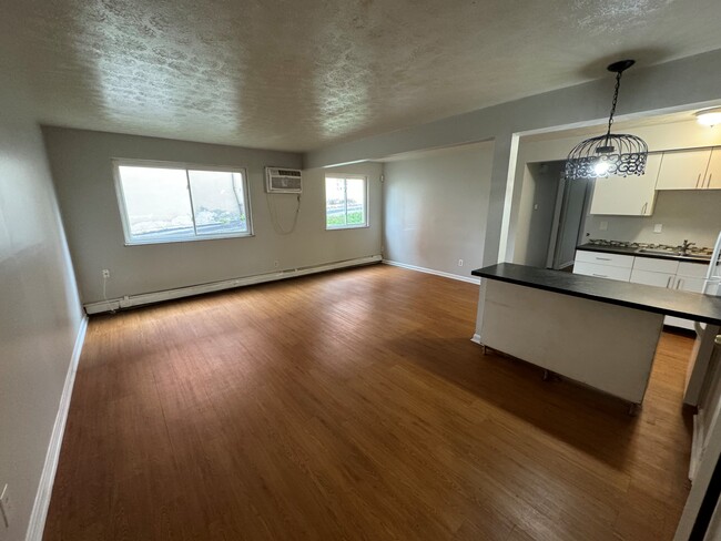
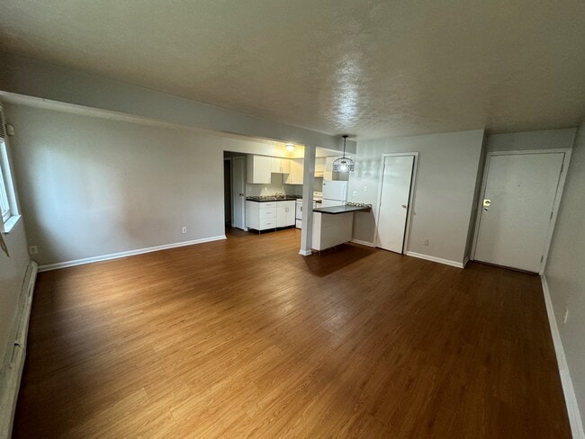
Spacious 1 bedroom on the first floor with updated kitchen, off street parking and coin laundry in the basement. Utilities included, tenant only pays for electric.
Pricing & Floor Plans
-
Unit 1BEDprice $825square feet 750availibility Now
-
Unit 2BEDprice $925square feet 900availibility Now
-
Unit 1BEDprice $825square feet 750availibility Now
-
Unit 2BEDprice $925square feet 900availibility Now
Fees and Policies
The fees below are based on community-supplied data and may exclude additional fees and utilities.
Pet policies are negotiable.
- Surface LotFree parking in back. First come, first serve. Plenty of spaces.
- Storage LockerFree storage lockers. First come, first serve.
Property Fee Disclaimer: Based on community-supplied data and independent market research. Subject to change without notice. May exclude fees for mandatory or optional services and usage-based utilities.
Details
Utilities Included
-
Gas
-
Water
-
Heat
-
Trash Removal
-
Sewer
Lease Options
-
12 mo
Property Information
-
Built in 1973
-
9 units/3 stories
About Westwood Nine Apartments
Spacious 1 bedroom on the first floor with updated kitchen, off street parking and coin laundry in the basement. Utilities included, tenant only pays for electric.
Westwood Nine Apartments is an apartment community located in Hamilton County and the 45211 ZIP Code. This area is served by the Cincinnati Public Schools attendance zone.
Contact
Community Amenities
- Laundry Facilities
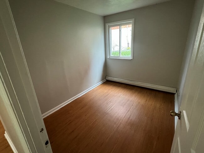
Apartment Features
Air Conditioning
Refrigerator
Tub/Shower
Smoke Free
- Air Conditioning
- Heating
- Smoke Free
- Cable Ready
- Tub/Shower
- Handrails
- Kitchen
- Oven
- Refrigerator
- Carpet
- Dining Room
- Basement
- Laundry Facilities
- Air Conditioning
- Heating
- Smoke Free
- Cable Ready
- Tub/Shower
- Handrails
- Kitchen
- Oven
- Refrigerator
- Carpet
- Dining Room
- Basement
| Monday | By Appointment |
|---|---|
| Tuesday | By Appointment |
| Wednesday | By Appointment |
| Thursday | By Appointment |
| Friday | By Appointment |
| Saturday | By Appointment |
| Sunday | By Appointment |
Situated about five miles northwest of Downtown Cincinnati, Westwood is the largest neighborhood in the city. Residents flock to Westwood for its many affordable historic homes and modern apartments available for rent in addition to its close proximity to I-74, I-75, and all that Downtown Cincinnati has to offer.
While Westwood is a predominantly residential neighborhood, it is also home to a slew of convenient stores and restaurants. Shopping opportunities abound in Westwood, with plenty of national retailers in Western Hills Plaza and local shops in the growing Town Hall District. Numerous neighborhood parks provide ample space to enjoy the outdoors in town as well as the sprawling 1,400-acre Mount Airy Forest, which is partially located in Westwood.
Learn more about living in Westwood| Colleges & Universities | Distance | ||
|---|---|---|---|
| Colleges & Universities | Distance | ||
| Drive: | 11 min | 4.4 mi | |
| Drive: | 10 min | 4.7 mi | |
| Drive: | 11 min | 5.1 mi | |
| Drive: | 15 min | 6.5 mi |


View GreatSchools Rating Methodology
Data provided by GreatSchools.org © 2025. All rights reserved.
Transportation options available in Cincinnati include Brewery District Station, Elm & Henry, located 5.4 miles from Westwood Nine Apartments. Westwood Nine Apartments is near Cincinnati/Northern Kentucky International, located 19.4 miles or 35 minutes away.
| Transit / Subway | Distance | ||
|---|---|---|---|
| Transit / Subway | Distance | ||
| Drive: | 11 min | 5.4 mi | |
| Drive: | 11 min | 5.5 mi | |
| Drive: | 12 min | 5.6 mi | |
| Drive: | 12 min | 5.6 mi | |
| Drive: | 12 min | 5.8 mi |
| Commuter Rail | Distance | ||
|---|---|---|---|
| Commuter Rail | Distance | ||
|
|
Drive: | 11 min | 5.4 mi |
| Airports | Distance | ||
|---|---|---|---|
| Airports | Distance | ||
|
Cincinnati/Northern Kentucky International
|
Drive: | 35 min | 19.4 mi |
Time and distance from Westwood Nine Apartments.
| Shopping Centers | Distance | ||
|---|---|---|---|
| Shopping Centers | Distance | ||
| Drive: | 6 min | 2.6 mi | |
| Drive: | 7 min | 2.7 mi | |
| Drive: | 7 min | 2.8 mi |
| Parks and Recreation | Distance | ||
|---|---|---|---|
| Parks and Recreation | Distance | ||
|
Mt. Airy Forest
|
Drive: | 6 min | 2.9 mi |
|
Buttercup Valley
|
Drive: | 9 min | 3.7 mi |
|
LaBoiteaux Woods
|
Drive: | 11 min | 4.9 mi |
|
Wilson Commons
|
Drive: | 13 min | 5.4 mi |
|
Imago Earth Center
|
Drive: | 14 min | 6.0 mi |
| Hospitals | Distance | ||
|---|---|---|---|
| Hospitals | Distance | ||
| Drive: | 8 min | 3.3 mi | |
| Drive: | 8 min | 4.0 mi | |
| Drive: | 11 min | 5.2 mi |
| Military Bases | Distance | ||
|---|---|---|---|
| Military Bases | Distance | ||
| Drive: | 71 min | 54.6 mi | |
| Drive: | 78 min | 59.6 mi | |
| Drive: | 80 min | 62.9 mi |
Westwood Nine Apartments Photos
-
Westwood Nine Apartments
-
-
2BR
-
2BR
-
2BR
-
2BR
-
2BR
-
2BR
-
1BR
Nearby Apartments
Within 50 Miles of Westwood Nine Apartments
-
Straight Street Apartments
650 Straight St
Cincinnati, OH 45219
$825 - $925
1-2 Br 3.3 mi
-
West Galbraith Apartments
1209 W Galbraith Rd
Cincinnati, OH 45231
$825
1 Br 5.4 mi
-
Roselawn Summit Apartments
1636 Summit Rd
Cincinnati, OH 45237
$825
1 Br 7.7 mi
-
Anna Marie Apartments, LLC
300-400 Hillside Ave
Cincinnati, OH 45215
$850 - $950
1-2 Br 8.9 mi
Westwood Nine Apartments has one to two bedrooms with rent ranges from $825/mo. to $925/mo.
Yes, to view the floor plan in person, please schedule a personal tour.
Westwood Nine Apartments is in Westwood in the city of Cincinnati. Here you’ll find three shopping centers within 2.8 miles of the property. Five parks are within 6.0 miles, including Mt. Airy Forest, Buttercup Valley, and Imago Earth Center.
What Are Walk Score®, Transit Score®, and Bike Score® Ratings?
Walk Score® measures the walkability of any address. Transit Score® measures access to public transit. Bike Score® measures the bikeability of any address.
What is a Sound Score Rating?
A Sound Score Rating aggregates noise caused by vehicle traffic, airplane traffic and local sources
2596 Westwood Northern Blvd
Cincinnati, OH 45211
Responded To This Review