
Hudson Ridge Apartments
7112-7312 JFK Blvd E,
North Bergen, NJ 07047
$1,900 - $2,800
Studio - 2 Beds
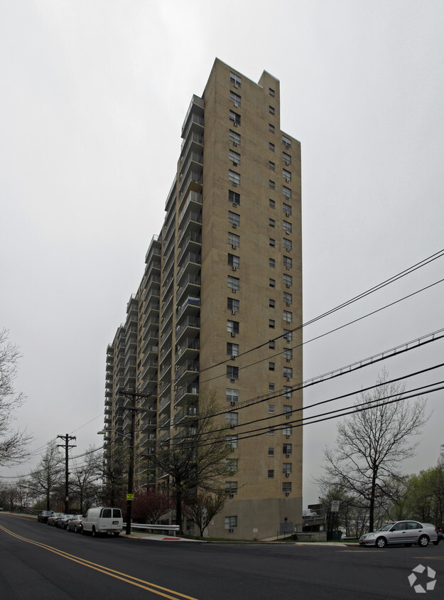
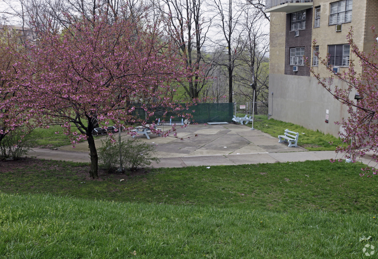
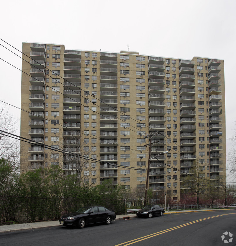

At West View Towers, experience stylish living. Located in North Bergen's 07047 area, moving to this community offers a wide variety of nearby attractions to enjoy. At this community, you'll have top amenities and features available to you. Some of these include: high-speed internet access, smoke free options, and convenient on-site parking options. The leasing team is waiting to show you all that this community has to offer. Stop by the leasing office to check the current floorplan availability.
West View Towers is an apartment community located in Hudson County and the 07047 ZIP Code. This area is served by the North Bergen School District attendance zone.
High Speed Internet Access
Refrigerator
Smoke Free
Oven
Situated on the other side of the Hudson River across from Manhattan, North Bergen exudes a laidback atmosphere plus convenient access to the hustle and bustle of one of the world’s most dynamic cities. The neighborhood rests atop the cliffs of Hudson Palisades, giving residents unbeatable views of the Manhattan skyline morning, noon, and night.
Proximity to the Big Apple means there’s seemingly endless rental opportunities. Single-family homes with quaint backyards share the street with relatively affordable apartment complexes. North Bergen remains a popular spot for families looking for extra space at a better price while still staying near the city.
Recreational opportunities are abundant in North Bergen — enjoy a bike ride along the trails, or walk the dog at James J. Braddock Park. Afterwards, relax and refuel at any one of North Bergen’s unique and tasty restaurants or bars.
Learn more about living in North Bergen| Colleges & Universities | Distance | ||
|---|---|---|---|
| Colleges & Universities | Distance | ||
| Drive: | 15 min | 5.5 mi | |
| Drive: | 17 min | 5.9 mi | |
| Drive: | 18 min | 6.3 mi | |
| Drive: | 18 min | 11.0 mi |


Transportation options available in North Bergen include Bergenline Avenue, located 1.0 miles from West View Towers. West View Towers is near Newark Liberty International, located 12.1 miles or 16 minutes away, and LaGuardia, located 17.5 miles or 30 minutes away.
| Transit / Subway | Distance | ||
|---|---|---|---|
| Transit / Subway | Distance | ||
|
|
Walk: | 19 min | 1.0 mi |
|
|
Drive: | 3 min | 1.4 mi |
|
|
Drive: | 7 min | 2.9 mi |
|
|
Drive: | 7 min | 3.0 mi |
|
|
Drive: | 19 min | 7.4 mi |
| Commuter Rail | Distance | ||
|---|---|---|---|
| Commuter Rail | Distance | ||
|
|
Drive: | 15 min | 5.5 mi |
|
|
Drive: | 16 min | 5.7 mi |
|
|
Drive: | 16 min | 5.7 mi |
|
|
Drive: | 17 min | 6.4 mi |
|
|
Drive: | 15 min | 7.1 mi |
| Airports | Distance | ||
|---|---|---|---|
| Airports | Distance | ||
|
Newark Liberty International
|
Drive: | 16 min | 12.1 mi |
|
LaGuardia
|
Drive: | 30 min | 17.5 mi |
Scores provided by
Traffic
ActiveAirport
CalmBusinesses
ActiveScores provided by
HowLoud What is a Sound Score Rating? A Sound Score Rating aggregates noise caused by vehicle traffic, airplane traffic and local sources. How It WorksTime and distance from West View Towers.
| Shopping Centers | Distance | ||
|---|---|---|---|
| Shopping Centers | Distance | ||
| Walk: | 14 min | 0.8 mi | |
| Walk: | 18 min | 0.9 mi | |
| Drive: | 4 min | 1.5 mi |
| Parks and Recreation | Distance | ||
|---|---|---|---|
| Parks and Recreation | Distance | ||
|
De Witt Clinton Park
|
Drive: | 16 min | 5.9 mi |
|
Damrosch Park
|
Drive: | 17 min | 6.1 mi |
|
American Museum of Natural History
|
Drive: | 20 min | 7.0 mi |
|
Children's Museum of Manhattan
|
Drive: | 20 min | 7.1 mi |
|
Riverside Park
|
Drive: | 20 min | 8.7 mi |
| Hospitals | Distance | ||
|---|---|---|---|
| Hospitals | Distance | ||
| Drive: | 6 min | 2.3 mi | |
| Drive: | 7 min | 3.5 mi | |
| Drive: | 9 min | 5.0 mi |
| Military Bases | Distance | ||
|---|---|---|---|
| Military Bases | Distance | ||
| Drive: | 22 min | 11.3 mi | |
| Drive: | 21 min | 13.5 mi | |
| Drive: | 39 min | 21.2 mi |
What Are Walk Score®, Transit Score®, and Bike Score® Ratings?
Walk Score® measures the walkability of any address. Transit Score® measures access to public transit. Bike Score® measures the bikeability of any address.
What is a Sound Score Rating?
A Sound Score Rating aggregates noise caused by vehicle traffic, airplane traffic and local sources.

6115 Granton Ave
North Bergen, NJ 07047


