
Inverness Apartments
5600 Shetland Way,
Westville, NJ 08093
$1,455 - $1,997
1-2 Beds
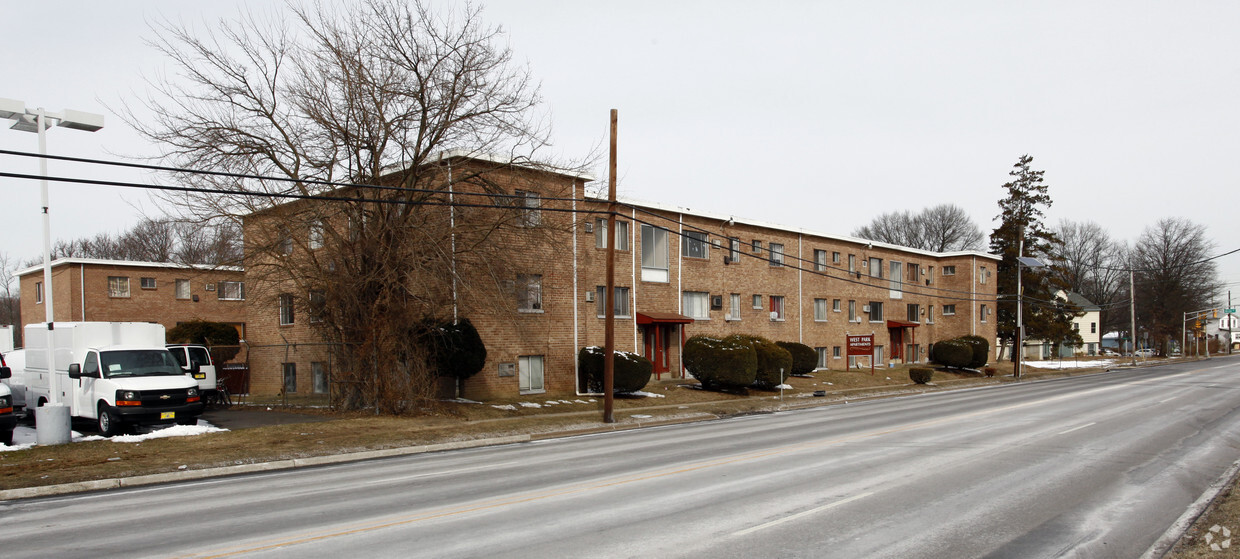
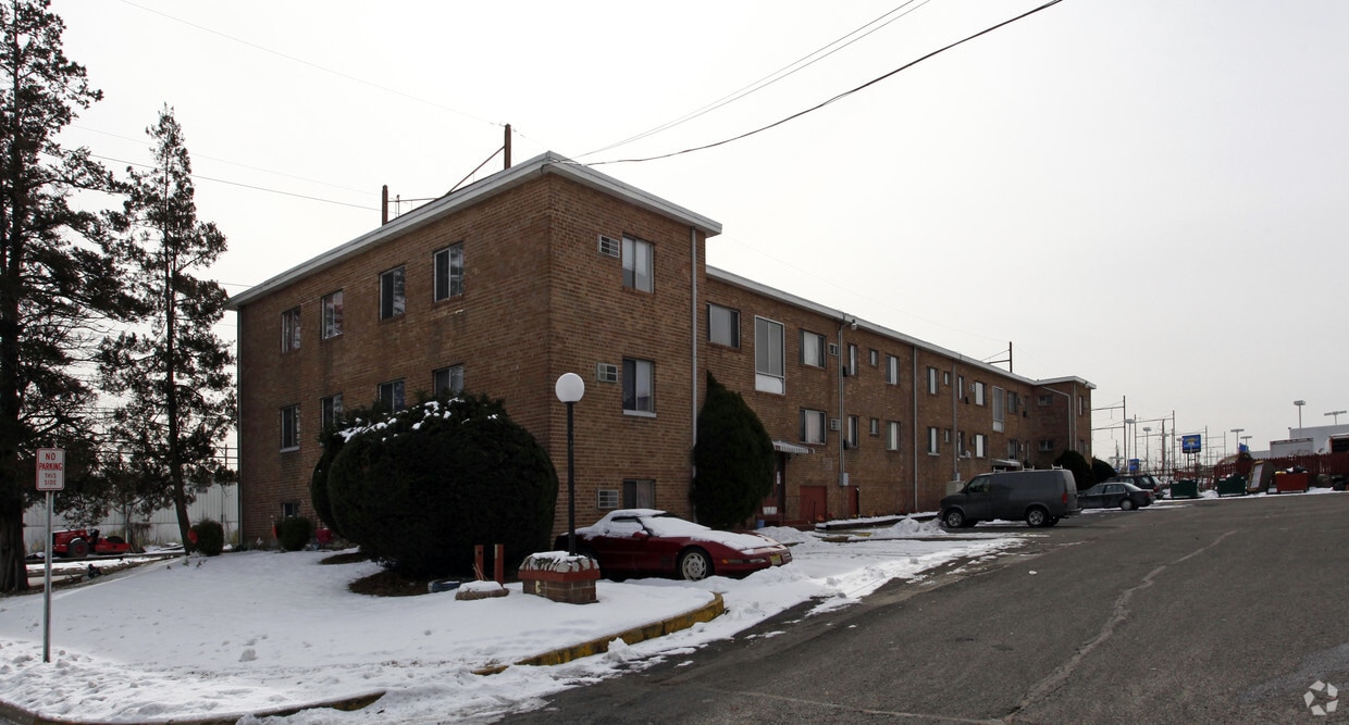
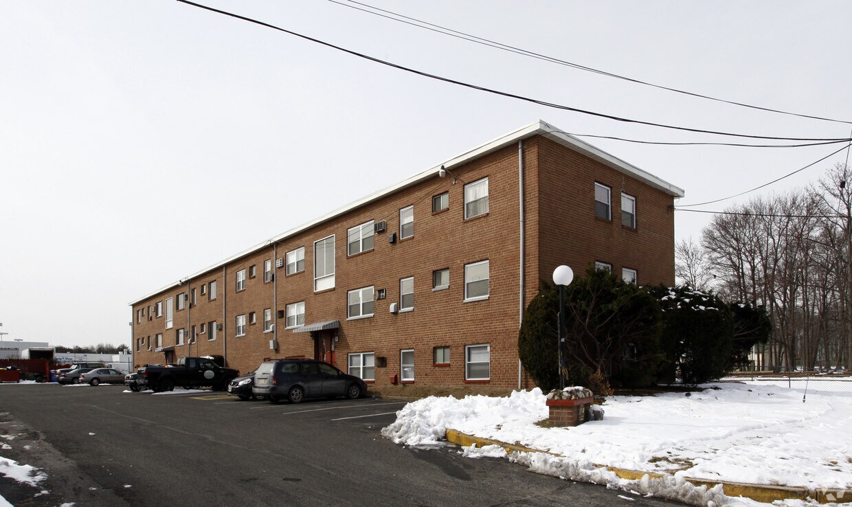
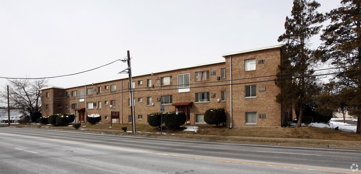

West Park Apartments is ready for your visit. With a location on Gateway Blvd in Westville's 08093 area, residents can easily connect with a number of attractions nearby. Make a visit to view the available floorplans. This community features a wide selection of great amenities like high-speed internet access, convenient on-site parking options, and smoke free options. Contact us or drop by to find out the availability today and find your new home at West Park Apartments.
West Park Apartments is an apartment community located in Gloucester County and the 08093 ZIP Code. This area is served by the Westville Boro Public School District attendance zone.
Air Conditioning
High Speed Internet Access
Refrigerator
Tub/Shower
Sitting along the banks of the Delaware River in Gloucester County, Westville is a small borough that carries a big sense of place. Named for Thomas West, who built a home here in 1775, this tight-knit community earned its nickname as "The Gateway to South Jersey" long before the phrase became a rallying cry. Center City Philadelphia sits just ten miles to the north, giving residents easy access to a major metropolitan hub without trading away that small-borough feel.
Westville spans just two square miles, yet it packs in a genuine community character rooted in civic pride and seasonal tradition. The borough's Broadway corridor anchors local commerce, while waterways on three sides open the door to boating, fishing, and weekend recreation. Roebling Bridge connections and quick access to I-295 and Route 130 keep commuters well-connected across the region.
Learn more about living in Westville| Colleges & Universities | Distance | ||
|---|---|---|---|
| Colleges & Universities | Distance | ||
| Drive: | 14 min | 6.7 mi | |
| Drive: | 11 min | 7.3 mi | |
| Drive: | 12 min | 7.7 mi | |
| Drive: | 16 min | 9.8 mi |


Transportation options available in Westville include Ferry Avenue, located 5.6 miles from West Park Apartments. West Park Apartments is near Philadelphia International, located 13.6 miles or 24 minutes away, and Trenton Mercer, located 40.6 miles or 57 minutes away.
| Transit / Subway | Distance | ||
|---|---|---|---|
| Transit / Subway | Distance | ||
|
|
Drive: | 9 min | 5.6 mi |
|
|
Drive: | 11 min | 7.3 mi |
|
|
Drive: | 11 min | 7.5 mi |
|
|
Drive: | 12 min | 7.7 mi |
|
|
Drive: | 13 min | 8.2 mi |
| Commuter Rail | Distance | ||
|---|---|---|---|
| Commuter Rail | Distance | ||
|
|
Drive: | 15 min | 9.6 mi |
|
|
Drive: | 19 min | 11.7 mi |
|
|
Drive: | 26 min | 13.2 mi |
|
|
Drive: | 23 min | 13.3 mi |
|
|
Drive: | 24 min | 13.7 mi |
| Airports | Distance | ||
|---|---|---|---|
| Airports | Distance | ||
|
Philadelphia International
|
Drive: | 24 min | 13.6 mi |
|
Trenton Mercer
|
Drive: | 57 min | 40.6 mi |
Scores provided by
Traffic
BusyAirport
CalmBusinesses
ActiveScores provided by
HowLoud What is a Sound Score Rating? A Sound Score Rating aggregates noise caused by vehicle traffic, airplane traffic and local sources. How It WorksTime and distance from West Park Apartments.
| Shopping Centers | Distance | ||
|---|---|---|---|
| Shopping Centers | Distance | ||
| Walk: | 5 min | 0.3 mi | |
| Drive: | 3 min | 1.2 mi | |
| Drive: | 2 min | 1.3 mi |
| Parks and Recreation | Distance | ||
|---|---|---|---|
| Parks and Recreation | Distance | ||
|
Camden Children's Garden
|
Drive: | 12 min | 7.8 mi |
|
Franklin D. Roosevelt Park
|
Drive: | 15 min | 8.6 mi |
|
Gloria Dei Church National Historic Site
|
Drive: | 14 min | 8.7 mi |
|
Independence Seaport Museum
|
Drive: | 16 min | 9.4 mi |
|
Thaddeus Kosciuszko National Memorial
|
Drive: | 16 min | 9.8 mi |
| Hospitals | Distance | ||
|---|---|---|---|
| Hospitals | Distance | ||
| Drive: | 3 min | 1.7 mi | |
| Drive: | 8 min | 5.8 mi | |
| Drive: | 10 min | 6.7 mi |
| Military Bases | Distance | ||
|---|---|---|---|
| Military Bases | Distance | ||
| Drive: | 14 min | 8.7 mi | |
| Drive: | 52 min | 30.0 mi | |
| Drive: | 51 min | 30.7 mi |
What Are Walk Score®, Transit Score®, and Bike Score® Ratings?
Walk Score® measures the walkability of any address. Transit Score® measures access to public transit. Bike Score® measures the bikeability of any address.
What is a Sound Score Rating?
A Sound Score Rating aggregates noise caused by vehicle traffic, airplane traffic and local sources.

910 Gateway Blvd
Westville, NJ 08093


