
Parkview Apartments
1424 Nottingham Way,
Hamilton, NJ 08609
$1,550 - $2,150
1-2 Beds


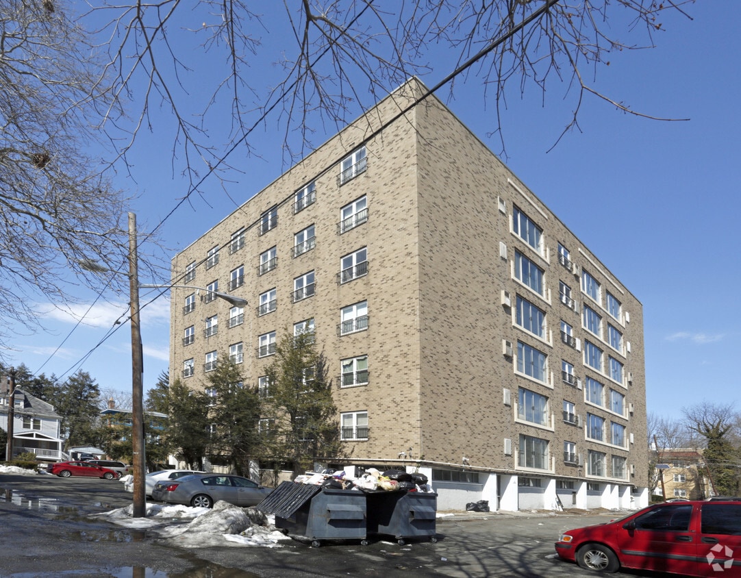
Find your new place at West House Apartments in Trenton, NJ. This community is located on W. State St. in Trenton. The leasing staff is available to help you find your perfect new place. Leasing 1 to 3 bedroom apartments, your new place is right here. Contact us or stop by today.
West House Apartments is an apartment community located in Mercer County and the 08618 ZIP Code. This area is served by the Trenton Public School District attendance zone.
Dishwasher
Hardwood Floors
Heating
Kitchen
Living in Trenton combines historical significance with contemporary urban living in New Jersey's capital city. The city's heritage shines through landmarks like the Old Barracks Museum, the New Jersey State House, and the William Trent House, while downtown continues to grow with transit-oriented development. Housing options include historic row houses and apartments, with current average rents at $1,515 for a one-bedroom unit, showing a moderate increase of 3.5% over the past year. Notable neighborhoods include the Mill Hill historic district, Chambersburg, and West Ward. The city's central location offers convenient transit access via Amtrak, NJ Transit, and SEPTA, connecting residents to both New York City and Philadelphia.
Cultural attractions include the New Jersey State Museum and the Trenton War Memorial, home to performances and events. Cadwalader Park, designed by Frederick Law Olmsted, spans 109.5 acres of recreational space.
Learn more about living in TrentonCompare neighborhood and city base rent averages by bedroom.
| Berkeley Square and Parkside | Trenton, NJ | |
|---|---|---|
| Studio | $1,171 | $998 |
| 1 Bedroom | $1,140 | $1,570 |
| 2 Bedrooms | $1,293 | $1,901 |
| 3 Bedrooms | - | $1,635 |
| Colleges & Universities | Distance | ||
|---|---|---|---|
| Colleges & Universities | Distance | ||
| Drive: | 5 min | 2.6 mi | |
| Drive: | 9 min | 3.6 mi | |
| Drive: | 14 min | 7.2 mi | |
| Drive: | 23 min | 10.1 mi |

Transportation options available in Trenton include Hamilton Avenue, located 3.2 miles from West House Apartments. West House Apartments is near Trenton Mercer, located 3.7 miles or 8 minutes away, and Philadelphia International, located 43.3 miles or 64 minutes away.
| Transit / Subway | Distance | ||
|---|---|---|---|
| Transit / Subway | Distance | ||
|
|
Drive: | 6 min | 3.2 mi |
| Drive: | 6 min | 3.2 mi | |
|
|
Drive: | 9 min | 4.6 mi |
|
|
Drive: | 16 min | 9.8 mi |
|
|
Drive: | 20 min | 12.8 mi |
| Commuter Rail | Distance | ||
|---|---|---|---|
| Commuter Rail | Distance | ||
|
|
Drive: | 4 min | 2.1 mi |
| Drive: | 5 min | 3.2 mi | |
|
|
Drive: | 8 min | 3.3 mi |
|
|
Drive: | 10 min | 5.1 mi |
|
|
Drive: | 14 min | 7.1 mi |
| Airports | Distance | ||
|---|---|---|---|
| Airports | Distance | ||
|
Trenton Mercer
|
Drive: | 8 min | 3.7 mi |
|
Philadelphia International
|
Drive: | 64 min | 43.3 mi |
Scores provided by
Traffic
BusyAirport
ActiveBusinesses
CalmScores provided by
HowLoud What is a Sound Score Rating? A Sound Score Rating aggregates noise caused by vehicle traffic, airplane traffic and local sources. How It WorksTime and distance from West House Apartments.
| Shopping Centers | Distance | ||
|---|---|---|---|
| Shopping Centers | Distance | ||
| Walk: | 16 min | 0.9 mi | |
| Drive: | 4 min | 2.1 mi | |
| Drive: | 4 min | 2.6 mi |
| Parks and Recreation | Distance | ||
|---|---|---|---|
| Parks and Recreation | Distance | ||
|
New Jersey State Museum Planetarium
|
Drive: | 3 min | 1.9 mi |
|
Drexel Woods Park
|
Drive: | 9 min | 5.2 mi |
|
Lawrence Nature Center
|
Drive: | 9 min | 5.2 mi |
|
Washington Crossing State Park
|
Drive: | 14 min | 7.5 mi |
|
Core Creek Park
|
Drive: | 17 min | 10.2 mi |
| Hospitals | Distance | ||
|---|---|---|---|
| Hospitals | Distance | ||
| Drive: | 6 min | 3.7 mi | |
| Drive: | 6 min | 3.8 mi | |
| Drive: | 19 min | 11.9 mi |
| Military Bases | Distance | ||
|---|---|---|---|
| Military Bases | Distance | ||
| Drive: | 33 min | 19.4 mi | |
| Drive: | 32 min | 21.5 mi |
What Are Walk Score®, Transit Score®, and Bike Score® Ratings?
Walk Score® measures the walkability of any address. Transit Score® measures access to public transit. Bike Score® measures the bikeability of any address.
What is a Sound Score Rating?
A Sound Score Rating aggregates noise caused by vehicle traffic, airplane traffic and local sources.
1315 W State St
Trenton, NJ 08618


