
Forest Hill Apartments
123 Davey St,
Bloomfield, NJ 07003
$1,659 - $2,509
Studio - 2 Beds
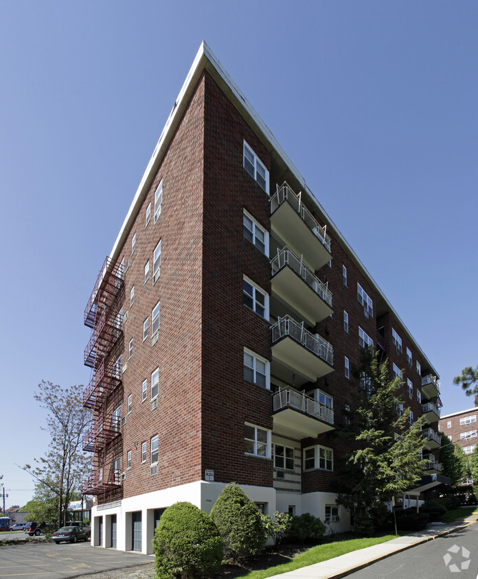
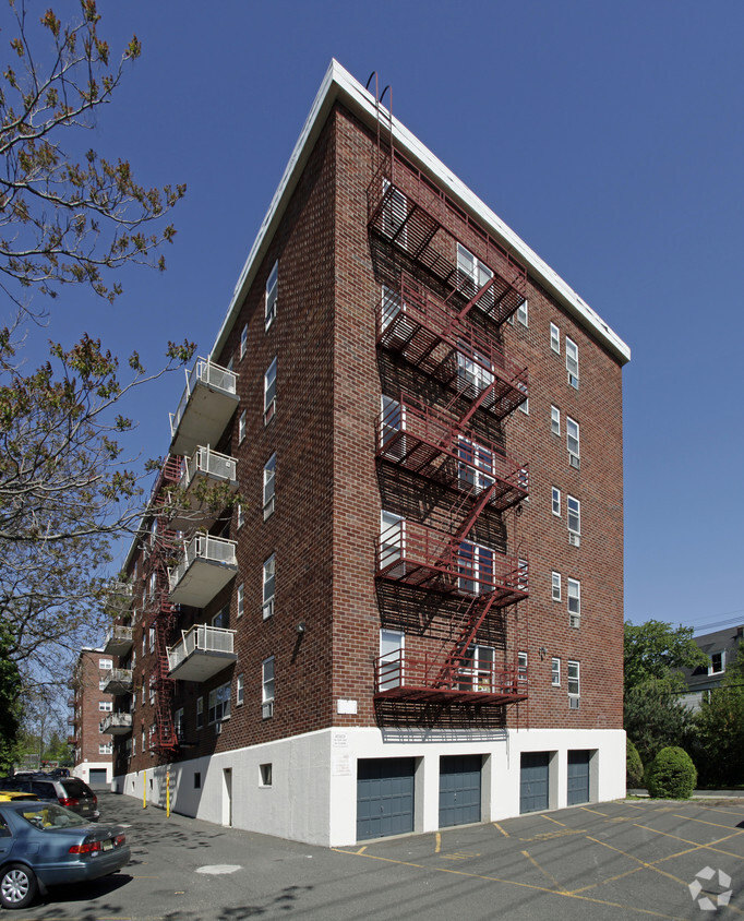

Experience Nutley living at West Bank Apartments. Located at 181 River Rd in Nutley, this community is convenient to everything. Let the knowledgeable leasing staff show you everything this community has in store. Experience a new standard at West Bank Apartments.
West Bank Apartments is an apartment community located in Essex County and the 07110 ZIP Code. This area is served by the Lyndhurst School District attendance zone.
Refrigerator
Heating
Oven
Range
Nutley, NJ sits just 15 miles from Midtown Manhattan, giving it that rare quality of feeling genuinely removed from city life while staying closely connected to one of the world's busiest economic centers. Tucked into Essex County along the Passaic River, this compact township covers only four square miles yet holds a population of nearly 30,000 residents, making it one of the more densely settled communities in the Garden State.
The township carries a strong sense of place rooted in its early-20th-century roots. Originally incorporated as Franklin Township in 1874, Nutley grew into a close-knit community with tree-lined streets and well-kept residential blocks that still define its character today. The Downtown district along Franklin Avenue anchors the social and commercial life of the area, while surrounding neighborhoods offer a quieter, more settled pace.
Learn more about living in Nutley| Colleges & Universities | Distance | ||
|---|---|---|---|
| Colleges & Universities | Distance | ||
| Drive: | 7 min | 2.7 mi | |
| Drive: | 7 min | 3.3 mi | |
| Drive: | 5 min | 3.5 mi | |
| Drive: | 9 min | 5.0 mi |


Transportation options available in Nutley include Branch Brook Park, located 4.3 miles from West Bank Apartments. West Bank Apartments is near Newark Liberty International, located 11.1 miles or 16 minutes away, and LaGuardia, located 20.3 miles or 38 minutes away.
| Transit / Subway | Distance | ||
|---|---|---|---|
| Transit / Subway | Distance | ||
|
|
Drive: | 8 min | 4.3 mi |
|
|
Drive: | 9 min | 4.7 mi |
|
|
Drive: | 9 min | 4.7 mi |
|
|
Drive: | 7 min | 5.3 mi |
|
|
Drive: | 10 min | 6.5 mi |
| Commuter Rail | Distance | ||
|---|---|---|---|
| Commuter Rail | Distance | ||
|
|
Drive: | 5 min | 1.7 mi |
|
|
Drive: | 4 min | 1.7 mi |
|
|
Drive: | 4 min | 1.8 mi |
|
|
Drive: | 6 min | 3.6 mi |
|
|
Drive: | 7 min | 4.4 mi |
| Airports | Distance | ||
|---|---|---|---|
| Airports | Distance | ||
|
Newark Liberty International
|
Drive: | 16 min | 11.1 mi |
|
LaGuardia
|
Drive: | 38 min | 20.3 mi |
Scores provided by
Traffic
-Airport
-Businesses
-Scores provided by
HowLoud What is a Sound Score Rating? A Sound Score Rating aggregates noise caused by vehicle traffic, airplane traffic and local sources. How It WorksTime and distance from West Bank Apartments.
| Shopping Centers | Distance | ||
|---|---|---|---|
| Shopping Centers | Distance | ||
| Drive: | 5 min | 1.3 mi | |
| Drive: | 3 min | 1.4 mi | |
| Drive: | 5 min | 2.1 mi |
| Parks and Recreation | Distance | ||
|---|---|---|---|
| Parks and Recreation | Distance | ||
|
Meadowlands Environment Center
|
Drive: | 14 min | 4.1 mi |
|
McDowell Observatory
|
Drive: | 14 min | 4.1 mi |
|
Richard W. DeKorte Park
|
Drive: | 11 min | 4.5 mi |
|
Kearny Marsh
|
Drive: | 9 min | 4.6 mi |
|
Branch Brook Park
|
Drive: | 9 min | 5.5 mi |
| Hospitals | Distance | ||
|---|---|---|---|
| Hospitals | Distance | ||
| Drive: | 7 min | 4.5 mi | |
| Drive: | 7 min | 5.5 mi | |
| Drive: | 9 min | 5.6 mi |
| Military Bases | Distance | ||
|---|---|---|---|
| Military Bases | Distance | ||
| Drive: | 22 min | 14.9 mi | |
| Drive: | 27 min | 16.0 mi | |
| Drive: | 37 min | 23.0 mi |
What Are Walk Score®, Transit Score®, and Bike Score® Ratings?
Walk Score® measures the walkability of any address. Transit Score® measures access to public transit. Bike Score® measures the bikeability of any address.
What is a Sound Score Rating?
A Sound Score Rating aggregates noise caused by vehicle traffic, airplane traffic and local sources.

181 River Rd
Nutley, NJ 07110


