
The Boulevard
2635 Contra Costa Blvd,
Pleasant Hill, CA 94523
$2,330 - $2,500
1 Bed

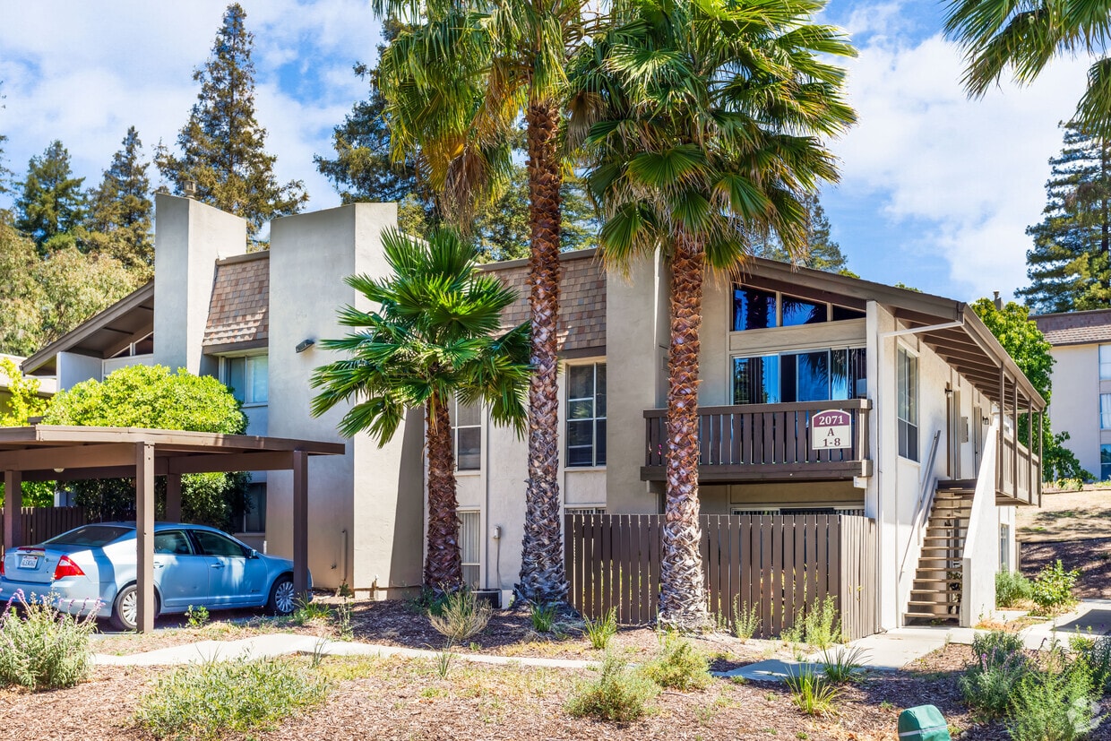
This well-maintained and professionally managed 115 unit apartment home offers one and two bedroom units. First floor units have patios. Second and third floor units have balconies. Some upper story units have vaulted ceilings. Viking Park Apartments features: Spacious units: -One bedroom approx. 730 sq. ft. -Two bedroom approx. 865 sq. ft. Pool Three on-site laundry facilities Assigned, covered parking Ample in-unit storage Pet friendly including pet waste stations Call us for current rates on: -1 bedroom, 1 bathroom apartment -2 bedroom, 1 bathroom apartment This complex is located convenient to many amenities including: 12 years of public education plus Diablo Valley College Shopping including Sunvalley Mall, Veranda Shopping Center, The Willows, DVC Plaza Shopping Center, many grocery, chain & department stores Various restaurants Several theaters The Contra Costa Canal Regional Trail Easy access to the 680 freeway, Highway 4 and public transportation including bus connections to BART
Viking Park Apartments is an apartment community located in Contra Costa County and the 94523 ZIP Code. This area is served by the Mt. Diablo Unified School District attendance zone.
Unique Features
Pool
Laundry Facilities
Property Manager on Site
Walking/Biking Trails
Air Conditioning
Dishwasher
High Speed Internet Access
Walk-In Closets
Pleasant Hill is exactly what you’d expect: a pleasant community in the California hills. This suburb offers urban amenities and small-town charm, along with upscale rentals ranging from single-family homes to modern apartments. A charming outdoor shopping center sits in the heart of downtown, along with neighborhood parks, movie theaters, and top-notch public schools like Sequoia Middle. Pleasant Hill offers proximity to even more shopping and entertainment options like Sunvalley Shopping Center and Six Flags in Concord. Suisun Bay is only a few miles north of town, and Walnut Creek sits directly south. Residents of this upscale suburb also have easy access to Berkeley, Oakland, Richmond, and San Francisco thanks to Interstate 680 and State Route 24.
Learn more about living in Pleasant Hill| Colleges & Universities | Distance | ||
|---|---|---|---|
| Colleges & Universities | Distance | ||
| Walk: | 9 min | 0.5 mi | |
| Drive: | 22 min | 10.2 mi | |
| Drive: | 25 min | 15.7 mi | |
| Drive: | 30 min | 17.2 mi |


Transportation options available in Pleasant Hill include Concord, located 3.4 miles from Viking Park Apartments. Viking Park Apartments is near Metro Oakland International, located 27.1 miles or 40 minutes away, and San Francisco International, located 39.0 miles or 58 minutes away.
| Transit / Subway | Distance | ||
|---|---|---|---|
| Transit / Subway | Distance | ||
|
|
Drive: | 8 min | 3.4 mi |
|
|
Drive: | 9 min | 4.8 mi |
|
|
Drive: | 10 min | 4.9 mi |
|
|
Drive: | 10 min | 6.0 mi |
|
|
Drive: | 12 min | 7.1 mi |
| Commuter Rail | Distance | ||
|---|---|---|---|
| Commuter Rail | Distance | ||
|
|
Drive: | 13 min | 8.0 mi |
| Drive: | 30 min | 18.4 mi | |
|
|
Drive: | 29 min | 20.2 mi |
|
|
Drive: | 31 min | 21.6 mi |
| Drive: | 33 min | 22.5 mi |
| Airports | Distance | ||
|---|---|---|---|
| Airports | Distance | ||
|
Metro Oakland International
|
Drive: | 40 min | 27.1 mi |
|
San Francisco International
|
Drive: | 58 min | 39.0 mi |
Scores provided by
Traffic
BusyAirport
ActiveBusinesses
CalmScores provided by
HowLoud What is a Sound Score Rating? A Sound Score Rating aggregates noise caused by vehicle traffic, airplane traffic and local sources. How It WorksTime and distance from Viking Park Apartments.
| Shopping Centers | Distance | ||
|---|---|---|---|
| Shopping Centers | Distance | ||
| Walk: | 11 min | 0.6 mi | |
| Walk: | 16 min | 0.9 mi | |
| Walk: | 18 min | 0.9 mi |
| Parks and Recreation | Distance | ||
|---|---|---|---|
| Parks and Recreation | Distance | ||
|
The Ruth Bancroft Garden
|
Drive: | 11 min | 4.7 mi |
|
Larkey Park
|
Drive: | 9 min | 5.1 mi |
|
Lindsay Wildlife Museum
|
Drive: | 9 min | 5.2 mi |
|
Gardens at Heather Farm
|
Drive: | 13 min | 5.5 mi |
|
John Muir National Historic Site
|
Drive: | 13 min | 5.9 mi |
| Hospitals | Distance | ||
|---|---|---|---|
| Hospitals | Distance | ||
| Drive: | 8 min | 3.4 mi | |
| Drive: | 8 min | 3.5 mi | |
| Drive: | 11 min | 6.1 mi |
| Military Bases | Distance | ||
|---|---|---|---|
| Military Bases | Distance | ||
| Drive: | 27 min | 8.6 mi | |
| Drive: | 15 min | 10.0 mi | |
| Drive: | 37 min | 24.6 mi |
Pets Allowed Fitness Center In Unit Washer & Dryer Stainless Steel Appliances Business Center Package Service Elevator
Pets Allowed Fitness Center In Unit Washer & Dryer Walk-In Closets Stainless Steel Appliances Hardwood Floors EV Charging
2095 Norse Dr
Pleasant Hill, CA 94523


