
eaves West Valley
700 S Saratoga Ave,
San Jose, CA 95129
$1,905 - $3,630
Studio - 2 Beds
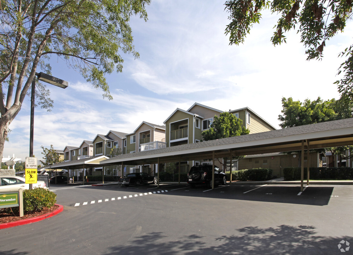
Experience your new apartment at Verandas in San Jose. This community can be found on N. Capitol Ave in San Jose. The leasing team is waiting to show you all that this community has to offer. Be sure to view the available floorplans. Start living the good life at Verandas. Stop by the leasing office to check the current floorplan availability.
Verandas is an apartment community located in Santa Clara County and the 95132 ZIP Code. This area is served by the Berryessa Union Elementary attendance zone.
Fitness Center
Laundry Facilities
Playground
24 Hour Access
Air Conditioning
High Speed Internet Access
Refrigerator
Patio
Countrybrook Lagoon gives residents easy access to the best of San Jose and Milpitas. Countrybrook Lagoon is only eight miles north of Downtown San Jose and about a mile from the border of Milpitas. Attracting even more renters, Countrybrook Lagoon is convenient to multiple tech companies including Intel, Cisco, Western Digital, and Oracle. Commuters can use major roadways like Interstate 880 or 680 to drive to work or hop onto the light rail transit that also travels up towards Berkeley. There are restaurants located along North Capitol Avenue and there are several shopping hubs near the neighborhood including Great Mall, a large outlet mall just over a mile away. This centrally located neighborhood has a variety of moderately priced to upscale houses, apartments, condos, and townhomes available for rent.
Learn more about living in Countrybrook Lagoon| Colleges & Universities | Distance | ||
|---|---|---|---|
| Colleges & Universities | Distance | ||
| Drive: | 8 min | 4.8 mi | |
| Drive: | 11 min | 6.9 mi | |
| Drive: | 13 min | 7.8 mi | |
| Drive: | 15 min | 9.2 mi |


Transportation options available in San Jose include Cropley Station, located 0.1 mile from Verandas. Verandas is near Norman Y Mineta San Jose International, located 5.8 miles or 11 minutes away, and Metro Oakland International, located 32.3 miles or 40 minutes away.
| Transit / Subway | Distance | ||
|---|---|---|---|
| Transit / Subway | Distance | ||
|
|
Walk: | 1 min | 0.1 mi |
| Walk: | 3 min | 0.2 mi | |
|
|
Walk: | 15 min | 0.8 mi |
|
|
Walk: | 16 min | 0.8 mi |
|
|
Walk: | 16 min | 0.9 mi |
| Commuter Rail | Distance | ||
|---|---|---|---|
| Commuter Rail | Distance | ||
| Drive: | 11 min | 6.1 mi | |
| Drive: | 10 min | 6.6 mi | |
| Drive: | 11 min | 6.9 mi | |
| Drive: | 12 min | 7.6 mi | |
| Drive: | 12 min | 7.6 mi |
| Airports | Distance | ||
|---|---|---|---|
| Airports | Distance | ||
|
Norman Y Mineta San Jose International
|
Drive: | 11 min | 5.8 mi |
|
Metro Oakland International
|
Drive: | 40 min | 32.3 mi |
Time and distance from Verandas.
| Shopping Centers | Distance | ||
|---|---|---|---|
| Shopping Centers | Distance | ||
| Walk: | 2 min | 0.1 mi | |
| Walk: | 3 min | 0.2 mi | |
| Walk: | 9 min | 0.5 mi |
| Parks and Recreation | Distance | ||
|---|---|---|---|
| Parks and Recreation | Distance | ||
|
Penitencia Creek County Park
|
Drive: | 5 min | 2.6 mi |
|
Live Oak Park - Santa Clara
|
Drive: | 8 min | 4.5 mi |
|
Ulistac Natural Area
|
Drive: | 9 min | 5.2 mi |
|
Ed Levin County Park
|
Drive: | 14 min | 6.1 mi |
|
Japanese Friendship Garden Regional Park
|
Drive: | 10 min | 6.8 mi |
| Hospitals | Distance | ||
|---|---|---|---|
| Hospitals | Distance | ||
| Drive: | 5 min | 3.6 mi | |
| Drive: | 12 min | 8.9 mi | |
| Drive: | 17 min | 10.2 mi |
| Military Bases | Distance | ||
|---|---|---|---|
| Military Bases | Distance | ||
| Drive: | 20 min | 12.5 mi |
What Are Walk Score®, Transit Score®, and Bike Score® Ratings?
Walk Score® measures the walkability of any address. Transit Score® measures access to public transit. Bike Score® measures the bikeability of any address.
What is a Sound Score Rating?
A Sound Score Rating aggregates noise caused by vehicle traffic, airplane traffic and local sources

1868 N Capitol Ave
San Jose, CA 95132


