
Sevens
777 W Middlefield Rd,
Mountain View, CA 94043
$3,613 - $8,498
Studio - 2 Beds
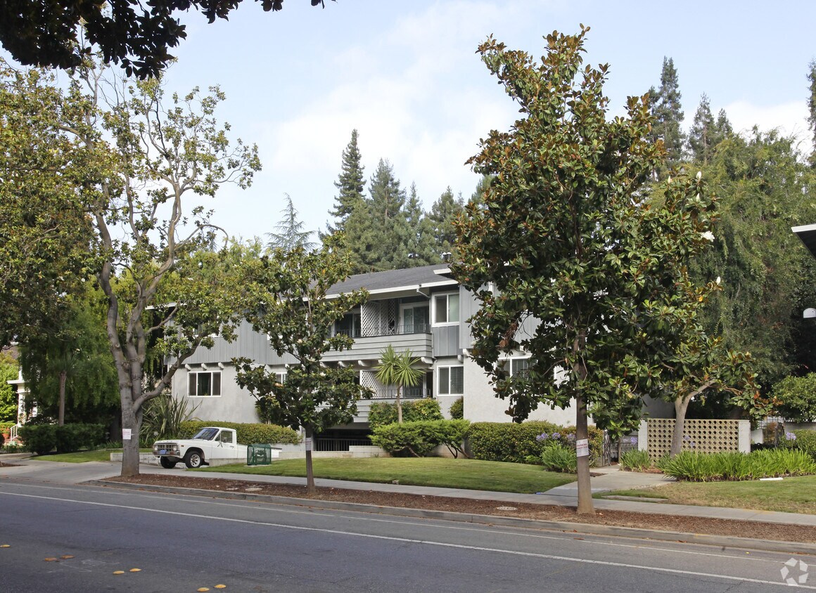
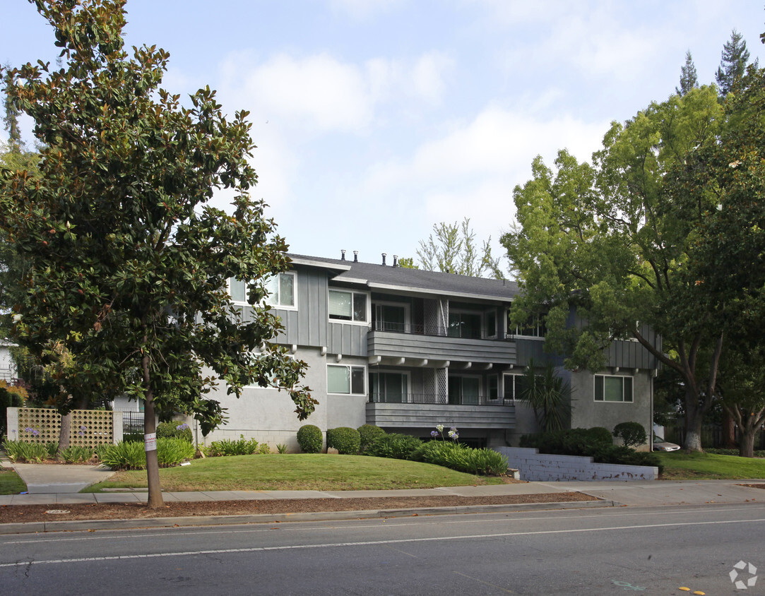

University Garden Apartments offers a blend of quality, design and comfort. Located at 861-875 University Ave in Palo Alto, this community is an ideal place to live. You'll experience a unique selection of features and amenities at this community. The leasing staff is excited to help you find your new home. Drop by to check the current floorplan availability.
University Garden Apartments is an apartment community located in Santa Clara County and the 94301 ZIP Code. This area is served by the Palo Alto Unified attendance zone.
Pool
Laundry Facilities
Recycling
Property Manager on Site
High Speed Internet Access
Microwave
Refrigerator
Disposal
Living in Palo Alto places you in Silicon Valley, where historic neighborhoods complement the city's technological presence. Tree-lined streets wind through the community, which is anchored by Stanford University. University Avenue features local boutiques and restaurants housed in preserved historic buildings, while the Stanford Shopping Center offers high-end retail destinations. The city maintains 36 parks and preserves, including the Baylands Nature Preserve and Foothills Park, where residents enjoy hiking trails and outdoor activities. Palo Alto's infrastructure supports alternative transportation, with dedicated bike lanes throughout the city.
The rental market in Palo Alto reflects the area's popularity, with current average rents ranging from $2,634 for studios to $6,139 for four-bedroom homes. Recent trends show steady growth, with rent increases varying from 1.8% to 17% across different unit sizes over the past year.
Learn more about living in Palo Alto| Colleges & Universities | Distance | ||
|---|---|---|---|
| Colleges & Universities | Distance | ||
| Drive: | 9 min | 2.8 mi | |
| Drive: | 8 min | 3.0 mi | |
| Drive: | 10 min | 5.2 mi | |
| Drive: | 18 min | 8.3 mi |


Transportation options available in Palo Alto include Bayshore Nasa Station, located 7.5 miles from University Garden Apartments. University Garden Apartments is near Norman Y Mineta San Jose International, located 15.1 miles or 21 minutes away, and San Francisco International, located 20.0 miles or 27 minutes away.
| Transit / Subway | Distance | ||
|---|---|---|---|
| Transit / Subway | Distance | ||
| Drive: | 11 min | 7.5 mi | |
|
|
Drive: | 12 min | 7.7 mi |
| Drive: | 11 min | 7.9 mi | |
|
|
Drive: | 12 min | 8.0 mi |
|
|
Drive: | 13 min | 8.1 mi |
| Commuter Rail | Distance | ||
|---|---|---|---|
| Commuter Rail | Distance | ||
| Walk: | 19 min | 1.0 mi | |
| Drive: | 5 min | 2.0 mi | |
| Drive: | 6 min | 2.4 mi | |
| Drive: | 8 min | 3.1 mi | |
| Drive: | 11 min | 6.0 mi |
| Airports | Distance | ||
|---|---|---|---|
| Airports | Distance | ||
|
Norman Y Mineta San Jose International
|
Drive: | 21 min | 15.1 mi |
|
San Francisco International
|
Drive: | 27 min | 20.0 mi |
Time and distance from University Garden Apartments.
| Shopping Centers | Distance | ||
|---|---|---|---|
| Shopping Centers | Distance | ||
| Drive: | 5 min | 1.4 mi | |
| Drive: | 5 min | 1.7 mi | |
| Drive: | 5 min | 1.7 mi |
| Parks and Recreation | Distance | ||
|---|---|---|---|
| Parks and Recreation | Distance | ||
|
Hopkins Creekside Park
|
Walk: | 16 min | 0.9 mi |
|
Junior Museum and Zoo
|
Walk: | 18 min | 1.0 mi |
|
Rinconada Park
|
Walk: | 21 min | 1.1 mi |
|
Seminary Oaks Park
|
Drive: | 3 min | 1.2 mi |
|
El Palo Alto Park
|
Drive: | 4 min | 1.3 mi |
| Hospitals | Distance | ||
|---|---|---|---|
| Hospitals | Distance | ||
| Drive: | 6 min | 1.9 mi | |
| Drive: | 7 min | 2.4 mi | |
| Drive: | 11 min | 6.4 mi |
| Military Bases | Distance | ||
|---|---|---|---|
| Military Bases | Distance | ||
| Drive: | 14 min | 8.0 mi |
What Are Walk Score®, Transit Score®, and Bike Score® Ratings?
Walk Score® measures the walkability of any address. Transit Score® measures access to public transit. Bike Score® measures the bikeability of any address.
What is a Sound Score Rating?
A Sound Score Rating aggregates noise caused by vehicle traffic, airplane traffic and local sources

861-875 University Ave
Palo Alto, CA 94301


