
Fayette Arms Apartments
2680 Fayette Dr,
Mountain View, CA 94040
$3,200 - $3,438
1-2 Beds
Sophisticated elegance and modern downtown lifestyle intersect where San Antonio meets Cuesta Ave. These vibrant two and three bedroom units offer plenty of glorious living space. For your convenience each unit is equipped with washer/dryer, some have fire place and tones of closet space. We are a walk distance to the quaint village like down town of Los Altos known for its outdoor recreation, shopping and upscale dining. Easy access to major surface routes including HWY 280 and 85. Also we are within the excellent Los Altos school district.
Tyndall Street Apartments is an apartment community located in Santa Clara County and the 94022 ZIP Code. This area is served by the Los Altos Elementary School District attendance zone.
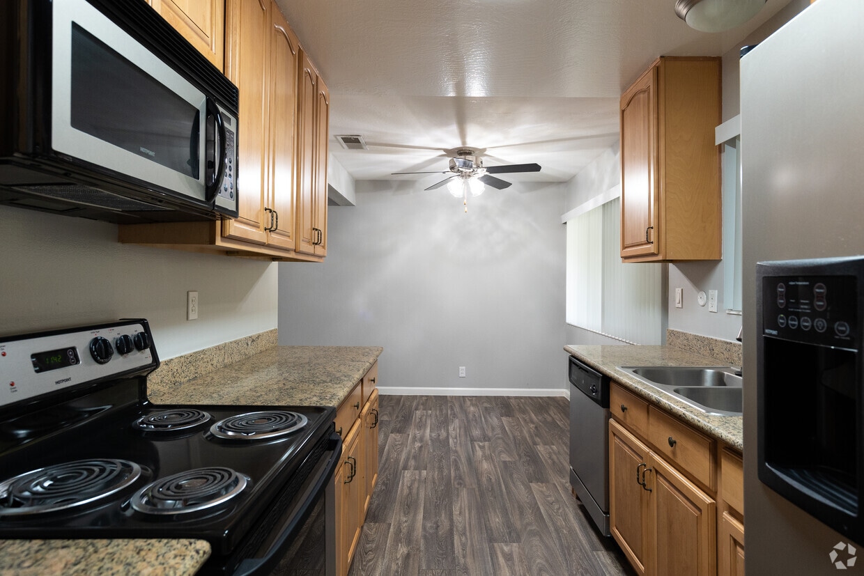
Unique Features
Pool
Laundry Facilities
Recycling
24 Hour Access
Washer/Dryer
Dishwasher
Granite Countertops
Microwave
Refrigerator
Tub/Shower
Disposal
Ice Maker
North Los Altos contains the city’s vibrant commercial centers. The many shops and eateries of Main Street are in the southern portion of North Los Altos, while the diverse restaurants and cafes of San Antonio Road are in the northern stretches near San Antonio Center.
Outside of these commercial areas, North Los Altos is predominantly residential, offering an array of apartments available for rent along tree-lined avenues. Many of the rentals in North Los Altos feature stunning mountain views, as well as close proximity to Mountain View, Foothill College, Stanford University, and Palo Alto. Getting around from North Los Altos is simple with access to El Camino Real, Interstate 280, and San Antonio Station.
Learn more about living in North Los AltosCompare neighborhood and city base rent averages by bedroom.
| North Los Altos | Los Altos, CA | |
|---|---|---|
| Studio | $2,461 | $2,461 |
| 1 Bedroom | $3,193 | $3,212 |
| 2 Bedrooms | $3,495 | $3,493 |
| 3 Bedrooms | $4,738 | $4,196 |
| Colleges & Universities | Distance | ||
|---|---|---|---|
| Colleges & Universities | Distance | ||
| Drive: | 5 min | 1.7 mi | |
| Drive: | 8 min | 3.6 mi | |
| Drive: | 12 min | 5.6 mi | |
| Drive: | 12 min | 6.2 mi |


Transportation options available in Los Altos include Mountain View Station, located 3.2 miles from Tyndall Street Apartments. Tyndall Street Apartments is near Norman Y Mineta San Jose International, located 12.0 miles or 20 minutes away, and San Francisco International, located 26.3 miles or 37 minutes away.
| Transit / Subway | Distance | ||
|---|---|---|---|
| Transit / Subway | Distance | ||
| Drive: | 8 min | 3.2 mi | |
|
|
Drive: | 10 min | 4.2 mi |
|
|
Drive: | 10 min | 4.5 mi |
| Drive: | 12 min | 5.3 mi | |
| Drive: | 12 min | 6.2 mi |
| Commuter Rail | Distance | ||
|---|---|---|---|
| Commuter Rail | Distance | ||
| Drive: | 6 min | 2.8 mi | |
| Drive: | 8 min | 3.1 mi | |
| Drive: | 11 min | 4.8 mi | |
| Drive: | 13 min | 5.3 mi | |
| Drive: | 15 min | 6.4 mi |
| Airports | Distance | ||
|---|---|---|---|
| Airports | Distance | ||
|
Norman Y Mineta San Jose International
|
Drive: | 20 min | 12.0 mi |
|
San Francisco International
|
Drive: | 37 min | 26.3 mi |
Scores provided by
Traffic
-Airport
-Businesses
-Scores provided by
HowLoud What is a Sound Score Rating? A Sound Score Rating aggregates noise caused by vehicle traffic, airplane traffic and local sources. How It WorksTime and distance from Tyndall Street Apartments.
| Shopping Centers | Distance | ||
|---|---|---|---|
| Shopping Centers | Distance | ||
| Drive: | 3 min | 1.7 mi | |
| Drive: | 5 min | 1.7 mi | |
| Drive: | 4 min | 1.7 mi |
| Parks and Recreation | Distance | ||
|---|---|---|---|
| Parks and Recreation | Distance | ||
|
Redwood Grove
|
Drive: | 4 min | 1.5 mi |
|
Foothill College Observatory
|
Drive: | 5 min | 1.9 mi |
|
Terman Park
|
Drive: | 6 min | 2.9 mi |
|
Esther Clark Nature Preserve
|
Drive: | 6 min | 2.9 mi |
|
Byrne Preserve
|
Drive: | 8 min | 3.2 mi |
| Hospitals | Distance | ||
|---|---|---|---|
| Hospitals | Distance | ||
| Drive: | 6 min | 2.3 mi | |
| Drive: | 13 min | 6.5 mi | |
| Drive: | 14 min | 6.7 mi |
| Military Bases | Distance | ||
|---|---|---|---|
| Military Bases | Distance | ||
| Drive: | 15 min | 6.1 mi | |
| Drive: | 61 min | 42.4 mi | |
| Drive: | 62 min | 42.6 mi |

Pets Allowed Fitness Center Pool High-Speed Internet Concierge
What Are Walk Score®, Transit Score®, and Bike Score® Ratings?
Walk Score® measures the walkability of any address. Transit Score® measures access to public transit. Bike Score® measures the bikeability of any address.
What is a Sound Score Rating?
A Sound Score Rating aggregates noise caused by vehicle traffic, airplane traffic and local sources.

550 Tyndall St
Los Altos, CA 94022


