Tropicana Palms

3710 Lee Blvd, EL PASO, TX 79936

2 Weeks Ago
Share Listing
Favorites
Tropicana Palms
Share Listing
Favorites

Highlights

  • English and Spanish Speaking Staff
  • Basketball Court
  • Porch
  • Planned Social Activities
  • Property Manager on Site
  • Business Center

About Tropicana Palms

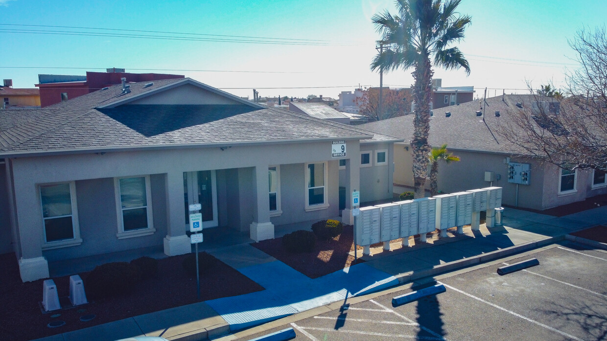
Tropicana Palms has all the comfort and conveniences you will need or want. Conveniently located in the heart of El Paso’s Eastside, you are minutes away from shopping, entertainment, and Fort Bliss. Move in today and benefit from our prompt maintenance service and professional management for all you living need. Our amenities will make you heart skip a beat, so hurry on down here and take a tour of your new home! If reasonable accommodations need to be made to complete the application process, Please contact us. Si se require hacer acomodaciones razonables para completar el proceso de solicitud, por favor pongase en contacto con nosotros.

Tropicana Palms is an apartment community located in El Paso County and the 79936 ZIP Code. This area is served by the Socorro Independent School District attendance zone.

Community Amenities

Playground

Clubhouse

Business Center

Basketball Court

  • Wi-Fi
  • Maintenance on site
  • Property Manager on Site
  • Planned Social Activities
  • Business Center
  • Clubhouse
  • Walk-Up
  • Playground
  • Basketball Court

Apartment Features

Washer/Dryer

Air Conditioning

Dishwasher

Microwave

Refrigerator

Tub/Shower

Disposal

Tile Floors

Indoor Features

  • Washer/Dryer
  • Air Conditioning
  • Heating
  • Ceiling Fans
  • Smoke Free
  • Cable Ready
  • Tub/Shower
  • Sprinkler System
  • Wheelchair Accessible (Rooms)

Kitchen Features & Appliances

  • Dishwasher
  • Disposal
  • Pantry
  • Kitchen
  • Microwave
  • Oven
  • Range
  • Refrigerator

Model Details

  • Tile Floors
  • Dining Room
  • Double Pane Windows
  • Large Bedrooms
  • Porch
Location
3710 Lee Blvd, EL PASO,
TX 79936
Get Directions
City - El Paso

El Paso sits where West Texas, New Mexico, and the Mexican state of Chihuahua converge, giving the city a cross-border identity that shapes everything from its architecture to its daily rhythm. With the Franklin Mountains rising inside city limits and the Rio Grande forming its southern edge, the geography alone sets it apart from anywhere else in Texas. Fort Bliss, one of the largest U.S. Army installations in the country, and the University of Texas at El Paso are two of the city's most significant economic and institutional anchors. The Chamizal National Memorial marks the site of a peacefully resolved international border dispute, a piece of history few American cities can claim.

Neighborhoods range widely in character. Manhattan Heights offers historic homes close to downtown, while Northeast El Paso spreads out with newer residential development near Fort Bliss. Kern Place, adjacent to UTEP's campus, has an established, walkable feel.

Learn more about living in El Paso 
Education
Colleges & Universities Distance
Drive: 15 min 7.5 mi
Drive: 17 min 11.6 mi
Drive: 21 min 13.5 mi
Drive: 23 min 17.2 mi
Tropicana Palms is within 15 minutes or 7.5 miles from El Paso C.C., Valle Verde. It is also near El Paso C.C., Mission Del Paso and El Paso C.C., Rio Grande.
Schools
Public Elementary & Middle School
Grades PK-8
829 Students
Attendance Zone
Public High School
Grades 9-12
2,498 Students
Attendance Zone
Private Elementary, Middle & High School
Grades K-12
34 Students
Nearby
Private Elementary School
Grades PK-5
129 Students
Nearby
Private Elementary, Middle & High School
Grades K-12
79 Students
Nearby
Transportation

Tropicana Palms is near El Paso International, located 7.2 miles or 18 minutes away.

Airports Distance
Airports Distance
El Paso International
Drive: 18 min 7.2 mi

Walkability Near Tropicana Palms

Getting Around
Fairly Walkable
Walkability
40 / 100
Limited Public Transit
Transit
30 / 100
Moderately Drivable
Drivability
70 / 100
Somewhat Bikeable
Bikeability
30 / 100

Scores provided by

What do Walkability, Transit, Drivability, and Bikeability mean? Walkability measures the walking distance to day-to-day needs. Transit measures access to public transportation. Drivability measures congestion, parking availability, and access to major roads. Bikeability measures the suitability for cycling. How It Works
Active
Soundscore
77 / 100

Traffic

Active

Airport

Calm

Businesses

Calm

Scores provided by

HowLoud What is a Sound Score Rating? A Sound Score Rating aggregates noise caused by vehicle traffic, airplane traffic and local sources. How It Works
Points of Interest

Time and distance from Tropicana Palms.

Shopping Centers Distance
Walk: 15 min 0.8 mi
Walk: 18 min 1.0 mi
Walk: 21 min 1.1 mi
Tropicana Palms has 3 shopping centers within 1.1 miles, which is about a 21-minute walk. The miles and minutes will be for the farthest away property.
Parks and Recreation Distance
Hueco Tanks State Historic Site
Drive: 13 min 7.1 mi
Gene Roddenberry Planetarium
Drive: 13 min 7.5 mi
El Paso Zoo
Drive: 16 min 9.9 mi
Chamizal National Memorial
Drive: 19 min 11.7 mi
Ascarate Park
Drive: 19 min 11.9 mi
Tropicana Palms has 5 parks within 11.9 miles, including Hueco Tanks State Historic Site, Gene Roddenberry Planetarium, and Ascarate Park.
Hospitals Distance
Hospitals Distance
Drive: 7 min 3.2 mi
Drive: 10 min 5.0 mi
Drive: 17 min 10.3 mi
Tropicana Palms has 3 hospitals within 10.3 miles, the nearest is The Hospitals of Providence - East Campus which is 3.2 miles away and a 7 minute drive.
Military Bases Distance
Drive: 17 min 9.3 mi
Drive: 188 min 91.9 mi
Drive: 163 min 117.7 mi
Tropicana Palms has 3 military bases within 117.7 miles, the nearest is Fort Bliss which is 9.3 miles away and a 17 minute drive.

Explore Similar Rentals Nearby