
Presidential Towers
555 W Madison St,
Chicago, IL 60661
$1,635 - $9,400
Studio - 2 Beds
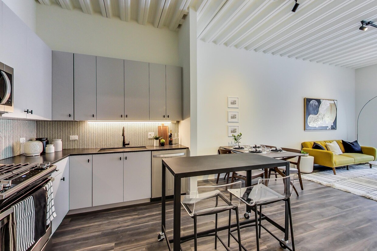
The Trailhead Apartments is the first building to attach directly to the 606 Trail! This unit features hardwood floors throughout, modern stainless steel & granite kitchen, enormous living room, extra large bedrooms, walk in closets, high ceilings, central heat/ac, in unit washer/ dryer & amazing views of the city! The building includes a rooftop sundeck, lounge/ business center, fitness center, bike storage, package room, secured entry & attached garage! Price Reflects Net Effective Rent inclusive of Concession. Adventure is coming to Bucktown.
Trailhead is an apartment community located in Cook County and the 60647 ZIP Code. This area is served by the Chicago Public Schools attendance zone.
Fitness Center
Roof Terrace
Business Center
Grill
Washer/Dryer
Hardwood Floors
Walk-In Closets
Tub/Shower
Hip, trendy, and yet somehow still sensible, Logan Square has long been one of Chicago's favorite neighborhoods. The area developed in the early 1800s, when a public green space was designed by landscape architect Jens Jensen. Today, Logan Square Park is located in the heart of the neighborhood, wrapped by Logan Boulevard and divided by Milwaukee Avenue.
Bicycle-friendly Logan Square is all about living local, from its craft breweries to local artists and restaurants. With its wide sidewalks and compact design, Logan Square is very walkable. If you choose a Logan Square apartment, you'll be about five miles from Downtown Chicago, with easy access to mass transit -- just hop on the L's Blue Line from the Logan Square Blue Line Station and you'll be downtown in minutes.
Learn more about living in Logan Square| Colleges & Universities | Distance | ||
|---|---|---|---|
| Colleges & Universities | Distance | ||
| Drive: | 7 min | 3.0 mi | |
| Drive: | 7 min | 3.1 mi | |
| Drive: | 7 min | 3.1 mi | |
| Drive: | 8 min | 3.4 mi |

Transportation options available in Chicago include Western Station (Blue Line - O'hare Branch), located 0.4 mile from Trailhead. Trailhead is near Chicago Midway International, located 11.3 miles or 21 minutes away, and Chicago O'Hare International, located 14.7 miles or 24 minutes away.
| Transit / Subway | Distance | ||
|---|---|---|---|
| Transit / Subway | Distance | ||
|
|
Walk: | 8 min | 0.4 mi |
|
|
Walk: | 14 min | 0.7 mi |
|
|
Drive: | 3 min | 1.5 mi |
|
|
Drive: | 4 min | 1.6 mi |
|
|
Drive: | 5 min | 2.3 mi |
| Commuter Rail | Distance | ||
|---|---|---|---|
| Commuter Rail | Distance | ||
|
|
Drive: | 4 min | 1.7 mi |
|
|
Drive: | 6 min | 2.5 mi |
|
|
Drive: | 6 min | 2.8 mi |
|
|
Drive: | 7 min | 3.4 mi |
|
|
Drive: | 8 min | 3.5 mi |
| Airports | Distance | ||
|---|---|---|---|
| Airports | Distance | ||
|
Chicago Midway International
|
Drive: | 21 min | 11.3 mi |
|
Chicago O'Hare International
|
Drive: | 24 min | 14.7 mi |
Time and distance from Trailhead.
| Shopping Centers | Distance | ||
|---|---|---|---|
| Shopping Centers | Distance | ||
| Walk: | 12 min | 0.6 mi | |
| Drive: | 3 min | 1.3 mi | |
| Drive: | 4 min | 1.4 mi |
| Parks and Recreation | Distance | ||
|---|---|---|---|
| Parks and Recreation | Distance | ||
|
Humboldt Park
|
Drive: | 3 min | 1.3 mi |
|
Wrightwood Park
|
Drive: | 7 min | 2.6 mi |
|
Oz Park
|
Drive: | 6 min | 2.9 mi |
|
Lincoln Park Zoo
|
Drive: | 7 min | 3.6 mi |
|
Garfield Park and Golden Dome Field House
|
Drive: | 8 min | 3.8 mi |
| Hospitals | Distance | ||
|---|---|---|---|
| Hospitals | Distance | ||
| Walk: | 18 min | 0.9 mi | |
| Drive: | 4 min | 1.6 mi | |
| Drive: | 7 min | 3.4 mi |
| Military Bases | Distance | ||
|---|---|---|---|
| Military Bases | Distance | ||
| Drive: | 33 min | 22.3 mi |
What Are Walk Score®, Transit Score®, and Bike Score® Ratings?
Walk Score® measures the walkability of any address. Transit Score® measures access to public transit. Bike Score® measures the bikeability of any address.
What is a Sound Score Rating?
A Sound Score Rating aggregates noise caused by vehicle traffic, airplane traffic and local sources

1744 N Western Ave
Chicago, IL 60647


