
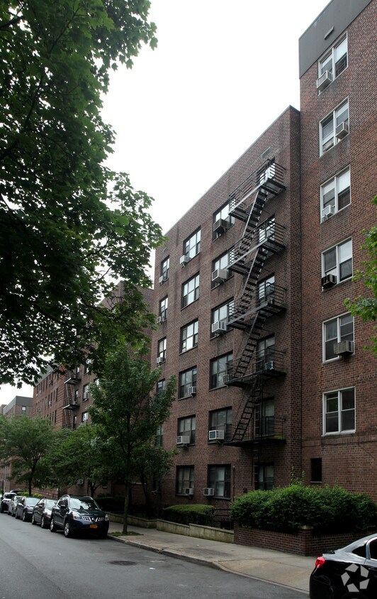
8615 60th Rd
8615 60th Rd,
Elmhurst, NY 11373
$2,450 Total Monthly Price
1 Bed 12 Month Lease
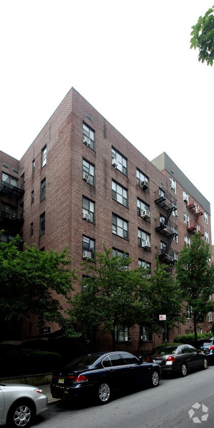
At The Wetherole in Rego Park, NY, you've discovered your new place. The location in Rego Park's 11374 area is an ideal place to live. From amenities to availability, the leasing team will be ready to help you find the perfect fit. Be sure to see the available floorplan options. Visit The Wetherole today.
The Wetherole is an apartment community located in Queens County and the 11374 ZIP Code. This area is served by the New York City Geographic District #28 attendance zone.
Dishwasher
Heating
Oven
Range
Rego Park sits in the heart of Queens, a dense, walkable square mile where Eastern European delis, Korean grocery stores, and Persian bakeries share the same block — a mix that reflects the neighborhood's genuinely international character. Anchored by the Queens Center Mall and Queens Place Mall along Queens Boulevard, the area draws steady foot traffic and offers everyday conveniences within easy reach. Nearby Forest Hills and Elmhurst expand the options for dining and green space, and Manhattan is accessible in under 30 minutes via the M and R subway lines at the 63rd Drive and Woodhaven Boulevard stations.
The housing stock leans heavily toward mid-rise and high-rise apartment communities, many built during the postwar boom that gave the neighborhood its name — Rego Park is a contraction of Real Good Park, the title used by the Real Estate Associates development company that built the area in the 1920s and 1930s.
Learn more about living in Rego Park| Colleges & Universities | Distance | ||
|---|---|---|---|
| Colleges & Universities | Distance | ||
| Drive: | 8 min | 3.8 mi | |
| Drive: | 11 min | 4.8 mi | |
| Drive: | 11 min | 5.3 mi | |
| Drive: | 11 min | 5.6 mi |


Transportation options available in Rego Park include 67 Avenue, located 0.4 mile from The Wetherole. The Wetherole is near LaGuardia, located 3.8 miles or 10 minutes away, and John F Kennedy International, located 9.4 miles or 15 minutes away.
| Transit / Subway | Distance | ||
|---|---|---|---|
| Transit / Subway | Distance | ||
|
|
Walk: | 7 min | 0.4 mi |
|
|
Walk: | 10 min | 0.5 mi |
|
|
Walk: | 19 min | 1.0 mi |
|
|
Drive: | 3 min | 1.1 mi |
|
|
Drive: | 5 min | 1.6 mi |
| Commuter Rail | Distance | ||
|---|---|---|---|
| Commuter Rail | Distance | ||
|
|
Drive: | 4 min | 1.3 mi |
|
|
Drive: | 8 min | 2.4 mi |
|
|
Drive: | 9 min | 3.4 mi |
|
|
Drive: | 9 min | 3.6 mi |
|
|
Drive: | 9 min | 3.7 mi |
| Airports | Distance | ||
|---|---|---|---|
| Airports | Distance | ||
|
LaGuardia
|
Drive: | 10 min | 3.8 mi |
|
John F Kennedy International
|
Drive: | 15 min | 9.4 mi |
Scores provided by
Traffic
-Airport
-Businesses
-Scores provided by
HowLoud What is a Sound Score Rating? A Sound Score Rating aggregates noise caused by vehicle traffic, airplane traffic and local sources. How It WorksTime and distance from The Wetherole.
| Shopping Centers | Distance | ||
|---|---|---|---|
| Shopping Centers | Distance | ||
| Walk: | 11 min | 0.6 mi | |
| Walk: | 15 min | 0.8 mi | |
| Walk: | 16 min | 0.8 mi |
| Parks and Recreation | Distance | ||
|---|---|---|---|
| Parks and Recreation | Distance | ||
|
Juniper Valley Park
|
Drive: | 5 min | 1.6 mi |
|
Queens Zoo
|
Drive: | 6 min | 2.1 mi |
|
Linden Park
|
Drive: | 6 min | 2.1 mi |
|
New York Hall of Science
|
Drive: | 7 min | 2.4 mi |
|
Flushing Meadows Corona Park
|
Drive: | 8 min | 3.2 mi |
| Hospitals | Distance | ||
|---|---|---|---|
| Hospitals | Distance | ||
| Drive: | 7 min | 2.2 mi | |
| Drive: | 8 min | 3.2 mi | |
| Drive: | 9 min | 3.8 mi |
| Military Bases | Distance | ||
|---|---|---|---|
| Military Bases | Distance | ||
| Drive: | 17 min | 8.7 mi | |
| Drive: | 27 min | 12.4 mi | |
| Drive: | 34 min | 14.7 mi |
What Are Walk Score®, Transit Score®, and Bike Score® Ratings?
Walk Score® measures the walkability of any address. Transit Score® measures access to public transit. Bike Score® measures the bikeability of any address.
What is a Sound Score Rating?
A Sound Score Rating aggregates noise caused by vehicle traffic, airplane traffic and local sources.

65-74 Wetherole St
Rego Park, NY 11374


