
The Village At Voorhees
10 Lucas Ln,
Voorhees, NJ 08043
$1,495 - $2,090
Studio - 2 Beds
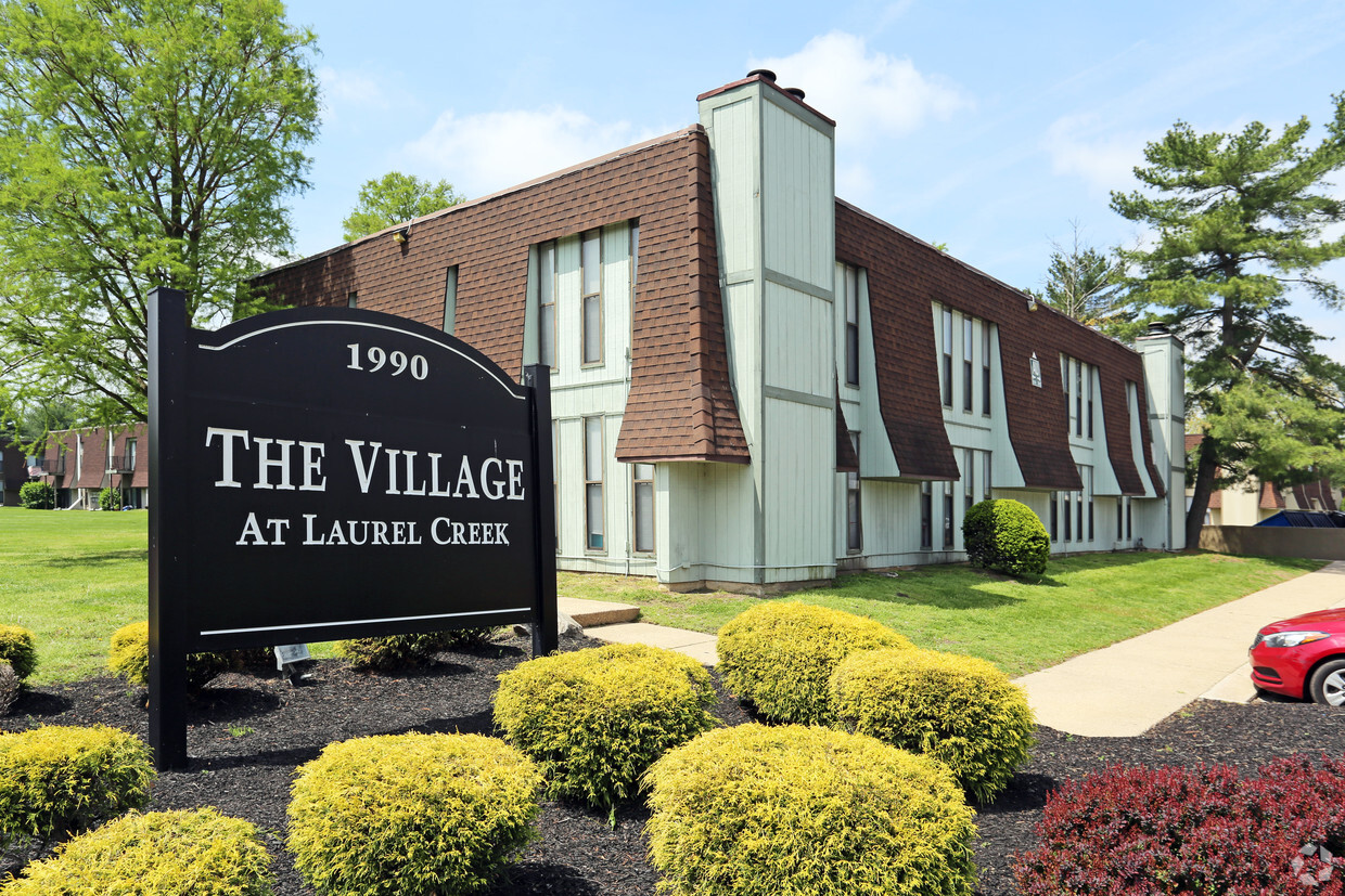
Welcome to The Village at Laurel Creek, a great place to call home. Our oversized living spaces feature fully equipped kitchens, wall-to-wall carpeting, and window treatments. Our community amenities include laundry facilities. We are conveniently located near the finest in shopping, dining, and entertainment. Call today to see your new home at The Village at Laurel Creek.
The Village at Laurel Creek is an apartment community located in Camden County and the 08021 ZIP Code. This area is served by the Lindenwold Board Of Education School District attendance zone.
Laundry Facilities
Property Manager on Site
Maintenance on site
Health Club Discount
Air Conditioning
Dishwasher
Walk-In Closets
Tub/Shower
Tucked into Camden County in South Jersey, Lindenwold is a small borough that punches well above its size when it comes to accessibility and everyday livability. Incorporated in 1929, the borough sits close enough to Philadelphia to make cross-river commuting straightforward, thanks to the PATCO Speedline, which runs its main operations facility right out of Lindenwold Station. New Jersey Transit's Atlantic City Line also stops here, giving residents two distinct transit corridors without the congestion of a major city.
The borough carries a settled, low-key character across its four square miles. Lindenwold Memorial Park draws outdoor enthusiasts with baseball and soccer fields, fitness circuits, and walking trails, while Timber Creek Park stretches 128 acres into neighboring Gloucester Township. For broader retail and dining options, the Voorhees Town Center sits just next door.
Learn more about living in Lindenwold| Colleges & Universities | Distance | ||
|---|---|---|---|
| Colleges & Universities | Distance | ||
| Drive: | 5 min | 2.3 mi | |
| Drive: | 13 min | 7.0 mi | |
| Drive: | 18 min | 10.1 mi | |
| Drive: | 19 min | 13.1 mi |


Transportation options available in Lindenwold include Lindenwold (Patco), located 2.7 miles from The Village at Laurel Creek. The Village at Laurel Creek is near Philadelphia International, located 19.4 miles or 32 minutes away, and Atlantic City International, located 39.3 miles or 70 minutes away.
| Transit / Subway | Distance | ||
|---|---|---|---|
| Transit / Subway | Distance | ||
|
|
Drive: | 5 min | 2.7 mi |
|
|
Drive: | 9 min | 4.6 mi |
|
|
Drive: | 12 min | 6.5 mi |
|
|
Drive: | 12 min | 7.6 mi |
|
|
Drive: | 14 min | 8.9 mi |
| Commuter Rail | Distance | ||
|---|---|---|---|
| Commuter Rail | Distance | ||
|
|
Drive: | 5 min | 2.6 mi |
|
|
Drive: | 11 min | 7.7 mi |
|
|
Drive: | 17 min | 10.8 mi |
|
|
Drive: | 23 min | 15.5 mi |
| Drive: | 24 min | 15.9 mi |
| Airports | Distance | ||
|---|---|---|---|
| Airports | Distance | ||
|
Philadelphia International
|
Drive: | 32 min | 19.4 mi |
|
Atlantic City International
|
Drive: | 70 min | 39.3 mi |
Scores provided by
Traffic
BusyAirport
CalmBusinesses
ActiveScores provided by
HowLoud What is a Sound Score Rating? A Sound Score Rating aggregates noise caused by vehicle traffic, airplane traffic and local sources. How It WorksTime and distance from The Village at Laurel Creek.
| Shopping Centers | Distance | ||
|---|---|---|---|
| Shopping Centers | Distance | ||
| Walk: | 2 min | 0.1 mi | |
| Walk: | 3 min | 0.2 mi | |
| Walk: | 3 min | 0.2 mi |
| Parks and Recreation | Distance | ||
|---|---|---|---|
| Parks and Recreation | Distance | ||
|
Downs Farms Trails
|
Drive: | 9 min | 5.2 mi |
|
Kresson Nature Trails
|
Drive: | 12 min | 6.5 mi |
|
Croft Farm Nature Trail
|
Drive: | 13 min | 7.9 mi |
|
Erlton North Trails
|
Drive: | 16 min | 10.2 mi |
|
Barclay Farmstead Nature Trail
|
Drive: | 17 min | 10.7 mi |
| Hospitals | Distance | ||
|---|---|---|---|
| Hospitals | Distance | ||
| Drive: | 3 min | 1.8 mi | |
| Drive: | 7 min | 4.1 mi | |
| Drive: | 13 min | 6.6 mi |
| Military Bases | Distance | ||
|---|---|---|---|
| Military Bases | Distance | ||
| Drive: | 22 min | 14.5 mi | |
| Drive: | 59 min | 35.3 mi | |
| Drive: | 59 min | 37.3 mi |

1990 Laurel Rd
Lindenwold, NJ 08021


