
461 Laughlin Ridge Rd
461 Laughlin Ridge Rd,
Pineville, MO 64856
$2,071
1 Bed
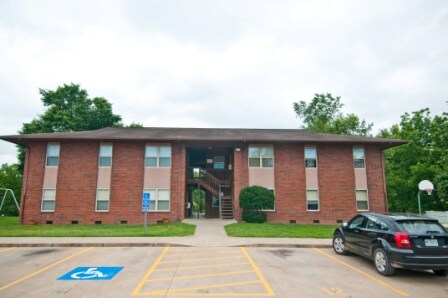
The Summit Apartments is a 12 unit family apartment complex located in Pineville, MO and just minutes from Neosho, MO and its many amenities. This property features clean, well-kept apartments and a great play area for children. The one bedroom apartments are approximately 650 square feet and the two bedrooms are approximately 800 square feet. For more information or to schedule a tour, call us today at the number listed above! (417) 223-4093
The Summit is an apartment community located in Mcdonald County and the 64856 ZIP Code. This area is served by the Mcdonald County R-I School District attendance zone.
| Colleges & Universities | Distance | ||
|---|---|---|---|
| Colleges & Universities | Distance | ||
| Drive: | 34 min | 28.0 mi | |
| Drive: | 46 min | 38.9 mi | |
| Drive: | 60 min | 39.8 mi |


Scores provided by
Traffic
-Airport
-Businesses
-Scores provided by
HowLoud What is a Sound Score Rating? A Sound Score Rating aggregates noise caused by vehicle traffic, airplane traffic and local sources. How It WorksWhat Are Walk Score®, Transit Score®, and Bike Score® Ratings?
Walk Score® measures the walkability of any address. Transit Score® measures access to public transit. Bike Score® measures the bikeability of any address.
What is a Sound Score Rating?
A Sound Score Rating aggregates noise caused by vehicle traffic, airplane traffic and local sources.

214 Clay St
Pineville, MO 64856


